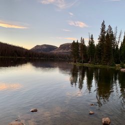
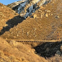
Cancel

    Open app

    Search

    Flag Rock

    5.0 (1 review)

    Flag Rock Photos

    You might also consider
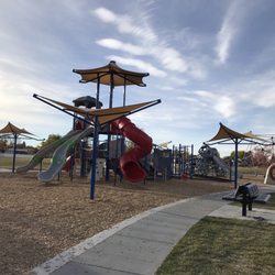
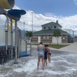
    Recommended Reviews - Flag Rock

    Your trust is our priority, so businesses can't pay to alter or remove their reviews. Learn more about reviews.
    Yelp app icon
    Browse more easily on the app
    Review Feed Illustration
    Photo of Sandra L.
    68
    26
    14

    8 years ago

    Helpful 1
    Thanks 0
    Love this 0
    Oh no 0

    Verify this business for free

    People searched for Hiking 1,453 times last month within 15 miles of this business.

    Verify this business

    Farmington Bay Waterfowl Mgmt Area

    Farmington Bay Waterfowl Mgmt Area

    4.5
    (8 reviews)
    3.4 mi

    Very nice area to walk around. There's a long wooden bridge path throughout to walk on and see many…read morewaterfowl. Just be sure to bring your insect repellent! Nice place to take sunset photos and see and hear many resident birds. Beautiful area to see the snow capped mountains or if in winter the frozen lake. Definitely worth a stop!

    Review #700!! This is one of my favorite places in the whole world - been coming here for years - I…read morecan't believe I haven't reviewed it yet haha!! I visit my son in SLC often and come here every chance I get when I'm in town - the birding is SPECTACULAR! The trails are well maintained and the surrounding ponds and mountains are beautiful. This is a helluva place to practice birding and bird photography skills. I've lost count of how many bird species I've seen here - there are over 60 species known to nest here! I've seen so many "lifers" here (birder-speak for first time sightings lol). The Bald Eagles nest here in winter and are easily spotted everywhere! Tundra Swans also pass through in the colder months are a quite a sight to see. They have a small rookery of nest boxes on tall stilts for the Great Blue Herons in spring and they're so fun to watch - especially once the babies hatch! It's especially picturesque with the big red barn reflecting on the large pond. It's right off the parking lot next to the Eccles Education Center. It's truly a beautiful place in all seasons - even winter when it's coveted in snow. You're surrounded by mountains and ponds on all sides - some close and some distant. Wildlife, birds, marshes, dramatic vistas - such a lovely, peaceful place. The Great Salt Lake is so close - and that's one reason there's so many birds (native and migratory) - it's a very important resource for them! There are numerous trails - they're almost entirely flat. Very well maintained- mostly gravel but some boardwalks across the ponds and marshes. There is also a seasonal driving route - it's closed in winter for the nesting birds. The roads are also gravel and dirt and can be a bit rough but doable. I've never needed anything more than our normal car. You can drive up to Goose Egg Island which gives you a great vantage point for the surrounding area and has nice views of the Great Salt Lake. Seasonal duck hunting is allowed so be vigilant and careful. They have a large paved parking lot with plenty of spaces. There are bathrooms in the parking area - decent, regular bathrooms in the education center when it's open and some vaulted toilets open year round and earlier/later than the education center. You don't need any special hiking gear - trails are super easy. But be sure to bring your binoculars or telephoto lenses!!

    Photos
    Red-winged Blackbird (early March 2023)
    Red-winged Blackbird (early March 2023)
    Downy Woodpecker
    Downy Woodpecker
    American Avocets passing through in late winter with some gulls in the background (early March 2023)

    See all

    American Avocets passing through in late winter with some gulls in the background (early March 2023)
    Antelope Island State Park

    Antelope Island State Park

    4.3
    (305 reviews)
    14.7 mi

    Look into the construction progress at the visitor's center before you go since that relates to…read moreavailability of potable water. The recommendation is drinking 1L of water per person per hour. I was surprised that this state park has $15 entry per car, but I think it's worth it! I found the restrooms clean. Some roads are dirt while the main parts are paved. The roads are well maintained. The self guided tour of the ranch including original equipment from many decades of the nineteenth and twentieth centuries was informative. Parking is easy next to the ranch. Horses are still there. A marina is onsite, but it appeared quite dried up such that you cannot dock boats on the day I went. Even in the first 20 minutes past the visitor's center, you'll likely see flies, dragonflies, bison, antelopes, birds, and more!

    - Why didn't anyone forewarn me about the pungency or abundance of carcasses at Bridger Bay Beach…read moreDx - Just as you're starting to drive in to the State Park, you're already hit with a powerful poopy odor. Yuck. - It's a 10-20min walk from parking to the water. Coarse sand. May wanna wear shoes. Little rocks will sneak into your sandals. - The sight of dead birds and millions of flies, dead and alive, throughout the beach and the stench of what I thought was ubiquitous decomposed bison dung but likely was actually the sulfurous odor of detritus (still revolting though) discouraged me from fulfilling the bucket list goal I came here for: to prove the rumor that the human body really is unsinkable in the hypersaline water of the Great Salt Lake. I couldn't bring myself to lie down. Only let the water up to my calves. Ain't no way I'm risking full skin infection within the 1st day of my vacation. Still had 7 days to go. Begrudgingly, I simply took a picture from where I stood, then slowly backed away from the omnipresent death around me. . On my way driving out I asked the lady at the entrance booth about the water quality. She said the sight of those many flies and the dead animals is normal around the super salty water and that it's still safe to float in it. She may be right (as the Internet also agrees), but I couldn't bring myself to go through with it, especially since there weren't many other people there doing the same thing to help me feel reassured. + Glad the showers by the parking lot are fully functional though. + And a hose next to the restrooms next to the showers. . Just gotta bring your own soap. + Sources say pronghorns live on this island. * Fun fact: Pronghorns are the 2nd fastest land animal on Earth, just after the cheetah! - Didn't see any pronghorns or bison during my visit though. Granted, I didn't visit as far deep in as Fielding Garr Ranch. You might have better luck. . $15/car. A bit expensive for me since as you can see, my experience came up short. And as it's a state park, it's not covered by the $80 America the Beautiful annual pass. . Only a few people were at this State Park when I visited early Saturday evening. - VC still under maintenance.

    Photos
    Fielding Garr Ranch
    Fielding Garr Ranch
    The Rock Wrens we're putting on a fantastic show! Sunset at Buffalo Point Trail - Nov 2022
    The Rock Wrens we're putting on a fantastic show! Sunset at Buffalo Point Trail - Nov 2022
    Mom & son holiday hike selfie!! Top of Buffalo Point Trail - Nov 2022

    See all

    Mom & son holiday hike selfie!! Top of Buffalo Point Trail - Nov 2022
    Gailey Trail at Nicholls Park

    Gailey Trail at Nicholls Park

    5.0
    (2 reviews)
    3.5 mi

    This is a nice and easy walk for the whole family. The ground is mostly level and the trail is…read moreshaded by beautiful trees. There are a few bridges to cross over, but you can take an alternative route if needed. I cannot wait for the stream to fill up with water again. So pretty!

    This is an amazing trail that sits in the middle of an urban area. The trail has a East entrance by…read moreNichols Park & a West entrance just off Main Street Kaysville & Nichols Road. It sets in the drainage of Baer Creek. City has made this into a great trail for walking, biking, running or just enjoying nature. Most of the trail is shaded by 60'+ Cottonwoods, Willows, Mountain Ash and Boxelder Trees. The creek is running mainly in the Spring and after a good rain. Trail splits and has 2 paths to follow which all connect back together. Wild raspberries & wild blackberries can be found all along the trail. Service berries, Chokecherries and other wild edibles can also be found. There are benches spaced out along the sides to take a rest or just take it all in. There are restrooms available at the park pavilion just 100 yards south of the trail. Haven't seen much wildlife except birds. Most of the trail has shredded bark laid down on the trail. If you walk from west to east and follow the loop it's about 2.3 miles. An awesome walk anytime of the day with new things to discover each time I walk it. Check it out! A hidden gem just waiting for your next activity.

    Photos
    Small Bridge
    Small Bridge
    Rules of the trail. Please pickup after the pooches!
    Rules of the trail. Please pickup after the pooches!
    Memrorial Bench

    See all

    Memrorial Bench
    The Living Room Trail

    The Living Room Trail

    4.4
    (39 reviews)
    15.8 mi

    I love taking friends from out of town on this hike! It's long enough that you feel like you did…read moresomething active, but not too far or too difficult that your friends never trust you to pick a trail again. The trail can be crowded at certain times of the day/year and it can seem confusing because of lack of signage/multiple spur trails but you really can't get lost if you keep heading towards the mountains. This trail is dog friendly! And the dog owners are very respectful and responsible. Which makes this trail even more fun to try!

    Trivia: What university originally established in 1850 as the University of Deseret and used in the…read more2002 Winter Olympics sits rather close to the base of this trail? Finding the actual trail can be a little bit of a challenge. From the road where everyone seems to park, we started on a shaded, tree-lined trail that looked promising. But after a short jaunt, we arrived in a dusty, tree free area with trails going in lots of directions. The group in front of us took off like they knew where they were going, but I wasn't fooled by their confidence. Yay Me! But BOOO on the existence of trail markings. I reviewed the map and pointed my hiking companion and I to the trail I thought was most closely aligned with GOOGLE maps and AllTrails. Service was a little spotty. Luckily, it all worked out! The trail is a solid 1000-1200 feet of elevation over a mile which is a solid click of UP. Bring water as shade is rare and the trees are really more shrubs and bush size. The living room area is superb, but depending on the time of day, VERY congested. The seats will feel like the best chair you've ever parked your tired rump, and you will begrudgingly give them up when the crowds form around you.

    Photos
    The Living Room Trail
    The Living Room Trail
    Sunrise views

    See all

    Sunrise views
    Causey Reservoir

    Causey Reservoir

    5.0
    (3 reviews)
    19.5 mi

    Causey Reservoir is one of my favorite places to go paddle boarding in Utah! I love this reservoir…read moreso much, it's so beautiful. No motorized boats are allowed on this reservoir, so it's the perfect place to kayak, canoe, paddle board, or just bring a floaty and float around. There's also a bunch of cliff jumping. There's no beach, so the main activity here is being in the water. The water is a beautiful color, the scenery is gorgeous. I just love this place so much! I would definitely recommend getting here early, especially on the weekend, as the parking lot fills up quickly, and the reservoir gets crowded. We got here around 9am and it was the perfect time. By the time we left around 1pm, the parking lot was completely full and there were a ton of people out on the reservoir. Even with the volume of people on the water, it never feels too crowded. There's no overnight camping here, and it's completely free to access this reservoir, which is one of the reasons its so popular. A beautiful place to spend the day!

    Kayaking at Causey Reservoir near Huntsville, Utah, was an absolute blast! The crystal-clear waters…read moreare perfect for a peaceful paddle or a day full of adventure. https://youtube.com/shorts/J-ih7Wbg-pY We loved exploring the hidden coves and taking in the stunning mountain scenery. The reservoir offers a little bit of everything--cliff diving, rope swings, and even some fantastic fishing spots. It's an outdoor lover's paradise, and the serenity of the area is unbeatable. Whether you're looking for excitement or just want to relax on the water, Causey Reservoir is the place to be. Can't wait to return!

    Photos
    Causey Reservoir Huntsville UT
    Causey Reservoir Huntsville UT
    Causey Reservoir Huntsville UT
    Causey Reservoir Huntsville UT
    Causey Reservoir Huntsville UT

    See all

    Causey Reservoir Huntsville UT
    Wheeler Creek Trail

    Wheeler Creek Trail

    5.0
    (1 review)
    18.4 mi

    So far this is my favorite hike. Not too long, not too short, not too hard. Just enough...well, for…read moreme. It located just south of Pineview dam. This is the Wheeler Canyon trail that follows Wheeler Creek. The trail is wide and heavily traveled. Great for hiking, biking, horseback riding, skiing and snowshoeing. I did the loop, it took me 2.5 hours and 5.73 miles. That was stopping frequently to take pictures because it's so pretty all over. From the beginning it's gorgeous. You're surrounded by towering, rocky mountains and the sound of the river below. As you get farther on the trail, the leaves are gold, red, and orange. One day we took our toddler to walk up the trail and explore a bit. It was easy and fun for her. Lots of birds, butterflies and caterpillars to check out. That's when I knew I had to come back and take a hike. After Wheeler Canyon there's a fork that takes you to Ice Box Canyon on the right or Art Nord trailhead to the left. I read about this trail and many prefer to go counterclockwise and go through Ice Box first. I also recommend going this route. It's a steady climb, not hard and shaded the entire way until you get to the south slope meadows. Ice Box Canyon was magical. The birds were singing, the sound of the water was hypnotic, and the red leaves blanketed the trail like a celebrity red carpet, minus the paparazzi and a little less narcissism. I had to stop and take pictures every second. I couldn't help it. If you're doing the loop, you'll run into another fork (on the south slope) once you're out of Ice Box Canyon. The sign is missing off the post. Go left. That will take you down through some meadows across a couple of bridges and then uphilll to the Art Nord Drive/trailhead. You will see Snowbasin Road on the right as you approach a trail map kiosk. Keep following the trail. You will descend on a windy trail towards a parking area. Keep going and you'll soon be back in Wheeler Canyon. I think about .65 miles. Take a jacket and plenty of water. When I went it started pouring the last quarter mile and the wind was awful tunneling through that canyon. It about knocked me over. I came out of the canyon only to find out there were 2 freaking tornadoes taht touched down. I'm not sure of the odds of that happening again but just be prepared for the weather. This would be a great hike for a family. Do the loop, go check out Ice Box Canyon, or just go up a little and back. No matter what you choose I think you'll enjoy it!

    Photos
    Wheeler Creek Trail
    Wheeler Creek Trail
    Wheeler Creek Trail

    See all

    Flag Rock - hiking - Updated June 2026

    Loading...
    Loading...
    Loading...