Falls View & Canyon Photos
 - Hiking Near Me - Quilcene, Washington")


You might also consider
More like Falls View & Canyon
Recommended Reviews - Falls View & Canyon
Start your review...

9 years ago
Updates: Camping is closed for all of 2017 due to trees falling. We checked it around August and the falls were quite reduced. It was still a neat experience! read more


While driving along the Hood Canal and passing through the Olympic National Forest's eastern panhandle, give your legs a stretch and take advantage of rejuvenating views. Falls View is a campground, however, it also offers a waterfall that cascades into the Big Quilcene River. Unlike many other places in the park, entrance is free. Since this is also a campsite there is a fee of $10 if you choose to stay the night. This is a second-growth forest canyon among spring blooming rhododendrons, lilies, and honeysuckle. Two short trails for the price of one: -Fallsview Loop Trail: This is a short jaunt for all ages interested in beautiful views. It loops back around to the start of the trail. The distance is only 0.1 miles and elevation is 440 feet. I highly recommend it for a photo opportunity! -Fallsview Canyon Trail: This trail takes you from the Falls View down to the floor of the canyon. Unfortunately, the trail does not bring you to the base of the falls to bathe or get a view from below. Instead, you're greeted with the bustling Big Quilcene River which has carved the canyon over hundreds of years. The trail quickly dips 200 feet of elevation in 0.1 mile. Keep in mind that grades are up to 10-20% in some spots and what you go down, you must come up. After 0.5 miles, there is a deceptive separate trail that splits leftward, but it's the end/beginning of the same trail which loops back around. The entire trail is 1.5 miles and in very good condition and maintained by the Mount Rose Trail Crew. Directions: From Quilcene, WA, travel 3.5 miles south on U.S. Highway 101. Falls View Campground is located on west side of U.S. Highway 101. If it is during the winter, you can park outside the gate and walk in (refer to image). Take a quick left and continue forward past the campground and picnic area. Fallsview Canyon Trail starts left of the parking area and goes downhill to the river. Fallsview Loop Trail's entrance is just to the right of that. read more


More info about Falls View & Canyon
27664 Olympic Hwy
Quilcene, WA 98376
Directions
Visit Website
http://www.fs.usda.gov/recarea/olympic/recarea/?recid=48031
Hours
Outdoor Amenities
Other Amenities
You might also consider


Falls View & Canyon - hiking - Updated July 2026
Best of Quilcene
People found Falls View & Canyon by searching for…
Trending Searches in Quilcene, WA
Beautiful Views near Falls View & Canyon
Berry Picking near Falls View & Canyon
Boat Launch near Falls View & Canyon
Boat Tours near Falls View & Canyon
Cliff Jumping near Falls View & Canyon
Crabbing Location near Falls View & Canyon
Dog Friendly Beaches near Falls View & Canyon
Jet Ski Rental near Falls View & Canyon
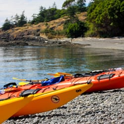
Kayak Rental near Falls View & Canyon
Lakes near Falls View & Canyon
Long Term Rv Parking near Falls View & Canyon
Off Road Trails near Falls View & Canyon
Peach Picking near Falls View & Canyon
Public Shower near Falls View & Canyon
Rv Campgrounds near Falls View & Canyon
Sunset Cruise near Falls View & Canyon
Swimming Holes near Falls View & Canyon
Things To Do On A Rainy Day near Falls View & Canyon
Things To Do With Teenagers near Falls View & Canyon
Tubing near Falls View & Canyon
U Pick Farms near Falls View & Canyon
View Points near Falls View & Canyon
Browse Articles
Browse Brands
Related Cost Guides
Related Searches in Quilcene, WA
Affordable Fishing Rental Services in Quilcene, Washington
Affordable Kayak Rental Services in Quilcene, Washington
Affordable Lodging Options in Quilcene, Washington
Affordable Long Term RV Parking in Quilcene, Washington
Best Boat Launch Spots in Quilcene, Washington
Best Crabbing Locations to Visit in Quilcene, Washington
Best Dog Hiking Trails Around Quilcene, Washington
Best Fishing Locations and Guides in Quilcene, Washington
Best Places for Horseback Riding in Quilcene, Washington
Book Top Fishing Trips in Quilcene, Washington Today
Book a Dinner Cruise Experience in Quilcene, Washington
Browse Top Hotels in Quilcene, Washington for Your Stay
Browse Vacation Rentals to Book in Quilcene, Washington
Check Out Off Road Trails in Quilcene, Washington
Discover Dog Friendly Trails to Explore in Quilcene, Washington
Discover Free Campgrounds in Quilcene, Washington Area
Discover Scenic Beach Camping Sites in Quilcene, Washington
Discover Scenic Mountain Bike Trails Near Quilcene, Washington
Discover Top Boat Tours in Quilcene, Washington for All Ages
Discover Trailer Park Options in Quilcene, Washington
Discover a Hiking Trail in Quilcene, Washington
Discover the Best Beaches in Quilcene, Washington
Discover the Best Fishing Lake in Quilcene, Washington
Discover the Best Night Hike Trails in Quilcene, Washington
Dog-Friendly Hikes With Dogs in Quilcene, Washington
Enjoy Fishing Pier Spots in Quilcene, Washington With Scenic Views
Enjoy Fishing With Kids in Quilcene, Washington Safely
Enjoy Hiking Adventures in Quilcene, Washington
Enjoy Off Leash Dog Hikes in Quilcene, Washington
Enjoy Sailing Adventures in Quilcene, Washington
Enjoy Tent Camping Spots Around Quilcene, Washington
Enjoy Whale Watching Experiences in Quilcene, Washington
Enjoy a Relaxing Bed & Breakfast Experience in Quilcene, Washington
Enjoy the Best Walking Trails in Quilcene, Washington
Experience Deep Sea Fishing Adventures in Quilcene, Washington
Experience Stunning Sunset Views in Quilcene, Washington
Experienced Fishing Guides Available in Quilcene, Washington
Explore Beautiful Parks and Green Spaces in Quilcene, Washington
Explore Bike Rentals Throughout Quilcene, Washington
Explore Boat Rentals for Every Need in Quilcene, Washington
Explore Easy Hikes Perfect for All in Quilcene, Washington
Explore Fun Activities to Do in Quilcene, Washington
Explore Hotels & Travel Options in Quilcene, Washington
Explore Mobile Home Parks in Quilcene, Washington Now
Explore Off Leash Dog Beaches in Quilcene, Washington
Explore Popular Boat Charters Near Quilcene, Washington
Explore Popular Campgrounds Near Quilcene, Washington
People who viewed Falls View & Canyon also viewed
Guillemot Cove Nature Reserve
7 reviews
Stephenson Canyon
2 reviews
Murhut Falls
3 reviews
Anderson Landing Preserve
5 reviews
Newberry Hill Heritage Park
6 reviews
Staircase Area - Olympic National Park
8 reviews
Seal Rock Campground
14 reviews
McCormick Village Park
6 reviews
Clear Creek Park
9 reviews
Nelson Park
3 reviews