Escoheag Trail Photos


You might also consider
More like Escoheag Trail
Recommended Reviews - Escoheag Trail
Start your review...

16 years ago
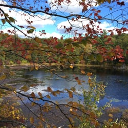
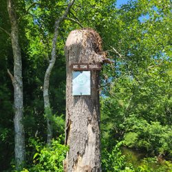
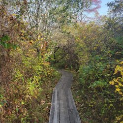
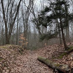
A short trail that goes forever The Escoheag Trail is a three and a half mile loop that is one of the many trials that make up the Arcadia Management Area. The entire area is well maintained by the Rhode Island chapter of the Appalachian Mountain Club and is used by hikers, mountain bikers, equestrians and snow shoers and cross skiers in the winter. Since most of Rhode Island is water you won't find any severe climbs in the state. However like many of the trails in Arcadia, the Escoheag Trail is seldom level. Lots of ups and downs and rights and lefts. Certainly not difficult but the variation does make it interesting. Lots of cool rocks and boulders scattered about everywhere, survivors from the glaciers. At one time this was a very popular picnic and camping spot called Ledges Picnic Area and several cool old buildings and foundations are still visible. I'm not sure exactly why they were abandoned. Perhaps because of the devastating fires that swept the whole area back in the 1951. The fires destroyed thousands of acres and changed the entire complexion of the region. Although it's a pleasant little hike in all weather I find it most enjoyable in the dead of winter, especially when it's snowing. Absolutely dead quiet, a very cool place to for some solitude and peace. If you stay on the marked loop, the Escoheag Trial ends far to quickly. However, one of the great things about the trail is that it links to other trails. The Mount Tom Trail, Barber Trail, Step Stone Falls Trail and The Ben Utter Trail as well as numerous others are all accessible from the Escoheag. So rather than thinking that the hike ends after the three and half miles you should think of it as just beginning. Hook up to one of the many other trials and you can hike, bike, ride or ski forever. read more


More info about Escoheag Trail
Arcadia Wildlife Management Area
Escoheag Hill Rd
Exeter, RI 02822
Directions
Hours
Outdoor Amenities
You might also consider


Escoheag Trail - hiking - Updated July 2026
Best of Exeter
People found Escoheag Trail by searching for…
Things to Do in Exeter, Rhode Island
Hiking Trails With Waterfalls in Exeter, Rhode Island
Abandoned Buildings in Exeter, Rhode Island
Walking Trails in Exeter, Rhode Island
Picnic Spots in Exeter, Rhode Island
Running Trails in Exeter, Rhode Island
Picnic Areas in Exeter, Rhode Island
Off Leash Dog Hikes in Exeter, Rhode Island
Picnic Tables in Exeter, Rhode Island
Tent Camping in Exeter, Rhode Island
Abandoned Places in Exeter, Rhode Island
Scenic Views in Exeter, Rhode Island
Waterfalls in Exeter, Rhode Island
Mountain Bike Trails in Exeter, Rhode Island
Waterfalls and Swimming Holes in Exeter, Rhode Island
Watch Sunset in Exeter, Rhode Island
Swimming Lakes in Exeter, Rhode Island
Camping & Campsites in Exeter, Rhode Island
Secret Spots in Exeter, Rhode Island
Beautiful Views in Exeter, Rhode Island
Nature Walks in Exeter, Rhode Island
People who viewed Escoheag Trail also viewed
Mount Tom Trail
6 reviews
Breakheart Trail
3 reviews
Long Pond Nature Area
9 reviews
Maxwell Mays Wildlife Refuge
13 reviews
Pardon Gray Preserve
10 reviews
Duval Trail System
1 review
Quinebaug Lake State Park
1 review
Old Furnace State Park
7 reviews
Westconnaug Meadows Hiking Trail
1 review
Bradner Preserve
1 review