Breakheart Trail Photos


You might also consider
More like Breakheart Trail
Recommended Reviews - Breakheart Trail
Start your review...

16 years ago
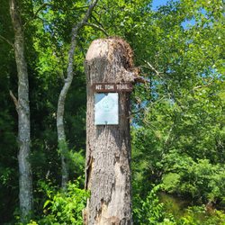
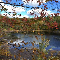
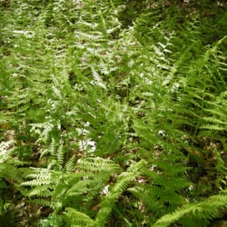
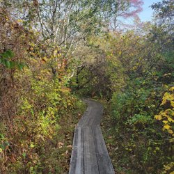
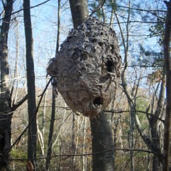
A hike that won't break your heart The Breakheart Trial is one of the many trails in the the area that ends up (or starts) at Breakheart Pond. This is one of the main trails and despite it's imposing name really isn't very difficult. Sure some hills, rocks, roots and water but certainly nothing that is going to break your heart or any other part of your anatomy. I heard the name actually stated many decades ago when the oxen had to haul the corn and other farm veggies up a huge, rather steep hill and of course struggled to get up it. The hill may be tough if you're hauling a wagon full of rutabaga but for a hiker it's really not much of a challenge. The old names given to places usually have interesting stories behind them. I have heard that Roast Meat Road in Connecticut received it's name because of a rather unfortunately incident in which a wagon of dry hay being dragged by a couple of oxen was hit by lighting. A rather unpleasant scene developed but I imagine the farmers did eat well that night. The actually Breakheart trail is pleasant with lots of water views including, rivers, steams, swamps and of course Breakheart Pond. In the spring it does get very muddy but there certainly are worse places. Of course because of the water, birds and many small animals make this their home. Lots of turtles, frogs and water snakes can be seen basking on rocks if you thread quietly. Unfortunately a vast number of stinging and biting insects are also present during certainly times of the year. Strong Deet is an absolute necessity if you dare venture here in the late spring, The main trail is poorly marked but easy enough to follow. If you want a challenge you can try some of the very small paths that lead off in all directions but you probably will get lost. Some of the paths just lead into old stone cellar foundations and then stop, Others meander into large open fields or into swamps. A reminder that in days gone by this whole area was once productive farm land. The Breakheart Trail is a well used path that is the most fun in the winter. Easy to follow the tracks of various critters in the snow and of course the horrible bugs are gone. It still is pleasant enough all year long if you don't mine sharing the woods with some insects and lots of mud. An ancient and well traveled path that may break an ankle if you're not careful but it certainly won't break your heart. read more


8 years ago
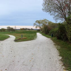
We found this trail via the AllTrails app and glad that we visited. This trail has some pretty views (see pictures attached) around the Breakheart Pond. There is adequate parking at a few points around the trail. The paths are wide but there are quite a bit of rocks and roots so you need to be careful with your footing. Other than the rocks and roots the walk is relatively flat (no hills to climb). We took the trail directly around the pond because we weren't sure how long it was (approximately 2 miles). The trails are marked but this could be improved on to indicate the mileage on each trail. Overall we really enjoyed this hike and its views and will be visiting again. read more


13 years ago
More info about Breakheart Trail
Frosty Hollow Rd
Exeter, RI 02822
Directions
Hours
Outdoor Amenities
You might also consider


Breakheart Trail - hiking - Updated July 2026
Best of Exeter
People found Breakheart Trail by searching for…
Hiking Trails With Waterfalls in Exeter, Rhode Island
Things to Do in Exeter, Rhode Island
Night Hike in Exeter, Rhode Island
Walking Trails in Exeter, Rhode Island
Off Road Trails in Exeter, Rhode Island
Waterfalls in Exeter, Rhode Island
Lakes & Ponds in Exeter, Rhode Island
Waterfalls and Swimming Holes in Exeter, Rhode Island
Running Trails in Exeter, Rhode Island
Night View in Exeter, Rhode Island
Scenic Views in Exeter, Rhode Island
Hiking With Kids in Exeter, Rhode Island
Off Leash Dog Hikes in Exeter, Rhode Island
Beautiful Views in Exeter, Rhode Island
Things to Do at Night in Exeter, Rhode Island
View Points in Exeter, Rhode Island
Bike Paths in Exeter, Rhode Island
Playgrounds in Exeter, Rhode Island
Hiking Trails Kid Friendly in Exeter, Rhode Island
What to Do in Exeter, Rhode Island
Swimming Lakes in Exeter, Rhode Island
Watch Sunset in Exeter, Rhode Island
Browse Nearby
BEST of Exeter, Rhode Island Restaurants near Breakheart Trail
BEST of Exeter, Rhode Island Coffee near Breakheart Trail
BEST of Exeter, Rhode Island Things to Do near Breakheart Trail
BEST of Exeter, Rhode Island Campgrounds near Breakheart Trail
BEST of Exeter, Rhode Island Breakfast near Breakheart Trail