1. Eales Preserve at Moosic Mountain

0

,

Cancel

Open app

Search

Eales Preserve at Moosic Mountain

5.0 (6 reviews)

Eales Preserve at Moosic Mountain Photos

More like Eales Preserve at Moosic Mountain

Recommended Reviews - Eales Preserve at Moosic Mountain

Your trust is our priority, so businesses can't pay to alter or remove their reviews. Learn more about reviews.
Yelp app icon
Browse more easily on the app
Review Feed Illustration

2 years ago

Helpful 0
Thanks 0
Love this 0
Oh no 0

8 years ago

Helpful 0
Thanks 0
Love this 0
Oh no 0

7 years ago

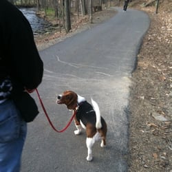
Bruised Ego Trail is the best- it's dog friendly too! Love that name and the views are gorgeous!

Helpful 0
Thanks 0
Love this 0
Oh no 0

12 years ago

Helpful 2
Thanks 0
Love this 2
Oh no 0

9 years ago

Blueberry trail is my favorite, great views and interesting landscape, still looking for the mysterious waterfall though Lol

Helpful 0
Thanks 0
Love this 0
Oh no 0
Photo of Seth L.
3
171
0

7 years ago

Helpful 0
Thanks 0
Love this 0
Oh no 0

Ask the Community - Eales Preserve at Moosic Mountain

Verify this business for free

People searched for Hiking 268 times last month within 15 miles of this business.

Verify this business

Scranton Iron Furnaces.

Scranton Iron Furnaces.

4.0(2 reviews)
10.8 km

We found the Scranton Iron Furnaces by chance as we were driving by to go to another location and…read moredecided to pull in. I'm so glad we did because the stop was educational and unique, even if it was really really cold on the particular day we chose to visit. The original reviewer, actually the only other reviewer at the time of me posting this, gave so much information and history about this location that I will try and keep it quick. There definitely is a lot to read and a lot to learn here. The furnaces are huge, not like anything I expected, and reading the plaques makes you think about how intense it must have been here back when this place was active. Is really interesting. It's also a large open space so it was dog friendly and our dog liked walking around and sniffing the paths. There was a nice grassy area down at the bottom for her to run around in as well. It was also helpful that we were the only people there, with the exception of a city cop who seemed to be sleeping in his car or hiding from the general public. It was definitely a unique place to visit and these furnaces are worth checking out if you're in Scranton, especially if you're a history buff, but between the open space and the stairs, it's also just a good place to wander and get some steps in.

The Scranton Iron Furnaces, aka the The Lackawanna Iron and Coal Company Furnaces, represent the…read more19th century iron industry in the United States at it's finest. The four massive stone blast furnaces are the remnants of a once extensive plant operated by the Lackawanna Iron & Steel Company. Started in 1840 as Scranton, Grant & Company, the firm began as a partnership between William Henry (he had already been experimenting in New Jersey will the concept of using a "hot-blast technique" to make steel), his son-in-law Seldon Scranton, George Scranton and Sanford Grant. Henry with help from the Scrantons and other investors bought 500+ acres of land in what was then called Slocum Hollow along the Roaring Brook and set up shop building their first blast furnace in 1841. Initially the operation hemorrhaged money and had numerous production issues that plagued the company for its first few years almost driving it to bankruptcy on several occasions. Eventually by 1844 more investors were brought in so that capital could be raised for upgrades and to take care of any lingering flaws in their production model. By the summer of 1844 the furnace averaged five to seven tons of pig iron a day, but the company soon went into the more profitable business of producing T-rails for the railroad industry as there were no facilities in America where rails were capable of being produced. Everything at that point had to be ordered and shipped from Europe. In 1851, the town of Slocum's Hollow changed its name to Scranton in honor of the majority owners of the iron works for their success. (Scranton had other names in between like Harrison in honor of Presidential candidate William Henry Harrison and Scrantonia but I'm just focusing on what stuck.) By 1865 the company had the largest iron production capacity in the United States and were the second largest independent steel making operation in America.. After a long and successful run the fortunes of the company began to change due to higher labor costs, multiple strikes, higher shipping costs, changing markets and more efficient steel making processes in Europe all of which caused the company to move the operation to the Buffalo area in at the beginning of the 20th century. (The operation in the Buffalo area lasted all the way thru several mergers until Bethlehem Steel shut it down in the 1980's.) In 1903 the Scranton property was sold to the Wyoming Valley Railroad, which contracted with a Philadelphia company that scrapped all of the equipment, and tore down all the structures except the stone blast furnaces that you still see today. From the Internet: "In the late 1960s the furnaces were acquired by the Commonwealth of Pennsylvania, and were administered under the State park system. The furnaces were transferred to the Pennsylvania Historical and Museum Commission in 1971. Today the four connected stone blast furnace stacks are surrounded by 3.84 acres. The furnaces are set into the south side of a hillside with a 10 foot wide bridge, supported by masonry arches connecting them to the rock cliff. The two easternmost furnaces, dated 1848-1849, are built of smooth dressed stone blocks and stand 40 feet high and are 40 feet wide at the base. No. 3 and No. 4 furnaces were constructed c.1852 and c.1857 respectively, and are constructed of rough dressed stone blocks and also stand 40 feet high. Furnace No. 3 is 46 feet wide at the base, and furnace No. 4 is 48 feet wide at the base. All of the furnace stacks still contain vestiges of their firebrick linings. The first, third and fourth stacks contain ruins of their 19th-century hearths." If you go today what you see quite honestly isn't a whole heck of a lot. The entrance to the furnace site has two small brown NPS style signs that lead you up a narrow driveway to the parking area which has space for maybe 15-20 cars. You've got what's left of the four blast furnace stacks, an example of a T-rail along the walkway the leads from the parking lot to the upper viewing platform and an acre or two of grassy park land that sits along Roaring Brook. Worth mentioning is that there are plenty of displays at the site explaining what you're looking at but if you need more your best bet would be to head over to the Anthracite Heritage Museum which is about four miles away over in McDade Park on the other side of town. If you go: The site itself is free and open to the public daily from sunrise until sunset. There are no amenities on site although you are very close to all the fun (LOL!) that downtown Scranton has to offer including the foamtastic fun over at Steamtown. There are a few special events that occur on the grounds annually. Most notably would be the Scranton Bonfire Festival which happens every year in October.

Photos
Scranton Iron Furnaces.

See all

Blanche D Price Memorial Park - Where the playground used to be? Looks like a new one is being built.

Blanche D Price Memorial Park

4.3(3 reviews)
37.8 km

As of 6/28/24, there is no playground. Looks like a new one is being built though. There is a nice…read morewalking path that is stroller friendly. We enjoyed ourselves despite no playground!

What a beautiful location, Blanche D Price, Memorial Park located in Pocono Pines Pennsylvania…read more My daughter booked and rented the Main Lodge in the park so she could have an indoor & outdoor setting, for a Wedding Reception. We were allowed to decorate, both indoors & outdoors, the tables & chairs were provided by the facility so you can set them up accordingly to how many guest and the type of celebration. We had approximately 200 guest, our celebration was for a BBQ wedding reception. Many of the guest complimented how spacious and roomy the venue they chose, they were delighted to see there was a playground just a few yards for the children to play and within eye's view from the main lodge. There is a small outdoor stage for entertainment but there is no shade or covering for the entertainers/musicians, granted you can provide a pop up tent if necessary. Inside the Lodge there is a small stage loft with lots of room for tables chairs and dancing.. The outside of the main lodge, is a wrap around deck for plenty of room to sets extra tables and chairs or hang out at the banister and listen to the music. Plenty of room to mingle with friends and meet the new family. The main lodge has its own male/female bathrooms,a kitchen, fridge, stove, oven there is a center island table for cutting or prepping, there is hot & cold water but no dishwasher so you will need to bring your kitchen amenities such as dish soap, trash bags etc. The location is well kept and clean as well as the playground equipment. was very happy & delighted to have such a wonderful venue to share with my family, my new family and friends for this memorable event.

Photos
Blanche D Price Memorial Park - Inside view of the Main Lodge

Inside view of the Main Lodge

Blanche D Price Memorial Park
Blanche D Price Memorial Park - Indoor of the main lodge,  and loft area for the entertainment wether it's be a DJ or a Band

See all

Indoor of the main lodge, and loft area for the entertainment wether it's be a DJ or a Band

Archbald Pothole State Park

Archbald Pothole State Park

3.0(3 reviews)
9.1 km

Pennsylvania has some mighty fine state parks. Arguably, the commonwealth's system of state parks…read moreis the nicest, biggest, baddest and most diverse in these United States of ours. You've got amazing places like Ohiopyle with all of its outdoor activities, places like Oil Creek which is where the first well in the country was drilled, the boulder field at Hickory Run or places that serve as monuments like Kinzua Bridge. But, with these destination spots you also get a place like Archbald Pothole. What is Archbald Pothole State Park? Did I really just type the word pothole? Does this place actually matter? Should this place really be a state park? Like Seinfeld, it's a park about nothing. Amazingly yes I did. Probably not and probably not. This park is an "ecological wonder" that was formed around 15,000 years ago during a glacial period. The pothole is 38 feet deep and has an elliptical shape. The largest diameter is 42 feet by 24 feet. At the bottom it is 17 feet by 14 feet. The pothole has a volume of about 18,600 cubic feet. From the Internet: "A meltwater stream flowing on top of the glacier probably broke through a crevasse (a crack in the glacier) and fell to the bedrock hundreds of feet below. There was enough force generated by the falling water to begin a whirling motion of rock fragments in a small depression. As the rock fragments swirled and bumped each other, they carved the bedrock, making the depression deeper and larger. The rock fragments eventually were reduced to tiny particles, but new rock fragments continually tumbled into the hole, enabling the grinding process to continue. As the glacier moved, so did the crevasse and the waterfall. Sand, gravel and rounded stones filled in Archbald Pothole and the waterfall moved off to make new potholes." The pothole was found in 1884 by an area miner during some blasting. The pothole was used briefly as an airshaft for the mine but by 1887 the owner of the land built a fence around the area and began to give tours. In 1914, the acre around the pothole was deeded to the Lackawanna Historical Society. In 1940 with the addition of 150 surrounding acres Archbald Pothole became a Lackawanna County park which Lackawanna County then flipped to the Commonwealth of Pennsylvania in 1961 thus creating what you have today. If you look at the park's map it more or less will show you what is here which is nothing. On one side you have apparently some athletic fields and on the other side you have the small area with the parking and the pothole with nothing in the middle except land for hunting. The state park website claims there is some sort of walking trail near the parking lot but if it's there, it's not marked. If you go: The pothole is open sunrise to sunset daily from mid-April to mid-November. The rest of the year the park is closed and there is no ranger presence or anything else here as the nearest station is over at Lackawanna State Park which is ten miles away. If you want to unleash your inner Elmer Fudd deer, squirrel and turkey hunting is allowed in the appropriate season on the 100+ acres designated for hunting.

Really? This is a State Park? I understand that's there's historical significance to this…read more"Pothole", but really Pennsylvania? A platform and fence around the outside just doesn't cut it. Looks like there's a lot of ground around, so a couple of walking trails would be nice. As it is, it takes a whopping 15 minutes to see it all. Also there's also trash in the hole. Let's get down there and clean it up.

Photos
Archbald Pothole State Park
Archbald Pothole State Park - Roadsign

Roadsign

Archbald Pothole State Park - The hole

See all

The hole

Eales Preserve at Moosic Mountain - hiking - Updated October 2026

Loading...
Loading...
Loading...