Cancel

    Open app

    Search

    Eagle Ridge Trail

    4.0 (1 review)

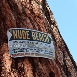
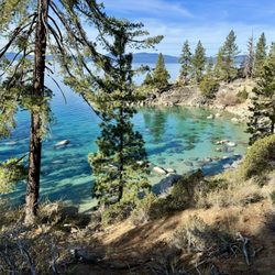
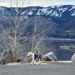
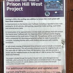
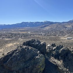
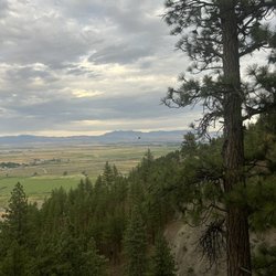
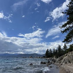
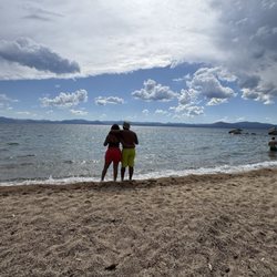
    Eagle Ridge Trail Photos

    You might also consider

    Recommended Reviews - Eagle Ridge Trail

    Your trust is our priority, so businesses can't pay to alter or remove their reviews. Learn more about reviews.
    Yelp app icon
    Browse more easily on the app
    Review Feed Illustration

    2 years ago

    Helpful 2
    Thanks 0
    Love this 1
    Oh no 0

    You might also consider

    Verify this business for free

    People searched for Hiking 1,356 times last month within 15 miles of this business.

    Verify this business

    Mount Tallac Trail

    Mount Tallac Trail

    4.7
    (92 reviews)
    12.0 mi

    I did this trail in late May when there was still a lot of snow on the mountain. I started the hike…read moreearly in the morning (7 a.m.) to make sure the snow was packed and not slippery (because of the sun beating down on it). There were only 2 other cars in the lot when I got there. That already signaled me that this trail may not be as safe to hike as I had initially thought. The hike started easy, but soon after I passed the second lake, it became tricky because it was really hard to keep track of the trail. Parts of the trail were either buried under the snow or harder to identify due to the fallen trees, bushes, and streams of water. I definitely went off the trail a few times, but thankfully, I had the map downloaded on AllTrails (yayyy AllTrails+ subscription), which came in clutch. The trail is mostly covered until you get past the 3rd lake. After the third lake, it was all rocky and exposed. It was really hard to follow the trail from that point on because of the snow. It gets steeper from there on out. Since the trail was convere in snow, I decided to rock scramble straight to the top. It was probably not the best idea. Having done that, I'd advise against it because the rocks were loose. One wrong step, and you are either falling or twisting your ankle. I did this hike with no poles, spikes, or gloves. Spikes would have helped because some areas required going downhill on snow-covered patches (some steeper than the others). I don't think you need gloves or warm layers. The views throughout the hike were amazing. Don't forget to stop and look back on your way up (and look up on your way down). Avoiding snow-covered areas in some cases will lead you off the trail, so take your time when going through those patches of snow. Don't let your ego get in the way and turn back if you start having doubts. A tip (shouldn't be a surprise) - When going through a patch of snow, make sure your first step is somewhat bigger so you don't step on the edges of the snow patch where the snow is usually thin and chances of you falling through are high.

    This trail is a killer! I've done strenuous hikes before, but I think part of my soul left on this…read moretrail. Not sure if it's the 80° weather, all the rocks, or I was just out of shape, but this trail really tested my mind over matter. The trailhead is easy to find, with a small parking lot but there's tons of parking nooks along the road for overflow. I would say this hike has 3 sections to conquer. 1. The trail starts off easy, soft dirt path with some shade alongside great views of Lake Tahoe. There's some slight parts of incline, but nothing too elevated. You pass by several lakes that are great picnic spots and we saw many dogs taking a swim. Butterflies everywhere. 2. The trail starts getting rocky the further you go, like walking along a dry creek. You hike uphill for what seems like a lifetime, then finally get to the base of the mountain.. of boulders. SO many rocks, BIG rocks, and switchbacks! ALL incline. And no shade. This took some time to get to the top. 3. You made it to the top! But oh no, you're not done yet. To get to the summit is about another mile to the right. The trail eventually splits with a less noticeable trail to the right. Keep right to get to the summit. This was probably the most beautiful part of the trail with open plains, soft grass, and wildflowers along both sides of the path. However, at this point I was so exhausted that my steps were like the mini steps of a toddler. The struggle was real ya'll. Every uphill was a battle. Finally, after what felt like a lifetime, you climb up some rocks and you're at the top of the summit, greeted by a metal sign "Mt Tallac 9,739" elevation. Whoo! It was a spectacular 360 view. There were oddly a ton of flies up there. Also, lots of butterflies and chipmunks. Of course going down was much faster but beware if you have bad knees. My knees usually never hurt going downhill but I definitely felt it on this hike. With 9.5 miles (out and back) of rocky trail and the 3,284 ft elevation gain, hiking sticks are a must! On part two of the trail, certain parts you can hear rattlesnakes so make sure you stay on the trail. Cover up and bring more water than you think you'd need. I plowed thru my hydropack and additional two bottles. At the end, the sight of the trailhead sign and our car was like heaven on earth.
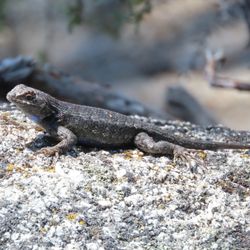
    Photos
    California tortoiseshell butterflies were everywhere
    California tortoiseshell butterflies were everywhere
    Doggo in the lake
    Doggo in the lake
    A cool stretch of forest running along a plateau above Fallen Leaf Lake. Awesome section of the trail.

    See all

    A cool stretch of forest running along a plateau above Fallen Leaf Lake. Awesome section of the trail.
    Donner Memorial State Park

    Donner Memorial State Park

    4.1
    (168 reviews)
    29.2 mi

    This is a beautiful park and we had a great location (127) with water at our site and bathrooms…read morejust yards away. But, Hwy 80 is probably less than 200 yards away and there's a train track above the camp. I remember lying in our tent thinking, "what is that noise? It's just constant." No Doppler effect of approaching traffic, just a solid din. Sorry to say we decided to visit the town (beautiful) and enjoy a shop or two (loved Cornerstone Bakery; stop in and grab a few things, as their pastries are superb) and decided to break camp early and enjoy a quiet night sleep. I don't mind clanging pots to keep the bears away, but incessant freeway traffic noise was just miserable. We'll return, but visit another site (there's lots to see here).

    July 8, 2026 - I still consider this one of the best campgrounds in CA, especially if you choose a…read morenice camping site. Lots to do here, kayaking, swimming, cycling and hiking. Beautiful forest setting with large lake. We did not have any interaction with staff, and most of the time that is a good thing. One star down, though, because the token machine for the showers was out of order, and if there are camp hosts, we didn't see them. I always research the sites before I reserve, some are much nicer and secluded than others. Lots of people come for day use also, so if you are headed to the lake from your campsite, go early to choose your beach spot for the day.

    Photos
    Books, mugs
    Books, mugs
    July 7, 2026 -Donner Lake
    July 7, 2026 -Donner Lake
    10.06.24 Donner Memorial State Park

    See all

    10.06.24 Donner Memorial State Park

    Eagle Ridge Trail - hiking - Updated August 2026

    Loading...
    Loading...
    Loading...