Kings Canyon Waterfall Trail Photos






You might also consider


More like Kings Canyon Waterfall Trail
Recommended Reviews - Kings Canyon Waterfall Trail
Start your review...


Reviews With Photos


An easy, short (quarter mile) elevation hike. There are 3 separate waterfalls in the same section that is the end of the hike. There is also a 1 mile loop. Good for kids and adults like myself who like to hike but aren't extreme. There is a bathroom and small parking lot. We brought a picnic lunch. Watch out for deer!


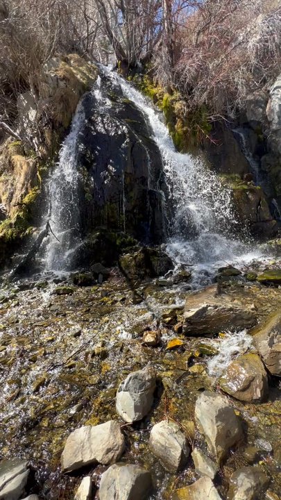
It has been a few years since I came to visit this little jewel in Carson City! Last time I was here, there was no parking lot, or bathroom. It was a park in the dirt off the main road kind of a place. I am glad to see that there have been improvements to this trailhead. The bathrooms (2 of them) are clean and there are lots of parking spaces for cars to chillax while their owners take a short stroll up to the waterfall. The trail from the parking lot to the waterfall is really quite short. Not a "hike" by any means. All ages can trek this with very little problems. I saw both a toddler (2 yrs??) and an elderly couple (not even gonna guess the age) along with many ages in between on the trail. In fact, I feel like maybe I haven't earned getting to see this waterfall after such a short walk with almost no effort, lol. I went Oct 22, not quite sure if there was still going to be water but hopeful. I was pleasantly surprised that not only was there water, but there was a fair amount of it as well. Not as much as early spring, but still, enough to still make this a legit waterfall this late in the year. There were the beginnings of icicles being formed as the weather as just begun to drop to near freezing overnight. I appreciate that there was no trash laying around, meaning people are picking up after themselves. Though it is a short walk, so really not much is needed for this trek.


Wonderful waterfall reward for minimal effort! Take the TRAIL, not the loop. From parking lot, its the trail to the right with the stairs. Perhaps a 15 minute dirt hike with some incline. No shade until you get to the falls. If you want more, there is a loop trail and other trails. Also, another trail with signs to left of parking lot. No toilet or water fountain.


The Kings Canyon Waterfall Trail is very nice! I'm not very good at hiking, no would I call myself athletic. This hike is very, very short. To get to the waterfall, you definitely are gaining elevation the whole time. I needed a break in the middle because I started sweating like nobody's business right quick! There is NO SHADE until you get to the waterfall and there is plenty of time to burn. I would say take a hat and put on some sunscreen. Water bottle too is a safe bet. The entire path is dirt so I wouldn't recommend doing this in sandals. I feel like this would be good if you've got kiddos, it's short and I'm sure they'd love to splash in the cool water. There is a way to go on a longer version of this hike. Right at the trailhead, you'll see a very helpful map. I believe there's a 9-mile hike, 1.75-mile hike, and the one we did was less than a mile. Ya girl can't hang for long in the heat haha. Getting to the waterfall is awesome! It's probably ten degrees cooler up there. Take a sack lunch and you'd got plenty of space to hang out. This would be a great place for a date! The falls sound lovely and you can dip your toes in the water. There were a fair amount of people the day we went. The view from the falls is really nice too. Overall, I could see myself doing this a couple times a year. It's a little out of the way, but should I find myself in Carson City, I would do this again for fun. 6/10 recommend


Wow, the trailhead and now parking area has really been improved with the new "remodel" of the entire trail head. Even the road down the hill has been repaved from a lousy broken pavement to a brand new blacktop. The waterfall trail has gotten way more use as people I guess get out during the pandemic and the old trail head was just a small dirt area to park and no restrooms at all, so you know what that led to! Now there's an all new restroom facility, maybe not too stinky! and a new paved parking lot that's way bigger than what was there before. A lot of earthwork went into the construction, so that wasn't cheap to do. Just glad we have a new parking lot and trail head for the Waterfall trail. The trail is about the same, not that big a deal, but it's somewhere close by to go hiking.


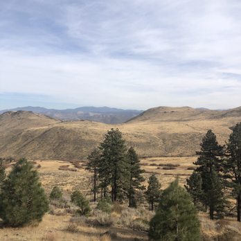
There is a long trail to get to the actual waterfall. It is uphill. If you are not used to hiking it can be strenuous on a hot day. Just when you start to think where is this thing, you round one more corner and there it is. Is it a huge waterfall? Not really. Is it a river you can swim in? Nope. But is is a great spot to go and enjoy. There is lots of shade. The water is cold. Bring a lunch too. Now if you are a hiker cross the waterfall and climb up the rocks to find the rest of the trail. The views of the Carson Valley are awesome.


The waterfall is still flowing up in Kings Canyon in early Fall Sept. 2018! I was positive it would've dried up a lot by now, but I was so wrong. The water level had dropped enough that there were a few visible ways to cross and stay pretty dry! On my first visit I'd wanted to cross, but the water was moving fairly quickly over submerged rocks I had to pass. This time I wasn't wearing the right shoes. I'll get there soon! LOCALS... You must check this out. If you haven't experienced this easily accessibly oasis in Carson, put it on your TO-DO List ASAP. The hike is relatively flat and maybe a mile out and back to the waterfall. So grab a water bottle and do it! Once you see it You will want to bring every visitor you know to see this surplus of water in the middle of the desert. It also feels like a rainforest!
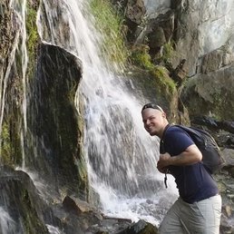

You can't really call this a hike (or at least to me it isn't) but it's definitely a cool, local spot to check out and is your chance to see a little waterfall without a whole lot of effort or time commitment. Honestly, I don't think it's even a mile round trip. I could be wrong though because I am terrible at judging distance. Lol.


King's Canyon road is a long, arduous incline from the Carson City desert climate to the high altitude alpine forest. If ridden until the end, it would lead all the way through the Tahoe Rim trail, over the ridge, and towards Lake Tahoe. That would be a big bike ride, certainly more than I could manage, especially with the current state of my bike that needed a tune-up. There are parts of the road that are blood pumping steep with loose rocks. It didn't take long before I had to stop and rest, and it was somewhat disheartening when I had to rest a stone's throw away from my previous rest point. I reached a point where it was easier and faster for me to slowly jog next to my bike instead of pedaling up. Once I was past the tree line, I would hear the nonstop baaing of sheep grazing in the canyon. Apparently, they allow sheep grazing in the area, probably with the hope that the sheep nibble down the flammable bushes. The best views of the road are past the mountain bike turnoff and around the high bend in the road. After the bend, a new set of mountain ridges come into view with additional pastureland and the Carson Valley in the distance. When I was sufficiently tired out, I jumped on my bike and let gravity take me down. After returning to the parking lot, I decided to see the supposed main event of the area: the waterfall, only a quarter mile hike up. The area around the waterfall had dense vegetation growth and was very humid, as one might expect. However, I was not very impressed. Maybe if I had seen it during snowmelt it would've been better.


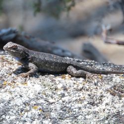
Oh. My. GOODNESS!!! Our family (2 adults, 4 kids ages 3, 7, 8, and 9) LOVED this trail! The trailhead was easy to find, and parking was super convenient. We went right and up the stairs after parking. The trail straight to the falls isn't too long - under a mile round trip for sure. We did that first, played in the rocks at the falls (which would also have been a great spot for a picnic lunch or snack), and then came back out to follow the sign for the upper loop. Our total distance was just over 2 miles. Kids were in love with the lizards. We also brought our puppy who was able to be off-leash most of the time. The short out-and-back to the falls was fairly popular, but we only came up on one other small group along the upper trail loop. Everyone was super nice along the trail - and how could we not be in such a gorgeous place!
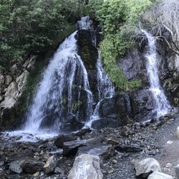


7 days ago
Super pretty hike with a couple different trails some very easy and others with pretty decent elevation changes read more


1 year ago
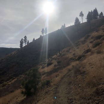
Spring is here! Discovered this close-in trail for quick midday hike. A few trails at this location to choose from. Small paved parking lot allows for off street parking. Trail head has bathroom facilities, clear trail signage. Be aware that some trails do not allow dogs while some allow them on leash. Did a quick family friendly hike to the Kings Canyon Waterfall (.3 miles) and then the North King's Loop (1.8 miles). Waterfall hike is short and a well-groomed trail makes for a great family friendly stroll for all ages. Falls are really flowing right now with a lot of shade trees. North King's Loop. 1.8 miles loop with about a 450' elevation gain for about .9 miles. Trails are well-groomed (kudos to City of Carson and volunteers). For most of the loop, the trail is narrow to a shoulder width with a hill on one side and a slope off on the other. My hike is late March, early spring, so still signs of snow and ice hazards on parts of the shade sections of the trail. Overall, a great hike in the City of Carson. read more


On a difficulty level; I'd say it's easy. This trail is kid, elderly and furry friend friendly. Even those who have foot injuries can walk right up with a little to no assistance. It's a popular spot in the Summer months. My last visit was on a hot July day. I almost had lunch there a few weeks ago, but I didn't feel like dealing with a crowd. It's a nice spot to cool down under the waterfall and have lunch. The older I get, the more I enjoy being outdoors and finding new trails to explore. It won't be long before I'm hanging in this waterfall again. read more
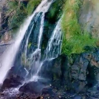


An easy, short (quarter mile) elevation hike. There are 3 separate waterfalls in the same section that is the end of the hike. There is also a 1 mile loop. Good for kids and adults like myself who like to hike but aren't extreme. There is a bathroom and small parking lot. We brought a picnic lunch. Watch out for deer! read more


8 months ago

4 years ago
It has been a few years since I came to visit this little jewel in Carson City! Last time I was here, there was no parking lot, or bathroom. It was a park in the dirt off the main road kind of a place. I am glad to see that there have been improvements to this trailhead. The bathrooms (2 of them) are clean and there are lots of parking spaces for cars to chillax while their owners take a short stroll up to the waterfall. The trail from the parking lot to the waterfall is really quite short. Not a "hike" by any means. All ages can trek this with very little problems. I saw both a toddler (2 yrs??) and an elderly couple (not even gonna guess the age) along with many ages in between on the trail. In fact, I feel like maybe I haven't earned getting to see this waterfall after such a short walk with almost no effort, lol. I went Oct 22, not quite sure if there was still going to be water but hopeful. I was pleasantly surprised that not only was there water, but there was a fair amount of it as well. Not as much as early spring, but still, enough to still make this a legit waterfall this late in the year. There were the beginnings of icicles being formed as the weather as just begun to drop to near freezing overnight. I appreciate that there was no trash laying around, meaning people are picking up after themselves. Though it is a short walk, so really not much is needed for this trek. read more


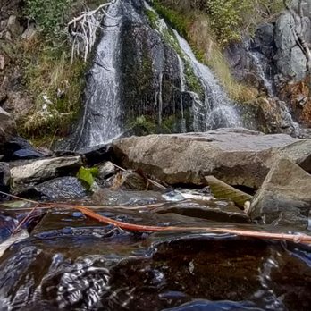


Wonderful waterfall reward for minimal effort! Take the TRAIL, not the loop. From parking lot, its the trail to the right with the stairs. Perhaps a 15 minute dirt hike with some incline. No shade until you get to the falls. If you want more, there is a loop trail and other trails. Also, another trail with signs to left of parking lot. No toilet or water fountain. read more


The Kings Canyon Waterfall Trail is very nice! I'm not very good at hiking, no would I call myself athletic. This hike is very, very short. To get to the waterfall, you definitely are gaining elevation the whole time. I needed a break in the middle because I started sweating like nobody's business right quick! There is NO SHADE until you get to the waterfall and there is plenty of time to burn. I would say take a hat and put on some sunscreen. Water bottle too is a safe bet. The entire path is dirt so I wouldn't recommend doing this in sandals. I feel like this would be good if you've got kiddos, it's short and I'm sure they'd love to splash in the cool water. There is a way to go on a longer version of this hike. Right at the trailhead, you'll see a very helpful map. I believe there's a 9-mile hike, 1.75-mile hike, and the one we did was less than a mile. Ya girl can't hang for long in the heat haha. Getting to the waterfall is awesome! It's probably ten degrees cooler up there. Take a sack lunch and you'd got plenty of space to hang out. This would be a great place for a date! The falls sound lovely and you can dip your toes in the water. There were a fair amount of people the day we went. The view from the falls is really nice too. Overall, I could see myself doing this a couple times a year. It's a little out of the way, but should I find myself in Carson City, I would do this again for fun. 6/10 recommend read more


3 years ago
Beautiful trail with lots of wildflowers in June. The lower loop is an easy hike but the upper loop is a moderate hike with some elevation. Gorgeous view of Carson City from the upper loop. read more


4 years ago
Wow, the trailhead and now parking area has really been improved with the new "remodel" of the entire trail head. Even the road down the hill has been repaved from a lousy broken pavement to a brand new blacktop. The waterfall trail has gotten way more use as people I guess get out during the pandemic and the old trail head was just a small dirt area to park and no restrooms at all, so you know what that led to! Now there's an all new restroom facility, maybe not too stinky! and a new paved parking lot that's way bigger than what was there before. A lot of earthwork went into the construction, so that wasn't cheap to do. Just glad we have a new parking lot and trail head for the Waterfall trail. The trail is about the same, not that big a deal, but it's somewhere close by to go hiking. read more


There is a long trail to get to the actual waterfall. It is uphill. If you are not used to hiking it can be strenuous on a hot day. Just when you start to think where is this thing, you round one more corner and there it is. Is it a huge waterfall? Not really. Is it a river you can swim in? Nope. But is is a great spot to go and enjoy. There is lots of shade. The water is cold. Bring a lunch too. Now if you are a hiker cross the waterfall and climb up the rocks to find the rest of the trail. The views of the Carson Valley are awesome. read more


8 years ago
The waterfall is still flowing up in Kings Canyon in early Fall Sept. 2018! I was positive it would've dried up a lot by now, but I was so wrong. The water level had dropped enough that there were a few visible ways to cross and stay pretty dry! On my first visit I'd wanted to cross, but the water was moving fairly quickly over submerged rocks I had to pass. This time I wasn't wearing the right shoes. I'll get there soon! LOCALS... You must check this out. If you haven't experienced this easily accessibly oasis in Carson, put it on your TO-DO List ASAP. The hike is relatively flat and maybe a mile out and back to the waterfall. So grab a water bottle and do it! Once you see it You will want to bring every visitor you know to see this surplus of water in the middle of the desert. It also feels like a rainforest! read more


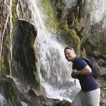
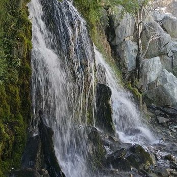
You can't really call this a hike (or at least to me it isn't) but it's definitely a cool, local spot to check out and is your chance to see a little waterfall without a whole lot of effort or time commitment. Honestly, I don't think it's even a mile round trip. I could be wrong though because I am terrible at judging distance. Lol. read more


4 years ago
Have to give this a one star because this trail was dog friendly before they modernized it. Now no dogs allowed. read more


King's Canyon road is a long, arduous incline from the Carson City desert climate to the high altitude alpine forest. If ridden until the end, it would lead all the way through the Tahoe Rim trail, over the ridge, and towards Lake Tahoe. That would be a big bike ride, certainly more than I could manage, especially with the current state of my bike that needed a tune-up. There are parts of the road that are blood pumping steep with loose rocks. It didn't take long before I had to stop and rest, and it was somewhat disheartening when I had to rest a stone's throw away from my previous rest point. I reached a point where it was easier and faster for me to slowly jog next to my bike instead of pedaling up. Once I was past the tree line, I would hear the nonstop baaing of sheep grazing in the canyon. Apparently, they allow sheep grazing in the area, probably with the hope that the sheep nibble down the flammable bushes. The best views of the road are past the mountain bike turnoff and around the high bend in the road. After the bend, a new set of mountain ridges come into view with additional pastureland and the Carson Valley in the distance. When I was sufficiently tired out, I jumped on my bike and let gravity take me down. After returning to the parking lot, I decided to see the supposed main event of the area: the waterfall, only a quarter mile hike up. The area around the waterfall had dense vegetation growth and was very humid, as one might expect. However, I was not very impressed. Maybe if I had seen it during snowmelt it would've been better. read more


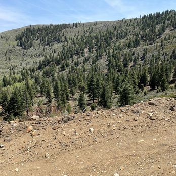

Oh. My. GOODNESS!!! Our family (2 adults, 4 kids ages 3, 7, 8, and 9) LOVED this trail! The trailhead was easy to find, and parking was super convenient. We went right and up the stairs after parking. The trail straight to the falls isn't too long - under a mile round trip for sure. We did that first, played in the rocks at the falls (which would also have been a great spot for a picnic lunch or snack), and then came back out to follow the sign for the upper loop. Our total distance was just over 2 miles. Kids were in love with the lizards. We also brought our puppy who was able to be off-leash most of the time. The short out-and-back to the falls was fairly popular, but we only came up on one other small group along the upper trail loop. Everyone was super nice along the trail - and how could we not be in such a gorgeous place! read more


8 years ago
Just a short walk for a quick getaway from the hustle and bustle. Well worth the 10 minute walk from the parking area. ****Always take care on the road leading to trailhead as there is always wildlife near by. read more
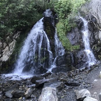


Awesome little hike up to the waterfalls! We loved the closeness to the trailhead. The walk was a little steep, but totally doable! The waterfalls were wonderful! The ONLY drawback to this hike was cigarette butts along the trail, a Aquafina bottle in the stream... read more


6 years ago
This was just a short jaunt from. Damonte ranch/SW Reno and you have the ability to make it a9.8 mike trip to the falls or two miles round trip. I loved it and my fur any legally was able to be off leash win win. read more


Amazing find. Typed in Hike for current location and lone behold this waterfall hike appeared. I was excited but concerned because there is always the chance it could be dried up. Fortunately it was not. It was a beautiful 25° outside in the fresh Ice air of the waterfall made the hike worth the journey. If your in the area it is well worth the 30min round trip walk. read more



4 years ago

9 years ago
Easy walk, great waterfalls view!!! We had an awesome time and enjoyed taking photos. It was a little breezy day(last Saturday!) but that doesn't stop me to....YES I did had a quick Waterfall shower! Haha Hike?! Nope, it's just an easy, fun trail for a nice walk! Waterfalls is a big bonus! read more


6 years ago

8 years ago
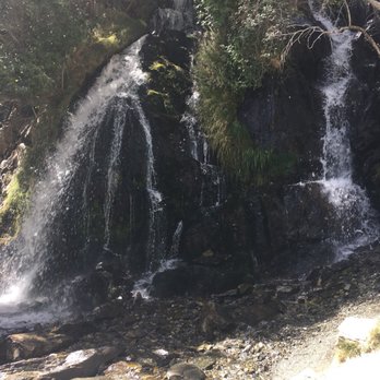
A nice easy walk to the waterfall. Great views of the Carson Valley as well. Recommend in the spring and fall for sure as it might be a bit too hot in the summer. read more


5 years ago

10 years ago
Short trail with a waterfall at the end. The trail is steep though and not shaded so can be hot in the heat. There is longer trail that wraps around in a circle. read more


8 years ago
7 years ago

10 years ago

10 years ago
11 years ago
More info about Kings Canyon Waterfall Trail
Ask the Community - Kings Canyon Waterfall Trail
What's the best time(s) of year to go?
Probably a silly question, but is there any water in July or are the falls completely dry by now? Even if dry, is it still a beautiful area to hike?
July will have wIll water except maybe in a drought year.
Review Highlights - Kings Canyon Waterfall Trail
You might also consider


















Why does Yelp recommend reviews?
1 review that is not currently recommended
The reviews below are not factored into the business's overall star rating.

10 years ago
Kings Canyon Waterfall Trail - hiking - Updated May 2026
Best of Carson City
People found Kings Canyon Waterfall Trail by searching for…
Things to Do in Carson City, Nevada
Hiking Trails With Waterfalls in Carson City, Nevada
Natural Hot Springs in Carson City, Nevada
River Swimming in Carson City, Nevada
Off Road Trails in Carson City, Nevada
Walking Trails in Carson City, Nevada
Fun Things to Do With Kids in Carson City, Nevada
Scenic View in Carson City, Nevada
Easy Hikes in Carson City, Nevada
Places to Take Pictures in Carson City, Nevada
Running Trails in Carson City, Nevada
Picnic Areas in Carson City, Nevada
Photo Spots in Carson City, Nevada
Mountain Biking in Carson City, Nevada
Fun Things to Do at Night in Carson City, Nevada
Waterfalls and Swimming Holes in Carson City, Nevada
Waterfalls in Carson City, Nevada
Dog Friendly Hiking Trails in Carson City, Nevada
Beautiful Views in Carson City, Nevada
Scenic Overlook in Carson City, Nevada
Trending Searches in Carson City, NV
Boat Rental near Kings Canyon Waterfall Trail
Botanical Gardens near Kings Canyon Waterfall Trail
Bounce House Rentals near Kings Canyon Waterfall Trail
Campgrounds near Kings Canyon Waterfall Trail
Cherry Picking near Kings Canyon Waterfall Trail
Cliff Jumping near Kings Canyon Waterfall Trail
Dog Friendly Things To Do near Kings Canyon Waterfall Trail
Flower Fields near Kings Canyon Waterfall Trail
Flower Shop near Kings Canyon Waterfall Trail
Garage Sales near Kings Canyon Waterfall Trail
Hair near Kings Canyon Waterfall Trail
Lakes near Kings Canyon Waterfall Trail
Nurseries & Gardening near Kings Canyon Waterfall Trail
Outdoor Activities near Kings Canyon Waterfall Trail
Outdoor Furniture Stores near Kings Canyon Waterfall Trail
Party Equipment Rentals near Kings Canyon Waterfall Trail
Pedicure near Kings Canyon Waterfall Trail
Pick Your Own Farms near Kings Canyon Waterfall Trail
Picnic Areas near Kings Canyon Waterfall Trail
Rainy Day Activities near Kings Canyon Waterfall Trail
Rock Quarry near Kings Canyon Waterfall Trail
Running Trails near Kings Canyon Waterfall Trail
Scenic Drive near Kings Canyon Waterfall Trail
Secret Spots near Kings Canyon Waterfall Trail
State Parks near Kings Canyon Waterfall Trail
Strawberry Picking near Kings Canyon Waterfall Trail
Sunrise View near Kings Canyon Waterfall Trail
Swimming Holes near Kings Canyon Waterfall Trail
Browse Articles
Browse Nearby
BEST of Carson City, Nevada Coffee near Kings Canyon Waterfall Trail
BEST of Carson City, Nevada Restaurants near Kings Canyon Waterfall Trail
BEST of Carson City, Nevada Things to Do near Kings Canyon Waterfall Trail
BEST of Carson City, Nevada Walking Trails near Kings Canyon Waterfall Trail
BEST of Carson City, Nevada Breakfast near Kings Canyon Waterfall Trail
BEST of Carson City, Nevada Parks near Kings Canyon Waterfall Trail
BEST of Carson City, Nevada Campgrounds near Kings Canyon Waterfall Trail
BEST of Carson City, Nevada Caves near Kings Canyon Waterfall Trail
BEST of Carson City, Nevada Visitor Centers near Kings Canyon Waterfall Trail
Browse Brands
Related Searches in Carson City, NV
Affordable Kayak Rental Services in Carson City, Nevada
Best Fishing Locations and Guides in Carson City, Nevada
Best Places for Horseback Riding in Carson City, Nevada
Best Sledding Spots and Fun in Carson City, Nevada
Check Out Off Road Trails in Carson City, Nevada
Discover Dog Friendly Trails to Explore in Carson City, Nevada
Discover Kid Friendly Hiking Trails in Carson City, Nevada
Discover Scenic Mountain Bike Trails Near Carson City, Nevada
Discover Scenic Waterfall Spots in Carson City, Nevada
Discover a Hiking Trail in Carson City, Nevada
Discover the Best Night Hike Trails in Carson City, Nevada
Dog-Friendly Hikes With Dogs in Carson City, Nevada
Enjoy Camping Adventures Around Carson City, Nevada
Enjoy Exciting Mountain Biking Adventures in Carson City, Nevada
Enjoy Kayaking Adventures in Carson City, Nevada
Enjoy Tent Camping Spots Around Carson City, Nevada
Enjoy a Beautiful Waterfall Hike in Carson City, Nevada
Enjoy the Best Picnic Spots and Ideas in Carson City, Nevada
Enjoy the Best Tubing Experiences in Carson City, Nevada
Enjoy the Best Walking Path in Carson City, Nevada
Enjoy the Best Walking Trails in Carson City, Nevada
Experience Thrilling White Water Rafting in Carson City, Nevada
Explore Beautiful Parks and Green Spaces in Carson City, Nevada
Explore Easy Hikes Perfect for All in Carson City, Nevada
Explore Fun Activities to Do in Carson City, Nevada
Explore Popular Campgrounds Near Carson City, Nevada
Explore the Best Beach Spots in Carson City, Nevada
Explore the Best Boating Spots in Carson City, Nevada
Explore the Best Swimming Holes Around Carson City, Nevada
Explore the Best Trail Options in Carson City, Nevada
Family Friendly Hiking With Kids in Carson City, Nevada
Find Beautiful Views in Carson City, Nevada
Find Popular Ziplining Spots Around Carson City, Nevada
Find the Best Parks for Picnics in Carson City, Nevada
Find the Best Scenic View Locations in Carson City, Nevada
Hike the Popular Waterfall Trail in Carson City, Nevada
Hiking Trails With Waterfalls in Carson City, Nevada
Off Leash Dog Hiking Trails in Carson City, Nevada
Plan a Scenic Drive Route Near Carson City, Nevada
Popular Outdoor Activities to Try in Carson City, Nevada
Popular Picnic Spots to Visit in Carson City, Nevada
Safe River Swimming Areas in Carson City, Nevada
Safe and Fun Parks for Kids in Carson City, Nevada
Top Playgrounds for Kids to Enjoy in Carson City, Nevada
Top Running Trails to Explore in Carson City, Nevada
Top Swimming Lakes to Enjoy in Carson City, Nevada
Top Swimming Spots and Pools in Carson City, Nevada
Top Things to Do With Kids in Carson City, Nevada
People who viewed Kings Canyon Waterfall Trail also viewed

Marlette lake trail
6 reviews

Genoa Loop Trail
4 reviews

Lower Galena Creek Trail - Jones-Whites Loop - Church's Pond
19 reviews

Bayview Trailhead-Bayview Campground
21 reviews

Galena Creek Regional Park
44 reviews

Davis Creek Regional Park
39 reviews

Callahan Park
12 reviews

Geiger Lookout
13 reviews

Mt Rose Summit
22 reviews

Washoe Lake State Park
38 reviews