Cancel

    Open app

    Search

    Dog Mountain

    4.0 (2 reviews)

    Dog Mountain Photos

    Recommended Reviews - Dog Mountain

    Your trust is our priority, so businesses can't pay to alter or remove their reviews. Learn more about reviews.
    Yelp app icon
    Browse more easily on the app
    Review Feed Illustration
    Photo of Edward L.
    605
    3890
    47715

    3 years ago

    Helpful 0
    Thanks 0
    Love this 1
    Oh no 0

    4 years ago

    Helpful 20
    Thanks 0
    Love this 19
    Oh no 0

    Verify this business for free

    People searched for Hiking 989 times last month within 15 miles of this business.

    Verify this business

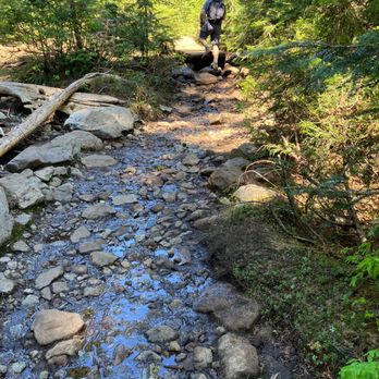
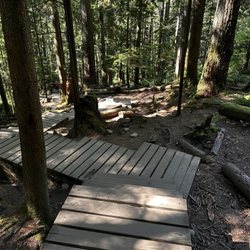
    Kennedy Falls - Terrain - August 2026.

    Kennedy Falls

    5.0(1 review)
    8.9 km

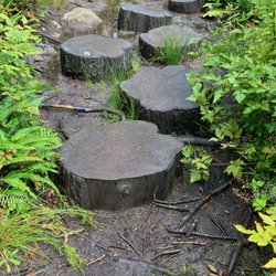
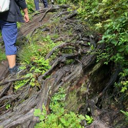
    The first and only time I have hiked to Kennedy Falls was in the summer of 2016, nine years ago…read more I've been wanting to go again, but unfortunately I never had the opportunity until yesterday (June 14, 2025). As nearly a decade has gone by, I didn't remember much about the hike except that it was fairly challenging because the terrain was quite rugged and technical with rocks and roots, there were logs to climb over, and I had to scramble up some short, but steep inclines. None of that has changed, but now along a short section of the trail (probably the part that I had to scramble up nine years ago), there is a chain to assist with climbing up and down. I had quite a bit of difficulty descending this portion of the trail (it was quite scary!), but it was fairly easy hiking back up. Until quite recently, I had no idea that Kennedy Falls was accessible by transit, and I organized a hike yesterday with my transit accessible hiking group. The #210 bus stops at Mountain Highway and Coleman Street, only about a ten minute walk from the entrance to the trails on Mount Fromme, although the walk up from the bus stop is quite steep, and I was huffing and puffing. (The walk from the bus stop was actually the steepest incline encountered on our entire hike. The hike, while difficult due to terrain, had minimal elevation.) The hike to Kennedy Falls, round trip, is 10km and about five hours. Hiking at a slow, relaxed pace, taking breaks (including 20 minutes at the falls and 10 minutes at the big Cedar tree, as well as other shorter breaks), the hike took six hours. To get to Kennedy Falls, you first hike along the Cedar Tree Trail. The first portion is quite easy and flat, then you eventually encounter logs, rocks, and the chain. After about 1.5 hours, you come to the big Cedar -- a HUGE tree that is estimated to be about 600 years old. Once leaving the Cedar, it takes about an hour to get to the falls, so a total of 2.5 hours from the beginning to the falls, one way. (The timing was also the same on the way back.) It was a great hike, and now that I know that it is transit accessible, I will be sure to go more often. As it can be quite wet and muddy, with numerous streams to cross, it is best to go during the summer when it's dry, so I likely won't be going in the spring, only summer and early fall. (Also due to the length of the hike, I prefer to go when the sun sets later.) Other things to note: the outhouses located at the start of the trail are still gendered (which makes no sense!), and the sign telling you not to throw pianos and other objects into the toilet is still there. There is also a water refill station at the entrance. Not that it matters to me, as I take transit, but parking there is difficult. A few of our group members drove, and they had trouble finding parking. Parking is free, but the parking lot is quite small, and Mount Fromme is very popular with mountain bikers (there are numerous mountain biking trails), so the parking lot was full at 10am. They were able to find parking on nearby side streets, but then had to walk 20 minutes up the steep hill (the bus stop was closer than where they parked). One person did manage to get a parking spot in the parking lot (after waiting 30 minutes), but it was only after we completed our hike that we noticed there was a three hour limit (thankfully he did not get a ticket). While transit is a pain in the ass (our bus was over ten minutes late!), it has its advantages. [Yelp collections: Hiking]

    Photos
    Kennedy Falls - Terrain - August 2026.

    Terrain - August 2026.

    Kennedy Falls
    Kennedy Falls

    See all

    Lynn Canyon Park

    Lynn Canyon Park

    4.8(75 reviews)
    5.9 km•Lynn Valley

    We took an Uber here to do some hiking and see the suspension bridge- they have a designated drop…read moreoff spot right in front of the ecology building and I highly recommend this since parking is so tight here The park is free. There are several trails that you can hike and we chose the creek path, it was about 2.5 km and a loop. It is fairly well marked as well. If you go on a weekend, there will be a lot of people so you can't straight too far from the trail anyway. There are a lot of stairs on the creek trail so be prepared for that and some of them are incredibly steep. It is beautiful, great river and Woods views. Plus we were blessed with 60° sunny weather today so it was absolutely gorgeous hiking weather. There is a café here, although we did not partake in any food or beverage, as well as clean restrooms and a water filling station. Take a moment to step into the ecology center if you would like to look at any of the exhibits and make a donation. They do have a lot of wooden bridges covering the more muddy bog areas, and the rest of the trail is dirt packed with tree roots veins. It is a well-made trail with appropriate steps and fencing to keep you in bounds.

    Awesome FREE park with a look suspension bridge! The suspension bridge is cool and a good photo…read morespot. We went on a Friday and it was pretty busy but we arrived around 11am and there were still a couple of parking spots available in the various small lots around the park. There is a snow chalet type building near the trail head & suspension bridge that has restrooms on the outside and some snacks and ice cream on the inside. We took the Twin Falls loop trail and went in the direction that started with the suspension bridge first and it was a lot more stairs and steeper than we anticipated. The hike back up from near the creek at the bottom had us sweaty and huffing and puffing as middle-aged parents. haha! But the trees and foliage was beautiful and we even saw a banana slug! We were cursing the 20 flights of stairs up and down but afterwards, we felt good.

    Photos
    Lynn Canyon Park - Lynn Canyon Park entrance sign.

    Lynn Canyon Park entrance sign.

    Lynn Canyon Park - The entrance sign for Lynn Canyon Suspension Bridge.

    The entrance sign for Lynn Canyon Suspension Bridge.

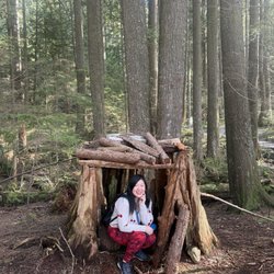
    Lynn Canyon Park - A little hut along the trail

    See all

    A little hut along the trail

    Lower Seymour Conservation Reserve

    Lower Seymour Conservation Reserve

    4.8(16 reviews)
    5.1 km

    Last year I discovered a hiking group that hikes in the Lower Seymour Conservation Reserve (LSCR)…read moreevery Monday morning for a couple of hours. Due to my school, I was only able to go on one hike with them last year as I found the group just before the fall semester started, but this year I've gone on half a dozen hikes with them and look forward to many more. There are 65km of hiking trails in the LSCR, ranging from easy (such as the Rice Lake Loop) to challenging, for more experienced hikers. There are several intermediate trails, including a portion of the Baden Powell trail, and with all the different trails, it is a great area to explore and your hike can range from an easy one hour walk to a hike of several hours -- there's something for everyone. The LSCR is located between Lynn Headwaters Regional Park and Lynn Canyon Park, so you can combine a hike in the LSCR with a hike in Lynn Headwaters or Lynn Canyon for more variety. Another great thing about the LSCR is that it is transit accessible! You can take the #227 or #228 bus, or take the #210 bus to Lynn Headwaters and walk about ten to fifteen minutes to LSCR. [Yelp collections: Hiking]

    This is the area that is on the other side of Lynn Valley Park. Had no idea this existed (or that…read moreit was technically a different park) until now. Parking is available in the nice large lot next to the water treatment centre. There are public washrooms here as well. Some of the trails here seem to be more like service roads. Very well maintained. There are plenty of bear warning signs too. Guess somebody got eaten at one point. Plenty of fellow hikers and dogs here for bears to snack on. I remember always seeing other people at some point. In other words, the place is pretty crowded during the summer months. The trails go quite a ways from here. Hikes can go from minutes to hours or days, depending on what one is looking for.

    Photos
    Lower Seymour Conservation Reserve
    Lower Seymour Conservation Reserve
    Lower Seymour Conservation Reserve

    See all

    Dog Mountain - hiking - Updated October 2026

    Loading...
    Loading...
    Loading...