1. Danielson Monument Trail

0

Newbury Park, CA

Cancel

Open app

Search

Danielson Monument Trail

5.0 (2 reviews)

Danielson Monument Trail Photos

You might also consider

More like Danielson Monument Trail

Recommended Reviews - Danielson Monument Trail

Your trust is our priority, so businesses can't pay to alter or remove their reviews. Learn more about reviews.
Yelp app icon
Browse more easily on the app
Review Feed Illustration

8 years ago

Helpful 15
Thanks 0
Love this 9
Oh no 0

6 years ago

Helpful 1
Thanks 0
Love this 0
Oh no 0

You might also consider
Verify this business for free

People searched for Hiking 1,577 times last month within 15 miles of this business.

Verify this business

Boney Mountain Overlook - Groovy creves at Boney Mountain

Boney Mountain Overlook

4.4(23 reviews)
0.3 mi

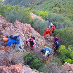
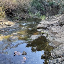
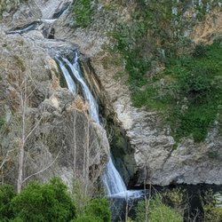
Date of the hike: 3.19.2011…read more According to my friend's GPS, we hiked 8.2 miles round trip with an elevation gain/loss of 2,000ft. We kind of just winged it and parked right at the end of Wendy Ave when you exit on the 101fwy. I think other websites out there say to park somewhere else. The hike itself had a couple signs here and there but we were still a little confused on which path to take. There's a nice waterfall about a mile into the hike and you'll have to cross a little stream. There's a lot of shade near the waterfall so it's a perfect area to rest or have a quick snack. I wish I read the description on LocalHikes.com (http://www.localhikes.com/Hikes/BoneyMountainOverlook_4472.asp) a little better. Instead of making a left towards Danielson Monument we took the other path which had a gradual incline, no switchbacks here. We did get to a different hill that has a good view and found the correct way to go to the overlook. If it wasn't for our time constraints, we would have back tracked and went up the right way. We'll have to go back and see the view from the top. http://www.flickr.com/photos/lamb1028/sets/72157626248248337/

I don't really know how far this hike is. I'd say is around 8 or 9 miles…read more You're not really hiking when you go here. I see it more like as if you're climbing up a big rock. IT's nice. Pretty popular. And, sometimes you see horse poop on the trails. I'd say 1/4th of the way in, there's a beautiful waterfall you can hang out at. Walking up the trail, you're surrounded by big green mountains. At the top of Boney Mountain, there's a 360 view of the city. Really nice. It just takes awhile to get up there. It's not too bad though. Parking here is free.

Photos
Boney Mountain Overlook - Who needs a gym for a total workout when there are rocks to climb at Boney Mountain

Who needs a gym for a total workout when there are rocks to climb at Boney Mountain

Boney Mountain Overlook - Mini cave at Boney Mountain

Mini cave at Boney Mountain

Boney Mountain Overlook

See all

Satwiwa Native American Indian Culture Center

Satwiwa Native American Indian Culture Center

4.3(15 reviews)
0.5 mi

One of our favorite hiking spots is around the Satwiwa Cultural Center. You can hike here for as…read morelong or as short a hike as you want. You can also make it strenuous or easy. There are lots of hiking options, with locations like a waterfall, an old cabin site, a windmill and some of the highest peaks in the Santa Monica Mountains (http://www.yelp.com/biz/satwiwa-to-tri-peaks-newbury-park#hrid:OtZHlQDQX4Dl-YnXoTqQdQ/query:hiking) available for you to reach in just a day hike (http://www.yelp.com/biz/santa-monica-mountains-national-recreation-area-thousand-oaks#hrid:RKnqDUDYH03tcNMqErH1rA/query:hike). The last time we went, we took the kids, so we weren't going to get to the top of Boney mountain that day. Instead, we parked at the end of Wendy Drive and hiked over to the Chumash Indian center. Apparently you don't have to do this and can park closer and walk on a paved road right up to the center if you want. That's OK though, it's a nice short hike and we saw a lot of wildflowers on the way. (We also had to get out of the way of mountain bikers, so watch out!) When we got there, we toured the Indian center, the kids played with all the stuffed animals and explored the kid-friendly things they had on display. They had lots of books on the area and the Chumash culture. We were interested in one of the red flowers we saw on the trail (couldn't remember the name of it from our college botany class) and asked one of the guys working there. They happily explained what it was and told us where we could see even better flowers on another trail. Then we went outside and sat in the Ap (the incomplete Chumash hut) and had lunch. After lunch, we walked through the little garden they have planted with indigenous plants and by then the little ones were getting tired so we headed back. It was a nice little hike. We saw lots of people on the trail since it was a Saturday, lots of dogs and mountain bikes. The cultural center has a water fountain and restrooms and when we were there they had some water bottles and power bars for sale. They also have a lot of summer events happening (http://satwiwa.org/calendar.php).

Was checking out the clearance section in little store then see a whole bin of T-shirts for 40% off…read morethen I go to buy the tshirt and no discount so I ask the cashier about the discount and she says she doesn't know About any discount which is clearly marked on the shirt and the whole bin of shirts, doesn't know what to do and then says I can do 15% I was like forget about it - it's a tiny store w limited items and they lost a sale because there's no effort to try to figure anything out - no attempt to Call to ask anyone just like lazy and I do not appreciate that, as someone who's worked a lot of Customer service I just can't believe the lack of enthusiasm to even try to Figure out the situation

Photos
Satwiwa Native American Indian Culture Center
Satwiwa Native American Indian Culture Center - Rolling clouds look magnificent

Rolling clouds look magnificent

Satwiwa Native American Indian Culture Center

See all

Hill Canyon Trail Head

Hill Canyon Trail Head

5.0(7 reviews)
5.6 mi

I thought this was a hidden gem in Santa Rosa Valley, but apparently everybody knows about this…read morebeautiful trail. Once you arrive at this park, there are multiple trails to enjoy that will satisfy different hiking levels. Some of the trails at this park go into the mountains with some significant elevation. The hill canyon trail is a flat trail at this park. As it was a super-hot day, my hiking group and I took an easy, and we just did a 3.7 mile out and back trail that was quite easy and took under hour and 20 minutes to do at a causal pace. The trail followed the river, which I heard bass can be seen in the water. The trail was very pretty and relaxing. While on the trail you need to be alert. You may encounter mountain bikers zooming through the trails. Plus, you also get horseback riders in this area. On a hot sunny day you always need to be alert to snakes. At the trailhead there is a small parking lot. I heard on the weekends this parking lot gets super busy early in the morning. Not too far away there is a larger lot available. This park is worth a visit for beginner hikers as well as advance hiker. Bring plenty of water and hat as most of the area is not shaded! Happy trails!
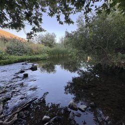
Love love love this trail!…read more Definitely one of my go to trails. You can either hike up the mountain that has a gradual incline. This trail leads to lizard rock once you get to the top and continue on. If you keep going it will lead you to paradise falls . If you plan on going that far, plan to take a lunch and water and comfortable hiking shoes. Or take a walk across the bridge and down a pathway where you'll see the creek which is so peaceful .

Photos
Hill Canyon Trail Head

See all

Danielson Monument Trail - hiking - Updated October 2026

Loading...
Loading...
Loading...