Cook's Meadow Loop Photos


More like Cook's Meadow Loop
Recommended Reviews - Cook's Meadow Loop
Start your review...


Reviews With Photos


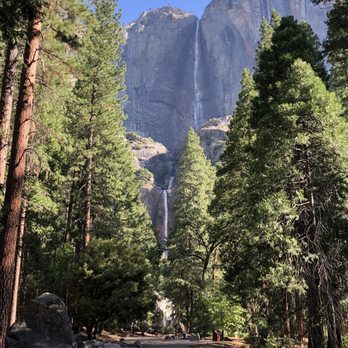
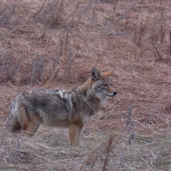
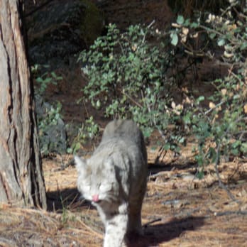
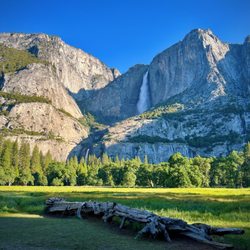
Would you pay $35 to see a former land fill? Millions of visitors do just that! Visitors pay a $35 entrance fee when driving into Yosemite National Park, and will first see Yosemite Falls, at 2425' the tallest in North America, just as they drive around Cook Meadows. Cook Meadows is one of the few meadows at 4000' elevation. It is located at the very end of Yosemite Valley, with Glacier Point on one side, Yosemite Lodge at the Falls on another side, and Yosemite Village on a third side. There is a second prominent meadow in Yosemite, in the northern section. It no longer exists, as the meadow was dammed up in the early 1900s and now lies beneath 50 feet of water of the Hetch Hetchy reservoir, source of drinking water for much of the Bay Area. When the valley was settled by white men in the late 1800s, they built a town on Cook meadows, with Ford model T s parked diagonally next to stores alongside the dirt road. Later they moved the town over to the edge of the valley, and used Cook Meadows as a land fill. Eventually Cook Meadows became a campground for tourists in the 20th century. The area was trampled over quite a bit, as there were no trails built until much later. In the 1997-1998 El Nino year, the Yosemite Valley and Cook Meadows were flooded by the overflowing Merced river. Afterwards, the Meadows was dug up, and the garbage from the landfill removed, so that the Meadows would have a natural drainage for rising waters. Camping was banned, wooden boardwalks added, and the Meadows restored to its former luster. We walk from our hotel at the Ahwahnee, through Yosemite Village, to Yosemite Falls, around the edge of the Meadows. We continue walking through Yosemite Lodge at the Falls, the primary lodge in the park, and around the backside of the Lodge, which border on the meadow. Hiding in the bushes in the early morning is an adult stag deer, with an impressive set of antlers. During the winter these deer will shed their antlers to conserve energy, and grow a new set in the summer. We continue walking on asphalt trails, with small fences on both sides, to keep people from wandering off onto the yet to be fully restored areas of the meadows. We reach Swinging Bridge, a wooden pedestrian bridge, over the Merced River, with Yosemite Falls towering in the background. As we walk alongside the Valley Loop road, we see a coyote hunting for squirrels in the brush of the meadows. A bus slows down to allow the tourists to click away on their cameras. The wife and I walk slowly along side the road, checking out the coyote 100 feet away. Deer are very common, coyotes less common, black bears mainly seen at dusk and at night, and bobcats rare, and mountain lions all but gone from the meadows. Grizzly bears are extinct in California, but can be seen in Wyoming, Montana and Alaska. We walk back to our hotel, with the walk completely around the meadows taking some 3 hours. That evening, while still dusk, we do see a bobcat, catching a squirrel for dinner. Sorry, but that's not on my dinner plate tonight!


This is an awesome/easy little loop on the valley floor that I'd recommend for those with kids wanting to view the rock formations as well as the foliage. Go at dusk to see the deer come out and feed. We saw a bear too!
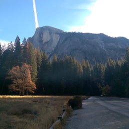


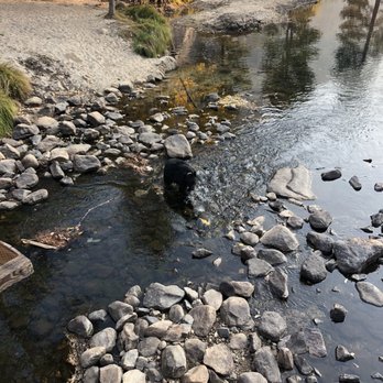
We arrived into the park on a Thursday at about 7:30am and parked at the lot in front of Swinging Bridge to do this loop (with Lower Yosemite Falls added one easily). Since park access is restricted because of COVID-19, there were plenty of parking spaces for us. This is a very easy hike - I'd label it more of a causal walk. A lot of this trail is shaded, only the portion between Sentinel Bridge on Southside Drive back to to Swinging Bridge parking lot was very exposed and sunny/hot. This walk is great because you get to see a lot of things - Swinging Bridge, Cook's Meadow, Yosemite Falls, Sentinel Bridge, the chapel, Merced River, and views of all the granite giants like Half Dome. We took our time, and Including the Lower Yosemite Falls Trail, it took us about 1 hour and 45 minutes. Along the wood boardwalk (which we had to ourselves), my husband spied a bear casually walking along the meadow. My son found some baby ducklings in a pond just off the Merced River too. read more




5 years ago

Would you pay $35 to see a former land fill? Millions of visitors do just that! Visitors pay a $35 entrance fee when driving into Yosemite National Park, and will first see Yosemite Falls, at 2425' the tallest in North America, just as they drive around Cook Meadows. Cook Meadows is one of the few meadows at 4000' elevation. It is located at the very end of Yosemite Valley, with Glacier Point on one side, Yosemite Lodge at the Falls on another side, and Yosemite Village on a third side. There is a second prominent meadow in Yosemite, in the northern section. It no longer exists, as the meadow was dammed up in the early 1900s and now lies beneath 50 feet of water of the Hetch Hetchy reservoir, source of drinking water for much of the Bay Area. When the valley was settled by white men in the late 1800s, they built a town on Cook meadows, with Ford model T s parked diagonally next to stores alongside the dirt road. Later they moved the town over to the edge of the valley, and used Cook Meadows as a land fill. Eventually Cook Meadows became a campground for tourists in the 20th century. The area was trampled over quite a bit, as there were no trails built until much later. In the 1997-1998 El Nino year, the Yosemite Valley and Cook Meadows were flooded by the overflowing Merced river. Afterwards, the Meadows was dug up, and the garbage from the landfill removed, so that the Meadows would have a natural drainage for rising waters. Camping was banned, wooden boardwalks added, and the Meadows restored to its former luster. We walk from our hotel at the Ahwahnee, through Yosemite Village, to Yosemite Falls, around the edge of the Meadows. We continue walking through Yosemite Lodge at the Falls, the primary lodge in the park, and around the backside of the Lodge, which border on the meadow. Hiding in the bushes in the early morning is an adult stag deer, with an impressive set of antlers. During the winter these deer will shed their antlers to conserve energy, and grow a new set in the summer. We continue walking on asphalt trails, with small fences on both sides, to keep people from wandering off onto the yet to be fully restored areas of the meadows. We reach Swinging Bridge, a wooden pedestrian bridge, over the Merced River, with Yosemite Falls towering in the background. As we walk alongside the Valley Loop road, we see a coyote hunting for squirrels in the brush of the meadows. A bus slows down to allow the tourists to click away on their cameras. The wife and I walk slowly along side the road, checking out the coyote 100 feet away. Deer are very common, coyotes less common, black bears mainly seen at dusk and at night, and bobcats rare, and mountain lions all but gone from the meadows. Grizzly bears are extinct in California, but can be seen in Wyoming, Montana and Alaska. We walk back to our hotel, with the walk completely around the meadows taking some 3 hours. That evening, while still dusk, we do see a bobcat, catching a squirrel for dinner. Sorry, but that's not on my dinner plate tonight! read more





6 years ago
This is an awesome/easy little loop on the valley floor that I'd recommend for those with kids wanting to view the rock formations as well as the foliage. Go at dusk to see the deer come out and feed. We saw a bear too! read more



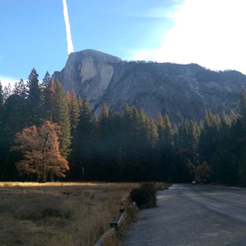
This is a really easy trail loop spanning about 1 mile, with flat terrain and stunning views. You can see Yosemite Falls, Half Dome, Glacier Point, and Sentinel Rock all in this little short loop. In fact, I passed it while leaving and entering the park (going towards the Upper Pines Campground), and almost drove right by it. You'll see side/street parking all along both side of the road, and a wide, flat meadow with a bridge winding through it, and that's when you know you're at Cook's Meadow. If you're taking the shuttle in, you can access it from shuttle stop #5, #9 (these two are across the street from each other) the easiest. It is bike and pet accessible, as well as wheelchair accessible, so you can keep that in consideration. But really it's a hike that will take you (at most) 30 minutes, and yet offer some beautiful views. I think it's a great introduction to the park when you enter, or even a great goodbye upon exiting. I went in the morning in late November, after I had checked out from my camp, when the dew had frozen over the meadow and it was just GORGEOUS. The views you can get, even on that tiny bridge were lovely... The sun slowly peeking out behind the mountains and catching the frozen dew, spinning silver colors around, trees ribbed in fall colors. Short, and so worth the trek through. I imagine it's also pretty spectacular in summer, when the meadow has tons of blossoms and blue sky. read more


2 years ago


10 years ago
More info about Cook's Meadow Loop
Ask the Community - Cook's Meadow Loop
Review Highlights - Cook's Meadow Loop
















Cook's Meadow Loop - hiking - Updated October 2026
Best of Yosemite Village
People found Cook's Meadow Loop by searching for…
Beaches in Yosemite Village, CA
Campgrounds in Yosemite Village, CA
Things to Do in Yosemite Village, CA
Snow Park in Yosemite Village, CA
Scenic View in Yosemite Village, CA
Playgrounds in Yosemite Village, CA
Hiking Trails in Yosemite Village, CA
National Parks in Yosemite Village, CA
Lodging in Yosemite Village, CA
Dirt Bike Rental in Yosemite Village, CA
Picnic Areas in Yosemite Village, CA
Off Road Trails in Yosemite Village, CA
State Park in Yosemite Village, CA
Watch Sunset in Yosemite Village, CA
Trails in Yosemite Village, CA
Waterfall in Yosemite Village, CA
River Swimming in Yosemite Village, CA
Boardwalk in Yosemite Village, CA
Swimming Lakes in Yosemite Village, CA
Camping Sites in Yosemite Village, CA
Free Snow Play in Yosemite Village, CA
Browse Nearby
BEST of Yosemite Village, California Parks near Cook's Meadow Loop
BEST of Yosemite Village, California Restaurants near Cook's Meadow Loop
BEST of Yosemite Village, California Things to Do near Cook's Meadow Loop
BEST of Yosemite Village, California Coffee near Cook's Meadow Loop
BEST of Yosemite Village, California Waterfalls near Cook's Meadow Loop
BEST of Yosemite Village, California Breakfast near Cook's Meadow Loop
BEST of Yosemite Village, California Visitor Centers near Cook's Meadow Loop
BEST of Yosemite Village, California Campgrounds near Cook's Meadow Loop
BEST of Yosemite Village, California Sledding near Cook's Meadow Loop


