Conewago Recreation Trail Photos
 - Hiking Near Me - Elizabethtown, Pennsylvania")


More like Conewago Recreation Trail
Recommended Reviews - Conewago Recreation Trail
Start your review...

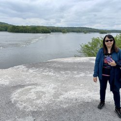
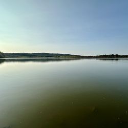
Reviews With Photos

A coworker suggested this system which connects to the Lebanon Valley trail system and it was quite a nice ride. Its a hardpan former railroad track, so its a smooth ride. My only issue is its width. i wish it was just a couple feet wider as the majority of it is about the size of a railroad track. This makes for a problem when you encounter other bikers, hikers or horses... usually all at once. Just a side note, theres no real address here so I used the closest intersection. If your driving on 230 away from E-town and come across industrial road, youve gone too far. You can see on the little map a railroad track diagram. Thats the place. Also, since its such a popular trail, parking can be an issue too.


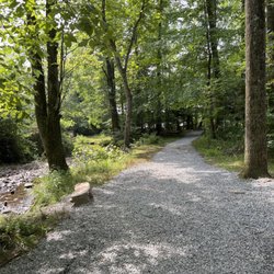
The Conewago trail is 5 miles long and connects directly to the Lebanon Valley Rail-Trail. The trail is a crushed stone trail; however, it's apparently old enough that gravels beneath begin to be exposed, making it rough to ride on. Furthermore, not only is the trail narrower than a typical rail trail, sections of it have a surface which is rounded or convex with ditches on both sides. This may make beginning bikers uncomfortable. As well, it could cause a bit of a congestion on a crowded day like today, when a family with a stroller is in the way. Scenery-wise it's also ranked low in my book. It's mostly a wooded scene without much of anything else; making the ride very monotonous and boring. The trail has to cross Rt. 743 (Hershey Rd) which has heavy traffic but without any light or sign, making it dangerous to cross. I do appreciate all the trails created by volunteers, but I also want to provide relative ratings based on my experience. Regretfully, this is one of the lower ranking trails for me. read more


Very nice trail, my wife and I rode Thursday morning (31 AUG). We did it out and back 10 miles total. Was in town to ride some of the other rail trails as well. While nicely maintained and great environment overall, this trail is not absolutely perfect for bikes. The crown is rather high (smart for water management), so you have to stick to the lanes or disaster would await. There is a mixture of surface, small loose gravel, and some crushed limestone. But with a gravel bike, we were on our Cannondale Topstone's or a hybrid with wider tires (28mm +) it's just fine. There is very slight grade in either direction. It is indeed beautiful. Beware there is a crossing for a Mill road, very steep on both sides, blind curves for cars. Do honor the caution and walk across. Also there are a lot of older & middle aged walkers especially lady dog walkers. Honor the speed limits for you own safety, and don't ride like a jerk and give us all a bad name. We got some tolerant smiles, but we were the only cyclists (did see one woman the day before when we walked a couple miles to check it out. read more
1 year ago
2 years ago
A coworker suggested this system which connects to the Lebanon Valley trail system and it was quite a nice ride. Its a hardpan former railroad track, so its a smooth ride. My only issue is its width. i wish it was just a couple feet wider as the majority of it is about the size of a railroad track. This makes for a problem when you encounter other bikers, hikers or horses... usually all at once. Just a side note, theres no real address here so I used the closest intersection. If your driving on 230 away from E-town and come across industrial road, youve gone too far. You can see on the little map a railroad track diagram. Thats the place. Also, since its such a popular trail, parking can be an issue too. read more


6 years ago
9 years ago
This is a very great trail to walk, hike, bike or run. It has a Beautiful scenery and clean trail. When I was there with my friends, the trail wasn't crowded at all. It would highly recommended this trail for all ages! read more

13 years ago
Very well maintained path for hikers, runners, and cycling enthusiasts. With several entrances along 13 miles of trail, it is easy to use and fun for all. Most of the trail is shaded and runs between farmer's fields and the Conewago Creek. read more


8 years ago
10 years ago
One of the prettiest trails I've ever seen! So gorgeous, flat and clean. Can't get better than that. read more


10 years ago
More info about Conewago Recreation Trail
Ask the Community - Conewago Recreation Trail
Review Highlights - Conewago Recreation Trail


Conewago Recreation Trail - hiking - Updated May 2026
Best of Elizabethtown
People found Conewago Recreation Trail by searching for…
Things to Do in Elizabethtown, Pennsylvania
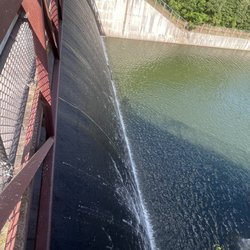
Hiking Trails With Waterfalls in Elizabethtown, Pennsylvania
Running Trails in Elizabethtown, Pennsylvania
Star Gazing in Elizabethtown, Pennsylvania
Walking Trails in Elizabethtown, Pennsylvania
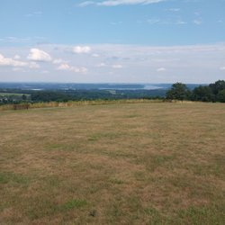
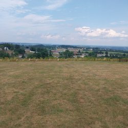
Sunrise View in Elizabethtown, Pennsylvania
Swimming Lakes in Elizabethtown, Pennsylvania
Sunset View in Elizabethtown, Pennsylvania
Scenic Views in Elizabethtown, Pennsylvania
Scenic Overlook in Elizabethtown, Pennsylvania
Secret Spots in Elizabethtown, Pennsylvania
Places to Take Pictures in Elizabethtown, Pennsylvania
Mountain Biking in Elizabethtown, Pennsylvania
Things to Do on a Rainy Day in Elizabethtown, Pennsylvania
Easy Hikes in Elizabethtown, Pennsylvania
Secluded Spots in Elizabethtown, Pennsylvania
Dog Friendly Trails in Elizabethtown, Pennsylvania
Lakes & Ponds in Elizabethtown, Pennsylvania
Hiking With Kids in Elizabethtown, Pennsylvania
Waterfalls in Elizabethtown, Pennsylvania
Playgrounds in Elizabethtown, Pennsylvania
New Businesses in Elizabethtown, Pennsylvania
Trending Searches in Elizabethtown, PA
Botanical Gardens near Conewago Recreation Trail
Bounce House Rentals near Conewago Recreation Trail
Campgrounds near Conewago Recreation Trail
Cherry Picking near Conewago Recreation Trail
Cliff Jumping near Conewago Recreation Trail
Dog Friendly Things To Do near Conewago Recreation Trail
Flower Fields near Conewago Recreation Trail
Flower Shop near Conewago Recreation Trail
Garage Sales near Conewago Recreation Trail
Garden Center near Conewago Recreation Trail
Hair near Conewago Recreation Trail
Lakes & Ponds near Conewago Recreation Trail
Nurseries & Gardening near Conewago Recreation Trail
Outdoor Activities near Conewago Recreation Trail
Outdoor Furniture Stores near Conewago Recreation Trail
Parks near Conewago Recreation Trail
Party Equipment Rentals near Conewago Recreation Trail
Pedicure near Conewago Recreation Trail
Photo Spots near Conewago Recreation Trail
Pick Your Own Farms near Conewago Recreation Trail
Picnic Areas near Conewago Recreation Trail
Places To Take Pictures near Conewago Recreation Trail
Rock Quarry near Conewago Recreation Trail
Running Trails near Conewago Recreation Trail
Strawberry Picking near Conewago Recreation Trail
Sunrise View near Conewago Recreation Trail
Swimming Holes near Conewago Recreation Trail
Table And Chair Rentals near Conewago Recreation Trail
Browse Articles
Browse Nearby
BEST of Elizabethtown, Pennsylvania Restaurants near Conewago Recreation Trail
BEST of Elizabethtown, Pennsylvania Coffee near Conewago Recreation Trail
BEST of Elizabethtown, Pennsylvania Things to Do near Conewago Recreation Trail
BEST of Elizabethtown, Pennsylvania Breakfast near Conewago Recreation Trail
Browse Brands
Related Searches in Elizabethtown, PA
Affordable Kayak Rental Services in Elizabethtown, Pennsylvania
Best Fishing Locations and Guides in Elizabethtown, Pennsylvania
Best Places for Horseback Riding in Elizabethtown, Pennsylvania
Best Spots for Star Gazing in Elizabethtown, Pennsylvania
Best Waterfalls and Swimming Holes in Elizabethtown, Pennsylvania
Check Out Off Road Trails in Elizabethtown, Pennsylvania
Discover a Hiking Trail in Elizabethtown, Pennsylvania
Discover the Best Night Hike Trails in Elizabethtown, Pennsylvania
Dog-Friendly Hikes With Dogs in Elizabethtown, Pennsylvania
Enjoy Camping Adventures Around Elizabethtown, Pennsylvania
Enjoy Exciting Mountain Biking Adventures in Elizabethtown, Pennsylvania
Enjoy Kayaking Adventures in Elizabethtown, Pennsylvania
Enjoy Tent Camping Spots Around Elizabethtown, Pennsylvania
Enjoy a Beautiful Waterfall Hike in Elizabethtown, Pennsylvania
Enjoy the Best Family Activities in Elizabethtown, Pennsylvania
Enjoy the Best Tubing Experiences in Elizabethtown, Pennsylvania
Enjoy the Best Walking Trails in Elizabethtown, Pennsylvania
Exciting Cliff Jumping Spots in Elizabethtown, Pennsylvania
Experience Thrilling White Water Rafting in Elizabethtown, Pennsylvania
Explore Beautiful Parks and Green Spaces in Elizabethtown, Pennsylvania
Explore Easy Hikes Perfect for All in Elizabethtown, Pennsylvania
Explore Fun Activities to Do in Elizabethtown, Pennsylvania
Explore Popular Campgrounds Near Elizabethtown, Pennsylvania
Explore Popular RV Parks Around Elizabethtown, Pennsylvania
Explore Popular Scenic Overlook Points in Elizabethtown, Pennsylvania
Explore Scenic Lakes to Visit in Elizabethtown, Pennsylvania
Explore Top Dog Parks in Elizabethtown, Pennsylvania Near You
Explore the Best Beach Spots in Elizabethtown, Pennsylvania
Explore the Best Swimming Holes Around Elizabethtown, Pennsylvania
Family Friendly Hiking With Kids in Elizabethtown, Pennsylvania
Find Beautiful Views in Elizabethtown, Pennsylvania
Find Cozy Camping Cabins in Elizabethtown, Pennsylvania
Find the Best Parks for Picnics in Elizabethtown, Pennsylvania
Find the Best Playgrounds to Visit in Elizabethtown, Pennsylvania
Find the Best Scenic View Locations in Elizabethtown, Pennsylvania
Hiking Trails With Waterfalls in Elizabethtown, Pennsylvania
Off Leash Dog Hiking Trails in Elizabethtown, Pennsylvania
Perfect Spots to Watch Sunset in Elizabethtown, Pennsylvania
Plan a Scenic Drive Route Near Elizabethtown, Pennsylvania
Popular Fishing Spots to Explore in Elizabethtown, Pennsylvania
Popular Outdoor Activities to Try in Elizabethtown, Pennsylvania
Popular Picnic Spots to Visit in Elizabethtown, Pennsylvania
Popular Things to Do in Elizabethtown, Pennsylvania
Safe River Swimming Areas in Elizabethtown, Pennsylvania
Safe and Fun Parks for Kids in Elizabethtown, Pennsylvania
Top Paddleboarding Activities in Elizabethtown, Pennsylvania
Top Places for Snorkeling in Elizabethtown, Pennsylvania
Top Playgrounds for Kids to Enjoy in Elizabethtown, Pennsylvania
Top Running Trails to Explore in Elizabethtown, Pennsylvania
Walk Dog Friendly Hiking Trails in Elizabethtown, Pennsylvania