Carmel Meadows Trailhead Photos


You might also consider
More like Carmel Meadows Trailhead
Recommended Reviews - Carmel Meadows Trailhead
Start your review...

1 year ago
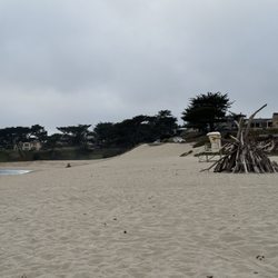
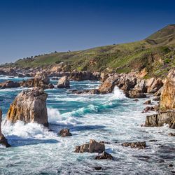
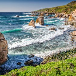
Something we thought that would be a quick "outdoor walk" turned into an hour stay at the beach. It was quite empty, which was a plus, and the sun was shining with a slight ocean breeze. Being able to walk along the coast and soaking in the sun rays and enjoying the sounds of the waves crashing is very, very soothing. You can walk along the beach or walk on a trail or go up a small hill to overlook the ocean! read more


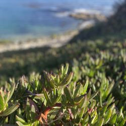
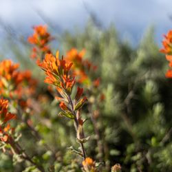
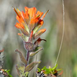
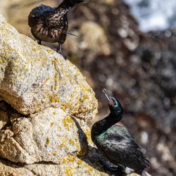
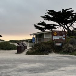
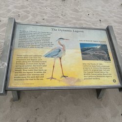
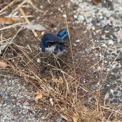
Location: corner of Ribera Rd and Cuesta Way Parking : enough for three cars. Street parking allowed It's inside the residential area therefore not as crowded/popular as the nearby Carmel Beach. Nicely maintained wide trails wide enough for wheelchair however unfortunately not a ADA compliant, only a staircase to go down /up. Full of wildflowers during spring time and since it's adjacent to the Bird Sanctuary, you can spot the variety shore birds . The trail leads to the Carmel Beach to north and the monastery beach to south. read more


More info about Carmel Meadows Trailhead
27612 Cabrillo Hwy
Carmel, CA 93923
Directions
Hours
Outdoor Amenities


Carmel Meadows Trailhead - beaches - Updated June 2026
Best of Carmel
People found Carmel Meadows Trailhead by searching for…
Hiking Trails in Carmel, California
Crabbing Location in Carmel, California
Scenic View in Carmel, California
Tide Pool in Carmel, California
Things to Do at Night in Carmel, California
Bird Sanctuary in Carmel, California
Places to Take Pictures in Carmel, California
Stroller Friendly Hikes in Carmel, California
Scenic Drive in Carmel, California
Walking Trails in Carmel, California
Public Beach Access in Carmel, California
Picnic Areas in Carmel, California
Things to Do on a Rainy Day in Carmel, California
Swimming Holes in Carmel, California
Seashell Beaches in Carmel, California
View Points in Carmel, California
Running Trails in Carmel, California
Things to Do in Carmel, California
Swimming Lakes in Carmel, California
Crab Fishing in Carmel, California
Public Parking in Carmel, California
Browse Nearby
BEST of Carmel, California Coffee near Carmel Meadows Trailhead
BEST of Carmel, California Restaurants near Carmel Meadows Trailhead
BEST of Carmel, California Things to Do near Carmel Meadows Trailhead
BEST of Carmel, California Tide Pools near Carmel Meadows Trailhead
BEST of Carmel, California Breakfast near Carmel Meadows Trailhead
BEST of Carmel, California Lakes near Carmel Meadows Trailhead
BEST of Carmel, California Vacation Rentals near Carmel Meadows Trailhead
BEST of Carmel, California Resorts near Carmel Meadows Trailhead
BEST of Carmel, California Campgrounds near Carmel Meadows Trailhead