Cancel

    Open app

    Search

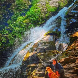
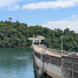
    Brasstown Bald Photos

    Recommended Reviews - Brasstown Bald

    Your trust is our priority, so businesses can't pay to alter or remove their reviews. Learn more about reviews.
    Yelp app icon
    Browse more easily on the app
    Review Feed Illustration

    9 months ago

    Helpful 34
    Thanks 10
    Love this 34
    Oh no 0

    Ask the Community - Brasstown Bald

    Brasstown Bald Observation Tower

    Brasstown Bald Observation Tower

    4.7(78 reviews)
    0.0 mi

    Came to Brasstown Bald Observation Tower for the views and it was a sight to see! It's not everyday…read more(at least where I live) that you can stand in such a high place and be able to see mountains spanning across 4 different states. The entry fee was 8 per adult (kids are free) which also includes a van ride to the overlook. Or you can choose to hike which wasn't a long hike but steep from what I saw. A must do for anyone visiting the area! Ohh... and make sure you watch the little movie at the top, it's very cool to see how one place is its own little world in different seasons and the history behind the place.

    The current Brasstown Bald observation tower was built in 1965, replacing an earlier stone tower…read morethat was constructed by the Civilian Conservation Corps (CCC) in 1935. The original 1935 stone tower was torn down in 1947 and replaced with a steel tower before the current structure was built - we'll folks looks like it's time to build another tower this one is in a state of disrepair. I came here to observe 4 states from the highest point in Georgia, but apparently the observation tower is in such bad shape that it is now closed to the public and your adventure will end after climbing a few flights of stairs ending at the base of the observation deck yeah there's a view from the lower level but in my opinion not worth the price of admission. Thankfully there's a shuttle van that takes you from the parking lot level to the top it runs about ever 10 minutes, our driver was very friendly and tried his best to entertain us during the short drive to the top but there's not much to say - the museum at the top is okay and takes about 2 minutes to tour it then time you walk the lower deck and wait for the shuttle back down - I purchased a refrigerator magnet for the RV from the gift shop and headed for the truck. I guess I am fortunate that I came and saw this, although it was never on my bucket list, I'm still trying to figure out why there's an old train engine in the museum it's quite the anachronism...

    Photos
    Brasstown Bald Observation Tower - Another great view!

    Another great view!

    Brasstown Bald Observation Tower
    Brasstown Bald Observation Tower - Instagram: @telephonesmoothie

    See all

    Instagram: @telephonesmoothie

    City of Blairsville, GA

    City of Blairsville, GA

    4.5(2 reviews)
    8.4 mi

    The city of Blairsville was perfect for our little mountain getaway!…read more Blairsville or "City of Mountains" is located in North Georgia (Union County) near Chattahoochee National Forest, and Vogel State Park. There's so much fun stuff to do around here such as renting a cabin, hiking, camping, fishing, paddle boating and so much more. Some of the places we visited while staying here: - Blairsville Downtown - Sleepy Hollow Enterprises - Vogel State Park - Helton Creek Falls - Blairsville Seafood Market "Mike's" - Brasstown Bald - Bell Mountain All of those destinations were 15-20 min away from each other at the most and all the activities, and views were absolutely worth it! I totally recommend staying in Blairsville and visiting all of those places. Also, don't miss Blairsville Downtown! It's a cute, small town but it's full with happy people ready to welcome you! The restaurants around it are great as well! ESPAÑOL ¡La ciudad de Blairsville fue perfecta para nuestra pequeña escapada a la montaña!   Blairsville o "City of Mountains" se encuentra en el norte de Georgia (Condado de Union) cerca del bosque nacional Chattahoochee y el parque estatal Vogel.   Hay muchas cosas divertidas que hacer por aquí, como alquilar una cabaña, ir de excursión, acampar, pescar, remar en bote y mucho más.   Algunos de los lugares que visitamos durante su estancia aquí:   - Blairsville Downtown   - Sleepy Hollow Enterprises   - Parque Estatal Vogel   - Helton Creek Falls   - Blairsville Seafood Market "Mike's"   - Brasstown Bald   - Bell Mountain   Todos esos destinos estaban a 15-20 minutos el uno del otro como máximo y todas las actividades, y las vistas valieron la pena! Recomiendo totalmente alojarse en Blairsville y visitar todos esos lugares.   Además, ¡no te pierdas el centro de Blairsville! ¡Es un pueblo pequeño y lindo, pero está lleno de gente feliz lista para darte la bienvenida! Los restaurantes a su alrededor también son geniales.

    SMALL TOWN CHARM IN A NEAT LITTLE PACKAGE!…read more Blairsville is a small town located straight up 400/19 in Union County. It is located near the Chattahoochee Forest and Vogel Park and has spectacular views and vistas. Town Square is at the center of town and where you will find restaurants and the historical court house which is now the site of the Historical Society Museum. It is a true gem and deserves its own review. It is a great little "get away" and a great place to go and re-acquaint yourself with nature, history and wonderful people. The town plays host to several festivals and community activities, (Friday night concerts) throughout the year. Although we were in town for the Mountain Heritage Festival, we wandered into town for breakfast and to see the historic courthouse which literally sits in the center of town where you can't miss it. A traffic circle directs you around the building. This town seems to be run by volunteers who love their town and its history. They were throughout the various venues and just full of useful information. We had such a nice visit, that we are considering returning to the fall festival when the weather is cooler and we are able to see the trees change color. If you come for a festival, you must have a meal downtown and take a look around. There is plenty of convenient public parking available. When you are traveling to Blairsville, you will encounter long winding roads that can appear to be a bit precarious. However just hang in there and you will be fine. These roads are very popular with cyclists, drivers of sport cars, and motorcyclists so you must be cautious and TAKE YOUR TIME. We actually were stuck behind a group of cyclists, so we simply put our hazard lights on and hunkered down while staying about two car lengths back. It is simply not safe to pass on these challenging roads. If you have ever ridden a bike on the street, you can appreciate how scary it must be to be on a winding mountain road and have an aggressive driver on your tail. Just be kind! The sorghum festival will be taking place during the first weekend in October, so make a plan!

    Photos
    City of Blairsville, GA
    City of Blairsville, GA
    City of Blairsville, GA

    See all

    Hiwassee Dam

    Hiwassee Dam

    4.7(3 reviews)
    28.2 mi

    The Hiwassee Dam is a little bit of a detour from Murphy, NC. But I highly recommend a stop. The…read moredam is hydroelectric and is remarkable to see just the size of it. You can drive over it too. I wasn't sure at the time if I could take a walk on it so I behaved myself this time. There appeared to be sidewalks on both sides in sections so I will do that next time. The dam is 307 feet high and holds 67 billion gallons of water. Hiwassee Lake is about 22 miles. The dam took 1600 men four years to build before being completed in 1940. At the time it cost $24 million to build. The dam generates enough electricity for 28,000 homes. The views are breathtaking here so if you are in the area this remarkable piece of work.

    If you're in the Murphy area, or planning a trip out to the falls, and enjoy being outdoors, be…read moresure to take a quick detour and venture into easily accessible Hiwassee. Surrounded by the Nantahala and Cherokee National Forests - This cozy and colorful park has a lot to offer, including a rich habitat for deer, wild turkey and other animals. Have your camera ready to snap memorable moments, scenery and wildlife. Built in the 1940's, the Hiwassee Dam is largely known to locals as 1 of 32 dams built & planned to provide flood control, navigation and electricity for the region. Today, this piece of history is known as one of the top 5 things to do/points of interest for those visiting Murphy. Upstream from Apalachia Reservoir, the river stretches for 22 miles northwest to southeast. The Pros: - Great for picnics. - Free and easy to locate parking. - The area features a day-use park that provides access to boating, fishing and paths for exploring the Hiwassee Reservoir and its tributaries. - The area is isolated and not overloaded with people/tourists (even during season). On most occasions you will find yourself alone and have this stunning area all to yourself. It's well suited for canoeing & rafting. - The dam is close to Cherokee, the falls and many of Murphy's other "must-see" areas. Prior to your trip, consider these tips: - Check out & research the weather conditions prior to making your plans to venture out onto the roads, or into the water. The reservoir comes from deep below the surface and the water temperature is super chilly, even in the summer. - Keep an eye out for snakes! - If it's summer, be sure to pack bug spray and sun screen. Fun Facts: - The dam is known as a historical landmark used by the Navy Bureau of Ordnance for torpedo testing into the deep water, and the isolation provided by its mountainous environs. - The dam is currently operational and still providing electricity today.

    Photos
    Hiwassee Dam
    Hiwassee Dam
    Hiwassee Dam

    See all

    Stonewall Creek Falls - Great mountain biking

    Stonewall Creek Falls

    4.5(2 reviews)
    21.1 mi

    Stonewall Creek Falls is located on the trail known as Stonewall Falls & White Twister Mountain…read moreBike Trail. It's an 11.5 mile trail used most often by mountain bikes (as the name would imply) and has multiple wet creek crossings. The parking area & trailhead are off Stonewall Creek Road, also known as Crooked Oak Road on one end and Carleton English Road on the other. Three names in less than 3 miles of road, but you would only know this if you are looking at Google Maps. [ DIRECTIONS ] The trailhead is approx. 1.3 miles from paved South Main Street in Tiger, GA. The road is gravel with no signage, but a small utility building with two power boxes surrounded by a chain link fence sits right on the corner. The road is a touch bumpy and is best for trucks, Jeeps, SUV's and vehicles with more clearance, but a car COULD make it through. [ THE TRAIL ] You'll know you've arrived when you reach a small forest service gate with a niche large enough for about 3 cars. There is also sufficient room for several more cars to park roadside. The Mountain Bike Trail has a 1492 foot elevation change and encompasses some of the roadway past the parking area. However, to get to the waterfall, go through the gate, cross the small creek and continue left downhill for about 1/2 mile. The waterfall will come into view near a large open camping area. [ THE FALLS ] The easiest waterfall to reach is the one at the camping area. It's approximately 20 feet tall. HOWEVER, there is another waterfalls upstream of the main falls, but it is difficult to reach. Scouting reports I have read say to use a steep side trail 100 yards or so further uptrail past the falls. You will see two faint trails and I've been told the first of the two is the better option, but be careful, BOTH are STEEP. I tried the second trail (didn't know the first trail was the better option at the time) and only made it halfway before turning back. It felt against my better judgement to try this alone with my tiny little dog. So I plan to come back on another day when I have another crazy adventurer with me for support (and possibly a 911 call). Just slightly upstream from the main falls is an easier path to Stonewall Creek. My thought is to try to wade through the river to the upper falls, which are far prettier according to some of the pics I've witnesses on hiking trail galleries: https://mtnimages.smugmug.com/Hiking-With-Mtnimages/Hike-to-Stonewall-Creek/i-bdsqddz/A TIP - If you hike upstream looking for the side trail to the upper falls and make it to a creek crossing, you've gone too far! There is also another waterfall downstream of the main falls, but requires some mountain goat skills and bushwacking, which I'm hoping to get into this summer as I want to trailblaze to more remote waterfalls. [ THINGS TO KNOW ] Hiking Distance: 1 miles (round trip to main falls) Difficulty: Easy & family friendly (main waterfall) Difficulty: Strenuous & dangerous (upper and lower falls) Creek Crossings: YES (1) small stream at the beginning Elevation Gain: n/a Waterfall Height: Approx 18-20 feet (main) Access to top of falls: NO Access to base of falls: YES Pool of water @ base of Falls: YES Sitting areas @ base: YES + camping area RESTROOMS: NO PARKING: YES (3+ cars) [ FINAL THOUGHTS ] I enjoy hiking very much! The beauty, serenity and adventure calls to me and the peace that comes from such adventures is simply unmatched. The only thing that disturbs my hiking serenity is when I can't reach my destination. I'm stubborn and bullheaded like that! The first waterfall was nice, but my mission was to see all three, or at the very least the main falls AND the upper falls.... so I left disappointed. Still, it was one of several waterfalls I toured today as I scouted new trails for my hiking groups 2020 expeditions. This is a great short hike to add to other longer hikes when looking to fill up a day. NOTE TO SELF: Be better prepared next time with trail map downloads and GPS trackers that work even offline to better navigate to falls that are off-trail. Also, bring a machete just in case some light bushwacking is required. 2020 / 9

    I love this places, beautiful, relaxing. I love to end here after mountain biking trails. Is not…read morecrowded place

    Photos
    Stonewall Creek Falls - 15Apr2020

    15Apr2020

    Stonewall Creek Falls - 2 of 4 - Main waterfall

    2 of 4 - Main waterfall

    Stonewall Creek Falls

    See all

    Jackson County Courthouse-Historical - The Courthouse

    Jackson County Courthouse-Historical

    5.0(3 reviews)
    47.7 mi

    98 steps. Not 100. I don't know why they missed this opportunity for a round number but I counted…read morethem going up and coming back down, getting the same. 98 steps. However, you can drive to the top where there is parking. If you do that, you'll miss the Jackson County Confederate Memorial that is midway on the stairs. The Historical Jackson County Courthouse is a 1913 Classical Revival structure that towers on a hill above and at the end of Sylva's main street. It has served here until 1994 when the new Justice Center opened a couple of miles away. It sat unused for several years until it was refreshed and restored, reopening in 2011 as the Jackson County Public Library complex that includes the Jackson County Historical Association, the Genealogical Society, and the Arts Council. Two stories and constructed of painted brick, it has a monumental portico at the front with large classical columns and is topped with a three-stage cupola above the central block. If you've been to Marshall NC, it does look a lot like the Madison County Courthouse. [Review 531 of 2026 - 4626 in North Carolina - 25713 overall]

    All those stairs!!!! They just call to be climbed!! It's a 55 ft elevation gain…read more It's very pretty from the bottom and from the top of the stairs. Take a moment to notice the Mountain View's. It's just lovely. Don't want to climb those stairs? Don't worry you can get to the Library and Courthouse by car.

    Photos
    Jackson County Courthouse-Historical - Jackson County Historical Courthouse and Public Library, Sylva

    Jackson County Historical Courthouse and Public Library, Sylva

    Jackson County Courthouse-Historical - Jackson County Historical Courthouse and Public Library, Sylva

    Jackson County Historical Courthouse and Public Library, Sylva

    Jackson County Courthouse-Historical - The courthouse

    See all

    The courthouse

    Brasstown Bald - landmarks - Updated May 2026

    Loading...
    Loading...
    Loading...