Cancel

    Open app

    Search

    Brandenburg Park

    5.0 (1 review)

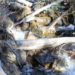
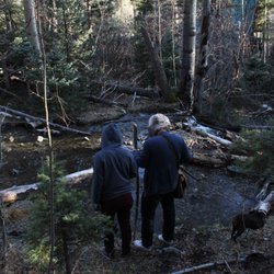
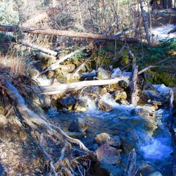
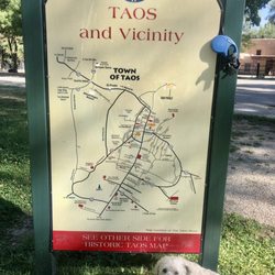
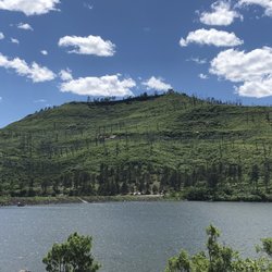
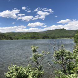
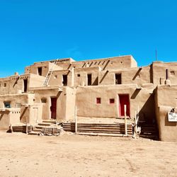
    Brandenburg Park Photos

    You might also consider

    Recommended Reviews - Brandenburg Park

    Your trust is our priority, so businesses can't pay to alter or remove their reviews. Learn more about reviews.
    Yelp app icon
    Browse more easily on the app
    Review Feed Illustration

    6 years ago

    Helpful 0
    Thanks 0
    Love this 0
    Oh no 0

    Verify this business for free

    Get access to customer & competitor insights.

    Verify this business

    Rio Grande Gorge Bridge - Can't walk across the bridge, but the overlook is here at the Rest Area  10-06-2025

    Rio Grande Gorge Bridge

    4.5(144 reviews)
    24.1 mi

    I hate that we couldn't access the sidewalk to be on the bridge. The area next to it does have…read moreparking but it is limited. They have a nice trail you can walk on and different areas to take cool photos. The best part is that it is free. They also have vendors selling goods in the parking lot.

    Located about 10 miles from Taos, NM stands this majestic bridge!…read more While on vacation, we decided to come see the gorge, the Rio Grande River, and the bridge that spans it. And what a sight it was to behold! We parked in the Rio Grande Gorge Rest Area. The bridge & gorge are viewable from here. There are sheltered picnic tables and restrooms here. In 1963 the bridge was started and was completed in 1965. It is part of the US Highway 64. There are three spans connected to create one bridge 1,280 feet long (two 300-foot-long approach spans with a 600-foot-long main center span). September of 2012, the bridge underwent a $2.4 restoration which included structural steelwork, a new concrete deck surface, new sidewalks, ramps, curbs, and gutters. We were unable to walk out onto the bridge, but we did walk out to the rim. The dirt path was easy to navigate. Once near the rim, it becomes rocky and there is no barrier to keep you safe from falling off the edge, so watch your step! Since I am not very steady of my feet, I didn't go out as far as I would have liked to. A few more steps and I would have had a better view, but I stopped. Sadly, the bridge was closed to pedestrians in Sept. 2025 due to suicides. I feel that by not getting to walk across the bridge, my experience was hindered. I would have loved to get a full head on view of the gorge! For me, having the view from here would have been safer and more ideal! You've probably seen this bridge since it has appeared in a few movies including Natural Born Killers, Twins, White Sands, She's Having a Baby, The Signal, Paul, Vacation, Wild Hogs, and Terminator Salvation. Locals call this bridge the "High Bridge" or the "Gorge Bridge". It is the seventh highest bridge in the U.S. It is located in the Rio Grande del Norte National Monument. If we make it back here in the future, I hope we will be able to walk to the center of the bridge!

    Photos
    Rio Grande Gorge Bridge - Bridge entrance from our unofficial parking lot

    Bridge entrance from our unofficial parking lot

    Rio Grande Gorge Bridge
    Rio Grande Gorge Bridge

    See all

    Sugarite Canyon State Park

    Sugarite Canyon State Park

    4.3(3 reviews)
    59.0 mi

    An Afternoon Well Spent !!…read more It has been many years since I've been to the Raton area and typically whenever I was in the area it was just a quick to use the bathroom or get gas. On this visit, it was on a Friday afternoon and I had a few hours to kill and wanted to actually see some of the area. I remembered from years past that there were some lakes up in the mountains that I had always wanted to see and now was my chance. The Park is only about 20 miles from Raton and the roads were not that busy. The drive up is really nice as you see mountains, hills ranches, and some great scenery. On the way to Lake Maloya I stopped at one of the smaller lakes, Lake Alice and spent about half an hour checking it out. There really isn't access to that lake but you can tell its frequented by anglers. It is a nice small scenic lake. I then made my way up to Lake Maloya which is a reservoir for the area and right on the Colorado border. The lake is magnificent!! On a nice warm summer day, there was a nice breeze and no bugs. There were boaters on the lake, some people canoeing and some campers but it was not that busy at all. I spent a good two hours stopping and driving farther up the lake until I came to the gate that takes you to Dorothy Lake ( for another time). The views are just amazing, I suggest bringing a canoe or kayak and spending a good day there. I'm not sure if there is swimming since I didn't see anyone swimming in the water. Next up was Sugarite Canyon, and when you stop at the main entrance they use the honour system where you pay, so please pay!!! I made my way to the visitors center and got a map of the trails. The canyon is a great place to hike and I saw no one else on the trail and felt like I had the place to myself. I can't describe how nice it was walking through the canyon, and all there is to see. I highly recommend hiking with a buddy since it is in a remote area and I saw a few different animal tracks as I made my way through the trails. In short, this area is worth a visit, you can spend a few hours there or a few days, its truly part of the magnificence that is New Mexico.

    Google know all about this place but not yelp? We are fixing…read morethat right now. As the parks service says "The nature enthusiast will appreciate the abundance of wildlife, birds, butterflies, and wildflowers among the lakes, creeks, forests, and meadows. Nearly all outdoor recreation activities are possible: Fishing, boating, hiking, horseback riding, hunting, and camping." All true. This is a huge park. Full of lakes, trails & wildlife. We took a 6 mile loop trail starting at the dam yesterday and saw NO ONE else. Lots of scat indicate there lots of moose and bear around, so be aware. There are numerous other trails as well add the aforementioned activities. Definitely worth a visit if you're in the area.

    Photos
    Sugarite Canyon State Park - Ponderosa Trail

    Ponderosa Trail

    Sugarite Canyon State Park
    Sugarite Canyon State Park

    See all

    Taos Pueblo - O

    Taos Pueblo

    3.8(210 reviews)
    20.2 mi

    My friend Bob had never been to New Mexico before and wanted to see an "iconic" pueblo. Taos…read morePueblo immediately came to mind and a place that Gayle and I had not been for over 18 years. It was a bit of a drive up (via the High Road), but well worth the time and effort. These multi-story homes are more than a thousand years old. None of the homes in the Taos Pueblo are vacant - five or six families live on the Pueblo full time, while the others live in town (with running water and electricity) but stay in their ancestral home many weeks throughout the year for important celebrations. We about the history of the Taos (or Tewa) people from our guide, Riley. That started at the Saint Geronimo Chapel and onward to the old church grounds, that hold the crumbling ruins of the original San Geronimo Chapel. Built in 1619 by Spanish priests using forced Native labor, it was destroyed during the 1680 Pueblo Revolt and again in 1847 by the U.S. Army (with women and children inside). In between were information on Pueblo ovens, family ties, and the Missing and Murdered Indigenous Women (MMIW) movement. There were also various shop sprinkled throughout, with a few pleasant surprises, like one run by an established Santa Fe painter, and some nicely done local jewelry and other art. There was a lot to see here and I appreciated the leisurely pace, while being respectful of restricted areas and honoring any cultural-related requests by our hosts.

    've always wanted to visit Taos Pueblo, even though it's quite out of the way. From Santa Fe, it's…read moreabout a 70-mile drive through winding mountain roads and small towns, which made the trip feel longer than it actually was. When I arrived, a staff member stopped me at a stop sign before I reached the exact location on the map. He explained where to park--either in the main lot or the one just ahead--and pointed out that the admission office is directly across the street, which was helpful. Adult admission is $25. I had seen complaints about the price beforehand, but honestly, I didn't feel that way at all. This isn't a state park or a monument--people are still living here--so the experience feels very real and meaningful. I picked up a brochure at the admission office. The highlights for me were the church (no photography allowed inside) and the cemetery, as well as the famous North House and South House. The air was crisp, and there was the smell of burning wood everywhere, which added to the atmosphere. I also stopped by a small shop selling handcrafted jewelry and decorations. I bought a hummingbird for $20 and was glad I had cash, since the seller told me I'd need to step outside to use Venmo (not sure why--my reception was fine). If you're interested in Pueblo history, this is absolutely a must-visit. It may not appeal to everyone, but for those who appreciate culture and history, it's a very special place. This lady was selling bread across from the office where they charge admission. It's $5 each absolutely delicious and no additive! Horno style bread," or Pueblo oven bread, is a traditional, dense white bread with a crunchy crust, historically baked in a beehive-shaped, outdoor adobe oven called a horno in the American Southwest. The term "horno" comes from the Spanish word for "oven

    Photos
    Taos Pueblo
    Taos Pueblo
    Taos Pueblo

    See all

    Brandenburg Park - parks - Updated June 2026

    Loading...
    Loading...
    Loading...