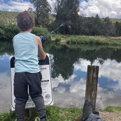
Cimarron Canyon State Park Photos


You might also consider
More like Cimarron Canyon State Park
Recommended Reviews - Cimarron Canyon State Park
Start your review...

2 years ago


10 years ago
More info about Cimarron Canyon State Park
28869 Hwy 64
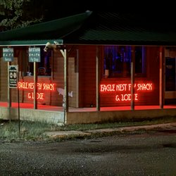
Eagle Nest, NM 87718
Directions
(575) 377-6271
Call Now
Hours
Outdoor Amenities


Why does Yelp recommend reviews?
1 review that is not currently recommended
The reviews below are not factored into the business's overall star rating.
10 years ago
Cimarron Canyon State Park - hiking - Updated June 2026
Best of Eagle Nest
People found Cimarron Canyon State Park by searching for…
Things to Do in Eagle Nest, New Mexico
Campgrounds in Eagle Nest, New Mexico
Fly Fishing Shop in Eagle Nest, New Mexico
Easy Hikes in Eagle Nest, New Mexico
Hiking Trails in Eagle Nest, New Mexico
Photo Spots in Eagle Nest, New Mexico
Parks for Picnics in Eagle Nest, New Mexico
Camping Sites in Eagle Nest, New Mexico
River Swimming in Eagle Nest, New Mexico
Public Shower in Eagle Nest, New Mexico
Places to Take Pictures in Eagle Nest, New Mexico
Fly Shop in Eagle Nest, New Mexico
State Parks in Eagle Nest, New Mexico
Attractions in Eagle Nest, New Mexico
Fishing Spots in Eagle Nest, New Mexico
Picnic Areas in Eagle Nest, New Mexico
Scenic Drive in Eagle Nest, New Mexico
Fishing Ponds in Eagle Nest, New Mexico
Jobs for 15 Year Olds in Eagle Nest, New Mexico
Places to Run in Eagle Nest, New Mexico
National Parks in Eagle Nest, New Mexico
Trout in Eagle Nest, New Mexico
Trending Searches in Eagle Nest, NM
Boat Rental near Cimarron Canyon State Park
Hiking near Cimarron Canyon State Park
Kids Activities Outdoor near Cimarron Canyon State Park
Nurseries & Gardening near Cimarron Canyon State Park
Parks near Cimarron Canyon State Park
Pedicure near Cimarron Canyon State Park
Photo Spots near Cimarron Canyon State Park
Picnic Areas near Cimarron Canyon State Park
Browse Articles
Browse Nearby
BEST of Eagle Nest, New Mexico Things to Do near Cimarron Canyon State Park
BEST of Eagle Nest, New Mexico Restaurants near Cimarron Canyon State Park
BEST of Eagle Nest, New Mexico Coffee near Cimarron Canyon State Park
BEST of Eagle Nest, New Mexico Horseback Riding near Cimarron Canyon State Park
BEST of Eagle Nest, New Mexico Parks near Cimarron Canyon State Park
BEST of Eagle Nest, New Mexico Hot Springs near Cimarron Canyon State Park
BEST of Eagle Nest, New Mexico Ski Resorts near Cimarron Canyon State Park
BEST of Eagle Nest, New Mexico Breakfast near Cimarron Canyon State Park
BEST of Eagle Nest, New Mexico Campgrounds near Cimarron Canyon State Park
Browse Brands
Related Searches in Eagle Nest, NM
Affordable Fishing Rental Services in Eagle Nest, New Mexico
Best Fishing Locations and Guides in Eagle Nest, New Mexico
Best Lookout Points to Visit in Eagle Nest, New Mexico
Best Nature Trails for Hiking in Eagle Nest, New Mexico
Best Parks for Parties and Events in Eagle Nest, New Mexico
Best Places for Horseback Riding in Eagle Nest, New Mexico
Best Places for Stunning Views in Eagle Nest, New Mexico
Best Things to Do on a Rainy Day in Eagle Nest, New Mexico
Best Water Parks for Kids in Eagle Nest, New Mexico
Book Private Boat Charters for Trips in Eagle Nest, New Mexico
Book Top Fishing Trips in Eagle Nest, New Mexico Today
Check Out Great Playgrounds in Eagle Nest, New Mexico
Discover Lakes & Ponds to Explore in Eagle Nest, New Mexico
Discover Popular Photo Spots in Eagle Nest, New Mexico
Discover Top Nature Parks to Visit in Eagle Nest, New Mexico
Discover a Hiking Trail in Eagle Nest, New Mexico
Discover the Best Fishing Lake in Eagle Nest, New Mexico
Discover the Best Running Track in Eagle Nest, New Mexico
Enjoy Hiking Adventures in Eagle Nest, New Mexico
Enjoy Scenic Night View Experiences in Eagle Nest, New Mexico
Enjoy the Best Night View Spots in Eagle Nest, New Mexico
Enjoy the Best Picnic Spots and Ideas in Eagle Nest, New Mexico
Enjoy the Best Tubing Experiences in Eagle Nest, New Mexico
Enjoy the Best Walking Trails in Eagle Nest, New Mexico
Experienced Fishing Guides Available in Eagle Nest, New Mexico
Explore Beautiful Parks and Green Spaces in Eagle Nest, New Mexico
Explore Bike Rentals Throughout Eagle Nest, New Mexico
Explore Free Picnic Areas Around Eagle Nest, New Mexico
Explore Free Things to Do Around Eagle Nest, New Mexico
Explore Landmarks & Historical Buildings in Eagle Nest, New Mexico
Explore Nature Spots Around Eagle Nest, New Mexico
Explore Popular Campgrounds Near Eagle Nest, New Mexico
Explore Popular Picnic Areas Around Eagle Nest, New Mexico
Explore Popular RV Parks Around Eagle Nest, New Mexico
Explore Popular Scenic Overlook Points in Eagle Nest, New Mexico
Explore Popular Scenic Views Near Eagle Nest, New Mexico
Explore Secret Spots Worth Visiting in Eagle Nest, New Mexico
Explore Top Dog Parks in Eagle Nest, New Mexico Near You
Explore Top Gyms in Eagle Nest, New Mexico Now
Explore the Best Boating Spots in Eagle Nest, New Mexico
Explore the Best Trail Options in Eagle Nest, New Mexico
Family Friendly Hiking With Kids in Eagle Nest, New Mexico
Find Beautiful Views in Eagle Nest, New Mexico
Find Cozy Camping Cabins in Eagle Nest, New Mexico
Find Exciting Tours to Take in Eagle Nest, New Mexico
Find Picnic Tables for Outdoor Fun in Eagle Nest, New Mexico
Find Top Outdoor Gear Stores in Eagle Nest, New Mexico
Find the Best Parks for Picnics in Eagle Nest, New Mexico
Find the Best Playgrounds to Visit in Eagle Nest, New Mexico
Find the Best Scenic View Locations in Eagle Nest, New Mexico
People who viewed Cimarron Canyon State Park also viewed
Rio Grande Gorge Bridge
144 reviews
Bobcat Pass Wilderness Adventures
55 reviews
Los Rios River Runners
114 reviews
Goose Lake Trail
2 reviews
Black Rock Hot Springs Trail
1 review
Brandenburg Park
1 review
Eagle Nest Marina
5 reviews
$$$$
High Altitude Health & Fitness
16 reviews
Roadrunner Tours
105 reviews
Blue Yonder Fly Fishing
4 reviews