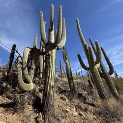
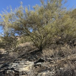
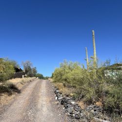
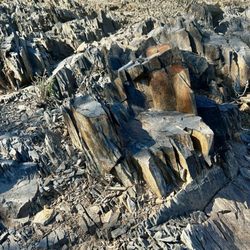
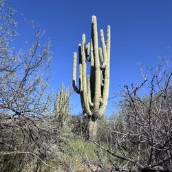
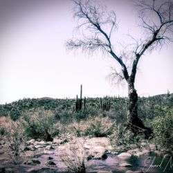
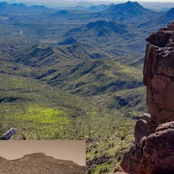
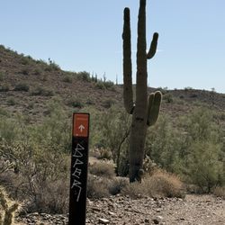
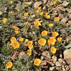
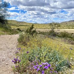
Blue Wash Trail Photos


You might also consider
More like Blue Wash Trail
Recommended Reviews - Blue Wash Trail
Start your review...


2 years ago
What a beautiful trail! And such a pleasant/ easy hike. The most effort you put in here is driving all the way past Cave Creek, other than that, it's such a peaceful & relaxing place. We hiked over to Camp Creek Falls and back. Couldn't have been more than 3 miles round trip. I didn't look at my watch afterwards. During the golden hour it was gorgeous. I fully recommend this place. But please, it's a super clean and well kept trail. Keep it that way. Otherwise I'll regret sharing it on yelp ;) read more


6 months ago
The kids, dogs, and I spent 3 hours hiking and playing in the AZ desert. It's been a couple of years since we've gone. This time of the year, the water is pretty low, but there's water and a waterfall, so the kids and dogs loved it! We had the waterfall to ourselves for a good half hour. My daughter played with her mermaids, and my son enjoyed rock climbing above the falls. It was wonderful being in the fresh AZ nature... until we had to hike back uphill to the car. The top thing to know is to turn LEFT at the American flag. There are some well placed rocks pointing the way. Also, you do have to climb down and over some big rocks... You do have to climb down and over some big rocks. And then back up and over them on the way back. Be sure to save energy for the hike back because it's inclined the whole way. Don't forget sunscreen! Maybe take water shoes if the kids want to play in the water. Stop by Raven's View restaurant on the way home. Enjoy! read more


Its always cool to find a trail in the valley that ends at a waterfall and when I heard about Blue Wash Trail I knew I had to check it out. I have been told with Blue Wash Trail it is the best to see it after a rainfall, so it's about timing when wanting to the waterfall. We went a few days after a rainy day and were still able to see the water. The trail itself it easy and apx 3 miles in and out with apx 450ft elevation gain. A thing to note when you get the bend where the American flag is flying on the hill, turn left and that will lead you towards the water hole. You walk down the wash for most of the hiking, the incline is when you are headed back to the car, but honestly its not that bad. Also this trial is exposed to the sun for most of it, not much shade, so make sure to wear sunscreen. Glad to have found this trail. read more


Loved this trail. It's a bit far out to get to depending on which area of the city you live, but it was easy and felt like you were out of the city, one of my favorite things. There was a nice creek and little water fall near the end of the trail. read more


2 years ago
Nice walk, mostly river bottom! Watch for rattlesnakes! All trails is a great directory on how to find the trailhead! The hike itself is about 3 miles round trip. Overcrowded if you ask me, not technical at all but pretty views at the end and nice to cool off. Unsure if it's dog friendly, but great for family's read more


More info about Blue Wash Trail
Cave Creek, AZ 85331
Directions
Hours
Outdoor Amenities
Ask the Community - Blue Wash Trail
You might also consider


Blue Wash Trail - hiking - Updated May 2026
Best of Cave Creek
People found Blue Wash Trail by searching for…
Hiking Trails With Waterfalls in Cave Creek, Arizona
Swimming Holes in Cave Creek, Arizona
Waterfalls in Cave Creek, Arizona
Sunrise Hike in Cave Creek, Arizona
Easy Hikes in Cave Creek, Arizona
Sunrise View in Cave Creek, Arizona
Things to Do in Cave Creek, Arizona
Places to Walk at Night in Cave Creek, Arizona
Scenic View in Cave Creek, Arizona
Rock Climbing in Cave Creek, Arizona
Dog Friendly Hiking Trails in Cave Creek, Arizona
Restaurants With a View in Cave Creek, Arizona
Places to Walk in Cave Creek, Arizona
Running Trails in Cave Creek, Arizona
Walking Trails in Cave Creek, Arizona
Natural Hot Springs in Cave Creek, Arizona
Stroller Friendly Hikes in Cave Creek, Arizona
Walking Paths in Cave Creek, Arizona
Beautiful Views in Cave Creek, Arizona
Hikes With Dogs in Cave Creek, Arizona
Trending Searches in Cave Creek, AZ
Botanical Gardens near Blue Wash Trail
Bounce House Rentals near Blue Wash Trail
Campgrounds near Blue Wash Trail
Cherry Picking near Blue Wash Trail
Cliff Jumping near Blue Wash Trail
Dog Friendly Things To Do near Blue Wash Trail
Flower Fields near Blue Wash Trail
Flower Shop near Blue Wash Trail
Garage Sales near Blue Wash Trail
Garden Center near Blue Wash Trail
Lakes & Ponds near Blue Wash Trail
Nurseries & Gardening near Blue Wash Trail
Outdoor Activities near Blue Wash Trail
Outdoor Furniture Stores near Blue Wash Trail
Party Equipment Rentals near Blue Wash Trail
Photo Spots near Blue Wash Trail
Pick Your Own Farms near Blue Wash Trail
Picnic Areas near Blue Wash Trail
Places To Take Pictures near Blue Wash Trail
Rock Quarry near Blue Wash Trail
Running Trails near Blue Wash Trail
Strawberry Picking near Blue Wash Trail
Sunrise View near Blue Wash Trail
Swimming Holes near Blue Wash Trail
Table And Chair Rentals near Blue Wash Trail
Browse Nearby
Browse Brands
Related Searches in Cave Creek, AZ
Affordable Kayak Rental Services in Cave Creek, Arizona
Best Fishing Locations and Guides in Cave Creek, Arizona
Best Nature Trails for Hiking in Cave Creek, Arizona
Best Places for Horseback Riding in Cave Creek, Arizona
Best Waterfalls and Swimming Holes in Cave Creek, Arizona
Check Out Off Road Trails in Cave Creek, Arizona
Discover Dog Friendly Trails to Explore in Cave Creek, Arizona
Discover Scenic Waterfall Spots in Cave Creek, Arizona
Discover Top Scenic Spots to Visit in Cave Creek, Arizona
Discover a Hiking Trail in Cave Creek, Arizona
Discover the Best Night Hike Trails in Cave Creek, Arizona
Discover the Best Running Track in Cave Creek, Arizona
Enjoy Camping Adventures Around Cave Creek, Arizona
Enjoy Exciting Mountain Biking Adventures in Cave Creek, Arizona
Enjoy Kayaking Adventures in Cave Creek, Arizona
Enjoy River Tubing Adventures in Cave Creek, Arizona
Enjoy Tent Camping Spots Around Cave Creek, Arizona
Enjoy a Beautiful Waterfall Hike in Cave Creek, Arizona
Enjoy the Best Walking Path in Cave Creek, Arizona
Enjoy the Best Walking Trails in Cave Creek, Arizona
Exciting Cliff Jumping Spots in Cave Creek, Arizona
Experience Thrilling White Water Rafting in Cave Creek, Arizona
Explore Beautiful Parks and Green Spaces in Cave Creek, Arizona
Explore Easy Hikes Perfect for All in Cave Creek, Arizona
Explore Fun Activities to Do in Cave Creek, Arizona
Explore Popular Campgrounds Near Cave Creek, Arizona
Explore Popular Scenic Overlook Points in Cave Creek, Arizona
Explore the Best Beach Spots in Cave Creek, Arizona
Explore the Best Boating Spots in Cave Creek, Arizona
Family Friendly Hiking With Kids in Cave Creek, Arizona
Find Cozy Camping Cabins in Cave Creek, Arizona
Find Popular Ziplining Spots Around Cave Creek, Arizona
Find the Best Parks for Picnics in Cave Creek, Arizona
Find the Best Scenic View Locations in Cave Creek, Arizona
Great Places to Walk in Cave Creek, Arizona
Hiking Trails With Waterfalls in Cave Creek, Arizona
Off Leash Dog Hiking Trails in Cave Creek, Arizona
Plan a Scenic Drive Route Near Cave Creek, Arizona
Popular Fishing Spots to Explore in Cave Creek, Arizona
Popular Outdoor Activities to Try in Cave Creek, Arizona
Popular Picnic Spots to Visit in Cave Creek, Arizona
Safe River Swimming Areas in Cave Creek, Arizona
Safe and Fun Parks for Kids in Cave Creek, Arizona
Top Climbing Spots and Gyms in Cave Creek, Arizona
Top Paddleboarding Activities in Cave Creek, Arizona
Top Running Trails to Explore in Cave Creek, Arizona
Top Swimming Lakes to Enjoy in Cave Creek, Arizona
Top Swimming Spots and Pools in Cave Creek, Arizona
Browse Articles
People who viewed Blue Wash Trail also viewed
Lookout Mountain Preserve
89 reviews
Tom's Thumb Trailhead
145 reviews
Shaw Butte Recreation Area
28 reviews
Reach 11 Recreation Area
19 reviews
McDowell Mountain Regional Park
60 reviews
Lost Dog Wash Trail
93 reviews
Black Mountain Summit Trail
31 reviews
Cave Creek Trail
3 reviews
Sonoran Preserve
3 reviews
Rose Garden Mountain
2 reviews