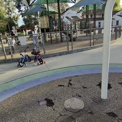
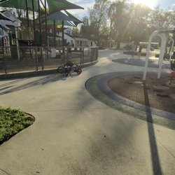
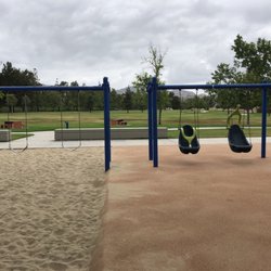
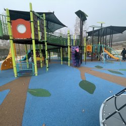
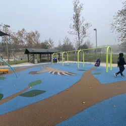
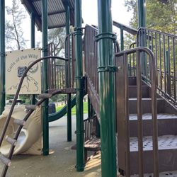
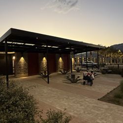
Bell Canyon Park Photos


You might also consider
More like Bell Canyon Park
Recommended Reviews - Bell Canyon Park
Start your review...

9 years ago
This park is a spectacular place to spend as little as an hour, or the entire day in! The trail loops in Bell Canyon take you West into El Escorpion Park and South into the larger Upper Las Virgenes Canyon Open Space Preserve (a.k.a. Ahmanson Ranch) and provide miles of trails to walk, hike, and mountain bike among ancient oaks, mesas, caves, and chaparral. In the winter, the cooler temps make the breeze sing through the mesa along the Old Ranch Road trail. There are plenty of spots to stop for lunch, but please remember to pack your trash when you leave to keep it beautiful! Many hikers bring their leashed dogs through and the majority of trails are easy for young children as well. In the summer, don't forget your sun protection and plenty of water as there is very little to no shade on several trail loops. And of course, bring your camera for pics of your visit. I posted summer and winter pics so you can see the changes. read more


6 years ago
My second time hiking here and I love it just as much as I thought I did the first time ...if not more. Great place to take your dogs as well. There are many different trails you can take. Today I got a little lost trying to go the same way the first time I came but ended up finding the way back through a different trail instead of having to turn back. This is definitely my go to spot for hiking now. read more

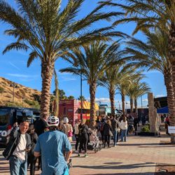
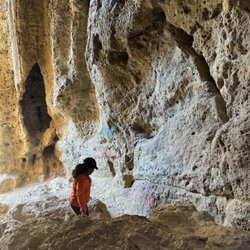
This has been my home away from home for as long back as I can remember. Basically, the park encompasses El Escorpion Canyon, a sparely wooded canyon on the south side of Castle Peak along El Escorpion creek, Castle Peak and its ridge, and Bell Canyon north of the peak along Bell Creek, all up to the Ventura County line. It is attached to the Upper Las Virgenes Canyon Open Space Preserve via El Escorpion Trail. There are a number of trails through the park, the best being the entire Castle Peak loop. There is a naming issue with this place. Basically, the two canyons are sometimes called separate parks. But recently Google maps has been showing them both as "Bell Canyon Park," and although I prefer El Escorpion Canyon, I'm willing to swallow my pride and call it all one park. Be careful throughout the park as there is lots of poison oak, bee hives, and rattlesnakes. You can also find some tarantulas and quail if you are lucky! While it is closed from dusk to dawn, this is an excellent place to go chill and look at the stars. Many a meteor shower was seen from these trails. Also look out for a sick BMX area. One of the best things about this park is that it is close to the city, yet remote. You can go out here and no one will usually bother you. But in recent years, that has been its downfall as well. More and more people are retreating out here, and there is a lot more graffiti and trash as of late. The Castle Peak Loop begins at the gate where Vanowen turns into Sunset Ridge. From there, you start hiking up the canyon. The first little part is often called Dog Shit Canyon cause of all the people who walk their dogs on this little part that is closest to suburbia. From there you head right across the creek and then straight up Castle Peak on the south side. Castle Peak is a tough hike. You can do it in less than 30 minutes if you know the terrain and are in good shape. Other than that, take it slow. There are 5 phases up this side of the peak. The first phase is kinda slippery and very steep. The second phase has this red soil and is a little more uneven than phase 1, if not as steep. Phase 3 is basically large rocks and gravel. Very slippery. Phase 4 is the section after the big white chalk part at the end of phase 3. It is rocky and has lots of smaller intersecting trails and is fairly solid. The last phase is the approach, where it gets even more rocky before you hit the top. From the top of Castle Peak is the best view of the west valley you'll find. Watch for different birds over the seasons. The swifts and the hummingbirds both do awesome dive bombs and are my favs. Then head west along the ridge. There, you will meet a fork in the trials. Head straight along the most traveled path and bear right until you end up on a very well maintained wide trail that goes down into Bell Canyon. This part ends at a little park with a baseball diamond and some picnic tables. Get some water at the park and then head down the trail along the creek, this one being Bell Creek, down to the horse trail. This horse trail along the suburban streets will take you back to the gate for the full loop. This can be done in reverse as well, duh. Interesting tidbit, where Bell Creek and El Escorpion Creek meet is the official start of the LA river. Check it out, and please help pick up any liter you see. Let's keep this park clean for future generations. Hope to see you there! read more
7 years ago
Wide trail is perfect for anyone. Whether you're biking, with a dog, or kids, this is a trail with different experience levels. You can choose Harder paths or stick to the main one for a stroll. Not much shade, but now after the rains it's a beautiful green! Parking can be a bit weird and many park on the street read more

11 years ago
13 years ago
12 years ago
14 years ago
12 years ago
More info about Bell Canyon Park
Ask the Community - Bell Canyon Park
Review Highlights - Bell Canyon Park
You might also consider


Why does Yelp recommend reviews?
1 review that is not currently recommended
The reviews below are not factored into the business's overall star rating.
12 years ago
Bell Canyon Park - parks - Updated May 2026
Best of West Hills
People found Bell Canyon Park by searching for…
Meteor Shower in West Hills, CA
Hiking Trails in West Hills, CA
River Swimming in West Hills, CA
Things to Do in West Hills, CA
Beautiful Views in West Hills, CA
Walking Trails in West Hills, CA
Watch Sunset in West Hills, CA
Pickleball Courts in West Hills, CA
Picnic Areas in West Hills, CA
Public Shower in West Hills, CA
Secret Spots in West Hills, CA
Parks for Kids in West Hills, CA
Browse Nearby
BEST of West Hills, California Playgrounds near Bell Canyon Park
BEST of West Hills, California Coffee near Bell Canyon Park
BEST of West Hills, California Restaurants near Bell Canyon Park
BEST of West Hills, California Things to Do near Bell Canyon Park
BEST of West Hills, California Hiking near Bell Canyon Park
BEST of West Hills, California Breakfast near Bell Canyon Park
BEST of West Hills, California Campgrounds near Bell Canyon Park
BEST of West Hills, California Limo Service near Bell Canyon Park
Browse Brands
Browse Articles
People who viewed Bell Canyon Park also viewed
Old Stagecoach Road Trail
4 reviews
Chatsworth
Serrania Ridge Trail
7 reviews
Woodland Hills
Caballero Canyon Trail
93 reviews
Pacific Palisades
Stoney Point
86 reviews
Chatsworth
Vanalden Cave
52 reviews
Tarzana
Top of Topanga Overlook
57 reviews
Michael D. Antonovich Regional Park at Joughin Ranch
6 reviews
Chatsworth
Topanga State Park
231 reviews
Pacific Palisades
Piuma/Stunt Trailhead
11 reviews
Garden of the Gods
13 reviews
Chatsworth