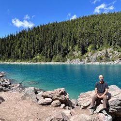
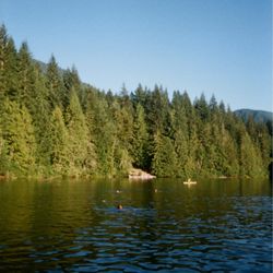
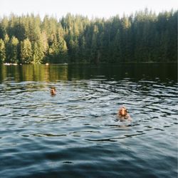
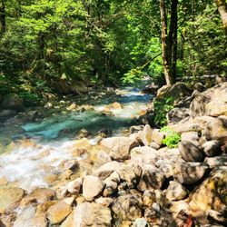
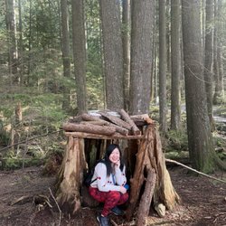
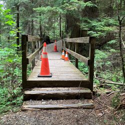
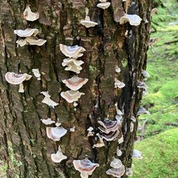
Beaver Lake Photos


You might also consider
More like Beaver Lake
Recommended Reviews - Beaver Lake
Start your review...

Reviews With Photos

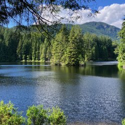
Less of a lake, and more of a pond, really. And by pond, I think it would be better labeled as a marsh. But you know what? I hardly care. It's beautiful, and it's right in the middle of one of the most beautiful parts of Vancouver--Stanley Park--and you really should stop by. I have to admit that I was a bit bummed out when I saw that my visit coincided with the closure of a big chunk of the seawall. From about Ferguson Point all the way around the tip and back down, they were doing restoration work. Undaunted, I charted a path that cut across the park and rejoined the walk on the other shore, and noticed that it cut right across adjacent to Beaver Lake. There are multiple trails that criss-cross all over Stanley Park, so be sure you have a map or a reliable way to find your route to the pond. I came from the west side, up the Lovers Walk, and then popped out on the road, but I passed signs for at least 4 other trails in the short little jaunt through the woods. Once you arrive at the lake, just sit down. That's it. Nothing fancy, nothing huge. It's just a pond. Where you sit. Or stroll. Or take pictures. Or in my case, open up the chocolate raspberry tart you've been packing, and let the late afternoon sun beam down on your face while you eagerly devour the confection. I sat there thinking about the last time I had a chocolate raspberry tart. I was out for dessert and as we mulled over the menu, I saw a little glimmer when I read the name of the tart, and we ordered it. It was the right choice then, and the right choice again on this day as I soaked in the yellow rays of dappled sunlight through the edges of the trees. I sat there on a bench, watching the very friendly ducks come and go, waddling across the trail and back into the water. Bigger lakes exist. Stanley Park is full of wonderful features to visit, to be sure. But Beaver Lake is one of them, and if your path takes you that way (perhaps a visit down the Lovers Walk like I took?) then it's worth a stop.


Not very far from Lost Lagoon, Beaver Lake offers a very different experience. Very active water scenery with ducks cruising, lotus blossoming, bees honey sucking, birds singing ... it has less human traffic at the time we are visiting. A nice resting place before continuing the trail journey. Given its location there are a lot of sky traffic - seaplanes and helicopters crossing the sky. If you are looking for a more serene and peaceful hike, Pacific Spirit Regional Park might be a better choice. read more


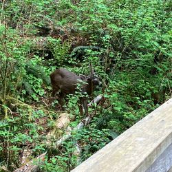
LOVED THIS. It was very marshy and because it was the middle of the day we didn't see any beavers, but it's beautiful and a wonderful little walk. A tour guide mentioned the dam that the beavers were working on and the pile the humans made undoing all their hard work, a truly sisphiean task. However! The lotus flowers were in bloom and they looked so beautifully perfect, white ones and pink ones all over the water. There were a few ducks here and there. We saw a large slug somewhere along the way, and then eventually got to a section of the walk where there was a ton of croaking. Ten minutes of patient (and impatient) searching later, we found a bullfrog hiding in the water under the grass! So worth it. If you're in the area I'd definitely recommend coming here. The hike in was also quite nice and cool, tree tops covering the sun. read more

. - Parks Near Me - Vancouver, British Columbia")
 - Parks Near Me - Vancouver, British Columbia")


8 years ago
9 years ago
Less of a lake, and more of a pond, really. And by pond, I think it would be better labeled as a marsh. But you know what? I hardly care. It's beautiful, and it's right in the middle of one of the most beautiful parts of Vancouver--Stanley Park--and you really should stop by. I have to admit that I was a bit bummed out when I saw that my visit coincided with the closure of a big chunk of the seawall. From about Ferguson Point all the way around the tip and back down, they were doing restoration work. Undaunted, I charted a path that cut across the park and rejoined the walk on the other shore, and noticed that it cut right across adjacent to Beaver Lake. There are multiple trails that criss-cross all over Stanley Park, so be sure you have a map or a reliable way to find your route to the pond. I came from the west side, up the Lovers Walk, and then popped out on the road, but I passed signs for at least 4 other trails in the short little jaunt through the woods. Once you arrive at the lake, just sit down. That's it. Nothing fancy, nothing huge. It's just a pond. Where you sit. Or stroll. Or take pictures. Or in my case, open up the chocolate raspberry tart you've been packing, and let the late afternoon sun beam down on your face while you eagerly devour the confection. I sat there thinking about the last time I had a chocolate raspberry tart. I was out for dessert and as we mulled over the menu, I saw a little glimmer when I read the name of the tart, and we ordered it. It was the right choice then, and the right choice again on this day as I soaked in the yellow rays of dappled sunlight through the edges of the trees. I sat there on a bench, watching the very friendly ducks come and go, waddling across the trail and back into the water. Bigger lakes exist. Stanley Park is full of wonderful features to visit, to be sure. But Beaver Lake is one of them, and if your path takes you that way (perhaps a visit down the Lovers Walk like I took?) then it's worth a stop. read more


6 years ago
A great section of Stanley Park to run or stroll around. It's so beautiful and quiet. It loops around so you can walk all around the lake and then get back on the main road area to see the rest of Stanley Park. read more


This is a gorgeous lake I never knew existed. It's located close to the parking lots by the Aquarium. You see mallard and peking ducks, and beavers are supposedly living here, I've seen gnawed-on tree trunks! Dogs welcome on leash and foggy days are breathtaking here. This woodland lake is circled by a clean, mud-less trail. It's fairly small but quiet and mysterious. read more


More info about Beaver Lake
Stanley Park
Vancouver, BC V6G 1Z4
Canada
Coal Harbour
Directions
Hours
Outdoor Amenities


Why does Yelp recommend reviews?
1 review that is not currently recommended
The reviews below are not factored into the business's overall star rating.
16 years ago
Beaver Lake - parks - Updated July 2026
People found Beaver Lake by searching for…
Hiking Trails in Vancouver, British Columbia
Swimming Holes in Vancouver, British Columbia
Scenic Drive in Vancouver, British Columbia
Swimming Lakes in Vancouver, British Columbia
Dog Swimming in Vancouver, British Columbia
Things to Do With Kids in Vancouver, British Columbia
Secluded Spots in Vancouver, British Columbia
Hidden Picnic Spots in Vancouver, British Columbia
Night View in Vancouver, British Columbia
Off Road Trails in Vancouver, British Columbia
Lakes & Ponds in Vancouver, British Columbia
Scenic Views in Vancouver, British Columbia
Picnic Areas in Vancouver, British Columbia
Dog Friendly Hiking Trails in Vancouver, British Columbia
Water Parks in Vancouver, British Columbia
Duck Pond in Vancouver, British Columbia
Beautiful Views in Vancouver, British Columbia
Bird Sanctuary in Vancouver, British Columbia
Redwood Forest in Vancouver, British Columbia
Night Walk in Vancouver, British Columbia
Flower Fields in Vancouver, British Columbia
Playgrounds in Vancouver, British Columbia
Browse Articles
Browse Brands
Related Searches in Vancouver, BC
Affordable Kayak Rental Services in Vancouver, British Columbia
Best Fishing Locations and Guides in Vancouver, British Columbia
Best Off Leash Dog Parks in Vancouver, British Columbia
Best Water Parks for Kids in Vancouver, British Columbia
Best Waterfalls and Swimming Holes in Vancouver, British Columbia
Check Out Great Playgrounds in Vancouver, British Columbia
Discover Baseball Fields Around Vancouver, British Columbia
Discover Beautiful Garden Spots in Vancouver, British Columbia
Discover Free Parking Options in Vancouver, British Columbia
Discover Fun Toddler Parks in Vancouver, British Columbia for Your Little One
Discover Lakes & Ponds to Explore in Vancouver, British Columbia
Discover Popular Photo Spots in Vancouver, British Columbia
Discover Soccer Fields in Vancouver, British Columbia Near You
Discover Top Boat Tours in Vancouver, British Columbia for All Ages
Discover the Best Beaches in Vancouver, British Columbia
Discover the Best Kids Park Spots in Vancouver, British Columbia
Enjoy Fishing Pier Spots in Vancouver, British Columbia With Scenic Views
Enjoy Kayaking Adventures in Vancouver, British Columbia
Enjoy Tent Camping Spots Around Vancouver, British Columbia
Enjoy Water Activities and Fun in Vancouver, British Columbia
Enjoy the Best Picnic Spots and Ideas in Vancouver, British Columbia
Enjoy the Best Walking Trails in Vancouver, British Columbia
Experience Thrilling White Water Rafting in Vancouver, British Columbia
Explore Beautiful Botanical Gardens in Vancouver, British Columbia
Explore Beautiful Parks and Green Spaces in Vancouver, British Columbia
Explore Boat Rentals for Every Need in Vancouver, British Columbia
Explore Family-Friendly Zoos and Wildlife in Vancouver, British Columbia
Explore Free Picnic Areas Around Vancouver, British Columbia
Explore Free Things to Do Around Vancouver, British Columbia
Explore Fun Activities to Do in Vancouver, British Columbia
Explore Nature Spots Around Vancouver, British Columbia
Explore Parks With Pull Up Bars in Vancouver, British Columbia
Explore Popular Campgrounds Near Vancouver, British Columbia
Explore Popular Picnic Areas Around Vancouver, British Columbia
Explore Popular RV Parks Around Vancouver, British Columbia
Explore Popular Recreation Centers Around Vancouver, British Columbia
Explore Popular Scenic Views Near Vancouver, British Columbia
Explore Scenic Lakes to Visit in Vancouver, British Columbia
Explore Secret Spots Worth Visiting in Vancouver, British Columbia
Explore Top Dog Parks in Vancouver, British Columbia Near You
Explore Top Marinas Near Vancouver, British Columbia
Explore Top Water Parks in Vancouver, British Columbia Today
Explore the Best Boating Spots in Vancouver, British Columbia
Find Beautiful Views in Vancouver, British Columbia
Find Parks and Recreation Activities in Vancouver, British Columbia
Find Picnic Tables for Outdoor Fun in Vancouver, British Columbia
Find Top Dog Swimming Spots in Vancouver, British Columbia
Find Top Skate Parks in Vancouver, British Columbia for All Skill Levels
Find Top-Rated Waterfalls in Vancouver, British Columbia Now
Find the Best Playgrounds to Visit in Vancouver, British Columbia