Angel's Rest Hiking Trail Photos


You might also consider
More like Angel's Rest Hiking Trail
Recommended Reviews - Angel's Rest Hiking Trail
Start your review...

Reviews With Photos

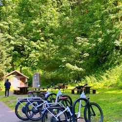
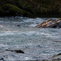
Great hike, even on a hot day. Arrived in the park around 10, and the waterfall stop offs were all full but parking lot at this trailhead had plenty of spots. Very shaded most of the way. Nice stream to stop and put your feet in on the way back. I logged 5 miles exactly. Took us 3 hours and 11 minutes including a nice long break at the top.

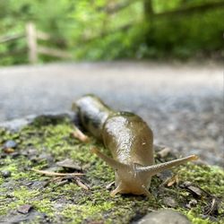
I arrived to the parking lot 8:30am on a Tuesday in June and I was the first and only car. The parking lot can accommodate ~10 cars. By the time I got back to the parking lot after my hike, there were maybe 1-2 spots left at 10:30am. The whole hike to Angels Rest lookout took ~2 hrs for 4.6 miles. I had the whole trail to myself. The path is quite narrow so it can only fit one person really. I saw a group of 8 or so starting the hike after I got to my car and I was glad to have gone early because there's no room to pass anyone on this trail. Most of the hike is shaded. It rained the day before so some parts of the path were muddy. I saw a variety of wildflowers, a slug and chipmunks. I would say difficulty is moderate. It helps to have hiking shoes because some of the path is rocky, but it's not necessary.


Arrived at 8 am on a thursday. Was the 2nd car in the parking lot. The lot for parking is not very large so would recommend coming early. There is incline from the get go. I needed my all trails map to figure out some of the directions. At the beginning it was unclear which way to go. The answer is left. Not sure where right goes. The trail was incredibly lush and green. So many ferns and flowers. Its absolutely beautiful. There are a lot of switch back and basically the entire trail is incline. The view at the top is stunning of the gorge. I ended up picking up a fair amount of other peoples garbage though and also other folks dog poop bags. Be sure to pack out what you pack in , including your dog poop. I didn't even have my doggies with me this time since they were at home in colorado but always believe in leaving a place better than i found it. Trail was dry. When i was on my way down and about half way down really started running into people. When i got back to parking lot around 10 there was a line of cars hoping to get a parking spot and just kind of waiting along the side of the road So seems like its a pretty happening spot. Come early! There are trash cans at the parking lot.

O lawd, I'm 3-staring a hike, I will end up on a late night show for sure! This is great as an after-work hike if you live in the Portland metro. Everyone else should...maybe try something more interesting. OK, OK. It's also good if you move your beanpoles back and forth semi-vigorously, but don't have much time, and would prefer not to use a treadmill/hamster wheel. Outside of those use cases, there are way more scenic and rewarding hikes in The Gorge. Pick pretty much anything. Well, except for Nesmith Point...which is probably the worst hike in The Gorge. Steep with no "summit" views. Just lovely.
Came here on a weekday, started at the Wahkeena Falls parking lot. The hike to Angel's Rest was steep with lots of switchbacks, but it was fun. Didn't see many people, intersections were well-signed with maps too! Pretty great, appreciate that. The viewpoint from Angel's Rest was great! I really enjoyed this hike, would recommend it.

Came right after 0730 on a Wednesday and we were the only ones there. It was so pretty in February, but definitely cold! You'll see multiple points of a water fall going up. Plenty of trees and birds. The trail getting closer to the top isn't paved, you have to walk through some loose rocks. Also, if you're going in the winter some of the paths are icy and slippery when making it to the top. But, once you're at the top it is absolutely stunning! Would definitely recommend this hike if you're in the area! It's a short quick hike, didn't need to bring water or snacks or anything. About 2 hours round trip if you're waling at a moderate pace.
This is a beautiful hike, in one of the most beautiful natural wonders in the country. There's no changing that. The Columbia River gorge = absolute beauty! That being said, this hike was way more technical than any hiking website or map indicates. It's hard when hikes are classified as only easy, moderate, difficult. Angel's Rest is classified as moderate, but here are the real details: If you go when any rain has fallen in the last few days, or when it's currently raining, 40% of the hike will be mud. Very murky, sticky yet slippery mud. It makes for some slow going. The rest of the trail is made of rocks, which if it's been raining, are extremely slippery. Some areas are just jagged rocks on the path. Near the end of the trail, there is a section of large rocks where you can almost lose the trail. Fear not, just cross the rocks and eventually, you'll reach the rest of the trail on the other side. At the top, you really do have great views of the Gorge. And there's no denying how beautiful the Gorge is! But for the difficulty, I do feel that there are hikes out there that are more pretty on the way up and a little less treacherous. I'd trade in the mud and rocks for a steeper trail any day. That being said, the Gorge is beautiful, the PNW is amazing, and if you aren't afraid of some mud and rocks, the views will take your breath away.

Another great trail located in Oregon. The trail is not the easiest, but also not difficult to complete. It's a moderate hike that has a good incline. Some parts can be rough as you are hiking on a bit of a rocky trail. Once you reach the top, take a moment to enjoy the view. Definitely worth the trip. Also, there are a couple of other routes that you can take that will make it a longer trail.

The best bang for your buck when it comes to hikes in the gorge! It's a quick drive from Portland. Depending on your skill level you can do this 4 mile round trip hike in about 2.5 hours. It is steep (straight up the the whole way)! But that's the fun part! A great workout in the gorgeous outdoors. The selling point of this hike is the view from the top. You can see both directions down the gorge, including the Portland skyline. Amazing. If you haven't done this one yet, what are you waiting for?? A few cons: it can get pretty muddy in the winter. If you don't come early, it does get crowded, although I've never not been able to find a parking spot. You can park on the edge of the street if needed. Parking is free.

A beautiful hike, not too far away from Portland. We went on a day where it rained the night before. I loved the view, very large area for rope to walk around, rest, and take pictures. One thing that I hated was the mud, it was muddy about 40% of the time and with steep and narrow trails made it hard. Decent parking and would come again.
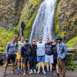
Amazing, this was a great hike. My cousin recommended this trail because she thought I was a city mouse and was told this hiking trail was easy........yeah, NOPE. It was a 9.7 miles round trip and it over 3500 feet elevation with steep trails. However, the view was beyond words to describe. Throughout this adventure, you start near a waterfall and gazed upon the Columbia Gorge and all of its glory as your hike up to the top. As you can up higher on the trail, you will be in an area that covered with flat rocks, which were amazing to sun bake and rest your feet. It is a dog-friendly trail, but I do get confused on how a tiny corgi can climb some of these steep steps on the way up or down. Worth the hike if you make it to the top. For beginners, it may be hellish, but the view is clearly divine.

If you live in Oregon and you've never visited Angel's Rest, are you really an Oregonian? But seriously, Angel's Rest Hiking trail is my all time FAVORITE trail to hike in Oregon. The trail is always well maintained and the end view is just absolutely GORGEous (see what I did there). Small tip.. since this hiking spot is becoming increasingly popular (especially in the summer), I advise to skip the morning and hike this trail in the late afternoon (3 or 4pm ish). You will see that it is less packed around this time. And please always pack a headlamp or bring a flashlight with you in case it starts to get dark on your trek back down. Once you reach the top of Angel's Rest, do yourself a favor and hike a little bit further if you have it in you. About 1 or 2 more miles up is Devil's Rest which is an even higher view of the Columbia river gorge. You will NOT regret it. Well.... your legs might, but your eyes won't!

4.9 mi, 1503 ft elevation gain, 2hrs 3 min to complete. Awesome trail as always. We beat the crowds and attempted to do this as a sunrise hike. We were a bit too late, but caught a bit of the sunrise on the way up. Clouds and fog were swirling around and moving fast at the top. Absolutely beautiful. Wish I had a hot cup of coffee at the top to enjoy! No parking pass or special access permit required before 0900!!! read more


This has to be one of the most popular trails near Portland and no matter how many times you come here the views will always mesmerize you. Although the hike is not very long, it's strenuous. I would recommend starting early or a little later in the evening because after a while, there is no shade and with the sun beating down on you ,it does take a toll on your energy and hydration levels .However , early summer if you want gorgeous view of wildflowers and a stunning view of the gorge this one is hard to beat. Parking can be tricky depending on the day and time you arrive . Be prepared for unexpected wildlife encounters. read more


Great hike, even on a hot day. Arrived in the park around 10, and the waterfall stop offs were all full but parking lot at this trailhead had plenty of spots. Very shaded most of the way. Nice stream to stop and put your feet in on the way back. I logged 5 miles exactly. Took us 3 hours and 11 minutes including a nice long break at the top. read more


I arrived to the parking lot 8:30am on a Tuesday in June and I was the first and only car. The parking lot can accommodate ~10 cars. By the time I got back to the parking lot after my hike, there were maybe 1-2 spots left at 10:30am. The whole hike to Angels Rest lookout took ~2 hrs for 4.6 miles. I had the whole trail to myself. The path is quite narrow so it can only fit one person really. I saw a group of 8 or so starting the hike after I got to my car and I was glad to have gone early because there's no room to pass anyone on this trail. Most of the hike is shaded. It rained the day before so some parts of the path were muddy. I saw a variety of wildflowers, a slug and chipmunks. I would say difficulty is moderate. It helps to have hiking shoes because some of the path is rocky, but it's not necessary. read more


2 years ago
It's a great hike, especially on a gorgeous day. When you get to the top, go further ... the views open up even more. read more


5 years ago
Arrived at 8 am on a thursday. Was the 2nd car in the parking lot. The lot for parking is not very large so would recommend coming early. There is incline from the get go. I needed my all trails map to figure out some of the directions. At the beginning it was unclear which way to go. The answer is left. Not sure where right goes. The trail was incredibly lush and green. So many ferns and flowers. Its absolutely beautiful. There are a lot of switch back and basically the entire trail is incline. The view at the top is stunning of the gorge. I ended up picking up a fair amount of other peoples garbage though and also other folks dog poop bags. Be sure to pack out what you pack in , including your dog poop. I didn't even have my doggies with me this time since they were at home in colorado but always believe in leaving a place better than i found it. Trail was dry. When i was on my way down and about half way down really started running into people. When i got back to parking lot around 10 there was a line of cars hoping to get a parking spot and just kind of waiting along the side of the road So seems like its a pretty happening spot. Come early! There are trash cans at the parking lot. read more


O lawd, I'm 3-staring a hike, I will end up on a late night show for sure! This is great as an after-work hike if you live in the Portland metro. Everyone else should...maybe try something more interesting. OK, OK. It's also good if you move your beanpoles back and forth semi-vigorously, but don't have much time, and would prefer not to use a treadmill/hamster wheel. Outside of those use cases, there are way more scenic and rewarding hikes in The Gorge. Pick pretty much anything. Well, except for Nesmith Point...which is probably the worst hike in The Gorge. Steep with no "summit" views. Just lovely. read more


3 years ago
Came here on a weekday, started at the Wahkeena Falls parking lot. The hike to Angel's Rest was steep with lots of switchbacks, but it was fun. Didn't see many people, intersections were well-signed with maps too! Pretty great, appreciate that. The viewpoint from Angel's Rest was great! I really enjoyed this hike, would recommend it. read more


Came right after 0730 on a Wednesday and we were the only ones there. It was so pretty in February, but definitely cold! You'll see multiple points of a water fall going up. Plenty of trees and birds. The trail getting closer to the top isn't paved, you have to walk through some loose rocks. Also, if you're going in the winter some of the paths are icy and slippery when making it to the top. But, once you're at the top it is absolutely stunning! Would definitely recommend this hike if you're in the area! It's a short quick hike, didn't need to bring water or snacks or anything. About 2 hours round trip if you're waling at a moderate pace. read more


6 years ago
This is a beautiful hike, in one of the most beautiful natural wonders in the country. There's no changing that. The Columbia River gorge = absolute beauty! That being said, this hike was way more technical than any hiking website or map indicates. It's hard when hikes are classified as only easy, moderate, difficult. Angel's Rest is classified as moderate, but here are the real details: If you go when any rain has fallen in the last few days, or when it's currently raining, 40% of the hike will be mud. Very murky, sticky yet slippery mud. It makes for some slow going. The rest of the trail is made of rocks, which if it's been raining, are extremely slippery. Some areas are just jagged rocks on the path. Near the end of the trail, there is a section of large rocks where you can almost lose the trail. Fear not, just cross the rocks and eventually, you'll reach the rest of the trail on the other side. At the top, you really do have great views of the Gorge. And there's no denying how beautiful the Gorge is! But for the difficulty, I do feel that there are hikes out there that are more pretty on the way up and a little less treacherous. I'd trade in the mud and rocks for a steeper trail any day. That being said, the Gorge is beautiful, the PNW is amazing, and if you aren't afraid of some mud and rocks, the views will take your breath away. read more


9 years ago
Another great trail located in Oregon. The trail is not the easiest, but also not difficult to complete. It's a moderate hike that has a good incline. Some parts can be rough as you are hiking on a bit of a rocky trail. Once you reach the top, take a moment to enjoy the view. Definitely worth the trip. Also, there are a couple of other routes that you can take that will make it a longer trail. read more


The best bang for your buck when it comes to hikes in the gorge! It's a quick drive from Portland. Depending on your skill level you can do this 4 mile round trip hike in about 2.5 hours. It is steep (straight up the the whole way)! But that's the fun part! A great workout in the gorgeous outdoors. The selling point of this hike is the view from the top. You can see both directions down the gorge, including the Portland skyline. Amazing. If you haven't done this one yet, what are you waiting for?? A few cons: it can get pretty muddy in the winter. If you don't come early, it does get crowded, although I've never not been able to find a parking spot. You can park on the edge of the street if needed. Parking is free. read more

A beautiful hike, not too far away from Portland. We went on a day where it rained the night before. I loved the view, very large area for rope to walk around, rest, and take pictures. One thing that I hated was the mud, it was muddy about 40% of the time and with steep and narrow trails made it hard. Decent parking and would come again. read more


Amazing, this was a great hike. My cousin recommended this trail because she thought I was a city mouse and was told this hiking trail was easy........yeah, NOPE. It was a 9.7 miles round trip and it over 3500 feet elevation with steep trails. However, the view was beyond words to describe. Throughout this adventure, you start near a waterfall and gazed upon the Columbia Gorge and all of its glory as your hike up to the top. As you can up higher on the trail, you will be in an area that covered with flat rocks, which were amazing to sun bake and rest your feet. It is a dog-friendly trail, but I do get confused on how a tiny corgi can climb some of these steep steps on the way up or down. Worth the hike if you make it to the top. For beginners, it may be hellish, but the view is clearly divine. read more


7 years ago
9 years ago
If you live in Oregon and you've never visited Angel's Rest, are you really an Oregonian? But seriously, Angel's Rest Hiking trail is my all time FAVORITE trail to hike in Oregon. The trail is always well maintained and the end view is just absolutely GORGEous (see what I did there). Small tip.. since this hiking spot is becoming increasingly popular (especially in the summer), I advise to skip the morning and hike this trail in the late afternoon (3 or 4pm ish). You will see that it is less packed around this time. And please always pack a headlamp or bring a flashlight with you in case it starts to get dark on your trek back down. Once you reach the top of Angel's Rest, do yourself a favor and hike a little bit further if you have it in you. About 1 or 2 more miles up is Devil's Rest which is an even higher view of the Columbia river gorge. You will NOT regret it. Well.... your legs might, but your eyes won't! read more


Where eagles dare! We have driven by this trail so many times and have heard so many great things about it, but have not had to chance to hike it. As an avid hiker Angel's Rest has been on my hiking list for a while now. The total distance is roughly around4.8 miles for the entire round trip. Whoever, it feels much longer due to the majority of this hike is on an incline with hills. The elevation gain is approximate 1450 feet. I would rate this as a moderately hard trail to hike due to the elevation and incline. The parking lot is small and gets full really fast. This trail can get really busy. I would recommend going in the early morning (6 or 7am), if you opt to go later parking will be a challenge. You can park on the side of the road, but even that is pretty limited. The trail is well worn and very rocky at times. This is a moderately hard trail in my opinion with the majority of it being on an incline while you work your way up. Wear really good sturdy hiking boots or shoes with a solid sole. A good portion of the trail is rock and you will have to climb some boulders near the top. There is a nifty waterfall a few miles in the beginning. I would caution everybody to stay on the trail and be careful on the drop offs and cliffs. There have been several fatalities due to falls attributed to this trail. So keep your kids close by and use caution and good judgement. There are some great picturesque spots with great views of the Columbia Gorge and the Columbia River. When you get to the top, be careful as there is no date or fencing so watch your step. The trail can get really wet and muddy after some rain so prepare to get a little bit dirty if you go in spring or the fall. At the top there is a wide open 360 degree view of the Columbia Gorge and Columbia River and the surrounding areas. This is really one of my favorite hikes along the Columbia Gorge, just keep in mind that you are basically going up and the entire hike is on an incline. I am definitely coming back and highly recommend this hike. Make sure to bring plenty of water and wear sturdy shoes. read more


Not sure how many stars to give. I've never been hiking before! Lol It was SO muddy and there was still a lot of snow. Took my husband, brother, sister law and myself 5 hours round trip to hike the 4.8 miles (mostly cause of me lol). Beautiful views! I'm sure I would have enjoyed myself more if I had better shoes and the ground wasn't so muddy. :) my dog LOVED it. read more

 - Hiking Near Me - Corbett, Oregon")
7 years ago
Amazing hike with amazing views. As a novice in hiking, I would say this is a moderate hike. Worked up a sweat but was able to complete it without any issues at all. If you have 2 to 3 hours, you need to check it out! read more


One of my favorite hikes along the gorge! This is a moderate hike... 4.6 miles roundtrip. The view at the top is pretty amazing. I would recommend this trail to anyone who wants to have an awesome view of the gorge. You get the most bang for your buck! read more


7 years ago
Pretty easy hike for the more advanced hikers. Nothing too difficult getting over and the trail is pretty wide so you don't have to worry about bumping into people. Once you get to the top it's all worth it from there. I just sat down for a good hour and stared at the gorgeous Columbia river. I recommend this trail for all the sightseers! read more


Everyone and their mother has probably hiked this trail. It isn't hard to see why. Unlike devil's rest, there is an amazing view when you reach the summit. However, like multnoma falls, the prettier the view....the greater the foot traffic. So go on a day that isn't perfectly sunny to avoid the crowd. I went on a cloudy day, and although it was a little chilly it was totally worth it! Definitely an easy hike if you are a beginner looking to start hiking. read more


11 years ago
Beautiful and spectacular hike. Moderately grueling. Recommend: take the scenic historic columbia river drive and park at the trailhead at Bridal Veil. Trailhead is on your right and parking is on your left or curbside. If you drive to Multnomah Falls you have gone too far and need to turn your booty around. Make sure to exit I-84 on Corbett hill Bring Gatorade and water and food for the very friendly chipmunks. You will love watching them stuff their cheeks! read more

10 years ago
17 years ago
18 years ago
11 years ago
Such a wonderful hike, would definitely go again. I usually hike on dry trails that lead through the woods, but the trails out here up north are just something else. Green, green, green is all you see throughout the hike while you mark your shoe tread into the damp trail. Saying so, I recommend bringing a hiking stick if you have bad balance/footwear without gripping tread. Hiking through, you will start to sweat but the trees and random breezes keep you going. As you progress up, (when foggy) you start to lose sight of the road you arrived from. At the top, (make sure you go left and not right, leading to Devil's Rest which is another couple miles) you get a great view of the river that runs along the highway. Sit down, relax, enjoy the views with some lunch, and don't forget to feed the chipmunks! Hope for the fog to not block your view at the top. All photos uploaded cannot do justice to the actual view itself.. even the pictures of slugs along the trails Lol. Hiking Level = Moderate. Terrain = Slippery with sharp rocks. Time = 1 hour up, 35 minutes down. Dog accessible = Yes. Weather gear = Rain proof light weight jacket and preferred pants/shorts PS: This is the only trail where I have seen about a total of 12 dogs hiking up with their owner. read more


13 years ago
Page 1 of 3
More info about Angel's Rest Hiking Trail
47505 Historic Columbia River Hwy
Corbett, OR 97019
Directions
Hours
Indoor Amenities
Outdoor Amenities
Ask the Community - Angel's Rest Hiking Trail
Review Highlights - Angel's Rest Hiking Trail


Angel's Rest Hiking Trail - hiking - Updated May 2026
Best of Corbett
People found Angel's Rest Hiking Trail by searching for…
Browse Nearby
BEST of Corbett, Oregon Coffee near Angel's Rest Hiking Trail
BEST of Corbett, Oregon Things to Do near Angel's Rest Hiking Trail
BEST of Corbett, Oregon Restaurants near Angel's Rest Hiking Trail
BEST of Corbett, Oregon Parks near Angel's Rest Hiking Trail
BEST of Corbett, Oregon Campgrounds near Angel's Rest Hiking Trail
BEST of Corbett, Oregon Waterfalls near Angel's Rest Hiking Trail
BEST of Corbett, Oregon Breakfast near Angel's Rest Hiking Trail
BEST of Corbett, Oregon Hotels near Angel's Rest Hiking Trail