Forest Park Photos


You might also consider


More like Forest Park
Recommended Reviews - Forest Park
Start your review...


Reviews With Photos


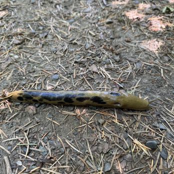
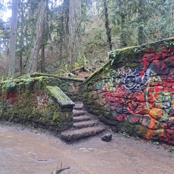
Great hike up to "Witch's Castle", or "Stone House", depending who you happen to ask. Saw lots of beautiful banana slugs, a heron and gorgeous mossy trees. Pups bring their humans and many seem to make this their daily trail run, so be mindful of traffic on this trail. When you get to the stone house, marvel at all the graffiti hodgepodge left by bored youth, but also the absence of graffiti on many other objects in the area to which the creativity may "flow". Cheers! "CC"
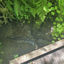

Really big and refreshing not lots of parking and no service be prepared for backpacking adventure if you plan on it- not extremely far. It's worth it.


I've been here since 2008, and I've done many hikes in Forest Park. It truly is an amazing city park. I hadn't been hiking in awhile and today decided to once again kick my butt on the BPA trailhead hike. Beautiful day!
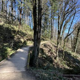

Here comes the sun.... Really enjoyed hiking in the sunny 70 degree weather. This place has so many trials to see we only had a small taste of this wonderful park. So many dogs walking the trail, runners and cyclist out. Tip: bring water and snacks in case you want to just sit and enjoy Mother Nature. Alta's enjoyed his walk, he lasted the whole hike. Wish we could have seen more but we were hungry.


We are blessed to be living so close to a forest in the city. When I am low on my dose of nature, Forest Park comes to the rescue! Forest Park offers multiple trails for walking, trail running, and hiking. I see tons of dogs and families with toddlers frequenting this park, so it is really for everyone! Our favorite trail is the one that starts at Lower Macleay Park and ends at Pittock Mansion. To be rewarded with breathtaking views of the city is an unmatched feeling!


Forest Park flanks the west side of the city and provides more than 5,000 acres of Northwest forest to explore, providing an easy escape from the urban environment. Every time I have visited Portland, I have spent time at this beautiful park, the trails are just enchanting. The park is home to many of the best hiking trails in the Portland area and contains more than 80 miles of hiking and walking trails. First-time visitors should bring a map to help navigate. The 30-mile Wildwood Trail is popular, as it connects with other pedestrian paths that circumnavigate the city. The park covers the eastern slope of the Tualatin Mountains and is one of the largest urban parks in the country. The park is easily accessible by car, bike, or public transportation. Another popular loop is the Maple Trail Loop, which highlights some of the tallest flora in the park. The iconic Pittock Mansion is also accessible with a hike through Forest Park starting from Lower Macleay Park.
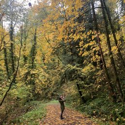

This is one of my most favorite parks in Portland. It was my first time going there in fall and I'm so happy I did - the Maple trail is so beautiful this time of year.


Let's be real, you really can't go wrong with any trail you might choose within Forest Park. I've taken many, and I've enjoyed every one. We recently did the Skyline Cruise Loop Trail, a 2.8 miler within Forest Park. It's connected to a few other trails, so you've got to follow a gps to stay within this specific loop...no good signage for it in particular. There isn't a lot of parking available off Skyline, and on a foggy Sunday morn there were already quite a few hikers and bikers there so we had to squeeze in. It's a long walk downward to the offshoot of the loop, and therefore a long trek back up at the end when you're a bit tired. The loop itself is fun...ups and downs, twists and turns. Pretty muddy, but would provide lots of good shade most of the time on a sunny day...and of course the beauty of Forest Park all around. For a shorter hike it's a decent workout.


Unreal how it's nestled so close to downtown Portland! I had cell service during the trails! There are so many trails to choose from. Tons of locals that come to the trails with their dogs! Tons of locals running the trails. Beautifully maintained!! I didn't see any official restrooms so plan accordingly! Free parking BE CAREFUL and lock your cars and hide all your belongings because I saw tons of cracked glass from the car windows. I saw so much glass.. it was Not a good sight to see! It's unfortunate that there are people that'll break car windows.


Forest Park is the largest urban forest in the US. How cool is that? Covering the northern parts of Portland's West Hills, it features over 80 miles of quintessential PNW trails full of moss, ferns, and pines. The most iconic trail is the Wildwood, which stretches for 30 miles north-south. What's not to like!? I've lived in Portland for over seven years and I feel like I'm only just now starting to get a handle on the vastness of Forest Park. Surely, having a working understanding of the FP trail system is on the "are you a local" test :) Here are a few tips I've learned over the years. * The Wildwood Trail is marked by blue diamonds. These blue diamonds appear on trees (not sign posts) every 1/4th mile * There are two semi-paved gravel trails in the park, Leif Erikson Dr and Old Saltzman Road, which intersect many of the other trails. These are popular for mountain biking and can be a entry points for newbie trail runners * Close to town are heavily trafficked trails including Pittock Mansion, the Washington Park portion of the Wildwood, and the ever-popular Witch's Castle off the Thurman St entrance * The northern sections are more wild and less trafficked * Remember to share the trail with proper hiker's etiquette. If approaching a group from behind, announce yourself and they will happily let you pass. I usually go with a friendly "mind if I squeeze past?" Likewise, if you are getting passed make way on the trail, especially for bikers and runners. If passing, give a friendly nod or wave of thanks. Be kind to your fellow nature lovers; it's not hard, people! * Finally, follow city rules in leashing your pet and picking up after them. Unleashed dogs can damage the ecosystem and upset local fauna, not to mention startling fellow hikers and runners appearing unseen around a corner. Happy hiking!
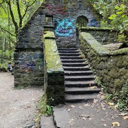

The park has many trails and there're different start points can go to witch's house (stone house). One is shorter and one is longer, depends which parking lot you start from. So if you don't want to spend too much time or don't wanna walk to long, make sure you go to the upper parking lot or check on google for more details. I took the shorter trail to the stone house. The trail was really really amazing. All shaded, green and easy to walk.
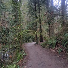

Amazing place for a hike. My husband and I came her on Valentine Day's for a rainy day hike while visiting the area. There was lots of rain so that meant there was plenty of parking. We didn't see any main bathrooms, but there was a porta potty next to the trailhead. We did not have a lot of time, so we did the 1/2 mile hike to the Witch's Castle and back. The trails were well covered, green, and so beautiful. The trail was very moderate, so nothing too strenuous. It was my first hiking out in PNW and it felt like we were hiking through a fairytale forest like you would see in the movies. We will defiantly to be back to explore more of this park!


Huge network of trails in a lush forest within the City, love! There are dozens and dozens of trails with access points from many locations like near the Portland Audobon, Forest Heights neighborhood, Skyline Drive and so much more. Gravel trails are well maintained and they meander up and down hills through tall trees, dense foliage, babbling creaks with spots of color from the wild flowers and blackberries dotting the landscape. It's absolutely beautiful! There are lots of other walkers, joggers and even some bikes, so while hiking puts you in a meditative stage, do pay attention to your surroundings. When you need an escape from the City but can't get far away, Forest Park will submerge you in the beauty of nature and provide the calm that only nature can provide.
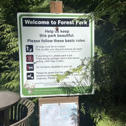

Amazing park that makes you feel so secluded and in the middle of nowhere. Towering trees crowd out the sun, so that only small golden rays can filter through and dapple the ground. Some parts of the trail cross streams. Birdsong fills air, and you can see occasional robins hopping on the trail, trying to find a snack. Tiny songbirds flit through the air. There are some inclines and slopes on some of the trails here, but nothing too bad. Take it in at your own pace. You can elect to just sit and soak in nature. Parking can be difficult to find at times, as this area is so popular due to its proximity to downtown, as well as being a beautiful experience! I highly recommend experiencing everything this park has to offer if you have the time. read more


I love coming to Forest Park when visiting Portland! There are many trails to choose from, it's well maintained, and there's a lot of signage, making it fairly easy to navigate around. I've come here a handful of times and have done some easy walks, as well as the more strenuous trek all the way up to Pittock Mansion. The observation deck is always a favorite stop too since it's such a pretty area. The whole park is very lush and seems to stay that way no matter the time of year. Not sure if all of the trails are dog friendly, but we have brought a dog on some and see lots of them throughout the park. read more


Calling out the Leif Erickson section here, at Germantown Road entrance. The drive down winding, narrow Germantown is pretty awesome in itself, but the trail here is pretty sedate, kinda flat to start, running through some old growth forest and in a matter of minutes it feels like wilderness except for the odd mountain biker whizzing past. It's a wide, graded path that was probably a fire road at one time, so it can get pretty popular and crowded on weekends, but there's plenty of room for all, though parking is pretty much limited to a pullout with a clearing on the side of the road. A nice place for a stroll. read more


1 year ago
Great hike up to "Witch's Castle", or "Stone House", depending who you happen to ask. Saw lots of beautiful banana slugs, a heron and gorgeous mossy trees. Pups bring their humans and many seem to make this their daily trail run, so be mindful of traffic on this trail. When you get to the stone house, marvel at all the graffiti hodgepodge left by bored youth, but also the absence of graffiti on many other objects in the area to which the creativity may "flow". Cheers! "CC" read more


4 months ago
Really big and refreshing not lots of parking and no service be prepared for backpacking adventure if you plan on it- not extremely far. It's worth it. read more
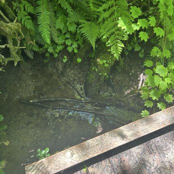
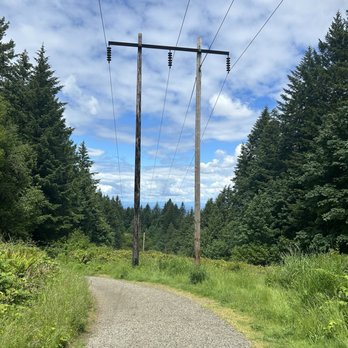


I've been here since 2008, and I've done many hikes in Forest Park. It truly is an amazing city park. I hadn't been hiking in awhile and today decided to once again kick my butt on the BPA trailhead hike. Beautiful day! read more


4 months ago

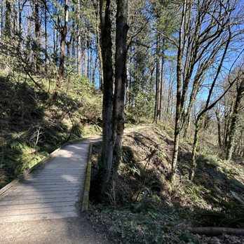
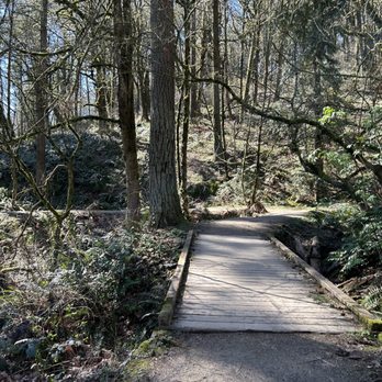
Here comes the sun.... Really enjoyed hiking in the sunny 70 degree weather. This place has so many trials to see we only had a small taste of this wonderful park. So many dogs walking the trail, runners and cyclist out. Tip: bring water and snacks in case you want to just sit and enjoy Mother Nature. Alta's enjoyed his walk, he lasted the whole hike. Wish we could have seen more but we were hungry. read more


3 years ago
We are blessed to be living so close to a forest in the city. When I am low on my dose of nature, Forest Park comes to the rescue! Forest Park offers multiple trails for walking, trail running, and hiking. I see tons of dogs and families with toddlers frequenting this park, so it is really for everyone! Our favorite trail is the one that starts at Lower Macleay Park and ends at Pittock Mansion. To be rewarded with breathtaking views of the city is an unmatched feeling! read more


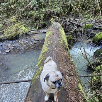


Forest Park flanks the west side of the city and provides more than 5,000 acres of Northwest forest to explore, providing an easy escape from the urban environment. Every time I have visited Portland, I have spent time at this beautiful park, the trails are just enchanting. The park is home to many of the best hiking trails in the Portland area and contains more than 80 miles of hiking and walking trails. First-time visitors should bring a map to help navigate. The 30-mile Wildwood Trail is popular, as it connects with other pedestrian paths that circumnavigate the city. The park covers the eastern slope of the Tualatin Mountains and is one of the largest urban parks in the country. The park is easily accessible by car, bike, or public transportation. Another popular loop is the Maple Trail Loop, which highlights some of the tallest flora in the park. The iconic Pittock Mansion is also accessible with a hike through Forest Park starting from Lower Macleay Park. read more


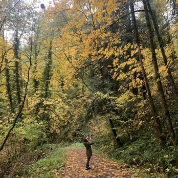

Let's be real, you really can't go wrong with any trail you might choose within Forest Park. I've taken many, and I've enjoyed every one. We recently did the Skyline Cruise Loop Trail, a 2.8 miler within Forest Park. It's connected to a few other trails, so you've got to follow a gps to stay within this specific loop...no good signage for it in particular. There isn't a lot of parking available off Skyline, and on a foggy Sunday morn there were already quite a few hikers and bikers there so we had to squeeze in. It's a long walk downward to the offshoot of the loop, and therefore a long trek back up at the end when you're a bit tired. The loop itself is fun...ups and downs, twists and turns. Pretty muddy, but would provide lots of good shade most of the time on a sunny day...and of course the beauty of Forest Park all around. For a shorter hike it's a decent workout. read more

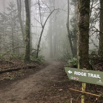


Unreal how it's nestled so close to downtown Portland! I had cell service during the trails! There are so many trails to choose from. Tons of locals that come to the trails with their dogs! Tons of locals running the trails. Beautifully maintained!! I didn't see any official restrooms so plan accordingly! Free parking BE CAREFUL and lock your cars and hide all your belongings because I saw tons of cracked glass from the car windows. I saw so much glass.. it was Not a good sight to see! It's unfortunate that there are people that'll break car windows. read more




1 year ago

2 years ago

Forest Park is the largest urban forest in the US. How cool is that? Covering the northern parts of Portland's West Hills, it features over 80 miles of quintessential PNW trails full of moss, ferns, and pines. The most iconic trail is the Wildwood, which stretches for 30 miles north-south. What's not to like!? I've lived in Portland for over seven years and I feel like I'm only just now starting to get a handle on the vastness of Forest Park. Surely, having a working understanding of the FP trail system is on the "are you a local" test :) Here are a few tips I've learned over the years. * The Wildwood Trail is marked by blue diamonds. These blue diamonds appear on trees (not sign posts) every 1/4th mile * There are two semi-paved gravel trails in the park, Leif Erikson Dr and Old Saltzman Road, which intersect many of the other trails. These are popular for mountain biking and can be a entry points for newbie trail runners * Close to town are heavily trafficked trails including Pittock Mansion, the Washington Park portion of the Wildwood, and the ever-popular Witch's Castle off the Thurman St entrance * The northern sections are more wild and less trafficked * Remember to share the trail with proper hiker's etiquette. If approaching a group from behind, announce yourself and they will happily let you pass. I usually go with a friendly "mind if I squeeze past?" Likewise, if you are getting passed make way on the trail, especially for bikers and runners. If passing, give a friendly nod or wave of thanks. Be kind to your fellow nature lovers; it's not hard, people! * Finally, follow city rules in leashing your pet and picking up after them. Unleashed dogs can damage the ecosystem and upset local fauna, not to mention startling fellow hikers and runners appearing unseen around a corner. Happy hiking! read more


The park has many trails and there're different start points can go to witch's house (stone house). One is shorter and one is longer, depends which parking lot you start from. So if you don't want to spend too much time or don't wanna walk to long, make sure you go to the upper parking lot or check on google for more details. I took the shorter trail to the stone house. The trail was really really amazing. All shaded, green and easy to walk. read more
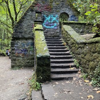


Amazing place for a hike. My husband and I came her on Valentine Day's for a rainy day hike while visiting the area. There was lots of rain so that meant there was plenty of parking. We didn't see any main bathrooms, but there was a porta potty next to the trailhead. We did not have a lot of time, so we did the 1/2 mile hike to the Witch's Castle and back. The trails were well covered, green, and so beautiful. The trail was very moderate, so nothing too strenuous. It was my first hiking out in PNW and it felt like we were hiking through a fairytale forest like you would see in the movies. We will defiantly to be back to explore more of this park! read more
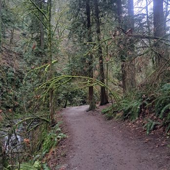
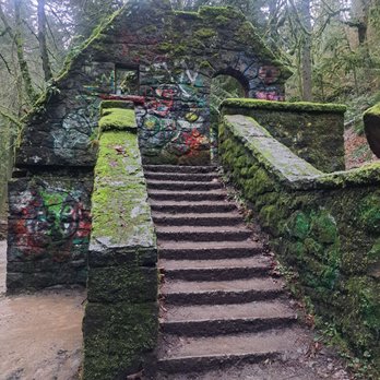

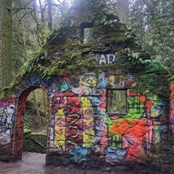


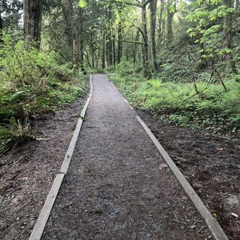
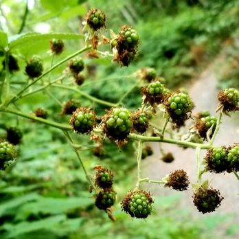
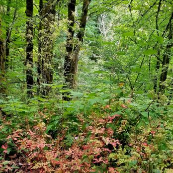
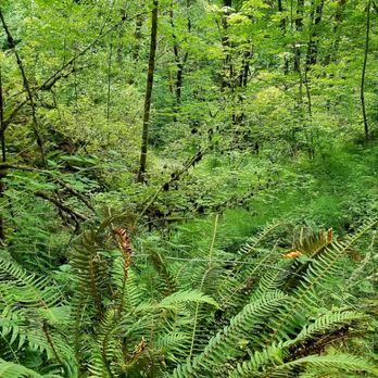
Huge network of trails in a lush forest within the City, love! There are dozens and dozens of trails with access points from many locations like near the Portland Audobon, Forest Heights neighborhood, Skyline Drive and so much more. Gravel trails are well maintained and they meander up and down hills through tall trees, dense foliage, babbling creaks with spots of color from the wild flowers and blackberries dotting the landscape. It's absolutely beautiful! There are lots of other walkers, joggers and even some bikes, so while hiking puts you in a meditative stage, do pay attention to your surroundings. When you need an escape from the City but can't get far away, Forest Park will submerge you in the beauty of nature and provide the calm that only nature can provide. read more






4 years ago


Beautiful park that's pretty easy to get to from a nearby neighborhood. Very green wooded forest with a well maintained trail for some easy hiking/causal walking. I'm not sure if or how much further the park goes but we did about a 2 mile trail that goes down toward lower MacLeay Park, and got to check out Witches Castle. It's an awesome park to visit if you're in the Portland area and don't have time to go outside the city for some exploring/hiking. read more

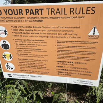


Great park to go for a walk, hike. There are two different entrances to this park. I first went here trying to find the witches castle, but I took the upper route. I, later found out I was right above the witches castle, but either way this is a great park.. I wouldn't say this is a park. It's more like a secluded Forrest area. I didn't even make it half way, because it is a long trail but enjoyable... Great scenery too.. read more


5 years ago
Forest Park is a majestic Pacific Northwest icon. Worthy of a Yelp rating of 6 stars out of 5, I would grant it that if I could. From the Pittock Mansion to the Witch's Hut, from Leif Ericson Drive to the Wildwood Trail, this nature preserve contains over 5,000 acres of hikable wilderness. Originally opened for logging and housing development and held largely by private landowners, much of the area was granted to the city during the Great Depression for unpaid property taxes. The extremely high costs of building a road through the unfriendly terrain, and the high likelihood of landslides after the trees were cleared led to an abandonment of the area for further development. A 1944 study of how to best use the land by the Portland City Club decided that since many trees had already been cleared, housing was out of the question, drilling for oil had proved fruitless, and that most of the area was too steep to farm, the best use for this recently acquired land was to create a city park. This idea was approved by the city counsel in 1947, and a year later on September 25, 1948 the city celebrated the formal opening of Forest Park. Now home to over 100 species of birds and over 60 species of mammals, the park contains 80 miles of hiking trails through rough terrain and a thick forest of Western Hemlock, Western Red Cedar, and Douglas Fir. The difficulty of the available trails range from easy and casual along Leif Erickson Drive, to very challenging on all Firelane Trails. No food, water, or bathrooms are available in the park, but a variety of restaurants are nearby at the many trailheads that grant access to the forest. A haven for recreation, the park is open to all forms of dog walking, hiking, biking, and trail running from the hours of first light until dusk, every day of the week, all throughout the year. A visit to Forest Park is a tranquil experience, and on the right day is bordering on a religious awakening, and should be experienced by all true nature lovers everywhere, at least once in their lives. Source: https://www.oregonencyclopedia.org/articles/forest_park/ read more

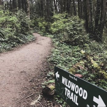


5 years ago


What a beautiful place to go for a short hike! Didn't bring the right shoes? No problem. The half mile trail to the Witch's House is doable even in sandals. Just enough of up and down to get your heart pumping but not to give you a hard attack. The trail is full of different species of mushrooms, has a river running right by it and a small bridge. The Witch's House has graffiti all over it, which takes away from the somewhat untouched forest and wilderness. The fall colors are majestic and the place feels surreal. read more


If I need a quick good hike, this is the place to come, and they have many different trials. My go to is from Lower Macleay to the Pittock Mansion, view Mt Hood if the weather is clear (and my favorite spot in town!) and recently I do Leif Ericsson for trail running (or brisk walk), this trail is less crowded and better if I want to think something or just enjoy quiet moment in nature. What's your favorite trail in this park? read more


Let's be honest for a moment - Forest park may be the coolest part about living in Portland. Before moving here I never would've guessed a park (honestly forest) of this size could exist in a major city. I kid you not, it has over 80 miles worth of hiking trails and is within 10 minutes of downtown Portland. There are trails for everyone - if you have mobility issues, small kids, or just want an easy trail I would start with the lower Macleay trail, it'll take you to the witch castle and past a lot of gorgeous growth ! read more


9 years ago
Forest Park is HUGE. It seems that most people focus on the portions of the park that can be accessed from Central Portland in Macleay Park and the adjacent Washington Park, but this 5100-acre municipal treasure stretches for more than 8 miles from there out to the suburbs almost all the way to the Sauvie Island Bridge. Within these thickly wooded hillsides overlooking the Willamette River, you can run, walk, or hike over 70 miles of trails. Some are steep, technical, root-filled, single-track switchbacks through dense vegetation, while others are wide, gravel-topped fire lanes that ascend to wildflower-filled meadows (these wider, smoother paths are suitable for bikes and even horses). Needless to say, I loved this place!! When I planned my first trip to Oregon in August 2017, I knew that the Portland portion of my adventure would have to include a trail run in Forest Park. Since I wanted to have fewer interactions with other people and hopefully more chances to see some wildlife, I chose to come in on the northwest side of the park at the Wildwood Newberry Trailhead. My Friday night Airbnb (Skyberry Farm http://www.skyberryfarm.com/) was just about a 1/2 mile down the road, all the better for rising early to hit the trail at first light on Saturday. My special friend/bodyguard and I set out at 5:30 am, just after the park officially opens for the day. Because the trees are *sooooooo* tall, it was still basically night in the forest, and it was awesome! Besides our breathing and footfalls, all we could hear were the rustling of the leaves, the morning bird songs, and the occasional plane passing overhead to break the spell. There's just nothing like running through the forest to get in touch with your primitive brain (in a low-risk way)... are you the predator or the prey? At any moment, you're expecting a T-Rex or saber-toothed tiger to spring out of the bushes, lol. After about 2 miles of mostly descent down the narrow (on this portion of) Wildwood Trail, we hit the clearing with the intersection to Firelane 15 and needed to make a choice. We decided to loop back around toward Skyline on the wide fire lane with less dense foliage surrounding, and I was glad that we did. Along the way, we visited Kielhorn Meadow for some wildflower viewing and then climbed to the top of the ridge where we were treated to an awesome view of the Willamette and St. John's neighborhood. The firelane dumped us out on the low traffic (at least at this time of day/week) Skyline Blvd, where we saw some cool houses and several cyclists, but only a couple of cars. The whole run including the rural street portions to/from Skyberry Farm was about 5.5 miles. Forest Park Conservancy (FPC) http://www.forestparkconservancy.org/forest-park/ Check FPC to learn about current trail conditions, find out about guided hikes, and how to volunteer to maintain this amazing park. They even have an app that you can buy with all the maps and useful info about points of interest in the park. 8 Essential Forest Park Hikes from Portland Monthly: https://www.pdxmonthly.com/articles/2017/5/15/eight-essential-forest-park-hikes Full trail maps from Portland Parks & Rec: https://www.portlandoregon.gov/parks/article/497319 http://www.pdxparks.org/maps/natural_areas/forest_park_trail_map_070711.pdf Mountain biking map: https://www.portlandoregon.gov/parks/finder/index.cfm?&action=ViewFile&polpdfsid=81 Note: Only the following trails (dirt roads & firelanes) are open to mountain biking; all other trails/firelanes are closed to bicycles. + NW Leif Erikson Dr + NW Saltzman Rd + NW Springville Rd + BPA Rd + NW Newton Rd + Holman Ln + Firelanes 1, 3, 5, 10, 12, & 15 read more


I feel very lucky to have a place like Forest Park so close to the city. It's very easy to get to and even though it's next to the city, it doesn't get all that crowded. Plus it is huge! Lots of long trails of varying grades. Perfect for trail running. Lush greenery all around. What I find most interesting is that edible mushrooms can be found here! You must go with a seasoned mushroom hunter though, since it's way too easy to misidentify something. On a recent outing, our group identified honey mushrooms, oyster mushrooms and boletes near Wildwood Trail. read more


7 years ago
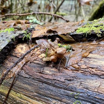
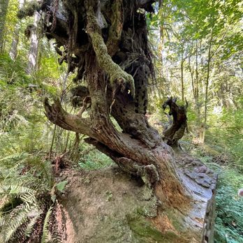
There really is so much to be thankful for. This lichen above for example. There's also vehicular back-up cameras, scoops, Ellen Degenerous memes, tangibles, clean ceilings, megabytes, a triceratop , hobos, the closed umbrella emoji, veal (vegan variety) and echos Who knows! There's probably even more. can you think of any? read more


My husband and I really enjoyed our hike at Forest Park. It was a relatively easy hike with lots of wildlife to be seen. It was my first time seeing a spotted owl and it was truly spectacular. We also saw Witches Castle on the trail which is a pretty cool place to take photos. It's crazy to me that this park is right in the city, but when you are in it, it feels like you are so far away from the city because it's a real escape into nature. read more


I don't even know if I would consider this a park, but more of a backyard to Portland. It's right behind the city, which is kinda cool, reminds me of Hong Kong where the backdrop of the mountains is right behind the city and it offers the hiking, parks etc. So coming from California, I knew Portland was super green as in leafy green color, but I really had no idea until I stepped into Forest Park, I mean holy shit. It's super green here, and then I get back to California and its ya know. brown and tan hahahaha Either way, tons of great hiking here if you can't get to the Gorge area because some asshole kid started fires and messed up everything for everyone else. read more

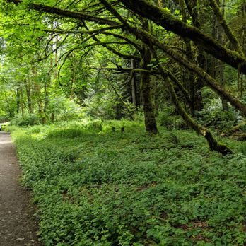

This is probably my second favorite park to go hiking/walking with my two wonderful puppies. If you follow me, you'll find out my first favorite. First of all, if you're in the mood to go hiking, you've picked the right park. Forest Park has dozens upon dozens of trails to choose from, with it's peaceful quiet of the surrounding trees, to the views of the river. This park is huge, many, many trails to choose from, so much so, you can get lost... which isn't a bad thing. read more


Page 1 of 7
More info about Forest Park
4099 NW Thurman St
Portland, OR 97210
Forest Park
Directions
(503) 223-5449
Call Now
Visit Website
http://www.forestparkconservancy.org
Hours
Indoor Amenities
Outdoor Amenities
Ask the Community - Forest Park
Can I bring my horse?
Are there designated camping grounds in the park?
It is not a camping park, unfortunately. I've often thought that would be cool!
Review Highlights - Forest Park
You might also consider





















Why does Yelp recommend reviews?
34 reviews that are not currently recommended
The reviews below are not factored into the business's overall star rating.

16 years ago

15 years ago

15 years ago

8 years ago

9 years ago

14 years ago

17 years ago

10 years ago

15 years ago
4 years ago

4 years ago

10 years ago

11 years ago

4 years ago

2 years ago
3 years ago

8 years ago

17 years ago

17 years ago

14 years ago


