
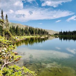
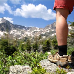
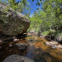
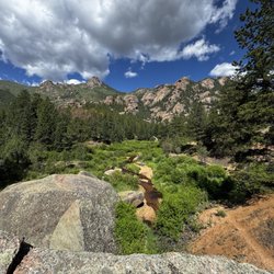
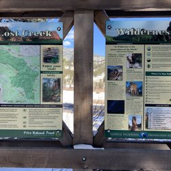
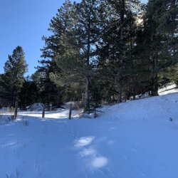
Abyss Trail Photos


You might also consider
More like Abyss Trail
Recommended Reviews - Abyss Trail
Start your review...

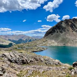
Great day hike/Backpacking trail. You can either park at the Bierstadt parking lot ( Guanella Pass ) above or park below (Burning Bear) and go up. Great views and varied terrain. For me Abyss Lake was so so and much preferred Helms lake but both have spectacular views of Bierstadt and Evans/Blue Sky. If you plan to camp there are some great spots below Helms at the junction going up. read more


4 years ago
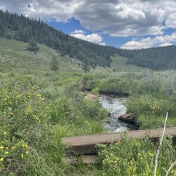
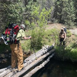
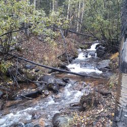
This is a absolutely beautiful trail tucked away off in guanella pass! It has a small parking lot. There is no bathroom and also no trash cans! So plan on packing out what you pack in INCLUDING your dog poop bags. Please dont leave them there for everyone else have to view or pick up. Be responsible for your things!!! If you are going on the weekend be sure to go early. This is a popular trail! we got there at 645 am. the lot was full and we ended up parking a bit away on the side of the road but when we got done cars were lined up for a LONG ways! And you could tell. The trail was so freaking busy! If it were not prime leaf peeping season i am guessing that maybe it may not have been that bad. This is also a leashed dog trail so please be sure to have that dog on a leash if you are heading to this area. Be respectful of the rules or dont come. So many aspens and so so beautiful! will definitely be back in the future! read more


Every year I seek out a new spot to check out the fall colors in Colorado. This year, Abyss Trail won the honor. STAR #1 - Easy to get to! Located off Guanella Pass Road, Abyss Trail is definitely easy to spot. Plus, there tons of color along Guanella Pass Road, which added to our leaf-peeping day. STAR #2 - There's tons of parking! We arrived a bit later than planned due to a navigation error (we fell victim to the AllTrails error mentioned in the pro tip below) and there were quite a few people filling the lot. We managed to snag a spot right up front, and noted some scattered spots open as we made our way to the trailhead. STAR #3 - No fee and no reservation needed! Yeah, you read that right. With some many parks and recreation areas switching to a reservation system or permit model, it's nice to hit the trails with the ones that don't require extra planning/fees. STAR #4 - Ample fall color! If you're there to leaf peep, you will not be disappointed. Early in the season, the first aspens to start changing color will be about 3 to 4 miles in. Lots of pine trees early on in the hike, don't get discouraged - keep going! STAR #5 - Potential elk sightings! While we weren't lucky enough to see any elk on our hike, there were sightings of bull elk in the days following. So cool. Abyss Trail was definitely a great way to kick off fall here in Colorado. I'll be heading back to finish the hike to Helm Lake and soak up more of the fall color in the future. **Pro Tip: If you're an avid user of AllTrails heed my warning - do NOT use it to direct you to the trailhead. It will try to take you to Mt Evans. This is NOT the way to the trailhead. I'm assuming there is a viewing area for Abyss Lake there. You can just head west on I70 to 470 to 285 to Guanella Pass Road, or from I70 go through Georgetown to Guanella Pass Road. We decided to make a loop of it and took Hwy 285 to Guanella Pass Road and the went through Georgetown back to I70 east home. read more


Great hike with beautiful views! Somewhat steep in some spots but not bad at all. The 6 miles to the lake so round trip around 12 miles was very doable and there was good shade so we didn't have to get there early. Big parking lot as well. Highly recommend. read more


More info about Abyss Trail
Grant, CO 80421
Directions
Hours
Outdoor Amenities


Abyss Trail - hiking - Updated July 2026
Best of Grant
People found Abyss Trail by searching for…
Browse Nearby
BEST of Grant, Colorado Things to Do near Abyss Trail
BEST of Grant, Colorado Coffee near Abyss Trail
BEST of Grant, Colorado Restaurants near Abyss Trail
BEST of Grant, Colorado Breakfast near Abyss Trail
BEST of Grant, Colorado Shopping near Abyss Trail
Browse Brands
Browse Articles
People who viewed Abyss Trail also viewed
Pine Valley Ranch
7 reviews
Chavez and Beaver Creek Trail
2 reviews
Corwina Park
4 reviews
Mount Morrison South Ridge Trail
5 reviews
Herman Gulch Trail Head
11 reviews
Bear Creek Canyon Park
2 reviews
Cheesman Canyon Fishing Access Trailhead
2 reviews
Chair Rocks Trail
1 review
Shadow Pines Loop Trail
1 review
Dos Chappell Nature Center
1 review