Winner Creek Trail Photos


More like Winner Creek Trail
Recommended Reviews - Winner Creek Trail
Start your review...


Reviews With Photos


1. BEAUTIFUL trail! My favorite in Alaska 2. 5 miles total to the tram and back 3. Tram is probably inop. Someone nearly got killed on it during summer 2019 4. Beautiful bridge with a big waterfall 2 miles in 5. Bring bear spray 6. Easy trail, perfect for beginners or those not in shape 7. Lots of moss and rainforest-type scenery


Did I seriously not write a review for this awesome little trail! I guess I was so busy hiking this summer that I didn't make time to Yelp. Hear me, oh non-Alaskans, oh hear me. If you are an inexperienced hiker and you only have to time to hike one trail while you're in the Anchorage area, THIS IS THE TRAIL YOU WANT TO HIKE. Even if you aren't terribly fit, start at the trailhead on Crow Creek Road. Hike one mile to the hand tram and the gorge and back. For mere 2 mile hike you will have a unique experience, get a some amazing photos and you'll want to kiss me. The hand tram is SO cool. The gorge and waterfall are stunning. It looks like something out of Fern Gully or Hawaii. If you go off the trail and walk under the handtram and follow the curvature of the river for about 500 feet you will get a unique view of the falls that a lot of people miss. You can also take a longer hike that's about 8 miles (I think) that will take you to the Aleyeska Resort. Catch it at the right time of year and you can pick blueberries too. If you want to berry pick, remember the blueberries aren't really on the Crow Creek side, they're mostly from the gorge to Aleyska. I really, really recommend this trail. Can you take a hint! Don't miss it!!! Directions: To get to the trail, take Seward Highway to Aleyska Highway. Then you can bear left at Crow Creek Road and drive about 3-4 miles and the trailhead will be on your right. Or you can take Seward Highway to Aleyska Highway, drive through Girdwood (you won't get lost, don't worry) and follow the signs for the Aleyska Resort. The Winner Creek Trailhead starts by the hotel and is clearly marked. Going from this direction, it's a much longer hike to get to the gorge and the falls.


Per recommendation from my fellow Yelpers, we embarked on this one adventure. And you could tell it's a popular trail since there were so many people there. The parking lot where the trail begins were full of tourists. We had to park over at the next trail head (Nordic ski Loop) The scenery was beautiful. It's different from other trails that we partook lately. A few minutes into the hike, we were transformed into a world of tall trees, berries shrubs, and mossy ground. My favorite part has got to be the bridge by the waterfall. There's a little path next to the bridge that gave you an amazing view of the rushing water. It's so relaxing The hand-tram was supposed to be the main attraction for this trail. However, it was my least favorite part. While the view from above was amazing and trilling, to me, the handtram reviews the true nature of some human beings. While there were several people who were willing to jump in and help to pull the tram, there were far more of those who just stood there and expected other to do the work for them. At least that was how it was when we were crossing. It's saddening. It angered me to see strong capable guys just stood there and watched a girl pulling the rope by herself. And just because you're a girl, that didn't give you the excuse to just step back and let another person (guy or girl) did all the work. We should all pitch in and share the work to the best of our abilities.


"The Flattop of Girdwood"? This trail is 3 miles *round-trip* (read: short!) on extremely well-maintained trial with very little gain. If you're visiting Alaska it's probably a must. It's different from most trails in the Anchorage metro in that it goes through rainforest rather than tundra. This means that there are no "views", to speak of. Just dense, bright green foliage, and rushing waters. It's extremely similar to your average trail in the Portland metro (Columbia River Gorge) and many in Western Washington (Olympic Peninsula). However, the terrain is quite unique for this part of Alaska (South Central), it's more like a slice of Southeast Alaska, 45 minutes from Anchorage. No boat or plane required. Let's just call out the pink elephant in the room: the hand tram. That is the reason most people do this trail, and it is quite unique. I've never seen one on any trail in the Pacific NW, and I've been on hundreds of hikes in that area. When I did this trail there were TONS of people bottlenecked at the hand tram. At least a dozen. Everyone was pitching in on the pushing and pulling. The tram was going back and forth VERY quickly. Personally, I'd rather go when no one else is there and I can take my time going across, taking in the sites, snapping photos, etc. Being that I moved here from the PacNW, I actually enjoyed the views of the little gorge better. I used to be jaded about narrow canyons of crystalline-blue water (seriously, I have a tough life, right?), but since moving to Alaska, you just don't see a feature like this as much. I scrambled down from the bridge and took photos of the area for at least 30 minutes. I think it is the real highlight of this hike. The end of the trail is a bit awkward and uneventful. I'd highly recommend doing a couple things to avoid the crowds: -go on a weekday in the summer: The days are long. The trail is short. You can do it. I know you can. -go in the winter: trail is fabulously well-graded and at a low elevation with little gain. It should be easy to do with snow on it. The green-on-white contrast might even make it more beautiful. If you're afraid of your tootsie's getting cold: welcome to Alaska, time to get new boots. I highly recommend eating at Jack Sprat before/after your hike: http://www.yelp.com/biz/jack-sprat-girdwood *edit*: I'm now seeing information that it might be longer than this, YMMV, do your research!
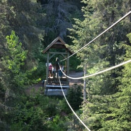

The Winner Creek Trail is a must try if you're in the Anchorage/Girdwood/Homer/Seward area. I actually found out about the trail from Yelp before I left for my Alaska trip and once again, I'm so thankful to Yelp for showing me the way time and time again. Winner Creek Trail is about 40-45 minutes from Anchorage and you get some spectacular views throughout the duration of the drive. Cliffs on your left, ocean on your right. Watch closely for wildlife on both sides! The trial head is a little hard to find as it is behind the ski resort but nonetheless, we found it back in early June. We actually went to hike the trail, realized we had to be at our helicopter/sled dog tour, and actually came back after the fact. The hike is different from others in Alaska in that it is rather brushy and doesn't have too great of views. The treasure of this hike is the hand tram. You can literally take a hand tram over the flowing water to the other side, hike some more, and then take it back. Everything is beautifully maintained and people are super friendly even though the trail was packed and it was quite hot. Definitely a dog friendly trail... We saw a whole bunch of dogs, families, kids, couples, etc. On the particular day and time that we hiked this trail was packed... I wish I knew this ahead of time and scheduled another day to try again or got there earlier. The hand tram was not too enjoyable because of the long lines on either side, forcing us to go too fast to really take it all in. I did, however, enjoy the hike up to the tram and the rushing water we went down to after taking the tram. I was able to take some pretty good pictures. It's awesome that this trail exists and that the hand tram is available for free to those who hike it!


Wow! How had I not found this place until now!? Bring your kids, your dogs, grandma, and buckets! We came here recently and coincidentally the blueberry festival was going on. Who needs the blueberry festival! We were able to pick so many blueberries along the trail and had our own festival. The really great plump blueberries were a bit off the trail. This hike was so worth it. The trail was well maintained and there are lots of great photo ops to include the bridge that runs over the creek, the gorge, hand tram, and overall gorgeous greenery. We accessed the trail from a different point (where road dead ends to the tramway) but you can also access it from across the tramway, ahead on the left. With those yummy blueberries in August be sure to keep an eye out for bears and be safe :-)


Another personal favorite, the Winner Creek Trail is in Girdwood and can be located from two different areas. Off of Crow Creek Road or behind the Alyeska Resort. The trail is especially one of my favorites to take visitors to and is a good trail to access year round. Located in a temperate rain forest, the trail starts at the t-junction behind Alyeska hotel by the tram. The trail meanders through a heavily wooded forest, over boardwalks and gravel fed paths to Winner Creek Gorge and a traversing hand tram. It can be completed as an out and back trail (2.5 miles each way) or you can connect the Crow Creek Road location, though you would have to coordinate transportation back to the trailhead. That option is 5.1 miles beginning to end. It is relatively close to Crow Creek Mine, so an option is to walk to the mine and take the free Glacier Velley Transit bus that runs during the summer. Most people however turn back at the hand trip for a full out and back experience. The trail is full of stunning vistas of the surrounding mountains. In the fall it also offers some excellent berry picking. Even in pouring rain the tree canopy offers enough coverage to where you would not get soaking wet. It is also an excellent trail for snowshoeing in the winter months. The area is notorious black bear and moose habitat and I have run across both while hiking. It seems like every time I come here during the summer months I run across a black bear. It is considered a multiuse trail so people will allow their dogs off leash. Which could present a problem if they are not good with voice command as one time during my hikes another group of hikers had their dog chase after the bear and ended up bringing it back to the group. You will reach a point a few miles into the trail where you come across a second t-junction and a wide planked bridge or the option to continue on a trail to the left. To reach the hand tram, you will need to continue left. If you go across the planked bridge it leads to the Upper Winner Creek train which is more difficult and leads to open tundra, but after crossing many rock and root covered areas. There are times where it is not uncommon for the hand tram to be down. Additionally there is another trail that leads off down to the waters edge right before the hand tram. It is quite picturesque for photos or to even sit on the rock ledge and watch the gushing torrents of water below you. Winner Creek trail offers a little something for everyone.


This 5 mile roundtrip hike from the Alyeska Resort has a truly phenomenal features: lush ferns, well-maintained boardwalks (for the first part of the trail), and a fabulous hand-operated tram that safely whisks you high above a creek. The grade is pretty even for most of the trail and is an out-and-back experience. I was able to hike it in 2 hours with almost no stops. What makes this trail great is that it has water features, mountain views, lush rainforest, berry-picking in the summer and fall, and the tram. Wish I could do this one every week!


I had one day in Anchorage and decided to do this trail and the Flattop trail. Spoiler alert, I didn't finish EITHER which means I'll just have to come back here one day. I came in late May, hiked to the Hand Tram and found out that it was "out of service for the season." MAJOR bummer. There's a path near there that can lead you down to the water, and it's not too difficult - the end requires either a brave jump or an easy scramble down the rocks. From there, I walked along the creek just a bit, but stopped not too far from there and just turned back. Not sure if it's possible to continue hiking without use of the tram. Trail was really flat, easy, serene ... I saw zero hikers, other than some rafters. On my way out, another pair arrived to go rafting. It was a Friday afternoon in May around 5pm and the trail felt very secluded. There's a bathroom at the trailhead and for the most part, helpful signage. Google Maps stopped its directions a little short of the actual trailhead - if you keep going, you'll see a sign post for Winner Creek on the right side of the road, which will lead you to a parking lot with several spaces


Looking for an easy, yet still scenic trail with a little bit of adventure, this one might be the one for you. Winner Creek starts right at Alyeska Resort and leads you all the way to Crow Creek Mine. I would not plan on starting from Crow Creek, not unless you are wanting a parking ticket, or worse, your vehicle towed. Buttttt ... back to the trail. Very minimal elevation changes, which makes it great for the young and even old. Part of the trail is even on bridged through the forest, which makes the trail that much easier. Some of the bridges do go over rivers of rushing water, but note some do not have a railing. Following the crowd of people, you will hit the hand tram which sits a few stories above the gorge. This is where I would highly, highly suggest you bring gloves if you plan on crossing. I can easily see those ropes tearing up your hands by the time you make it across and then back again. If you don't have any, last time I was there, there was a spare set located on each side for users to use. I wouldn't guarantee or count on them being there again, but maybe you'll get lucky. After across, you can hike another mile or so and check out Crow Creek Mine. Without giving too much away for another review, Crow Creek Mine offers an interactive mining museum with a bunch of little historic buildings with old mining antiques scattered around the grounds. Roam the roads, pan for some gold or take a guided tour of their land. Either way makes for a unique Alaskan experience between the trail and the mines.


This was a fabulous and beautiful and fun hike. It's a 3+ mile trail that goes from the Alyeska Resort to the Crow Creek Mine. It's windy, up and down, and very pretty. It's not exactly an easy, breezy hike, but it's by no means difficult either. It's a fairly well-maintained, nice trail. Walking through the forest is just beautiful, plus all the creeks and waterfalls and bridges and... It's awesome. There's even a hand tram! Totally fun. Definitely a bit of a work out. But note that is it note a loop. You've got to come back along the trail or some other way once you reach the end.


4 years ago
Winner, winner, chicken dinner! One of my favorite "easy hikes." The city of Girdwood is enchanting. I'm in my very own version of Beauty and the Beast whenever I'm adventuring in the area. I was grateful to have been able to experience this trail in its entirety, prior to an accidental death, and the ultimate closing of the hand tram. You can start this hike at the Alyeska Hotel (more popular) or at Crow Creek Mine (less popular). From Crow Creek Mine to the gorge it's about 1 mile. With the hand tram closed, theres no safe way to cross the gorge. From the Alyeska Hotel to the gorge, it's about 2 miles. I'd recommend starting from the hotel for a longer hike. That side also has many natural staircases, unique bridges/water sights, basically, the best photo opps. When in season, this trail offers lots of berry, mushroom, and other foraging opportunities. Highly recommend. read more


I've now down this hike twice and it's one of my favorites. Located at the base of Alyeska Resort, it's probably about 6 miles round trip before you arrive at a stunning waterfall. It's literally worth the hike. A combination of dirt and gravel I would consider it to be a medium skill trail, but beginners should have no problem. I can't speak for the hand tram portion. Unfortunately that was closed, I believe due to an accident involving a hiker. You should have no problem finding parking at the resort. Bear spray recommended, as always. If you need to grab a snack before or after, there's a Kaladi Brothers café inside the resort. read more

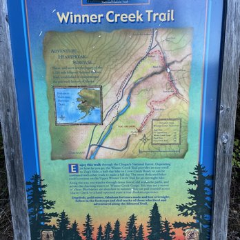
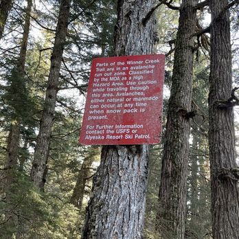
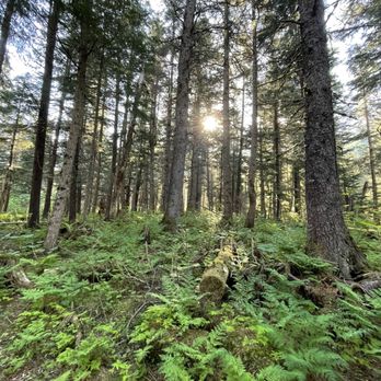


1. BEAUTIFUL trail! My favorite in Alaska 2. 5 miles total to the tram and back 3. Tram is probably inop. Someone nearly got killed on it during summer 2019 4. Beautiful bridge with a big waterfall 2 miles in 5. Bring bear spray 6. Easy trail, perfect for beginners or those not in shape 7. Lots of moss and rainforest-type scenery read more

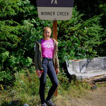


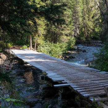

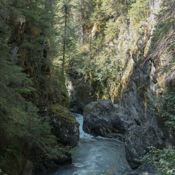

Did I seriously not write a review for this awesome little trail! I guess I was so busy hiking this summer that I didn't make time to Yelp. Hear me, oh non-Alaskans, oh hear me. If you are an inexperienced hiker and you only have to time to hike one trail while you're in the Anchorage area, THIS IS THE TRAIL YOU WANT TO HIKE. Even if you aren't terribly fit, start at the trailhead on Crow Creek Road. Hike one mile to the hand tram and the gorge and back. For mere 2 mile hike you will have a unique experience, get a some amazing photos and you'll want to kiss me. The hand tram is SO cool. The gorge and waterfall are stunning. It looks like something out of Fern Gully or Hawaii. If you go off the trail and walk under the handtram and follow the curvature of the river for about 500 feet you will get a unique view of the falls that a lot of people miss. You can also take a longer hike that's about 8 miles (I think) that will take you to the Aleyeska Resort. Catch it at the right time of year and you can pick blueberries too. If you want to berry pick, remember the blueberries aren't really on the Crow Creek side, they're mostly from the gorge to Aleyska. I really, really recommend this trail. Can you take a hint! Don't miss it!!! Directions: To get to the trail, take Seward Highway to Aleyska Highway. Then you can bear left at Crow Creek Road and drive about 3-4 miles and the trailhead will be on your right. Or you can take Seward Highway to Aleyska Highway, drive through Girdwood (you won't get lost, don't worry) and follow the signs for the Aleyska Resort. The Winner Creek Trailhead starts by the hotel and is clearly marked. Going from this direction, it's a much longer hike to get to the gorge and the falls. read more

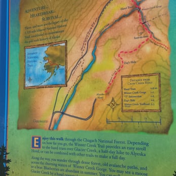


Per recommendation from my fellow Yelpers, we embarked on this one adventure. And you could tell it's a popular trail since there were so many people there. The parking lot where the trail begins were full of tourists. We had to park over at the next trail head (Nordic ski Loop) The scenery was beautiful. It's different from other trails that we partook lately. A few minutes into the hike, we were transformed into a world of tall trees, berries shrubs, and mossy ground. My favorite part has got to be the bridge by the waterfall. There's a little path next to the bridge that gave you an amazing view of the rushing water. It's so relaxing The hand-tram was supposed to be the main attraction for this trail. However, it was my least favorite part. While the view from above was amazing and trilling, to me, the handtram reviews the true nature of some human beings. While there were several people who were willing to jump in and help to pull the tram, there were far more of those who just stood there and expected other to do the work for them. At least that was how it was when we were crossing. It's saddening. It angered me to see strong capable guys just stood there and watched a girl pulling the rope by herself. And just because you're a girl, that didn't give you the excuse to just step back and let another person (guy or girl) did all the work. We should all pitch in and share the work to the best of our abilities. read more

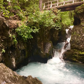


"The Flattop of Girdwood"? This trail is 3 miles *round-trip* (read: short!) on extremely well-maintained trial with very little gain. If you're visiting Alaska it's probably a must. It's different from most trails in the Anchorage metro in that it goes through rainforest rather than tundra. This means that there are no "views", to speak of. Just dense, bright green foliage, and rushing waters. It's extremely similar to your average trail in the Portland metro (Columbia River Gorge) and many in Western Washington (Olympic Peninsula). However, the terrain is quite unique for this part of Alaska (South Central), it's more like a slice of Southeast Alaska, 45 minutes from Anchorage. No boat or plane required. Let's just call out the pink elephant in the room: the hand tram. That is the reason most people do this trail, and it is quite unique. I've never seen one on any trail in the Pacific NW, and I've been on hundreds of hikes in that area. When I did this trail there were TONS of people bottlenecked at the hand tram. At least a dozen. Everyone was pitching in on the pushing and pulling. The tram was going back and forth VERY quickly. Personally, I'd rather go when no one else is there and I can take my time going across, taking in the sites, snapping photos, etc. Being that I moved here from the PacNW, I actually enjoyed the views of the little gorge better. I used to be jaded about narrow canyons of crystalline-blue water (seriously, I have a tough life, right?), but since moving to Alaska, you just don't see a feature like this as much. I scrambled down from the bridge and took photos of the area for at least 30 minutes. I think it is the real highlight of this hike. The end of the trail is a bit awkward and uneventful. I'd highly recommend doing a couple things to avoid the crowds: -go on a weekday in the summer: The days are long. The trail is short. You can do it. I know you can. -go in the winter: trail is fabulously well-graded and at a low elevation with little gain. It should be easy to do with snow on it. The green-on-white contrast might even make it more beautiful. If you're afraid of your tootsie's getting cold: welcome to Alaska, time to get new boots. I highly recommend eating at Jack Sprat before/after your hike: http://www.yelp.com/biz/jack-sprat-girdwood *edit*: I'm now seeing information that it might be longer than this, YMMV, do your research! read more


The Winner Creek Trail is a must try if you're in the Anchorage/Girdwood/Homer/Seward area. I actually found out about the trail from Yelp before I left for my Alaska trip and once again, I'm so thankful to Yelp for showing me the way time and time again. Winner Creek Trail is about 40-45 minutes from Anchorage and you get some spectacular views throughout the duration of the drive. Cliffs on your left, ocean on your right. Watch closely for wildlife on both sides! The trial head is a little hard to find as it is behind the ski resort but nonetheless, we found it back in early June. We actually went to hike the trail, realized we had to be at our helicopter/sled dog tour, and actually came back after the fact. The hike is different from others in Alaska in that it is rather brushy and doesn't have too great of views. The treasure of this hike is the hand tram. You can literally take a hand tram over the flowing water to the other side, hike some more, and then take it back. Everything is beautifully maintained and people are super friendly even though the trail was packed and it was quite hot. Definitely a dog friendly trail... We saw a whole bunch of dogs, families, kids, couples, etc. On the particular day and time that we hiked this trail was packed... I wish I knew this ahead of time and scheduled another day to try again or got there earlier. The hand tram was not too enjoyable because of the long lines on either side, forcing us to go too fast to really take it all in. I did, however, enjoy the hike up to the tram and the rushing water we went down to after taking the tram. I was able to take some pretty good pictures. It's awesome that this trail exists and that the hand tram is available for free to those who hike it! read more
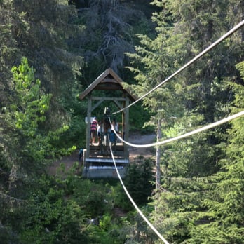


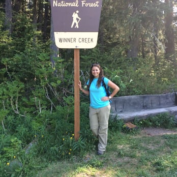


Wow! How had I not found this place until now!? Bring your kids, your dogs, grandma, and buckets! We came here recently and coincidentally the blueberry festival was going on. Who needs the blueberry festival! We were able to pick so many blueberries along the trail and had our own festival. The really great plump blueberries were a bit off the trail. This hike was so worth it. The trail was well maintained and there are lots of great photo ops to include the bridge that runs over the creek, the gorge, hand tram, and overall gorgeous greenery. We accessed the trail from a different point (where road dead ends to the tramway) but you can also access it from across the tramway, ahead on the left. With those yummy blueberries in August be sure to keep an eye out for bears and be safe :-) read more


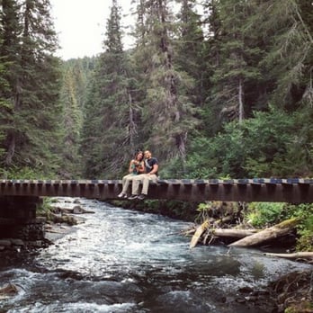

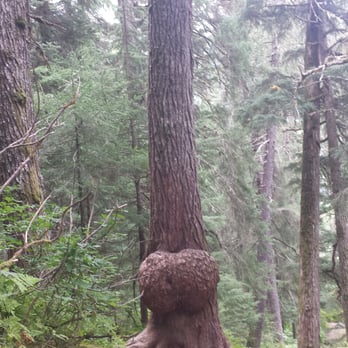


Another personal favorite, the Winner Creek Trail is in Girdwood and can be located from two different areas. Off of Crow Creek Road or behind the Alyeska Resort. The trail is especially one of my favorites to take visitors to and is a good trail to access year round. Located in a temperate rain forest, the trail starts at the t-junction behind Alyeska hotel by the tram. The trail meanders through a heavily wooded forest, over boardwalks and gravel fed paths to Winner Creek Gorge and a traversing hand tram. It can be completed as an out and back trail (2.5 miles each way) or you can connect the Crow Creek Road location, though you would have to coordinate transportation back to the trailhead. That option is 5.1 miles beginning to end. It is relatively close to Crow Creek Mine, so an option is to walk to the mine and take the free Glacier Velley Transit bus that runs during the summer. Most people however turn back at the hand trip for a full out and back experience. The trail is full of stunning vistas of the surrounding mountains. In the fall it also offers some excellent berry picking. Even in pouring rain the tree canopy offers enough coverage to where you would not get soaking wet. It is also an excellent trail for snowshoeing in the winter months. The area is notorious black bear and moose habitat and I have run across both while hiking. It seems like every time I come here during the summer months I run across a black bear. It is considered a multiuse trail so people will allow their dogs off leash. Which could present a problem if they are not good with voice command as one time during my hikes another group of hikers had their dog chase after the bear and ended up bringing it back to the group. You will reach a point a few miles into the trail where you come across a second t-junction and a wide planked bridge or the option to continue on a trail to the left. To reach the hand tram, you will need to continue left. If you go across the planked bridge it leads to the Upper Winner Creek train which is more difficult and leads to open tundra, but after crossing many rock and root covered areas. There are times where it is not uncommon for the hand tram to be down. Additionally there is another trail that leads off down to the waters edge right before the hand tram. It is quite picturesque for photos or to even sit on the rock ledge and watch the gushing torrents of water below you. Winner Creek trail offers a little something for everyone. read more


8 years ago

This 5 mile roundtrip hike from the Alyeska Resort has a truly phenomenal features: lush ferns, well-maintained boardwalks (for the first part of the trail), and a fabulous hand-operated tram that safely whisks you high above a creek. The grade is pretty even for most of the trail and is an out-and-back experience. I was able to hike it in 2 hours with almost no stops. What makes this trail great is that it has water features, mountain views, lush rainforest, berry-picking in the summer and fall, and the tram. Wish I could do this one every week! read more


12 years ago

9 years ago
I had one day in Anchorage and decided to do this trail and the Flattop trail. Spoiler alert, I didn't finish EITHER which means I'll just have to come back here one day. I came in late May, hiked to the Hand Tram and found out that it was "out of service for the season." MAJOR bummer. There's a path near there that can lead you down to the water, and it's not too difficult - the end requires either a brave jump or an easy scramble down the rocks. From there, I walked along the creek just a bit, but stopped not too far from there and just turned back. Not sure if it's possible to continue hiking without use of the tram. Trail was really flat, easy, serene ... I saw zero hikers, other than some rafters. On my way out, another pair arrived to go rafting. It was a Friday afternoon in May around 5pm and the trail felt very secluded. There's a bathroom at the trailhead and for the most part, helpful signage. Google Maps stopped its directions a little short of the actual trailhead - if you keep going, you'll see a sign post for Winner Creek on the right side of the road, which will lead you to a parking lot with several spaces read more


11 years ago
Looking for an easy, yet still scenic trail with a little bit of adventure, this one might be the one for you. Winner Creek starts right at Alyeska Resort and leads you all the way to Crow Creek Mine. I would not plan on starting from Crow Creek, not unless you are wanting a parking ticket, or worse, your vehicle towed. Buttttt ... back to the trail. Very minimal elevation changes, which makes it great for the young and even old. Part of the trail is even on bridged through the forest, which makes the trail that much easier. Some of the bridges do go over rivers of rushing water, but note some do not have a railing. Following the crowd of people, you will hit the hand tram which sits a few stories above the gorge. This is where I would highly, highly suggest you bring gloves if you plan on crossing. I can easily see those ropes tearing up your hands by the time you make it across and then back again. If you don't have any, last time I was there, there was a spare set located on each side for users to use. I wouldn't guarantee or count on them being there again, but maybe you'll get lucky. After across, you can hike another mile or so and check out Crow Creek Mine. Without giving too much away for another review, Crow Creek Mine offers an interactive mining museum with a bunch of little historic buildings with old mining antiques scattered around the grounds. Roam the roads, pan for some gold or take a guided tour of their land. Either way makes for a unique Alaskan experience between the trail and the mines. read more


12 years ago
This was a fabulous and beautiful and fun hike. It's a 3+ mile trail that goes from the Alyeska Resort to the Crow Creek Mine. It's windy, up and down, and very pretty. It's not exactly an easy, breezy hike, but it's by no means difficult either. It's a fairly well-maintained, nice trail. Walking through the forest is just beautiful, plus all the creeks and waterfalls and bridges and... It's awesome. There's even a hand tram! Totally fun. Definitely a bit of a work out. But note that is it note a loop. You've got to come back along the trail or some other way once you reach the end. read more



7 years ago


13 years ago

10 years ago
I'm a beginner at hiking. Not the most fit but when an adventure is at hand I'm usually up for it! I came here on my girls trip yesterday. For me it was a good challenge. I saw people hiking with kids as young as 3 and 4 on foot and probably as old at 60's-70's. We hiked to the hand tram and came back. We saw a nice gorge while out as well! I didn't do the hand tram because I'm not a fan of heights. read more


10 years ago
There are the Upper and Lower trails. We went on the Lower and it was a great hike--not too steep but there were ups and downs. Beautiful! You'll be surrounded by nature. A must for visitors and especially locals! Make sure to try the Hand Tram! read more


12 years ago




10 years ago

9 years ago
This was one of my favorite trails that I did in Alaska. If you're looking for a relatively flat trail that is decently long and has great views of a creek, then this is the trail for you! It is very well shaded so it makes for a really cool (i.e., temperature) hike. Some special features of this trail is that it passes by two incredible bridges (one more precarious than the other), as well as a hand tram. Be prepared that if you do the upper and lower trails, they don't meet up and you have to cut back through town to go back to the ski resort. The trail itself is very well-groomed near the resort. The second half of the trail (if you're starting near the ski resort) is not as well-groomed and not as well-traveled (which has its pluses and minuses). The only other downside is I'm not sure the markers are accurate, but I'd take my opinion with a grain of salt. In sum, definitely a trail you should check out! read more


10 years ago
The trail is well groomed and very wide. The hand tram is cool when you get to the middle however it is a tough job pulling the cart across so be ready to use some arm strength. read more


11 years ago
Very pretty! Fun for all ages! People visiting from the hotel to meander and also locals coming for a day visit! People strolling and also people running the trail. Easy hike. Glad to have visited! read more




14 years ago

11 years ago

12 years ago
8 years ago
11 years ago


11 years ago
Winner Creek Trail seemed to be closed during the winter season but we still hiked it. I loved the greenery and there were many helpful signs that guide you to the mine trail, creek trail and even to the hand tram. There were about 5 parking spaces along with a bathroom. We wanted to try the hand tram but the way to get there was blocked with thick ice and all. Plus the tram was closed until it's spring (which is open now) Even though we didn't get to experience it, we hiked for a good few miles. Something different from Californian hikes. Plus, the mountain view was amazing!! If you're staying in Anchorage/Girdwood for only few days, I would suggest checking our this trail! It's forestry and so lush. There's also a lake and wooden path, but sadly it was frozen when we went. It was still beautiful though and we ended up walking though the frozen lake :D So much fun! This trail is very family and kid-friendly. read more


13 years ago
10 years ago
13 years ago
10 years ago
More info about Winner Creek Trail
Ask the Community - Winner Creek Trail
Review Highlights - Winner Creek Trail



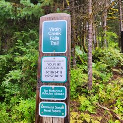




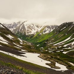
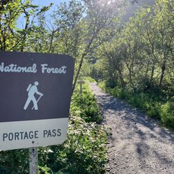










Why does Yelp recommend reviews?
1 review that is not currently recommended
The reviews below are not factored into the business's overall star rating.

11 years ago
Winner Creek Trail - hiking - Updated May 2026
Best of Girdwood
People found Winner Creek Trail by searching for…
Things to Do in Girdwood, Alaska
Things to Do on a Rainy Day in Girdwood, Alaska
Places to Take Pictures in Girdwood, Alaska
Waterfall Hike in Girdwood, Alaska
Photo Spots in Girdwood, Alaska
Picnic Areas in Girdwood, Alaska
Secret Spots in Girdwood, Alaska
Beautiful Views in Girdwood, Alaska
Scenic Overlook in Girdwood, Alaska
Walking Trails in Girdwood, Alaska
Gold Panning in Girdwood, Alaska
Scenic Drive in Girdwood, Alaska
Hiking Trails in Girdwood, Alaska
Parks for Picnics in Girdwood, Alaska
Natural Hot Springs in Girdwood, Alaska
Hiking With Kids in Girdwood, Alaska
Browse Nearby
BEST of Girdwood, Alaska Restaurants near Winner Creek Trail
BEST of Girdwood, Alaska Coffee near Winner Creek Trail
BEST of Girdwood, Alaska Things to Do near Winner Creek Trail
BEST of Girdwood, Alaska Shopping near Winner Creek Trail
BEST of Girdwood, Alaska Bike Rentals near Winner Creek Trail
Browse Brands
Browse Articles
People who viewed Winner Creek Trail also viewed

Rabbit Lake Trail
5 reviews

Flattop Mountain Trail
64 reviews

South Fork Eagle River Trail
6 reviews

Campbell Creek Trail
8 reviews

South Fork Falls
14 reviews

Turnagain Arm Trail
5 reviews

Byron Glacier Trailhead
18 reviews

McHugh Creek - Chugach State Park
11 reviews

Chugach State Park Bird Point Trailhead
5 reviews

Virgin Creek Falls
16 reviews