Chugach State Park Bird Point Trailhead Photos


You might also consider
More like Chugach State Park Bird Point Trailhead
Recommended Reviews - Chugach State Park Bird Point Trailhead
Start your review...

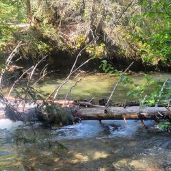
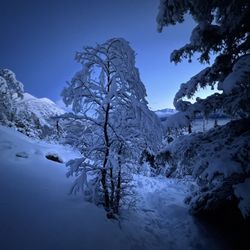
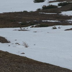
There are many different sections to Chugach State Park, like.... - Potter Creek - McHugh Creek - Beluga Point - Falls Creek - Indian Creek - Bird Creek You can spend a lot of time discovering all these incredibly vast areas of the park. What really stood out for me was making a brief stop here at milepost 96.5 along Seward Highway (35 miles south of Anchorage) for BIRD POINT TRAIL. I believe coming to Bird Point will help provide a glimpse into the magical setting of the Turnagain Arm waterway within the Cook Inlet part of the Gulf of Alaska. According to the entrance sign near the trailhead, Bird Point is... "A place to reflect and enjoy." "See wildlife foraging in scenic surroundings." " Smell the richness of earth and see." "Hear the whoosh of a beluga's breathing or the rush of a 6-foot bore." "Touch land that was once tropical ocean bottom." Welp, I don't know about all that wildlife because I didn't see anything during my visit...but definitely walking the easy 1.9-mile trail will allow for plenty of opportunities to appreciate nature and the great outdoors. It's a $5 fee for parking. Then, there'll be plenty of viewpoints on the paved connector pathway for picture moments of the Kenai and Chugach Mountain Ranges. When I was here towards the end of June, there was still some snow covering the mountain peaks which added to the beautiful backdrop and that was even, still, on an overcast day. I didn't hike the full length of the trail, maybe I used 30 minutes in total, but it was enough to get a feel for how special this part of Southcentral Alaska is. And just past here at Bird Point are still more exciting roadside pullovers along the Seward Highway journey to appreciate the sights before arriving in the town of Girdwood, where I highly suggest riding the Alyeska Resort Tram. Overall, Bird Point is a scenic stretch of Chugach State Park that's not difficult for exiting your car and taking time to walk around and explore. read more


2 years ago
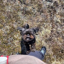
If you're like me, you want a hike that doesn't make you climb 1000 feet in 5 minutes. I prefer a gentle slope and that's what you will find in Chugach State Park. It is a nice rolling trail with footbridges to avoid rough ground and crossing streams. I'm no expert on mushrooms, but there were a lot of them. Not sure that you were allowed to pick them, but some mushroom foragers were doing so. I've included some pictures for you mycologists. The trail had a nice spruce like smell that was pleasant. And we saw plenty of dogs at walking their owners. There were also benches along the trail in case you wanted to take a break. We saw wild berries and other native plants. It took use about 90 minutes to walk about 3 miles. read more


In celebration of Earth Day 2022, I wanted to share how fun and picture-perfect Bird Point is for those traveling south of Anchorage. Thanks Andrew for the great idea! Be sure to go when the wildflowers and fireweed are blooming, it's the Alaska equivalent of Texas' pictures in the bluebonnets every spring. The flowers are perfect for a roadside photo shoot, and if you hit the tides right you can see the bore tide come in like a wall of water. I also truly appreciate how accessible the different areas of the park are to those with limited mobility. read more

16 years ago
I think this is the best place to stop in-between anchorage and girdwood. Public restrooms available. Great handicap access. Free telescopes!! Great view. There is also RV parking for those on an adventure.. read more


More info about Chugach State Park Bird Point Trailhead
973 Seward Hwy
Indian, AK 99540
Directions
Hours
Outdoor Amenities


Chugach State Park Bird Point Trailhead - parks - Updated May 2026
Best of Indian
People found Chugach State Park Bird Point Trailhead by searching for…
Hiking Trails in Indian, Alaska
Picnic Areas in Indian, Alaska
Parks for Picnics in Indian, Alaska
Scenic Overlook in Indian, Alaska
Walking Trails in Indian, Alaska
Things to Do in Indian, Alaska
Natural Hot Springs in Indian, Alaska
Beautiful Views in Indian, Alaska
Places to Take Pictures in Indian, Alaska
Hiking With Kids in Indian, Alaska
Waterfall Hike in Indian, Alaska
Playgrounds for Kids in Indian, Alaska
Free Parking in Indian, Alaska
Parks for Kids in Indian, Alaska
Lookout Points in Indian, Alaska