Cancel

Open app

Search

Wild Hudson Valley

5.0 (4 reviews)
Closed • Closed

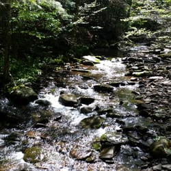
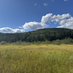
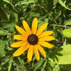
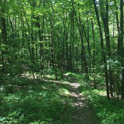
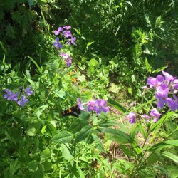
Wild Hudson Valley Photos

You might also consider

Recommended Reviews - Wild Hudson Valley

Your trust is our priority, so businesses can't pay to alter or remove their reviews. Learn more about reviews.
Yelp app icon
Browse more easily on the app
Review Feed Illustration

4 years ago

Helpful 0
Thanks 0
Love this 0
Oh no 0

4 years ago

Business owner information

Photo of Justin W.

Justin W.

Helpful 0
Thanks 0
Love this 0
Oh no 0

12 years ago

Helpful 0
Thanks 0
Love this 0
Oh no 0

12 years ago

Helpful 1
Thanks 0
Love this 0
Oh no 0

Ask the Community - Wild Hudson Valley

Verify this business for free

People searched for Hiking 440 times last month within 15 miles of this business.

Verify this business

Kaaterskill Falls - March 2026

Kaaterskill Falls

(165 reviews)

One of the tallest waterfall in NY, similar height to Taughannock Falls. Physical requirement is…read moredifferent tho, Kaaterskill Falls has about 500foot of elevation change and a lot of slippery stone steps at the end, if you come here when the weather is still cold. Parking: most people park at the Laurel-House Road parking area, because it is the closest. Or you can park at Mountain Top Historical Society, the old train station, which an extra mile. Starting from the old railroad station is nice, you can still see some old tracks on the ground. Walk to the overlook is fairly easy, once you get to the start point of Lower falls junction, it is where you need to be prepared. I recommend hiking shoe, especially in colder months where the ground is wet and iced. When you reach to the stone steps, they can get slippery. I am surprised no one fell in late March. Half of the steps were cover in ice and people were wearing regular sneakers. Once you reach the base of the two tier falls, the view is tremendous. If water levels are high, you can feel the energy of the water. There is a lot of spray from the falls when you get close. There is short trail to the middle tier pool. It was iced up during winter, spikes will definitely be useful. The end was amazing too. So close to the lead of the waterfall. You can keep going and follow Escarpment trail and follow the edge of the valley. There is monument for fireman Frank Layman who died during firefighting in 1900, at his monument, you can see route 23A bend around mountain. And if you keep going, there are a couple viewpoint to overlook the valley. Nice break points to enjoy the view and rest your legs.

We did the ~1 mile hike to the upper falls from the Scutt Road parking lot. The hike is fairly…read moreeasy, though sections of the trail have a lot of rocks and roots. A few small hills, but not much elevation change. The viewing point gets quite crowded, so it's probably best to go during off peak times. We started out at 5:45pm and there were still lots of people there. Because it's been quite dry, the falls were not gushing, but still offered a satisfying steady stream. From the upper viewing point, you can see the hikers on the lower levels below. The lower hike winds around to the bottom pool of the falls, so it's kind of cool to see from above, almost like a mini Grand Canyon. It's worth the journey and the lower falls hike is probably quite nice too, but we didn't have time for it on this trip.

Windham High Peak - Burnt Knob Loop

Windham High Peak - Burnt Knob Loop

(2 reviews)

Excellent place to hike…read more 1) We did a two car -- end to end hike. 2) We did the Windham High Peak, then went to the Burnt Knob and Acra Point. 3) The views were unbelievable.

The Burnt Knob Loop leads to the summit of Windham High Peak with a gorgeous view, roughly ~7 miles…read moreof hike with beautiful scenery all around. The loop is a bit of a misnomer since the hiking trail itself connects two separate trail heads via two parking lots. One side of the trail shares a parking lot with the trail to Blackhead mountain summit and the two trails goes in separate directions at about 1 mile into the hike. The connection between the two hikes allows one to extend either trail further. We didn't go to the blackhead trail, since it was marked to be difficult to very difficult. The burnt knob loop was a moderate hike, we parked our car at the parking lot shared with blackhead trail and the roundtrip to and from the summit (~3.5 mile) took about 4.5 hours with breaks for lunch on top of the Peak. The trail itself was well designed and very enjoyable, offering numerous view points with spectacular views of mountains and the grassland below. The trail markers are very clearly defined from one to the other, and instead of having continuous steep elevation, it interchanges between longer periods of flat trails and short intervals of arduous elevated trails. It was almost like interval training! This really modulates the pace of the hike, after heart pounding climbs, there are enough time to recover with a period of easy going trails. There are many view points along this trail leading up to the summit, which offers very different and beautiful views. At the summit, the shadows of the clouds on the fields and the beautiful flat grasslands with side views of mountains are absolutely stunning, we spent a lot time lazying around here before heading back down. Highly recommended to all nature lovers looking for some great hike with beautiful views!

Overlook Mountain - Cooking lunch in the Overlook Mountain back country, at my off-trail camping site.

Overlook Mountain

(86 reviews)

Love hiking here! If…read moreyou're in this part of the Catskills, I highly recommend this trail. It's easily accessible and an easier hike to do. The trail is well-groomed and very walkable. There aren't any scrambles or large boulders, which is good.. The view from the top is pretty epic, and the fire tower which has been closed every time I've hiked the mountain has great views too. I would highly recommend this hike.

This place is absolutely amazing! I've hiked all the Catskills mountains three times over through…read morethe years and I had never been to overlook because there was no reason to but I had heard so much about this location I just had to visit and satisfy my curiosity on why this place is so popular. First off the parking lot is medium sized and parking on the road (even off the road) is risky because certain spots you are not allowed to park so arrive early, get a legit parking spot and save yourself the wasted trip or the hassle of returning to your vehicle to a ticket or it completely gone (towed). The hike up and back for Overlook is approximately 5 miles so everyone is spot on mentioning the distance. It's fairly steep all the way up and while you don't have any views on the way up, you do encounter some old ruins which is a neat break along the way. Once you do make it to the top you are met with a small shed that has some very minor historical information inside and on peak weekends you'll find stewards that can assist with information about the area and hiking tips. The fire tower can't be missed to the left after the small shed and the view is to the right of the shed. I have to say, I've been atop many mountains and it's been a long while since I've had my breath taken away but when I saw the view at Overlook it was breath taking. What made the view so beautiful and different than other mountains I've hiked is that the view is expansive with no mountains obstructing so you can see as far as the eyes can see. It's truly a remarkable view being so high up and seeing so far out. This mountain is known for its rattlesnake population. Sadly I never got to see one because I always hike in the early morning hours and they normally come out at around high noon when the sun is the hottest.

Mountain Top Arboretum

Mountain Top Arboretum

(8 reviews)

This arboretum is free to enter. It has several walking trails with distinct trees in each section…read more The East Meadow takes you through pine alley and was sunny and grassy. The Hemlock Trail was dense with trees and most of the trail was covered in roots. It led to the Hidden Marsh, which had a nice little boardwalk to walk out into the bright, vast marsh. We also checked out Woodlands Walk, which was a short set of loops, with fun little signs that told a cute children's story along the way. There were a few signs on the trails, but there wasn't quite as much information about the trees and plants as I would have expected. Still, it was great for a stroll and some sections felt like easy hiking, so it's a very pleasant place to wander for a few hours.

Mhew! This place is ok if you want to kill time and take a stroll in the woods. While I do…read moreunderstand the term "arboretum" means various trees and plants, I hoped to see some flowers in the mix. I've been to other arboretums in NYS and they have flowers that add to the appeal of visiting these places. I stopped in to kill time since I was early for checking into my camp site nearby. This arboretum had a few miles of trails with various facts about the trees and plants they care for. If you visit be sure to donate to help the staff maintain the property. While it didn't blow me away I do understand and appreciate the hard work that goes into maintaining places like this.

Kaaterskill Clove

Kaaterskill Clove

(2 reviews)

This was my first hike in NY State. The day was perfect. It was mostly flat with a bit of steep…read moreareas. We stopped to see the falls but there want much "falls". We got to an area that has the natural pool, but the water was freezing. There were loads of families, enjoying their food and of course quality time. I'd definitely do this hike again.

I generally don't find myself deep into the Catskills, until yesterday, but boy was I psyched when…read moreI stopped in for a moment to take a picture or two. Going in, all I could think about was the Catskill Mountains seen in the background and just how high I was. Sitting on top of that mountain (inside my car, that is; I wouldn't be dumb enough to do it any other way), is this mountain range with State land and great photo-op spot. When I saw the deep gorge followed by huge mountain in back of that, all my mind could think about (and I don't advise anyone trying this) is "has anyone ever thrown something intentionally off the ledge into the gorge, just to see how deep it is?" I had noticed a few pieces leading up to the placard explaining the park, but otherwise, no problems exist. Although I never really had a problem with parking, it's only a small park and ride spot over on the side of the road. However, when I got there, I got the best view in the house; I had a nice clear view of the Catskills in front of me, though trying to take a pic, I had to exit my car (due to the nature of my type of picture being iPhone-Panoramic. It's still a great view. I just wouldn't have the guts to head to the placue except for on my iPhone's camera and can read about it online instead. Thanks.

Devils Path

Devils Path

(5 reviews)

Wow, talk about a beautiful drive to get here! Completely isolated with the surrounding town…read morebringing you to the past. The narrow zig-zag roads getting here from the east are a blast to drive on. Taking the devil's path is no joke if you're doing the whole trail. Highly suggest packing light for the hike. Totally regretted my 35lb backpack setup. The elevation spikes and drops will put your knees and ankles to the test. The look out points are gorgeous. Each one deserves to be taken in during a break. The biodiversity is incredible here. You'll notice the nature changes at different points of the hike. Including the areas casted in darkness from the dense trees. The next drinkable source of water from the beginning is a far distance so make sure you pack accordingly. The devils tombstone is the halfway point which is where most people set up camp. Cant harp enough... snacks, snacks, snacks. Stay safe if you choose to part take on this hike! One of the best hikes I've been on.

The infamous Devils Path! This trail is infamous for being extremely difficult. Is Devils Path…read moredifficult? No and yes! For any experienced hiker doing any of the shorter trails it is fairly straight forward and I'd say fairly easy (for an experienced hiker). What makes DP extremely hard or difficult is when you attempt the entire length in one day. You go up and down five mountains throughout the trip and while any experienced hiker will say going down the mountains can be worst than going up, after you are on your way up the 5th mountain doing DP you will welcome downhill really fast. LOL! I hiked Devils Path with a group of 4 strong experienced hikers for a day trip. We started at Prediger Road, left a car in the middle of our planned route at Stony Clove Notch and finally we left car at our end target Spruceton parking lot. We had lunch at Stony Clove where we refilled our water supplies with the water spout we found there. We assessed our personal abilities and decided we were all in excellent shape and able to keep pressing forward to complete our goal to finish DP in one day. Best advice I can give anyone that is daring to attempt this in a single day is (1) be experience with the distance having done at least 15 miles minimum in the past and (2) bring FOOD, lots of food (leave the diet at home). Also, plan a bail out point in case you realize the distance is too great for you. Devils Path to me isn't so much a hard trail to do but it most certainly is a trail that will test your endurance to the max! My group did car spotting at 4:30am, started our journey about 6:30am and completed the full trail about 6:45pm just before sunset. Would I do this again? Probably not but I am proud to be in the small percentage of people to have completed this in a single day. The sense of accomplishment is resounding. I COMPLETED DEVILS PATH IN ONE DAY!! Woohoo!! :o)

Wild Hudson Valley - hiking - Updated May 2026

Loading...
Loading...
Loading...