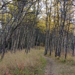
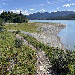
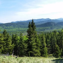
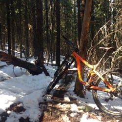
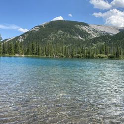
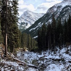
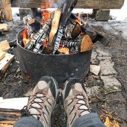
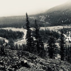
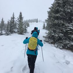
Cancel

    Open app

    Search

    Wedge Pond

    5.0 (1 review)

    Wedge Pond Photos

    Recommended Reviews - Wedge Pond

    Your trust is our priority, so businesses can't pay to alter or remove their reviews. Learn more about reviews.
    Yelp app icon
    Browse more easily on the app
    Review Feed Illustration
    Photo of Nina S.
    572
    556
    1868

    7 years ago

    Helpful 0
    Thanks 0
    Love this 0
    Oh no 0

    Verify this business for free

    Get access to customer & competitor insights.

    Verify this business

    Troll Falls

    Troll Falls

    4.7(3 reviews)
    8.4 km

    A lovely, easy hike with a HUGE beautiful pay off at the end! It's a family friendly stroll with…read moreplenty of parking at the trailhead and it's easy to do in a couple of hours at most. The elevation is easy, and the stroll through the forest is leisurely and beautiful. In the winter you may want cramp ons or hiking poles since the packed down snow can get slick, but they're not necessary. At the end you'll find the beautiful Troll Falls. In the winter they're frozen the most miraculous bright blue and ice climbers have a great time climbing it's relatively easy verticals. Unlike the Johnston Canyon hike in Banff National Park, the Troll Falls hike allows you to get right up to the water falls, which makes for a truly special experience. Check my photos for proof!

    In the mountains and wanna go hiking, but need a spot that's not too difficult and also…read moreentertaining for wee kids? This is it. We were looking at different trail maps and unsure where to take our two year old for a hike that would grasp her attention span and also would be able to drag her along in a sled if she gets tired from all the walking. When Troll Falls popped out and had everything e were looking for. It's right at the bottom of the ski slope so if you find yourself driving up the mountain, you've gone too far. There is a decent sized parking lot by the entrance to the trail. The secret weapon for kids entertainment (aside from nature chats) are the hidden Troll Dolls around. Fun for everyone to try to be the first to spot them along the way! Even in December this was a fantastic crisp walk to do and at the end you come to a frozen waterfall. It was the most amazing thing to see, and to be able to walk on the frozen river. Just breathtaking! My husband is a geologist so he gives me all the geology chat along the way too. Really fantastic walk, I can't wait to do it again in summer and have a totally different experience. We seen a wolf run across the main road as we drove down to the trail so remember to stay safe when you are out there!

    Photos
    Troll Falls - Spot the troll dolls

    Spot the troll dolls

    Troll Falls
    Troll Falls

    See all

    Moose Mountain

    Moose Mountain

    4.3(3 reviews)
    23.1 km

    Fabulous hiking trail, provides great views at the top although you can't go all the way to the top…read morebecause there is a ranger station up there...... Our mutual friend J uses it for training because the driveway to go up to the parking lot is maintained in the winter so it's good for burning lotta calories and running straight uphill while training in cleats if that's your kind of thing....... I should mention that only go this route if your car is in good shape or you have a 4 x 4 because the dirt road is pretty rough on the way up and on the way down. We broker serpentine belt for the second time in a year !

    Moose Mountain is fat tire mountain bike freedom. The mountain is host to to countless miles of…read morecommunity maintained gorgeous mountain bike single track. There's a big difference between riding your mountain bike on trails, and riding on trails that were creatively crafted for the sole purpose of mountain biking. These trails have been crafted corner by corner from the dirt up for the very best mountain bike experience. The result is a breathtaking combination of smiles, thrills, and high fives. Respect these trails! If you pack it in, pack it out. If you break it, fix it. If you can't jump it - don't. If it's a downhill trail, use it in the down hill direction. If you don't feel like riding in the uphill direction, the road is open from May 15 - December 1. There's no shame in loading a pickup truck full of bikes and driving to the top. Just make sure to drive with respect and do your best not to dust storm them people who choose to ride up. If you do like pedalling upward and onward, there is a really fun trail (Pneuma) that rides along near moose mountain road. While it's not as efficient as riding up the road, it's a far more enjoyable. Pneuma is possibly the most fun I've ever had riding up a hill. Going for a hike? Great - there's room for that too! Grab your best walking stick and a hiking map so you can stick to the hiking trails. While it may be tempting to walk up the downhill mountain bike trails, please don't. You won't be missing out - trails that are intended for hiking have far more interesting hiking terrain, scenery, and take you locations with gorgeous views. Group hikes up DH mountain bike trails are just detrimental to the trails and dangerous for everyone. Here's your hiking info - http://www.braggcreek.ca/kananaskis/trails/moosemtn.htm Directions: Head south on 22 until you reach Bragg Creek. Hang left at the 4-way stop sign until a T intersection with a stop sign. Turn right at the 'T' intersection onto HWY 66. Continue to drive west past McLean Creek, past "Station Flats", the next road on the right side is Moose Mountain Rd. Moose Mountain Road is open Most trails are accessed by driving up Moose Mountain Rd and end out at Canyon Creek/Ing's Mine. There is parking at Ing's Mine and Station Flats.

    Photos
    Moose Mountain
    Moose Mountain - 25 degrees Celsius and there be snow in them hills!

    25 degrees Celsius and there be snow in them hills!

    Moose Mountain

    See all

    Galatea Creek - Avalanche fall out

    Galatea Creek

    5.0(3 reviews)
    3.1 km

    When: Mid-October Difficulty: Moderate to Advanced,…read moredepending on weather Distance: 8 miles out and back to Lake Lillian (We couldn't get to Galatea due to weather) Time Required: 5-6 hours out and back (Keep sunset and daylight in mind when choosing a start time) Conditions: Trail offers large expanses of shade broken up by sections that show the mountain tops and allow you to look down into the valley. Interesting Elements: Rock slide and avalanche path crossings Payoff: Lake Lillian, Backpack Camp, and (if reachable) Galatea Lake Would you recommend this hike to visitors?: Yes. Especially in the Spring/Summer The Kananaskis area is just off the beaten path for many tourists who are either visiting Banff or Canmore, so you'll find a trail that's frequented by locals and a bit quieter than those closer to town. Under normal conditions, I'd say this trail is most definitely moderate. There's about a 1,500 ft elevation gain over the course of about 4 miles, and it's extremely gradual save for a section or two. For us, the trail ended up being slightly more advanced due to overnight temps below freezing and light snow which, over the course of the day, turned to ice. Ascending was tricky, but careful foot placement had us moving at a steady pace. Descending was another story, making sure to step cautiously to maximize what little traction was available from unmolested snow and rocks. In these conditions poles and/or traction aids are recommended, and if we had them, the trail would have been moderately difficult. The views of the creek as you cross the multiple bridges are peaceful. Mountains are in view almost the entire time, and there are several points at which you really get a sense of scale for this incredible place. Sadly the big payoff for us was not Lake Lillian, but rather the campsite where we found two hikers who'd started a wonderful fire! We also shared some mulled wine with two Russian hikers too, warming us up from the inside and making the descent a lot more enjoyable.

    Came here on a weekday afternoon around 2PM, parking lot about half full. Saw a lot of people on…read morethe way down when we were going up. Trail crossed the creek a few times, lots of bridges. Path wasn't too steep, definitely moderate, good views along the way. Rocky in some parts but manageable. Took about two hours to the lakes - Lillian Lake was pretty, and Galatea Lakes were awesome! Basically had the lakes to ourselves, it was great. Didn't see anyone on the way down, we were the only car when we got back around 7PM. Great hike!

    Photos
    Galatea Creek - Lillian Lake en route to Galatea

    Lillian Lake en route to Galatea

    Galatea Creek - Remote campsite next to Lillian Lake

    Remote campsite next to Lillian Lake

    Galatea Creek - Wanna feel small??

    See all

    Wanna feel small??

    Prairie Mountain

    Prairie Mountain

    5.0(1 review)
    34.7 km

    This was an intense hike with a steep learning curve! (haha…read moresee what I did there? ) This place was a lot easier to find than I thought it would be, thank goodness! Basically head down Hwy 66 until you come to winter closure gates. When the gates are closed you can park on the side of the road, with several trailhead options right beside the road. They all meet up to the main trail so we took the one past the gates. It's pretty much like hiking Vancouver's Grouse Mountain - a ~700m gain thigh-burning grind of a ~3km climb straight to the summit! And being that we live in Alberta, I tend to forget mountains have an entirely separate agenda when it comes to weather, regardless of what season it currently is on ground level lol. It was spitting rain when we started our hike about 9:30am, which slowly turned to sleet after 20-30 minutes up the trail, until finally snowing a little further up Thank god I had a random poncho hiding in my car, because I was ill-prepared for snow! With leftover winter still gripping the mountains, it was a little difficult without spikes for traversing the snowy bits, but I managed with great trail runners haha. As we got past the tree line towards the summit, it turned into a complete whiteout of hard snow/sleet pelting against our faces! The flagpole at the top still stands though, with the little thrashing about in the strong winds! It's a great view from up there, as you can see from the pictures lol. I must say the way back down was ridiculous fun, sliding down snow, bouncing between trees for braking and running down the mud! I am definitely coming back to actually see the majestic valley view without snow!

    Photos
    Prairie Mountain - ...now snowing!

    ...now snowing!

    Prairie Mountain
    Prairie Mountain

    See all

    Wedge Pond - hiking - Updated May 2026

    Loading...
    Loading...
    Loading...