Troll Falls Photos


More like Troll Falls
Recommended Reviews - Troll Falls
Start your review...

7 years ago
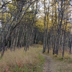
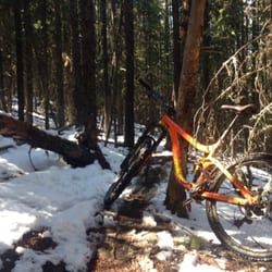
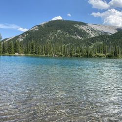
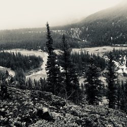
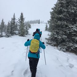
A lovely, easy hike with a HUGE beautiful pay off at the end! It's a family friendly stroll with plenty of parking at the trailhead and it's easy to do in a couple of hours at most. The elevation is easy, and the stroll through the forest is leisurely and beautiful. In the winter you may want cramp ons or hiking poles since the packed down snow can get slick, but they're not necessary. At the end you'll find the beautiful Troll Falls. In the winter they're frozen the most miraculous bright blue and ice climbers have a great time climbing it's relatively easy verticals. Unlike the Johnston Canyon hike in Banff National Park, the Troll Falls hike allows you to get right up to the water falls, which makes for a truly special experience. Check my photos for proof! read more


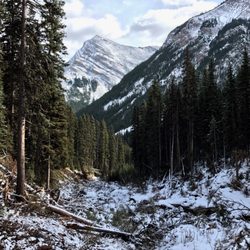
In the mountains and wanna go hiking, but need a spot that's not too difficult and also entertaining for wee kids? This is it. We were looking at different trail maps and unsure where to take our two year old for a hike that would grasp her attention span and also would be able to drag her along in a sled if she gets tired from all the walking. When Troll Falls popped out and had everything e were looking for. It's right at the bottom of the ski slope so if you find yourself driving up the mountain, you've gone too far. There is a decent sized parking lot by the entrance to the trail. The secret weapon for kids entertainment (aside from nature chats) are the hidden Troll Dolls around. Fun for everyone to try to be the first to spot them along the way! Even in December this was a fantastic crisp walk to do and at the end you come to a frozen waterfall. It was the most amazing thing to see, and to be able to walk on the frozen river. Just breathtaking! My husband is a geologist so he gives me all the geology chat along the way too. Really fantastic walk, I can't wait to do it again in summer and have a totally different experience. We seen a wolf run across the main road as we drove down to the trail so remember to stay safe when you are out there! read more

9 years ago
Like walking through Narnia! It feels like a fairy land. There was lots of families there, a great beginner hike for children. There was a dad whistling the smurfs theme song along the trail haha it was really cool. read more


More info about Troll Falls
Stoney Trail
Turner Valley, AB T0L
Canada
Directions
Hours
Outdoor Amenities


Troll Falls - hiking - Updated July 2026
People found Troll Falls by searching for…
Hiking Trails in Turner Valley, Alberta
Parks in Turner Valley, Alberta
Things to Do in Turner Valley, Alberta
Walking Trails in Turner Valley, Alberta
Fun Things to Do With Kids in Turner Valley, Alberta
Easy Hikes in Turner Valley, Alberta
Beautiful Views in Turner Valley, Alberta
Running Trails in Turner Valley, Alberta
Swimming in Turner Valley, Alberta
Kids in Turner Valley, Alberta
Natural Hot Springs in Turner Valley, Alberta
Trail in Turner Valley, Alberta
What to Do in Turner Valley, Alberta
Canyoneering in Turner Valley, Alberta
Playgrounds in Turner Valley, Alberta
Stuff to Do in Turner Valley, Alberta
Hiking With Kids in Turner Valley, Alberta
Fishing Spots in Turner Valley, Alberta
Nature in Turner Valley, Alberta
Night Hiking in Turner Valley, Alberta
Waterfalls in Turner Valley, Alberta
Hikes With Waterfalls in Turner Valley, Alberta