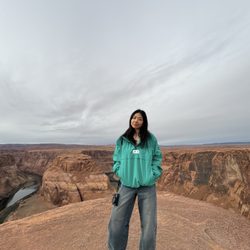
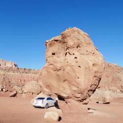
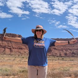
Wahweap Hoodoo Photos


You might also consider
More like Wahweap Hoodoo
Recommended Reviews - Wahweap Hoodoo
Start your review...

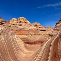
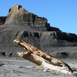
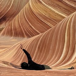
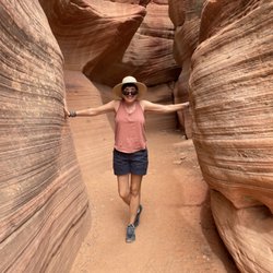
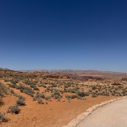
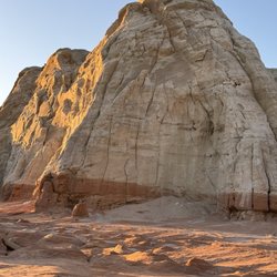
Very cool, bizarre, and eerie. Really interesting to explore the hoodoos' areas. First the hike is in the wash and after a couple of miles in, several sections of hoodoo parks. We only saw 2 other people on whole day. Utah has so much to offer. read more


More info about Wahweap Hoodoo
Fish Hatchery Rd
Big Water, UT 84741
Directions
Hours
Outdoor Amenities
You might also consider


Wahweap Hoodoo - hiking - Updated May 2026
Best of Big Water
People found Wahweap Hoodoo by searching for…
Browse Articles
Browse Brands
Related Searches in Big Water, UT
Affordable Jet Ski Rental Options in Big Water, Utah
Best Fishing Locations and Guides in Big Water, Utah
Best Lookout Points to Visit in Big Water, Utah
Best Nature Trails for Hiking in Big Water, Utah
Best Places for Horseback Riding in Big Water, Utah
Best Waterfalls and Swimming Holes in Big Water, Utah
Check Out Off Road Trails in Big Water, Utah
Discover Popular Photo Spots in Big Water, Utah
Discover Top Boat Tours in Big Water, Utah for All Ages
Discover Top Nature Parks to Visit in Big Water, Utah
Discover a Hiking Trail in Big Water, Utah
Discover the Best Night Hike Trails in Big Water, Utah
Dog-Friendly Hikes With Dogs in Big Water, Utah
Enjoy Scenic Night View Experiences in Big Water, Utah
Enjoy Tent Camping Spots Around Big Water, Utah
Enjoy the Best Picnic Spots and Ideas in Big Water, Utah
Enjoy the Best Walking Trails in Big Water, Utah
Exciting Cliff Jumping Spots in Big Water, Utah
Experience Stunning Sunset Views in Big Water, Utah
Explore Beautiful Parks and Green Spaces in Big Water, Utah
Explore Easy Hikes Perfect for All in Big Water, Utah
Explore Popular Campgrounds Near Big Water, Utah
Explore Popular Scenic Overlook Points in Big Water, Utah
Explore Popular View Points Around Big Water, Utah
Explore Scenic Lakes to Visit in Big Water, Utah
Explore the Best Boating Spots in Big Water, Utah
Explore the Best Swimming Holes Around Big Water, Utah
Explore the Best Trail Options in Big Water, Utah
Family Friendly Hiking With Kids in Big Water, Utah
Find Beautiful Views in Big Water, Utah
Find Fun Kids Activities Outdoor in Big Water, Utah
Find Parks and Recreation Activities in Big Water, Utah
Find the Best Parks for Picnics in Big Water, Utah
Find the Best Scenic View Locations in Big Water, Utah
Hiking Trails With Waterfalls in Big Water, Utah
Must-See Tourist Attractions Around Big Water, Utah
Perfect Spots to Watch Sunset in Big Water, Utah
Picnic Areas With BBQ Pits Available in Big Water, Utah
Plan a Scenic Drive Route Near Big Water, Utah
Popular Fishing Spots to Explore in Big Water, Utah
Popular Picnic Spots to Visit in Big Water, Utah
Popular Places to Take Pictures in Big Water, Utah
Popular Things to Do in Big Water, Utah
Relax at Natural Hot Springs Near Big Water, Utah
Safe River Swimming Areas in Big Water, Utah
Safe and Fun Parks for Kids in Big Water, Utah
Top Running Trails to Explore in Big Water, Utah
Top-Rated Boat Rental Services in Big Water, Utah