Visit Virginia's Blue Ridge Photos

More like Visit Virginia's Blue Ridge
Recommended Reviews - Visit Virginia's Blue Ridge
Start your review...



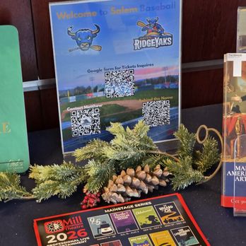
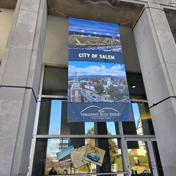
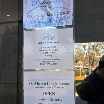
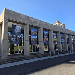
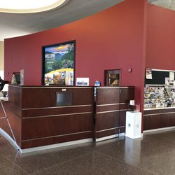
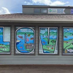
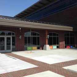
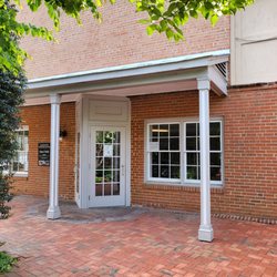
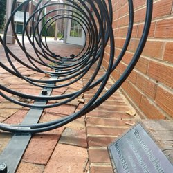
Visit Virginia's Blue Ridge is the official destination marketing organization for the Roanoke Valley region in Virginia, which encompasses the cities of Roanoke and Salem and the counties of Botetourt, Franklin, and Roanoke; promoting the region as a unique destination for leisure travel, meetings, and sporting events. This not-for-profit entity, includes a Visitor Information Center, conveniently located across the street from the Hotel Roanoke, and inside the old renovated building where Roanoke's historic Norfolk & Western Railway passenger station used to be. There you will find a knowledgeable and very friendly staff willing to help you find information on outdoor recreaction activities, arts, communities, culture, restaurants, and local attractions like the Blue Ridge Parkway, hiking trails, breweries, the Museum of Transportation, and the Taubman Museum of Art, just to name a few. As you very well know, this area has over 1,000 miles of trails for hiking, camping, biking (the region is known as East Coast Mountain Biking Capital) and paddling, as well as access to the Blue Ridge Parkway and Appalachian Trial. We have a great numbers of tourists who come to visit from Germany, France, Belgium, Italy, Spain, and the Netherlands to take advantage of our many leisure resources. Although it is mostly for tourists to help them plan their trip. But they can be very helpful to locals as well in helping them plan their vacation or to discover places and activities in their own back yard that they never knew existed and were missing out on. I'm also aware that many families and individuals thinking of purchasing a home and moving into one of our communities have taken advantage advantage of this Center and its services. I remember when I first moved into Roanoke, I gave them a visit and found out detailed first hand information of the difference neighborhoods around and what each had to offer. At times when the center is closed, you can visit their website: www.visitvbr.com where information is available 24 hours a day. Besides for picking up information, the place is a joy to visit. It is well clean and organized, often with wonderful exhibits all around. Today when I visited, I was able to see among other things one of those antique bikes with a large front wheel and a small back one, one of the RCA dogs that they are collecting money to try to restore, many decorated doors representing businesses and organizations, where in a similar style as Hotel Roanoke does with Christmas trees, all those who visit the center can vote for which one they like the best. I invite you to view my photographs accompanying this review to get a better sense of the place and all it has to offer. The Virginia's Blue Ridge Visitor Center is the official Visitor Center for the region, and it's also the home to the Roanoke History and O. Winston Link Museums. read more


More info about Visit Virginia's Blue Ridge



















Visit Virginia's Blue Ridge - visitorcenters - Updated October 2026
Best of Roanoke
People found Visit Virginia's Blue Ridge by searching for…
Trending Searches in Roanoke, VA
Apple Orchards near Visit Virginia's Blue Ridge
Apple Picking near Visit Virginia's Blue Ridge
Corn Maze near Visit Virginia's Blue Ridge
Costume Store near Visit Virginia's Blue Ridge
Craft Fairs near Visit Virginia's Blue Ridge
Dog Parks near Visit Virginia's Blue Ridge
Hair Stylists near Visit Virginia's Blue Ridge
Halloween Events near Visit Virginia's Blue Ridge
Haunted Houses near Visit Virginia's Blue Ridge
Men's Clothing near Visit Virginia's Blue Ridge
Pick Your Own Farms near Visit Virginia's Blue Ridge
Places To Take Pictures near Visit Virginia's Blue Ridge
Pumpkin Patches near Visit Virginia's Blue Ridge
Browse Articles
Browse Nearby
BEST of Roanoke, Virginia Coffee near Visit Virginia's Blue Ridge
BEST of Roanoke, Virginia Hotels near Visit Virginia's Blue Ridge
BEST of Roanoke, Virginia Restaurants near Visit Virginia's Blue Ridge
BEST of Roanoke, Virginia Things to Do near Visit Virginia's Blue Ridge
BEST of Roanoke, Virginia Photo Spots near Visit Virginia's Blue Ridge
BEST of Roanoke, Virginia Attractions near Visit Virginia's Blue Ridge
BEST of Roanoke, Virginia Breakfast near Visit Virginia's Blue Ridge
BEST of Roanoke, Virginia Star Gazing near Visit Virginia's Blue Ridge
BEST of Roanoke, Virginia Caves near Visit Virginia's Blue Ridge
Browse Brands
Related Cost Guides
Related Searches in Roanoke, VA
Best Lookout Points to Visit in Roanoke, Virginia
Best Nature Trails for Hiking in Roanoke, Virginia
Best Waterfalls and Swimming Holes in Roanoke, Virginia
Book a Guided Cave Tour in Roanoke, Virginia Today
Discover Beautiful Public Gardens in Roanoke, Virginia
Discover Easy Hiking Trails Near Roanoke, Virginia
Discover Kid Friendly Hiking Trails in Roanoke, Virginia
Discover Popular Photo Spots in Roanoke, Virginia
Discover Top Nature Parks to Visit in Roanoke, Virginia
Discover the Best Campground Spots in Roanoke, Virginia
Discover the Best Lake Spots in Roanoke, Virginia
Enjoy Hiking Adventures in Roanoke, Virginia
Enjoy a Sculpture Park in Roanoke, Virginia
Enjoy the Best Night View Spots in Roanoke, Virginia
Enjoy the Best Walking Trails in Roanoke, Virginia
Enjoy the Scenic Boardwalk Attractions in Roanoke, Virginia
Explore Easy Hikes Perfect for All in Roanoke, Virginia
Explore Free Picnic Areas Around Roanoke, Virginia
Explore Natural Caves and Attractions in Roanoke, Virginia
Explore Popular Picnic Areas Around Roanoke, Virginia
Explore Popular Scenic Views Near Roanoke, Virginia
Explore Rest Stops Available in Roanoke, Virginia
Explore Scenic National Park Locations in Roanoke, Virginia
Explore Scenic Sunset Hike Trails Around Roanoke, Virginia
Explore Top Dog Parks in Roanoke, Virginia Near You
Explore the Best Places to Run in Roanoke, Virginia
Explore the Best Swimming Holes Around Roanoke, Virginia
Explore the Best Wildlife Park Options in Roanoke, Virginia
Explore the Scenic River Walk in Roanoke, Virginia
Family Friendly Hiking With Kids in Roanoke, Virginia
Find Beautiful Views in Roanoke, Virginia
Find Picnic Tables for Outdoor Fun in Roanoke, Virginia
Find the Best Bridge Spots in Roanoke, Virginia
Find the Best State Parks Camping Spots in Roanoke, Virginia
Hiking Trails With Waterfalls in Roanoke, Virginia
Plan Nature Center Visits in Roanoke, Virginia
Plan a Scenic Drive Route Near Roanoke, Virginia
Popular Dog Walking Areas in Roanoke, Virginia
Popular Fishing Spots to Explore in Roanoke, Virginia
Popular Running Routes to Try in Roanoke, Virginia
Popular Things to See in Roanoke, Virginia
Safe Bike Trails for Kids in Roanoke, Virginia
Safe and Fun Parks for Kids in Roanoke, Virginia
Stair Climbing Activities and Gyms in Roanoke, Virginia
Top Hiking Trails to Explore in Roanoke, Virginia
Top Spots for Night Hiking in Roanoke, Virginia
Top Swimming Lakes to Enjoy in Roanoke, Virginia
Top-Rated Hikes in Roanoke, Virginia to Explore