1. Upton State Forest

0

Upton, MA

Cancel

Open app

Search

Upton State Forest

4.2 (5 reviews)

UPTON STATE FOREST · YELP ASSISTANT

Ask Yelp Assistant

Upton State Forest Photos
You might also consider

Recommended Reviews - Upton State Forest

Your trust is our priority, so businesses can't pay to alter or remove their reviews. Learn more about reviews.
Yelp app icon
Browse more easily on the app
Review Feed Illustration

5 years ago

Helpful 0
Thanks 0
Love this 0
Oh no 0

3 years ago

Helpful 0
Thanks 0
Love this 0
Oh no 0
Photo of David S.
1520
406
1534

10 years ago

Helpful 7
Thanks 0
Love this 2
Oh no 0

8 years ago

Helpful 1
Thanks 0
Love this 0
Oh no 1

8 years ago

Helpful 0
Thanks 0
Love this 1
Oh no 0

Verify this business for free

People searched for Hiking 947 times last month within 15 miles of this business.

Verify this business

Hopedale Park Lands

Hopedale Park Lands

4.8(6 reviews)
4.4 mi

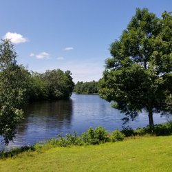
This is a great place to take an easy, mostly level, 3-mile walk around a beautiful pond. The trail…read morewhich is more like a single lane gravel road, is well marked and maintained. There also numerous, nicely marked trails off this main loop. It's a fairly quiet trail and easy enough that the occasional toddler and stroller passed. At one end of the trail, you need to walk a short way across a bridge under construction. There's not much of a sidewalk to use, but the traffic was very quiet during our weekend outing. According to their website, the initiation of Parklands acquisition was in 1899, and in 1900 the town brought in Warren H. Manning to help architect the entire layout.  There is no parking on the pond boat ramp or at the spaces next to  the bath house. This area is well-marked and the Hopedale Police Department will continue to ticket unauthorized and non-handicap vehicles parked in this area. This area is a drop-off zone only. Vehicles should be parked along Hopedale Street. We found plenty of parking on Hopedale Street, and used the green space there to lunch by the pond. There are benches scattered along the pond loop. Dogs are allowed on a leash and the trail is well marked, which according to their website is the result of the efforts of Mark Andolina, Jr., a Boy Scout from Hopedale Troop 1, who created a new trail map and installed new trail markers as part of his Eagle Scout project. We look forward to a return visit.
Great hike around the pond. the side trails off the main trail are good for mnt bike.read more

Photos
Hopedale Park Lands - Natural habitat

Natural habitat

Hopedale Park Lands - Nice pond

Nice pond

Hopedale Park Lands - Stone bridge over the pond

See all

Stone bridge over the pond

Upper Charles River Trail

Upper Charles River Trail

4.0(6 reviews)
6.2 mi

Great place to walk, run or ride your bike…read more It's not lit up at night, so avoid the trail when it gets dark. The people are usually very friendly that you come across, many walking their dogs and surprisingly picking up after their pets. I wish the geese weren't doing their mess on parts of the trail because sometimes if you're running and not looking down- you can step in it. They have tables to eat lunch. People fish there as well. There's also markers so you know how much you've walked or ran. Great trail to see some nature too. We've seen little bunnies, chipmunks, and at one point at dusk I was being chased by a bat. lol So yeah, don't walk there at night. Also the police will check it out from time to time so at least you know they're looking out for you as well.

I first found out about this path when my boss took me here after work one day. He likes to go on…read morewalks to delay returning home when his psychotic girlfriend (according to him) or her psychotic 10yr old daughter (also, according to him) are too much to handle. Sometimes his goal is to wait for them to fall asleep, then go home. I duck out before it gets to that point. The Upper Charles River Trail will eventually be 24 miles long and through Milford, Ashland, Sherborn, Holliston, and Hopkinton. It's on an old CSX right of way. I believe the Milford section is the only section complete so far, roughly ~5 miles. I don't jog that long anyway, especially with the sunset getting earlier. I usually park at Fino Field and go the trail until it intersects Route 85 by the Sports Authority, then turn back. Round trip is ~4.5 miles GPSed. The trail is paved and has mile markers in 1/4 mile increments. Traffic is pretty light when I'm there; dusk, weekdays. I see more walkers and less bikers. There are unimproved trails through the woods that you can stumble into and I'm still exploring where they all go. Also, I believe what they call "Vietnam" has an entrance on the north end of the trail across US495. NEMBA actually owns it. (http://www.nemba.org/Articles/VietnamFAQs.html) I'd like to try Vietnam out, but reading reviews saying that there are "6 foot drops out of nowhere" kind of scares me.

Photos
Upper Charles River Trail
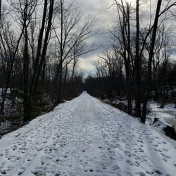
Upper Charles River Trail - Upper Charles trail in the winter

See all

Upper Charles trail in the winter

Upton State Forest - hiking - Updated November 2026

Loading...
Loading...
Loading...