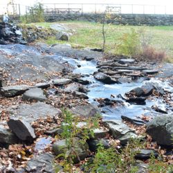
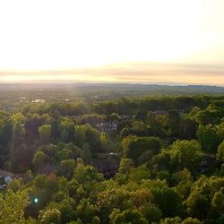
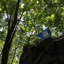
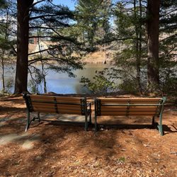
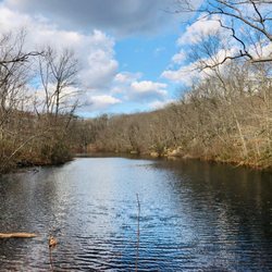
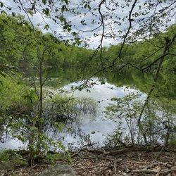
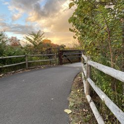
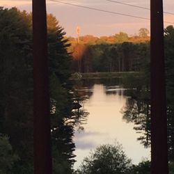
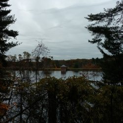
Tyler Mill Preserve Photos


You might also consider
More like Tyler Mill Preserve
Recommended Reviews - Tyler Mill Preserve
Start your review...


2 months ago


3 years ago
A great tranquil walk through the woods does wonders for the mind and body. Town owned nature preserve with well maintained, blazed trails. Miles of light to moderate loops, some steep areas walking along the ridge line. Dogs love it too! read more

10 years ago
Firstly, let me say, that rating hiking trails shouldn't even be practiced. Reviews and photos are great, but to rate trails in the woods is a highly subjective experience, and I don't think it's fair. For instance, I found a review here on Yelp unfairly harsh on Tyler Mill Preserve. The reviewer clearly wanted an intense and rigorous workout on a mountainside. While they do exist here, Connecticut is not primarily known for that. We are more about streams and lowlands woods. I found Tyler Mill a perfectly nice hiking trail, with a cool elevated scenic ridge. The trail is rather short. You're done in thirty minutes, but it's decently cleared, not insanely rigorous, and has just enough incline challenge to get to the ridge, and break a sweat. Sure, it's relatively easy, but it's a nice stop, and the visuals inside the evergreen canopy, while not full of giant boulders and rock formations, are still nice just because it's still nature. And you will see wildlife. I spotted a large deer buck, who was clearly stunned by my presence. Facing the kiosk from the parking lot, look/walk towards the left about twenty yards to the trail opening. Follow the orange trail to the right, which will loop ahead towards the ridge up towards the left at the incline. Note: When you first enter, you will see the orange markings early on the left tree. You could choose this direction or go on towards the right, which I believe is more correct. Once ahead, there is a choice to decline down the trail on the slight right, towards a paved road, which I assumed would exit, so I disregarded it. The incline is somewhat steep, but it's very short, so stick with it. It's cool up there. The info kiosk and trail is set a ways back from the road past several large athletic fields, at the very end of a long parking lot on the left corner. read more


More info about Tyler Mill Preserve
E Center St
Wallingford, CT 06492
Directions
Hours
Outdoor Amenities


Why does Yelp recommend reviews?
1 review that is not currently recommended
The reviews below are not factored into the business's overall star rating.
7 years ago
Tyler Mill Preserve - hiking - Updated July 2026
Best of Wallingford
People found Tyler Mill Preserve by searching for…
Scenic Drive in Wallingford, Connecticut
Walking Trails in Wallingford, Connecticut
Fishing in Wallingford, Connecticut
Things to Do With Kids in Wallingford, Connecticut
Running Trails in Wallingford, Connecticut
Places to Take Pictures in Wallingford, Connecticut
Photo Spots in Wallingford, Connecticut
Hiking Trails in Wallingford, Connecticut
Things to Do on a Rainy Day in Wallingford, Connecticut
Scenic View in Wallingford, Connecticut
Free Things to Do in Wallingford, Connecticut
Scenic Spots in Wallingford, Connecticut
Things to Do at Night in Wallingford, Connecticut
Nature Preserve in Wallingford, Connecticut
Mountain Biking in Wallingford, Connecticut
Waterfall in Wallingford, Connecticut
Fishing With Kids in Wallingford, Connecticut
State Park in Wallingford, Connecticut
Fishing Spots in Wallingford, Connecticut
Bird Sanctuary in Wallingford, Connecticut
Beautiful Views in Wallingford, Connecticut
Night Hike in Wallingford, Connecticut
Browse Nearby
BEST of Wallingford, Connecticut Restaurants near Tyler Mill Preserve
BEST of Wallingford, Connecticut Coffee near Tyler Mill Preserve
BEST of Wallingford, Connecticut Things to Do near Tyler Mill Preserve
BEST of Wallingford, Connecticut Breakfast near Tyler Mill Preserve
BEST of Wallingford, Connecticut Shopping near Tyler Mill Preserve
BEST of Wallingford, Connecticut Wineries near Tyler Mill Preserve