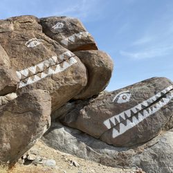
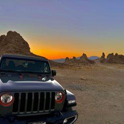
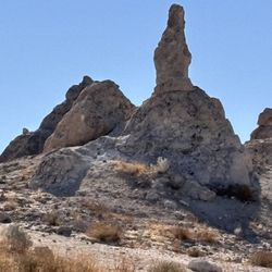
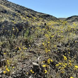
Town Of Darwin Photos


More like Town Of Darwin
Recommended Reviews - Town Of Darwin
Start your review...

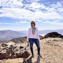
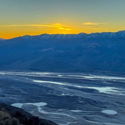
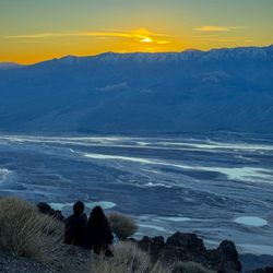
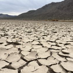
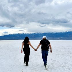
Darwin is an old mining town which was operational for almost 100 years. The mines have been closed since the 1970s, and less than 50 people live there presently. We spent a night at Darwin on our way from Alabama Hills to Death Valley. read more


More info about Town Of Darwin


Town Of Darwin - landmarks - Updated May 2026
Best of Darwin
People found Town Of Darwin by searching for…
Things to Do in Darwin, California
Public Services & Government in Darwin, California
Things to See in Darwin, California
Tourist Attractions in Darwin, California
Scenic Overlook in Darwin, California
Historical Sites in Darwin, California
View Points in Darwin, California
Night View in Darwin, California
Landmarks in Darwin, California
What to Do in Darwin, California
Sightseeing in Darwin, California
Must See in Darwin, California
Points of Interest in Darwin, California
Arts & Entertainment in Darwin, California
Places to Take Pictures in Darwin, California
Browse Articles
Browse Nearby
Browse Brands
Related Searches in Darwin, CA
Beautiful Flower Fields in Darwin, California
Best Lookout Points to Visit in Darwin, California
Best Nature Trails for Hiking in Darwin, California
Best Places for Stunning Views in Darwin, California
Best Spots for Star Gazing in Darwin, California
Discover Charming Historic Homes in Darwin, California
Discover Fun Things to Do Alone in Darwin, California
Discover Historic Sites and Places in Darwin, California
Discover Popular Landmarks in Darwin, California
Discover Popular Photo Spots in Darwin, California
Discover Romantic Views in Darwin, California
Discover Top Nature Parks to Visit in Darwin, California
Discover the Best Caves to Explore in Darwin, California
Discover the Best Dinosaur Park Experiences in Darwin, California
Discover the Best Night Hike Trails in Darwin, California
Enjoy Hiking Adventures in Darwin, California
Enjoy Scenic Night View Experiences in Darwin, California
Enjoy the Best Night View Spots in Darwin, California
Enjoy the Best Walking Trails in Darwin, California
Experience Stunning Sunset Views in Darwin, California
Explore Beautiful Parks and Green Spaces in Darwin, California
Explore Easy Hikes Perfect for All in Darwin, California
Explore Free Picnic Areas Around Darwin, California
Explore Nature Spots Around Darwin, California
Explore Popular Scenic Views Near Darwin, California
Explore Popular View Points Around Darwin, California
Explore Scenic National Park Locations in Darwin, California
Explore Secret Spots Worth Visiting in Darwin, California
Explore the Best Trail Options in Darwin, California
Find Beautiful Views in Darwin, California
Find Exciting Tours to Take in Darwin, California
Find Top Dog Friendly Parks to Visit in Darwin, California
Find Top-Rated Waterfalls in Darwin, California Now
Find the Best Bridge Spots in Darwin, California
Find the Best Playgrounds to Visit in Darwin, California
Get Your City Pass for Attractions in Darwin, California
Hiking Trails With Waterfalls in Darwin, California
Must-See Tourist Attractions Around Darwin, California
Perfect Spots to Watch Sunset in Darwin, California
Popular Picnic Spots to Visit in Darwin, California
Popular Places to Take Pictures in Darwin, California
Popular Places to Walk Around in Darwin, California
Popular Things to Do in Darwin, California
Popular Things to See in Darwin, California
Relax at Natural Hot Springs Near Darwin, California
Stair Climbing Activities and Gyms in Darwin, California
Top Hiking Trails to Explore in Darwin, California
Top Places to Visit in Darwin, California for Sightseeing