1. The Western Greenway

0

Waltham, MA

Cancel

Open app

Search

The Western Greenway

4.5 (2 reviews)

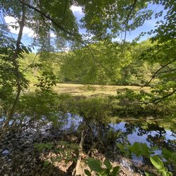
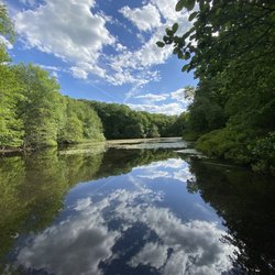
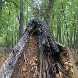
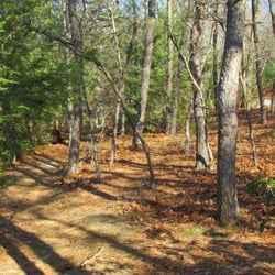
The Western Greenway Photos

You might also consider

Recommended Reviews - The Western Greenway

Your trust is our priority, so businesses can't pay to alter or remove their reviews. Learn more about reviews.
Yelp app icon
Browse more easily on the app
Review Feed Illustration

12 years ago

Helpful 2
Thanks 1
Love this 1
Oh no 0

8 years ago

Helpful 1
Thanks 0
Love this 0
Oh no 0

Verify this business for free

People searched for Hiking 2,302 times last month within 15 miles of this business.

Verify this business

Cat Rock Park

Cat Rock Park

4.2(53 reviews)
2.1 mi

First time here, but I don't know a single person that hasn't recommended it without rave reviews…read more PROS: Trails. Great for off leash dog walking. There were tons of dogs roaming about, owners right on their heels, so no worries about unattended animals. Clean(er) ponds, since they're connected to flowing water sources. There was only spot we saw where the water seemed stagnant. Most everywhere else it was relatively clean. It's not crystal blue Caribbean waters, obviously, but for your dog to swim in, it's good. CONS: Parking seemed tight. Found a spot, but it looks like local residents are not happy about street parking for overflow, so there were signs prohibiting street parking. This was at the Drabbington entrance. I'm sure there's another entrance I don't know about. OVERALL: My new gold standard for off leash hiking.

Great hike! This hike is easy and the length is 1.2 mi, it might take 30 minutes to walk around…read more The huge surprise was that you can let your dog walk without the leash. A lot of people bring their dogs. This hike has a lake where your dog can swim. Nature is beautiful, when you are walking around you could hear the woodpeckers. The only problem is parking. There are not a lot of parking spots, and if you go there, there are only residents parking on the weekends. There is no additional parking available for people who just visiting the park.

Photos
Cat Rock Park
Cat Rock Park
Cat Rock Park - The two lovely dogs are hunting for rabbits.

See all

The two lovely dogs are hunting for rabbits.

Oak Hill Conservation Site

Oak Hill Conservation Site

4.3(6 reviews)
17.9 mi

Great place to hike in Littleton. Went yesterday for the first time and was pleasantly surprised…read morewith the variety of trails in a (relatively) small area. There is one park entrance with a few parking spaces on Oak Hill Road, and another entrance on Harvard Road. Upon entering at Oak Hill Road, we followed the red trail up to Lookout Rock where we found a beautiful view overlooking the surrounding areas. Nearby, there was the highest point in all of Littleton. We then followed another trail to Tophet Chasm. The trails were well maintained, the park was not crowded (saw 3 other people there in a total of 2 hours), and the scenery was beautiful. Tucked away in Littleton center, this place is a gem. We printed out a trail map before heading over, which turned out to be necessary since it's pretty easy to lose your way if you change trails. The blue trail was the hardest - which lead us up and down hills on trails with little grooming. The ground was a little wet at times, which in combination with the leaves on the ground made it difficult to balance at times. Overall, this park is great. The red trail is lined with gravel and by far the easiest trail. The yellow trail is the longest, and the other trails weave in between. Even if you're not a hiker or avid exerciser, this park is great for everyone and has trails for all ability levels.

I wasn't impressed with this site. It's in the eastern half of the state and you hear almost…read moreconstant noise from planes, a train, and automobiles. We took the Chasm trail but the trail off it to the chasm itself was closed for repairs. Hit the Summit trail and didn't see an overlook at the top, just an ugly concrete water tower. My now my knee was bothering me as I am not a spring chicken, so we went back down to the parking lot. Looked at the map and saw it was quite a ways beyond the water tower to the lookout. I probably could have made it to the outlook and back if I hadn't gone off on the chasm trail. Maybe this is a better site for younger folks, though they did have reading glasses at the kiosk for older folks like me, which I've never seen anywhere before and which, along with clearly marked trails, got them a second star.

Photos
Oak Hill Conservation Site
Oak Hill Conservation Site - One of the harder trails

One of the harder trails

Oak Hill Conservation Site

See all

Blue Hills Reservation - Boston skyline

Blue Hills Reservation

4.4(138 reviews)
13.4 mi

If you're looking for a place to go hiking near Boston, Blue Hills Reservation is the perfect spot…read moreto go to! It is just a couple miles south of Boston! There's many different trails here, though I haven't done all of them, I mainly enjoy going up from Chickatawbut Rd (towards Braintree/Quincy) and near the Milton 2B Exit on Canton Ave/Washington St. The Skyline Trail is great if you've got some time on your hands but for a short hike, I wouldn't recommend. This trail is around 3 miles and at the summit, you get a grand skyline view of Boston! On this route, you will see the Summit tower & the Observatory. In the winter time, skiing and snow tubing is very popular here.

Not sure if I picked the wrong day or the wrong trail but my "hiking" experience in the Blue Hills…read morefell short. In general, there's not great hiking around Boston unless you keep doing the same trails in Milddlesex but I had heard a lot of good things about Blue Hills so off I went. 1. The Skyline trail, for being the most popular one, was extremely poorly marked. I'm glad I downloaded the AllTrails map ahead of time for the route because even with the map, I got turned around several times and had to scurry forward and back to try to find the markings. At one point, the markings disappeared completely, i.e., I was definitely off-trail, and I couldn't find my way back without committing to another rock scramble back down, so I just consulted the map, did another trail, and cut back to the same route a few minutes later. 2. So very, very buggy. Most of the time that I was walking, I was swatting a bug, trying not to eat a bug, or actually eating a bug. Not the most pleasant of hiking conditions but something avoidable by just coming later in the season when all the bugs are dead. Passed by some lakes that looked very scenic from a distance but then, when you get close, you see it's all pretty much stagnant water/pond scum and millions of mating bugs. 3. This may be relatively minor but if you're coming from Boston, the traffic to get over here is dreadful and, again depending on which starting point you use, there aren't bathrooms available. Plan accordingly. 4. Parking was free and easy - I went with the Shea Memorial Rink in Quincy and hopped right onto the trailhead from there. 5. Hiking shoes are fine but I think this hike is doable in sneakers. Aside from a scramble here or there, the elevation was pretty gradual. Do be careful of the various roots and whatnot. I guess the lesson is: bug spray and download the trail map. Unless you're fine making a day of it and trying different trails, but even so, download the map.

Photos
Blue Hills Reservation

See all

The Western Greenway - hiking - Updated October 2026

Loading...
Loading...
Loading...