Tangle Creek Falls Photos


More like Tangle Creek Falls
Recommended Reviews - Tangle Creek Falls
Start your review...

We happened upon these falls after the Glacier Adventure tour nearby and we were stunned at how beautiful these were! They are right there off the road side, and so close, so beautiful! I was surprised it was not marked on the map it was so pretty! You can kinda take a picture of it from the car gliding by but the best is to stop and take a good picture of it, as it is really good! read more


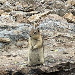
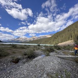
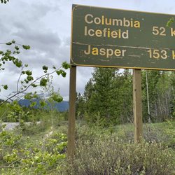
As you're leaving the Columbia Icefields - Athabasca Glacier area heading north towards Jasper...these Tangle Creek Falls are fantastic in terms of being a quick, efficient and beautiful roadside stop! You don't have to walk/hike at all to arrive here...or in fact...even exit your car! For me...this was a rewarding experience without having to work hard to get to. I would be cautious when driving... If you're going north to Jasper...Tangle Creek Falls are situated on the right hand side of the road and can easily be passed if you're not going slow because the road slopes downhill as you're driving, so that's where I'd keep my foot close to the brake. Worst case scenario you pass it and then just turn around. No big deal. Off to the left hand side parallel to the falls...there's a parking lot pullover area for you to leave your car. Then cross the street and you're standing in front of a 3-layer/tier waterfall that I found to be quite photogenic. In fact...among all the waterfalls I confronted throughout my Canadian Rockies adventure (which interestingly weren't too many)...I found these Tangle Creek Falls to probably be the best! I would say this stop is popular because it's so nearby the Columbia Icefield area...within just a couple of kilometers. So, for me, lol...I found it difficult to capture pictures of the falls without being "photobombed". Some strangers were occupying their selfie photos time too much and I did have to stand by the edge of the road and wait for them to finish. Lol, just so you know...you may encounter an issue like this. But me...I'm very, very picky about avoiding strangers in my picture moments. Also here at the falls, people were climbing the rocks and ledges to immerse themselves among the falls in a more optimal manner for photos. I was okay with standing by the edge of the road and snapping pics. I felt satisfied with how my photos appeared. You only need a few minutes hanging out here at this terrific roadside stop. I used 15 minutes before returning to my car. Overall, for what it is (being located right on the side of Icefields Parkway)... I found Tangle Creek Falls to be a memorable experience along my journey north towards the attractions of Jasper. read more


7 years ago
This is a pretty falls that's literally on the side of Icefields Parkway. You can look at it while driving by or stop to get a picture. The parking lot is across the street, so make sure to be careful when crossing the highway. The falls starts out wide at the top and narrows some at the bottom. You can climb up to get closer to the falls, but the best view is really from the roadside at the bottom. read more

10 years ago
Tangle Creek Falls - Beautiful Multitiered Falls - Icefields Parkway Stop. This waterfall is a multi-tiered cascade of water, with a vertical drop of about 100-feet. It can be viewed from the Icefields Parkway (Highway 93). Look for the road sign indicating "Tangle Creek Falls." It's worth a photo stop. read more
. - Hiking Near Me - Improvement District No. 9, Alberta")
More info about Tangle Creek Falls
Jasper National Park
Icefields Parkway
Improvement District No. 9, AB T0L
Canada
Directions
Hours
Outdoor Amenities