Cancel

    Open app

    Search

    Swift Glacier/Worm Flows Route

    5.0 (1 review)

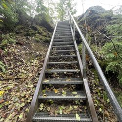
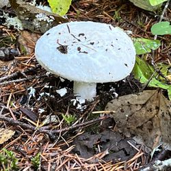
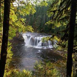
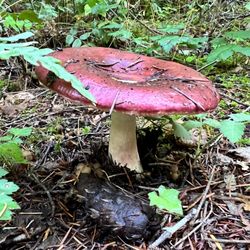
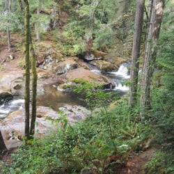
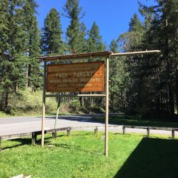
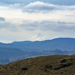
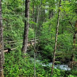
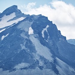
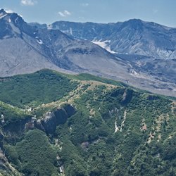
    Swift Glacier/Worm Flows Route Photos

    More like Swift Glacier/Worm Flows Route

    Recommended Reviews - Swift Glacier/Worm Flows Route

    Your trust is our priority, so businesses can't pay to alter or remove their reviews. Learn more about reviews.
    Yelp app icon
    Browse more easily on the app
    Review Feed Illustration

    9 years ago

    Helpful 0
    Thanks 0
    Love this 1
    Oh no 0

    Verify this business for free

    Get access to customer & competitor insights.

    Verify this business

    Beaver Falls - Standing underneath Beaver Falls is a Must-Do!

    Beaver Falls

    5.0(1 review)
    45.6 mi

    What a wonderful under the radar waterfall this is...Beaver Falls!…read more Located 6 miles east of Clatskanie, Oregon, this area near the Columbia River is beautiful. Let's get straight to the heart of what Beaver Falls is all about... If you plug "Beaver Falls Trailhead" into Google Maps, you'll have no problem finding it. Then just park along the side of Highway 30 and hike 1/3rd of a mile through the forest to the base of the falls. It's that easy. When I visited on a Thursday in early afternoon of July, there was hardly anyone around which was good for taking quality photos. Best of all, you can swim in the waters. So definitely bring a bathing suit, towel and a pair of water shoes so the rocks won't hurt your feet while entering the pool beneath Beaver Falls. The water is cold but once you jump in and get comfortable, it's a terrific setting. There's also a long rope where you can swing across and splash down below. It's great for kids (and adults too, lol) to have playful times. For me, I was content soaking in the pool and appreciating the surroundings. More info... - It's free to visit. - Cell phone reception works fine. - You can walk underneath the falls! This is a Must-Do. You can capture some amazing moments standing beside Beaver Falls. It's not hard or dangerous and offers a unique perspective. - Beaver Falls is just one of many outstanding waterfalls situated around Oregon and especially near the Columbia River. There's also Lower Lewis River Falls, Panther Creek Falls and Spirit Falls, to name a few. - You can spend a few hours hanging out or as little as 30 - 40 minutes. It depends on your time horizon. But overall, it's really pleasant to be here that I'd suggest bringing snacks, lunch and maybe having a picnic. This Beaver Falls is absolutely so much fun to hang out at. When you can swim in the waters, swing from a rope and even walk underneath the falls, It makes for a worthwhile summer visit.

    Photos
    Beaver Falls - Quiet setting at the falls and ideal for going swimming in the waters.

    Quiet setting at the falls and ideal for going swimming in the waters.

    Beaver Falls - Hiking down towards Beaver Falls.

    Hiking down towards Beaver Falls.

    Beaver Falls - Beautiful Beaver Falls!

    See all

    Beautiful Beaver Falls!

    Lava Canyon

    Lava Canyon

    4.9(14 reviews)
    10.6 mi

    Just went to visit this hike, I've done it before and the expierence was amazing. Went last week…read moreand the bridge was close so it cut out hike short but the view was beautiful and worth it

    A very unique and beautiful area to visit!…read more The trailhead has a nice parking area, with bathrooms. The trail to the winding, aqua blue stream is wide and well maintained. You can view the main attraction from trails on both sides, as well as looking down from the bridge. We took the trails on both sides of the water. The trail across the bridge is much easier to traverse, and winds down to the (closed down) suspension bridge. The opposite side leads down beyond the suspension to the waters edge, but even to get down to that point isn't for the faint of heart. It includes a narrow, steep downhill trek...including a section over running water (with a wire handrail for support). Once you arrive at the water at the bottom you can view the suspension bridge above, and if you dare, the waterfall below. We did attempt to continue on a little ways down the trail from there, but as reviews describe, the next section is even steeper with a very loose and dangerous footing. I got vertigo trying to look over the edge at the falls right before that section, so continuing on was a huge no. I'm sure that many people without height woes have no issues moving on, but if you're like me, the trail ends there. This area is stunning. The waters and canyon are a site that pictures simply cannot do justice. Highly recommend!!

    Photos
    Lava Canyon - A lot of stairs so be prepared

    A lot of stairs so be prepared

    Lava Canyon
    Lava Canyon - The bridge is close.

    See all

    The bridge is close.

    Lewis River Falls - Lewis River Falls

    Lewis River Falls

    4.7(15 reviews)
    14.7 mi

    Came up here after seeing all the beautiful pictures and our experience did not disappoint. We…read moreweren't quite sure what to expect so I budgeted a whole day for the visit. We got a parking pass for the upper parking lot (just above the upper falls) and then we proceeded to hike from there all the way down to the lower falls, stopping at the upper and middle falls to check everything out. The scenery is beautiful and the falls were great. Our favorite were the lower falls, which the kids loved to play in. It's definitely a long drive from Cougar and the road has lots of twists, turns, and dips, but so glad we finally did it.

    The falls can't be beat, the forest and trails fabulous. We have been coming once a year in the…read morefall right after the campground season ends. And although we adore the area, I'm not so sure we will be returning the campground again unfortunately. Night one I awoke to the sounds of a LOT of critters scrambling up and down all sides of our van. It was funny (and of course a sound we've heard in forests before), until one found it's way in and joined me in my bed. What would be considered a cute mouse outside is not so adorable next to my face. It is the forest, it's their home...but of the many times we've stayed here the sounds of countless tiny feet scurrying all over our rig hasn't occurred. New issue at the campground? I duno. Can't deny the beauty and draw of the area though...it will always deserve 5 stars...just wanted to give a heads up to anyone else who isn't a fan of unwelcome nighttime visitors in their sleeping quarters. :)

    Photos
    Lewis River Falls
    Lewis River Falls
    Lewis River Falls - Lewis River Falls

    See all

    Lewis River Falls

    Shoe Lake Hike Via Pacific Crest Trail - Old Snowy

    Shoe Lake Hike Via Pacific Crest Trail

    5.0(1 review)
    50.0 mi

    Had been stalking the White Pass/Shoe Lake area for windows of good weather the last month or two…read more(every weekend, it would conveniently be rainy/snowy up there!). Recently I saw the forecast open up for some sunny conditions---during the work week. I decided to make the trip---isn't that what vacation days are for?? I drove up to White Pass, from the east side, with clear blue skies the entire way. I parked on the highway (across from the Kracker Barrel at the base of the White Pass slopes). I slapped on my 35lb pack, grabbed my dogs, and we scrambled up the slopes. I like going this route (vs. starting at the Trailhead) because there are nice views and it cuts down on distance. It's a bear of a workout though! Once on the PCT, it's a nice, fairly flat, and scenic hike---y'know, the usual. Near the new ski run up on top, I heard/saw workers cutting/burning trees to clear way for the ski run (sometimes I wish I could make them turn the ski lift ON, so I could be taken all the way up to the Miriam Lake Basin....but what fun would that be?? I had seen evidence of recent snow every here and there (1-4" patches of snow). Once at the Miriam Lake Basin/Hogback Ridge, I made my way to Shoe Lake. There's one stretch of this big open piece of trail where there was quite a bit of hard icy snow. Camped above the beautiful Shoe Lake. I heard an elk bugling at around 7pm---it must have been south down the hill. Such a cool sound to hear! But it was also scary, because within seconds I also heard something very big plodding around nearby--definitely an elk. It was so close I could hear it breathing. A wee bit scary! (and cool) Oh, I did spy some huckleberries along the way, amazingly enough---but they weren't as good as the ones I picked 3weeks ago. Such a late season! The night yielded beautiful views of the Milky Way, constellations, Jupiter, satellites, and the like. The hike back was nice for most of the way. I saw a herd of mountain goats in the Miriam Lake Basin. The snow/ice mentioned earlier was pretty scary in the morning. The first clouds of the trip rolled in around 1pm...but I was pretty much done. While unloading at my car, an employee from the Kracker Barrel rode his bike to me. He was wondering where I was and if I was ok. Apparently, I forgot to roll my driver's side window up---so it was open for 24hrs!! Everything was fine, but I sure felt dumb. Anyway, probably my last backpacking trip of 2011. A great way to end the season!

    Photos
    Shoe Lake Hike Via Pacific Crest Trail - Reflection

    Reflection

    Shoe Lake Hike Via Pacific Crest Trail - From Nearby Peak

    From Nearby Peak

    Shoe Lake Hike Via Pacific Crest Trail - At Dusk

    See all

    At Dusk

    Panther Creek Falls - This is Panther Creek Falls

    Panther Creek Falls

    4.8(16 reviews)
    27.9 mi

    Located just off the Columbia River Gorge lies this beautiful, unique waterfall that flows…read morebeautifully down the rocky moss. Getting here on the side road can be a little risky, so please drive safe, drive slow, and share the road. Parking is right after the crossing signal in an open dirt lot across from the falls. There's two paths, the upper view point which will no give you the view you see in Al the pictures, but it's easy for a quick teaser. Stay to the left and up to go down to the falls and there you'll see this beautiful fall. The path can get muddy from the cliffs and water running on the sides. The multiple fall streams on the moss is what makes this fall so eye pleasing. The rocks are slippery so mind to the paths and enjoy beautiful fall!

    Well what can I say besides this is one of the most beautiful hikes I have ever been on. The hike…read moreto get to the waterfall is short enough and once you get there, you could literally watch the water fall for hours. It looks like something out of a movie, a fantasy movie with fairies and goddesses. The path to get there can be a little bit narrow, so I recommend wearing shoes with good grip and don't take too much with you, it's best to pack light for this one. You could truly sit there for hours with nothing but the water entertaining you. It's so pure and cleansing and definitely something you will think about the rest of your day, if not week. I highly recommend this beautiful aspect of nature.

    Photos
    Panther Creek Falls - Panther Creek Falls

    Panther Creek Falls

    Panther Creek Falls - At the bottom of Panther Creek Falls.

    At the bottom of Panther Creek Falls.

    Panther Creek Falls

    See all

    Falls Creek Falls - Icy cold, gorgeous

    Falls Creek Falls

    4.9(18 reviews)
    29.1 mi

    This review is for Lower Falls Creek Trail which was a ~3.2 miles round trip that took ~1.5 hours…read moreto complete. Just 50 mins away from Multnomah Falls; we decided to cross the Bridge Of The Gods into Washington! There was a $3 toll fee at the bridge (class 1 vehicle). Trail was narrow for the most part where you will need to stop to let others pass. Overall, not too difficult with a stunning waterfall at the end! Required to drive on dirt road to reach the trailhead. Short video of the hike for those interested! https://youtu.be/O3n5GA00KA4

    Great out and back at approximately 3 miles RT. The falls are so spectacular, a much longer trek…read morewould be perfectly acceptable! The trail itself is pretty narrow at times, we had to pull off often to let others through from the opposite direction. The environment is lovely, beautiful trees and the wonderful sounds of rushing water. When you approach the falls it's pretty jaw-dropping. From a distance, peeking through the trees the anticipation of what's coming is energizing. Once you arrive there are large boulders and layers to climb around to get different views (warning, some spots slippery). Although you can't possibly see the top areas of the falls fully, what you get to see is simply gorgeous. A beautiful pool and forest surroundings, along with a waterfall of spectacular height with a plethora of refreshing spray...what more could you want?! I've taken in quite a few falls in the area and so far this one takes the cake. Definitely worth a trek to see in person, as pictures do not do it justice. Would LOVE to see this hike and falls snow-covered too!

    Photos
    Falls Creek Falls
    Falls Creek Falls
    Falls Creek Falls

    See all

    Swift Glacier/Worm Flows Route - climbing - Updated May 2026

    Loading...
    Loading...
    Loading...