Summit Adventure Photos


You might also consider
More like Summit Adventure
Recommended Reviews - Summit Adventure
Start your review...

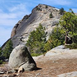
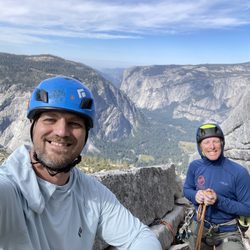
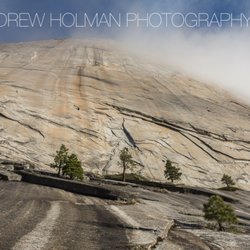
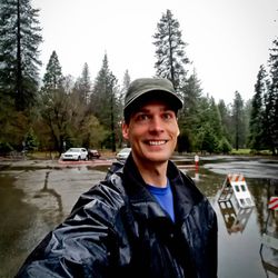
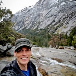
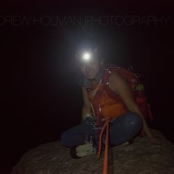
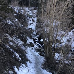
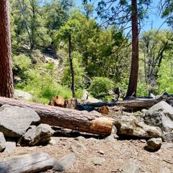
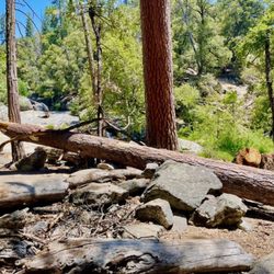
Wonderful experience and plan to return. I went on a weekend expedition to the Ansel Adams Wilderness by Yosemite. It was absolutely incredible. I went with a church group with 10 other men and we were greeted late at night by two guides that had the best attitudes even though we arrived super-late. They had everything ready to go at the campsite so we didn't have to worry about any gear and just go right to sleep. They took care of all of our meals, too. The next morning we took a 6-mile hike and went swimming in a mountain lake all the while discussing meaningful things in our lives to connect with one another. It was a real bonding and growing experience. We later did a 3-hour solo trip to be alone for 3 hours and really enjoyed it. The next day we went rock climbing and learned a great deal from the experience, much more than just rock climbing. We were only there for about 36 hours in total, but loved every minute of it. Some other things about the company: They have multiple pre-packaged "courses" in addition to the ability to create customized courses which is what we went on. Their pre-packaged courses include Father-Children courses, Leadership development courses, single parent courses, among many other adventure courses. All of the courses are aimed at giving a God-centered educational experience that you will not forget. Activities include camping, hiking, rock climbing, swimming, among other activities. They are headquartered in a cool cabin in Bass Lake, CA, but operate all over the world. Adventure sites include some of the most beautiful places in the world like Mt. Rainier, Yosemite, Death Valley, Joshua Tree, Holy Land and South America among other places. Super helpful guides and instructors who obviously love their jobs (I'm candidly a little jealous). From the website: "Our focus is providing custom programming using service, adventure and experiential education as tools to strengthen relationships with God and others......Since 1973, Summit Adventure has used wilderness and adventure as tools to facilitate transformation, build compassion, strengthen relationships and deepen faith. These processes take place through time-tested and proven strategies that Summit Adventure has used over the past four decades." The adventures are reasonably priced. Summit Adventure is a not-for-profit organization. read more


More info about Summit Adventure


Why does Yelp recommend reviews?
1 review that is not currently recommended
The reviews below are not factored into the business's overall star rating.
11 years ago
Summit Adventure - climbing - Updated May 2026
Best of Bass Lake
People found Summit Adventure by searching for…
Things to Do in Bass Lake, California
Rock Climbing in Bass Lake, California
Swimming Lakes in Bass Lake, California
Hiking Trails With Waterfalls in Bass Lake, California
Climbing Gym in Bass Lake, California
Playgrounds in Bass Lake, California
Things to Do at Night in Bass Lake, California
Scenic View in Bass Lake, California
Ropes Course in Bass Lake, California
Things to Do on a Rainy Day in Bass Lake, California
Secret Spots in Bass Lake, California
Swimming in Bass Lake, California
Hiking Trails Kid Friendly in Bass Lake, California
Bouldering in Bass Lake, California
Tent Camping in Bass Lake, California
Adventure Park in Bass Lake, California
Off Road Trails in Bass Lake, California
Lakes & Ponds in Bass Lake, California
Night Hike in Bass Lake, California
Playgrounds for Kids in Bass Lake, California
Walking Trails in Bass Lake, California
Running Trails in Bass Lake, California
Trending Searches in Bass Lake, CA
Bounce House Rentals near Summit Adventure
Campgrounds near Summit Adventure
Cliff Jumping near Summit Adventure
Dog Friendly Things To Do near Summit Adventure
Floral Designers near Summit Adventure
Flower Shop near Summit Adventure
Lakes & Ponds near Summit Adventure
Mexican Catering near Summit Adventure
Mountain Bike Trails near Summit Adventure
Nurseries & Gardening near Summit Adventure
Party Equipment Rentals near Summit Adventure
Pedicure near Summit Adventure
Photo Spots near Summit Adventure
Pick Your Own Farms near Summit Adventure
Picnic Areas near Summit Adventure
Places To Take Pictures near Summit Adventure
Running Trails near Summit Adventure
Rv Rental near Summit Adventure
Strawberry Picking near Summit Adventure
Summer Camps For Kids near Summit Adventure
Sunrise View near Summit Adventure
Browse Articles
Browse Nearby
BEST of Bass Lake, California Coffee near Summit Adventure
BEST of Bass Lake, California Waterfalls and Swimming Holes near Summit Adventure
BEST of Bass Lake, California Restaurants near Summit Adventure
BEST of Bass Lake, California Things to Do near Summit Adventure
BEST of Bass Lake, California Hiking near Summit Adventure
BEST of Bass Lake, California Breakfast near Summit Adventure
BEST of Bass Lake, California Sledding near Summit Adventure
BEST of Bass Lake, California Snow Play near Summit Adventure
Browse Brands
Related Searches in Bass Lake, CA
Affordable Kayak Rental Services in Bass Lake, California
Best Fishing Locations and Guides in Bass Lake, California
Best Fun Things to Do in Bass Lake, California
Best Gymnastics for Kids Activities in Bass Lake, California
Best Places for Horseback Riding in Bass Lake, California
Best Sledding Spots and Fun in Bass Lake, California
Best Waterfalls and Swimming Holes in Bass Lake, California
Check Out Off Road Trails in Bass Lake, California
Discover Dog Friendly Trails to Explore in Bass Lake, California
Discover Exciting Adventure Options in Bass Lake, California
Discover Fun Activities to Do in Bass Lake, California
Discover Fun Recreation Activities in Bass Lake, California
Discover Outdoor Gym Facilities in Bass Lake, California
Discover Scenic Mountain Bike Trails Near Bass Lake, California
Discover Scenic Waterfall Spots in Bass Lake, California
Discover Top Yoga Options and Studios in Bass Lake, California
Discover the Best Night Hike Trails in Bass Lake, California
Enjoy Camping Adventures Around Bass Lake, California
Enjoy Hiking Adventures in Bass Lake, California
Enjoy Indoor Lap Pool Facilities in Bass Lake, California
Enjoy Kayaking Adventures in Bass Lake, California
Enjoy Tent Camping Spots Around Bass Lake, California
Enjoy Water Activities and Fun in Bass Lake, California
Enjoy a Beautiful Waterfall Hike in Bass Lake, California
Enjoy the Best Bouldering Experiences in Bass Lake, California
Enjoy the Best Family Activities in Bass Lake, California
Enjoy the Best Walking Trails in Bass Lake, California
Exciting Cliff Jumping Spots in Bass Lake, California
Experience Thrilling White Water Rafting in Bass Lake, California
Explore Beautiful Parks and Green Spaces in Bass Lake, California
Explore Bike Rentals Throughout Bass Lake, California
Explore Boxing Gyms in Bass Lake, California
Explore Easy Hikes Perfect for All in Bass Lake, California
Explore Fitness Centers and Gyms in Bass Lake, California
Explore Fun Activities to Do in Bass Lake, California
Explore Martial Arts Options in Bass Lake, California
Explore Popular Campgrounds Near Bass Lake, California
Explore Popular Recreation Centers Around Bass Lake, California
Explore Popular Scenic Overlook Points in Bass Lake, California
Explore Scenic Lakes to Visit in Bass Lake, California
Explore Summer Camps for All Ages in Bass Lake, California
Explore Top Gyms in Bass Lake, California Now
Explore Top Parkour Spots and Activities in Bass Lake, California
Explore Top Trampoline Parks in Bass Lake, California
Explore Top Water Parks in Bass Lake, California Today
Explore Volleyball Courts Available in Bass Lake, California
Explore the Best Beach Spots in Bass Lake, California
Explore the Best Boating Spots in Bass Lake, California
Explore the Best Rock Climbing Areas in Bass Lake, California
Explore the Best Swimming Holes Around Bass Lake, California
People who viewed Summit Adventure also viewed
Way of the Mono Trail
6 reviews
Southern Yosemite Mountain Guides
19 reviews
The Shadow of the Giants
6 reviews
Minarets Pack Station and Resort
8 reviews
Glass Rock
1 review
Nelder Grove
10 reviews
Jackson Road Trail
1 review
Yosemite Outfitters
5 reviews
Ahwahnee Hills Regional Park
5 reviews
Goat Meadow Snow Play Area
4 reviews