Cancel
Open app
Search
Sign Up
Log In
Nearby
Bookmarks
Start a Project
Add a Business on Yelp
Add Review
Directions
Website
+5
EB Rental
John R. said: I have been a member for the last 3 years and whilst the duffy is… read more
Estero Adventures
Electric Boat Rentals. Our fleet of pontoon-style boats is the perfect way to explore… read more
Knob Hill Ranch
Grant C. said: Fantastic horseback riding experience! My husband and I are beginners… read more
More like Silver Peak Wilderness
Things to Do
Campgrounds
Sand Dunes
Off Road Trails
Start your review...
Get app
11 years ago
Amazing view. Blue ocean, lush green. So pretty. Backpacking start: Salmon creek TH end: Backeye TH distance: 19 miles 1st night: Lion Den camp 2nd night: on the top of hill near Backeye camp read more
See all
San Simeon, CA 93452
Visit Website
http://www.fs.usda.gov/recarea/lpnf/recarea/?recid=10973
Hours
What time does Silver Peak Wilderness open?
What time does Silver Peak Wilderness close?
Does Silver Peak Wilderness have parking?
Yes, Silver Peak Wilderness has parking options.
People searched for Hiking 122 times last month within 15 miles of this business.
The first .5 mile has a wooden path but don't try to do the full loop! The trial is quite overgrown…read moreand poison ivy is all along it. There was a small sign that indicated a part of the trail was under maintenance but once on the trail there's little direction other than small signs that tell about the trail. With no warning, suddenly you're in a very overgrown part that continues onto a broken bridge. By the point we got here we assumed we were more than halfway and didn't wanna risk more poison ivy which he had hardly gotten past. I'm glad we chose to continue because after getting past the broken bridge which was blocked off at the end (not the end we had come on) it was open, far less poison ivy and we made it to a road intended for vehicles to grt to the campground I think? It had some beautiful parts but not the sort of thing to bring kids out ages. Very narrow path for most of it!
A nice trail that's part nature walk, part moderate hike. The distance ranges from 3.5 - 3.8 miles…read moreit's a loop trail that goes around Sam Simeon State park/Campground. If you're staying at the camp ground you can easily get to the trail by following the park map. If you're not visiting the campsite there is a pullout area across the campground entrance on the other side near the beach where you can walk the trail under PCH. Coming from the beach trail around the loop you'll get around 450 feet of elevation gain, the trail is pretty simple to follow but if you're looking for direction to follow online there is a map on All Trails under "San Simeon trail to Washburn Campground Loop"
Walk way from the campground goes under PCH right to the beach.
The trail head right next to the path that leads to the beach. This trail goes around Washburn campground.
Watch out for the bugs.
This is a nice quick walk off of Hwy 1 with a lot of roadside parking available. It's a nice quiet…read morewalk since the highway has very few cars and there's thick vegetation around. My complaint with this waterfall is that we couldn't figure out how to get to it! The signage is bad and they need to point you in the right direction more. We were prepared to climb some rocks, as we'd heard that you have to to get to the falls, but when we couldn't figure out which rocks to climb, we just turned around. We were able to see the waterfall from a distance and heard people splashing around. Definitely not a trail to walk when muddy and definitely be prepared to climb a lot of boulders to get to the waterfall.
June 2025 As a city person, this is not a "normal easy…read moretrail" Fair warning, the trail is everywhere, no signs or one real pathway to the fall I'm not a hiker and end up turning back because I didn't think I can hope over wet boulders and climb pass a ledge to reach the waterfalls I'm sure it was worth it, I hear others swimming and having fun but I'm too old for that trail I hope you guys give this a try but be careful
A short hike/scramble to the falls
People say there's nothing to do in San Simeon except Hearst Castle...Of course, those with inside…read moreknowledge know where the cool non-touristy stuff can be found. Where.. The Jung Ranch Trail has two entry points where you can park and hike. The most accessible starting point (perfect for those staying in the area's motels) is at the end of 271 Vista Del Mar Ave. The other end of this trail is off Lone Palm Dr. The Hike.. The Jung trail about 1 mile in length from endpoint to endpoint. For the most part, it's pretty flat and could be easily walked by most people. This trail goes along San Simeon's breezy beach cliffs with plenty of access to the beach and the tide pools below. The Tide Pools.. If you have kids be sure to come here around low tide. While the specimens not be amazing when compared to other famous tide pools, there are crabs and sea anemones everywhere. You'll like see a sea lion of the farther out rocks. The kids said this was the highlight of our most recent trip. Know this! It can be very windy and cold on this trail. Dress appropriately. Definitely snakes in the field so stay on the path..
This trail isn't far from Hwy 1. There is a small area on a side road to the North park, or a…read morelonger side road on the south end to park. you can walk the trail which I believe is around 2-3 miles. We saw the pictures of the tide pools so was hoping to see something. So we made our way down and was walking the tide-pools getting looks as if we were nuts because the waves were big so we had to wait until the wave went down to walk a little bit, stop, and go again. But we didn't see anything in the tide-pools.
Black seagull poop
2020 review (8/21/2020) - The is the best family-friendly trail in the area. They've done extensive…read morecleanup since my last visit and many of the downed trees have been removed. It's mostly flat and the only risk to small kids are the Cliffs. The yelp address is misleading (this is not located in Pittsburgh). To get here you must park in the Hearst Memorial Beach parking lot. Walk down to the beach and walk north about 200 yards. Look for the trail that goes up to the cliff area ( just past the Hearst Winery Barn).. Many people just hike to the San Simeon point and the benches. BUT I highly recommend you continue your adventure through the tall tree path all the way to the cove with a sea cave. There are several openings along the tree trail that give exclusive and private views of the coastline. - When you start this hike keep a look out on the right hand side for a very short path that leads to a huge climbing tree.. The kids will love playing on that.. - The farther you go the fewer people you will see.
I read about this area via a SLO county travel site:…read morehttps://highway1discoveryroute.com/activities/hiking-san-simeon-ragged-point/ where it's also referred as the San Simeon Point Trail. Access to these trails are from William Randolph Hearst State Beach. Gates to the park open at 8 a.m. and there's no fee to enter. The trail is about 2 miles round trip and can be accessed if you walk along the beach (on the right side of the pier if you're facing it. You'll see a trail that leads up to the bluff, about 1/2 way down the beach. Once along the bluffs, you'll wind through the trees and catch views of the beach and pier. Not too far in, there are a few fallen trees and the path, at first seems to have disappeared-it hasn't. Look to the right and there's a small opening in the fence that allows day hikers to continue on (it's marked private property with allowance for passage of day use hikers.) It's a quiet trail that's partially shaded and very quiet. For a short while I was a bit unnerved being alone but soon enough I came across some locals walking their dogs. The hike out to the point is the big payoff and plan to spend a little while admiring the views, including a small cove to the north. It was the perfect short morning adventure and definitely a less known gem in the area.
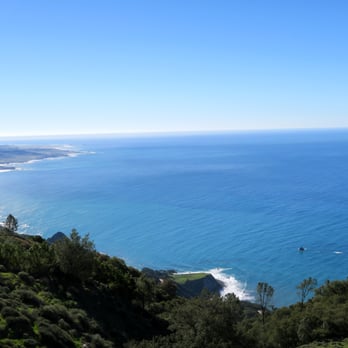
View from top of trail
Pelicans
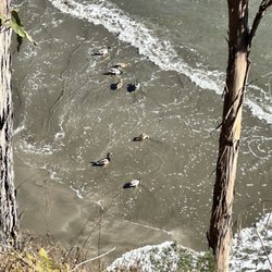
Ducks!
This place is terrible, stay away (so I will have less issues trying to book for next time)…read more Joking aside, this place is gorgeous. On the RV side they have two bathrooms and a shower, and it's a short walk to the ocean where a natural stream creates a lagoon on the sand before pouring out into the ocean. I would come here every year if I could get a spot!
I love camping here. It's been years and coming back recently was as magical as always…read more I've only camped in the ocean sites due to having a VW camper van. The other sites are tent camping only. I must say, the ocean sites are very snug and limited in space. If you're looking for a spacious camping site with privacy, you're not going to get here. And not all of the sites are the same size so if you have a trailer and a truck, you're gonna have to really be choosy at which is a site to book. This is right underneath the underpass so you're going to hear road noise. But to be honest, a lot of the sound was drowned out by the nearby stream and the ocean. It was walking distance to what felt like a private beach. Since the last time I've been here it looks like they made a mini dam with the running stream creating a mini swimming cove with crystal clear water. There are no electrical hook ups but the bathroom has running water and hot showers available. The bathrooms can get freaking disgusting from the day use visitors, but they do clean it every morning. And let's not forget the beautiful drive to get here. Magical.
Facebook.com/DavidPasillasPhoto
Da Pose
Another Da Pose
Thanks to Yelp pal Hannah S.'s review, I had bookmarked this spot as a place to stop when we were…read morein the area. The views are indeed scenic! We grabbed some coffee at the shop located here and then took a stroll behind the stores to savor the cool breezes, the trees, and the lovely sights of the Pacific Ocean. There's actually a trail, too, but we didn't venture down it as we were pressed for time. This is worth a stop to bask in the beautiful seascape.
Lovely scenic stop along the PCH as you make your way up from Cambria towards Big Sur. There's a…read morerestaurant, gas station, great coffee shop, bathrooms, art work, some hiking and view points, and an inn all at this little stop area. I walked all the way to the back where there's a lovely overlook with expansive Pacific Ocean views all along the cliffs and out as far as the eye can see! I even saw a sea otter hanging out with a sea gull - playing around in the waves together haha!! I think the gull was chasing him and gobbling up the otter's leftovers lol. There's another hiking trail on site down to the black sands of Young Creek Beach - but it's a super steep hike down a 400 foot cliff and I wasn't feeling it lol! But there are lots of nice seating areas overlooking the trail, beaches and cliffs so it's still very enjoyable. I grabbed a coffee and some dessert at the coffee shop instead which I can highly recommend!! It was fantastic and the staff were wonderful (see my review for Ragged Point Coffee Shop & Bakery). At the time of my visit, it was about as far as you could go up the PCH to Big Sur bc the road further up is washed out but they're working on it. Still a great little spot to explore - lots of parking and great views. I'd definitely consider staying at the inn next time!
My coffee from the cute coffee shop - was fabulous!
Nice seating areas with incredible views!
Got a latte to sip while we savored the scene
As of Oct 17, 2020 this place is still temporarily closed due to the El Dorado fire…read more The road leading to the trailhead may close seasonally. Please DO NOT park in undesignated spots as you are likely to get towed. Adventure Pass or National Parks Pass is required for entry. Due to many search and rescue situations in the past, hikers may not venture past the waterfall at the end of this route. There is a large parking lot at the trailhead with BOTH free and PAID parking. The gravel lot to the left is free. The lined spots require a day pass which you can purchase at the general store a few miles down the road. Making it to the very top requires a little scrambling and rock climbing, but its doable. So many places to relax and enjoy nature. Overnight camping is no longer allowed, but if you want to hang out for the day and set up a little picnic there are spots and bathrooms. Upper Big Falls is currently closed until 5/21/21 due to public safety. The closure is from the observation deck up to the waterfalls itself. Do not hike or climb past the observation deck. Forest Adventure Pass Daily Pass--Costs: $5 per dayForest Adventure Pass Annual Pass--Costs: $30 Annually Forest headquarters 602 So. Tippecanoe Ave San Bernardino Ca 92408 Tel no (909) 382 2682 (800)735 2922
We decided to come here for a hike, we drove like 50 minutes from AG. The rode goes up a mountain…read morethen descents towards a series of creek passings (about 18). Luckily we took a pick up truck because the creek water level in some of them were about 3ft deep. No 4x4 is needed but definitely helps, car height is more important. When we actually got to the end of the road we went on a hike crossing a couple more creeks. When just about made it to the falls it was tough to get down if your a inexperienced hiker or kid. You have to climb down with a rope, pretty sketchy.. We just decide to hang out at one of the creeks we crossed by foot, very tranquil.
Entrance
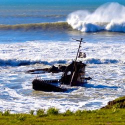
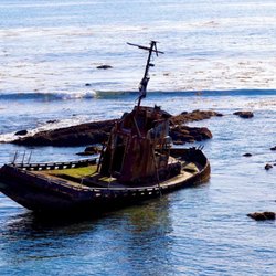
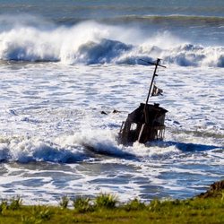
When on a highway 1 trip, its always nice to stop in at the Estero Bluffs where there are views of…read morethe bay and Morro Rock. This park provides a great opportunity for wildlife viewing and opportunity to enjoy the beach near the San Geronimo Creak at the end of a rocky trail. At this park you can also enjoy tidepools, grassland, bluffs and wetlands. And during low tide you can see a breached fishing boat that you can take pictures with or if you are tall and brave enough stand on but be careful as rusty. The boat is found on the southern end of the park. Go during low tide to see the boat and enjoy the tidepools. Multiple parking lots are located off highway one. The best access to the beach can be found at the intersection of highway 1 and San Geronimo Road.
During Camp Keep we went to the tide pools. We were able to climb rocks and look for sea life. A…read morelot of the kids did find mussels, snails, barnacles, even a sea star. It was just a great experience for us all. The naturalist was great, she was informative and so patient. The rocks could be a bit slippery so make sure you have the right shoes.
Point Esteros shipwreck at low tide
King tide swallowing the Point Estero shipwreck Jan 2023!
Views from the end of the trail AFTER all the crazy storms of Jan 2023 - don't think this part of the trail will last much longer lol
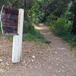
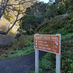
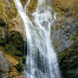
The Salmon Creek Trail and Waterfall is one of the funner places to take the family along Highway 1…read morein lower Monterey County. This trail is located about 3.5 miles north of the Ragged Point Inn along the middle of large bend in the road. There's a pull-off just north of the trailhead. You have to walk across the bridge to get to the actually trail. After a short walk down the trail you will come to a fork in the road. Follow the arrow to the "Balls".. It used to say Falls but someone changed it to "Balls"... This is a review of the Waterfall Trail that is a split off from the Salmon Creek Trail. The waterfall is less than a quarter mile so most families can make it to the waterfall. Those seeking to access the actual water pool will have to do some hiking over slippery rocks and cold rushing water. That's not advisable unless you're a crafty hiker. Your reward is to stand below, or even behind a 120-foot waterfall. The best pictures have to be earned the hard way on this hike. There's also a cave in this same area. Tips - The rocks here are slippery!! If you want to get to the base of the waterfall I recommend water shoes or just using you bare feet. - Check out the tunnel and graffiti under the bridge.. The trail is just off area where you park, don't cross the bridge, rather just walk down the tiny trail to the base of the bridge ( see my picture).
Short hike from the turn out. Definitely a good pit stop on the drive to big sur. The trail can be…read morea little bit confusing when you're trying to get to the upper falls. Will definitely have to climb some rocks but worth it. We didn't climb to the upper falls because there was quite a few people.
Secret tunnel under highway
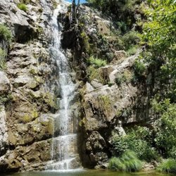
Salmon creek waterfall
BEST of San Simeon, California Restaurants near Silver Peak Wilderness
BEST of San Simeon, California Coffee near Silver Peak Wilderness
BEST of San Simeon, California Things to Do near Silver Peak Wilderness
BEST of San Simeon, California Breakfast near Silver Peak Wilderness
BEST of San Simeon, California Beaches near Silver Peak Wilderness
BEST of San Simeon, California Campgrounds near Silver Peak Wilderness
BEST of San Simeon, California Shopping near Silver Peak Wilderness
Campgrounds in San Simeon, CA
Things to Do in San Simeon, CA
Redwood Trees in San Simeon, CA
Hiking Trails in San Simeon, CA
Bonfire in San Simeon, CA
Camping Sites in San Simeon, CA
Snow Play in San Simeon, CA
Off Road Trails in San Simeon, CA
Swimming Lakes in San Simeon, CA
Camping Cabins in San Simeon, CA
Sand Dunes in San Simeon, CA
Beach Fire Pits in San Simeon, CA
Canyoneering in San Simeon, CA
Fun Things to Do at Night in San Simeon, CA
Tide Pools in San Simeon, CA
Night Hike in San Simeon, CA
Bird Sanctuary in San Simeon, CA
Bridge in San Simeon, CA
Dog Friendly Trails in San Simeon, CA
Horseback Riding on Beach in San Simeon, CA
Parks BBQ Grills in San Simeon, CA
Attractions in San Simeon, CA
Tent Camping in San Simeon, CA
Waterfall Hike in San Simeon, CA
Affordable Canoe Rental Options in San Simeon, California
Affordable Kayak Rental Services in San Simeon, California
Atv Rentals/Tours
Best Dog Hiking Trails Around San Simeon, California
Best Fishing Locations and Guides in San Simeon, California
Best Places for Horseback Riding in San Simeon, California
Best Sightseeing Experiences Available in San Simeon, California
Discover Popular Bike Trails in San Simeon, California
Discover Scenic Mountain Bike Trails Near San Simeon, California
Discover a Hiking Trail in San Simeon, California
Dog-Friendly Hikes With Dogs in San Simeon, California
Enjoy Camping Adventures Around San Simeon, California
Enjoy Exciting Mountain Biking Adventures in San Simeon, California
Enjoy Kayaking Adventures in San Simeon, California
Enjoy Off Leash Dog Hikes in San Simeon, California
Enjoy the Best Walking Trails in San Simeon, California
Explore Easy Hikes Perfect for All in San Simeon, California
Explore Fun Activities to Do in San Simeon, California
Explore Top Dog Parks in San Simeon, California Near You
Explore the Best Beach Spots in San Simeon, California
Explore the Best Swimming Holes Around San Simeon, California
Family Friendly Hiking With Kids in San Simeon, California
Find Beautiful Views in San Simeon, California
Find Parks and Recreation Activities in San Simeon, California
Find Popular Ziplining Spots Around San Simeon, California
Find a Park With BBQ Pits in San Simeon, California
Find the Best Playgrounds to Visit in San Simeon, California
Hiking Trails With Waterfalls in San Simeon, California
Hot Springs
Off Leash Dog Hiking Trails in San Simeon, California
Picnic Areas With BBQ Pits Available in San Simeon, California
Popular Outdoor Activities to Try in San Simeon, California
Popular Picnic Spots to Visit in San Simeon, California
Safe River Swimming Areas in San Simeon, California
Safe and Fun Parks for Kids in San Simeon, California
Top Dog Friendly Things to Do in San Simeon, California
Top Playgrounds for Kids to Enjoy in San Simeon, California
Top Running Trails to Explore in San Simeon, California
Top Swimming Spots and Pools in San Simeon, California
Top Things to Do With Kids in San Simeon, California
Walk Dog Friendly Hiking Trails in San Simeon, California
Apple Orchards near Silver Peak Wilderness
Apple Picking near Silver Peak Wilderness
Archery near Silver Peak Wilderness
Attraction Farms near Silver Peak Wilderness
Blow Dry Bar near Silver Peak Wilderness
Corn Maze near Silver Peak Wilderness
Halloween Events near Silver Peak Wilderness
Hiking near Silver Peak Wilderness
Kids Birthday Party near Silver Peak Wilderness
Makeup Artists near Silver Peak Wilderness
Photo Spots near Silver Peak Wilderness
Pick Your Own Farms near Silver Peak Wilderness
Places to Take Pictures near Silver Peak Wilderness
Public Shower near Silver Peak Wilderness
Pumpkin Patches near Silver Peak Wilderness
Quilt Shop near Silver Peak Wilderness
Rock Quarry near Silver Peak Wilderness
State Parks near Silver Peak Wilderness
Waterfalls near Silver Peak Wilderness
Things to do in San Simeon
Brands by name
Articles by date
I decided to explore Harmony Headlands after several days of storms that were replaced with…read moreperiodic showers, su shine, and gusting winds. I have to say, with the right gear (boots, waterproof clothing, hat), it was still worth it. What was enjoyable about this mid-February hike was the varied scenery and sounds as you journey towards the coast. There were rolling green hills, cows, falcons, frogs, ducks, grasses blowing in the wind....the sceneries changed over the 1.5 mile trek and it was serene. With the storms, the trail did turn muddy early. Even with rain, I highly recommend this hike for the scenery during the walk and the calming effect that comes from the journey.
Finally getting around to doing this hike (more like walk) and it did not disappoint! Just a little…read moreover 4 miles, I would consider this a nice easy out and back hike with just under 300 feet of elevation gain. Once you get to the ocean, the views are magnificent! You get a chance to walk along the coast for about a mile each way. Once you reach the end you can either sit on a bench or get up close with the waves on the rocks. Will definitely be making this a regular spot we go to, as we loved it!
We really enjoyed this 3.6 mile loop with 80% shade, well maintained trails (one creek crossing…read morebut with easy stepping stones). I appreciated the signage, especially pointing out and explaining the native flora and fauna. It was chilly most of the time this morning (48 degrees) but felt warmer in the sun. I'm sure this is a great little hike in all four seasons! We'll be back someday.
This hike in early April was beautiful, filled with wild flowers. There is a lot of traffic noise…read morefor the first part of the hike, but it gets better as you go up. Speaking of the incline, it meets my standards by starting low and going up fairly gradually. The views are incredible, and the hike back easy. It did feel longer than the posted signs claimed.
Campground is so beautiful. It was built in 1937 so that's how old the trees are. They are…read moreGigantic and majestic.!!! I Campground is covered in Eucalyptus trees, Monterey cypress trees, Holly leaf cherry trees and more. The campground is located on the Inlet of the Bay and bread across the street. You can rent kayaks. We did! There are docs you can bring a building to split, although don't have the information on that one. There's a golf course right outside the gate . And it is beautiful. The campground is quiet and serene and peaceful . The smell of eucalyptus permeates the air. The campsites are a very nice size, fairly private, with adequate restrooms and showers strategically placed for easy access. Easy to reach, simple to find trash and recycle receptacles. Morro Bay waterfront, shops and restaurants are 1 mile away. And there is a lot to do there, including going for a walk around Morro Rock
Sad. This park is so unkept. Weeds, dead brush and awful bathrooms. Showers are terrible. I don't…read morecare how cheap it is. Jenky.
A really gorgeous and peaceful spot that isn't overly crowded. The boardwalk isn't dog friendly,…read morebut otherwise it's a great place for a scenic walk.
A worthwhile stop after visiting the Castle…read more There's ample parking and plenty of things to do on this beach access site. A nice stroll along a pier, perhaps a walk along the beach and some small tide pool exploration, or if you're lucky a chance to visit their discovery center. So stop by and stretch your legs out a bit. Bathrooms - Yes
Nice hideaway from the common campers. Up the hill from the San Simeon Campground…read more If you tent camp know that a lot of sites are uneven or rough. Bring tarps for under the tent. I also bring moving blankets to layer the tent floor. The condensation that builds up in the tent will make the floor wet. My set up was tarp, tent, moving blankets, air mattresses. Slept great. The bathrooms up here are pits but the toilets are decent enough and the buildings are handicap accessible. You can drive down to San Simeon and use the showers. They take tokens (if the machines work but luckily we found a shower that ran without tokens). The negatives: Ground squirrels. Dozens and dozens with zero fear. Keep your food secured in totes or in your car. The crows and squirrels will get into your plastic bags. It can get breezy in the afternoon. Secure your tents and canopy. Cell service? Spotty if at all but that makes the charm even better. Bring a book. Games. Take a hike. Hikes; this is tick country. Wear long socks and tuck your long pants into them. You e been warned. Fire pits (with a cooking grate) are nice. Nice concrete picnic tables. It's roughly 10 minutes to Cambria, 10 minutes to Hearst Castle, 15 minutes to Cayucos, 25 minutes to Morro Bay. I'll stay here again for sure.
April 15-18, 2025 - San Simeon State Park…read more There are two campgrounds at San Simeon State Park: San Simeon Creek Campground and Washburn Campground. Washburn Campground is a primitive campground located approximately 1 mile inland from the beach on a plateau overlooking the Santa Lucia mountains. The campground is accessed through the entrance kiosk at San Simeon Creek Campground. There is a short portion of the road that leads into the campground that is unpaved. We had no problem with it in our motorhome. There are 68 campsites. Facilities include a fire ring and picnic table at each campsite, water spigots, and chemical flush toilets. Token-operated showers, an RV sanitation station and RV water fill-up are available nearby at the San Simeon Creek Campground. Washburn Campground is the more remote and quieter of the two campgrounds. The campsites are fairly spacious and level. We stayed in site 212; but next time I will choose a site not at the corner of the roadway, because there was too much traffic along the rough unpaved road alongside our campsite. We had a beautiful view, though, of the mountains. Saw deer in the distance.