
Shirley Lake Trailhead Photos


You might also consider


More like Shirley Lake Trailhead
Recommended Reviews - Shirley Lake Trailhead
Start your review...


Reviews With Photos


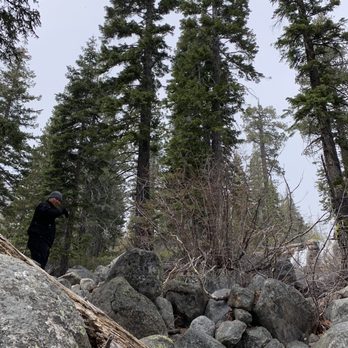
We did this yesterday and got a great workout. We did the out and back to Shirley Lake. During summer you can hike to the lake and then hike to the tram at Squaw Valley and take that back down for no cost. It is closed now. Be aware on this hike that it is not clearly marked in areas where the trail is primarily granite. Look for boulders that have a blue painted stripe. In areas where the trail is more forest look for blue painted rocks. You really have to be aware of where you are. We met up with other hikers who also looked for markers. The granite sections are physically demanding. Take your time and enjoy the views. Your reward at the lake is worth it.


6 years ago
Thank you to the hotel clerk who casually mentioned a spot to check out. What a treat it was to drive 3 hours from SF and be mystified with the views! read more




12 years ago
We did this yesterday and got a great workout. We did the out and back to Shirley Lake. During summer you can hike to the lake and then hike to the tram at Squaw Valley and take that back down for no cost. It is closed now. Be aware on this hike that it is not clearly marked in areas where the trail is primarily granite. Look for boulders that have a blue painted stripe. In areas where the trail is more forest look for blue painted rocks. You really have to be aware of where you are. We met up with other hikers who also looked for markers. The granite sections are physically demanding. Take your time and enjoy the views. Your reward at the lake is worth it. read more


16 years ago

9 years ago
7 years ago
I was in search for a hike to see a really cool waterfall and this was the perfect location. The water was crystal blue and there was tons of beautiful greenery. There were even blue spray painted, striped rocks along the trail to follow as one goes along. The hike isn't too long and follows the waterfall nearly the entire way. Google maps provides a better idea of where this trail is rather than apple maps. read more


14 years ago
More info about Shirley Lake Trailhead
Squaw Creek Rd
Squaw Valley, CA 96146
Directions
Hours
Outdoor Amenities
Ask the Community - Shirley Lake Trailhead
You might also consider















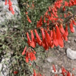
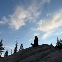
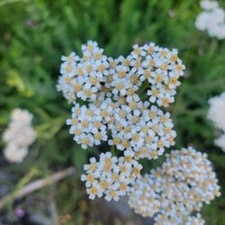
Shirley Lake Trailhead - hiking - Updated October 2026
Best of Squaw Valley
People found Shirley Lake Trailhead by searching for…
Hiking Trails With Waterfalls in Squaw Valley, CA
Indoor Rock Climbing in Squaw Valley, CA
Walking Trails in Squaw Valley, CA
Photo Spots in Squaw Valley, CA
Waterfalls and Swimming Holes in Squaw Valley, CA
Things to Do in Squaw Valley, CA
Climbing Gym in Squaw Valley, CA
Easy Hikes in Squaw Valley, CA
Dog Friendly Hiking Trails in Squaw Valley, CA
Parks for Kids in Squaw Valley, CA
Waterfalls in Squaw Valley, CA
Hikes With Dogs in Squaw Valley, CA
Hiking With Kids in Squaw Valley, CA
Running Trails in Squaw Valley, CA
Bouldering in Squaw Valley, CA
Scenic View in Squaw Valley, CA
Sunset View in Squaw Valley, CA
Fall Colors in Squaw Valley, CA
Playground in Squaw Valley, CA
Stair Climbing in Squaw Valley, CA
Trending Searches in Squaw Valley, CA
Browse Articles
Browse Nearby
BEST of Squaw Valley, California Coffee near Shirley Lake Trailhead
BEST of Squaw Valley, California Restaurants near Shirley Lake Trailhead
BEST of Squaw Valley, California Breakfast near Shirley Lake Trailhead
BEST of Squaw Valley, California Things to Do near Shirley Lake Trailhead
BEST of Squaw Valley, California Walking Trails near Shirley Lake Trailhead
BEST of Squaw Valley, California Photo Spots near Shirley Lake Trailhead
BEST of Squaw Valley, California Campgrounds near Shirley Lake Trailhead
BEST of Squaw Valley, California Sledding near Shirley Lake Trailhead
BEST of Squaw Valley, California Snow Tubing near Shirley Lake Trailhead
Browse Brands
Related Searches in Squaw Valley, CA
Best Fishing Locations and Guides in Squaw Valley, California
Best Places for Stunning Views in Squaw Valley, California
Best Sightseeing Experiences Available in Squaw Valley, California
Best Spots for Star Gazing in Squaw Valley, California
Best Waterfalls and Swimming Holes in Squaw Valley, California
Check Out Off Road Trails in Squaw Valley, California
Discover Dog Friendly Beaches Near Squaw Valley, California
Discover Popular Photo Spots in Squaw Valley, California
Discover the Best Beaches in Squaw Valley, California
Discover the Best Night Hike Trails in Squaw Valley, California
Enjoy Camping Adventures Around Squaw Valley, California
Enjoy Tent Camping Spots Around Squaw Valley, California
Experience Stunning Sunset Views in Squaw Valley, California
Explore Beautiful Parks and Green Spaces in Squaw Valley, California
Explore Bike Rentals Throughout Squaw Valley, California
Explore Family-Friendly Zoos and Wildlife in Squaw Valley, California
Explore Landmarks & Historical Buildings in Squaw Valley, California
Explore Popular Campgrounds Near Squaw Valley, California
Explore Popular RV Parks Around Squaw Valley, California
Explore Popular Scenic Overlook Points in Squaw Valley, California
Explore Popular Scenic Views Near Squaw Valley, California
Explore Popular State Park Destinations in Squaw Valley, California
Explore Popular View Points Around Squaw Valley, California
Explore Scenic Lakes to Visit in Squaw Valley, California
Explore Secret Spots Worth Visiting in Squaw Valley, California
Explore Summer Camps for All Ages in Squaw Valley, California
Explore Top Water Parks in Squaw Valley, California Today
Explore the Best Beach Spots in Squaw Valley, California
Find Beautiful Views in Squaw Valley, California
Find Cozy Camping Cabins in Squaw Valley, California
Find Exciting Tours to Take in Squaw Valley, California
Find the Best Scenic View Locations in Squaw Valley, California
Find the Best Swimming Pools in Squaw Valley, California Today
Hiking Trails With Waterfalls in Squaw Valley, California
Must-See Tourist Attractions Around Squaw Valley, California
Perfect Spots to Watch Sunset in Squaw Valley, California
Picnic Areas With BBQ Pits Available in Squaw Valley, California
Plan a Scenic Drive Route Near Squaw Valley, California
Popular Kids Activities in Squaw Valley, California
Popular Picnic Spots to Visit in Squaw Valley, California
Popular Places to Take Pictures in Squaw Valley, California
Popular Things to Do in Squaw Valley, California
Popular Things to See in Squaw Valley, California
Relax at Natural Hot Springs Near Squaw Valley, California
Safe River Swimming Areas in Squaw Valley, California
Top Swimming Lakes to Enjoy in Squaw Valley, California
Top-Rated Camping Sites in Squaw Valley, California
Where to Catch the Best Sunrise View in Squaw Valley, California


