Schnebly Hill Road Photos


You might also consider


More like Schnebly Hill Road
Recommended Reviews - Schnebly Hill Road
Start your review...


Reviews With Photos
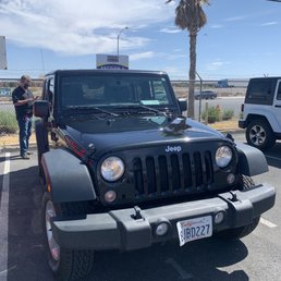

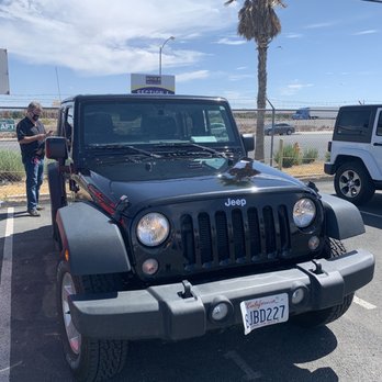
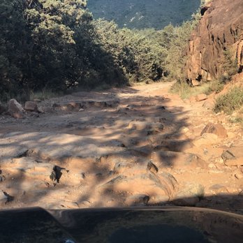
This trail is rated as "easy," and from what I've read about it; it used to be. I don't think it is being maintained anymore. My husband and I rented a Jeep Wrangler and thought this "easy". 11.8 mile trail would be fun to do before going out to dinner. First of all there is no way a vehicle that was not a 4x4 could complete this trail; there are HUGE boulders everywhere.....I'm talking rocks that are over a foot tall all over the trail, and often times there is no way to go but right over them! Add that to the fact that you have 2,000-3,000 foot drops all around you & it's pretty terrifying! I was the passenger and I was hanging on for dear life! The entire trail took almost 2 hours and I couldn't wait for it to be over! I had no idea it would take almost 2 hours to complete....and needless to say there are no bathrooms anywhere! No cell service most of the time either! Several Pink Jeep tours passed us: and maybe I would have felt more comfortable with an experienced guide who knew the area. My husband did seem to enjoy the ride; but I'm pretty sure he was a little scared at times too. I am from Florida where there are no hills; let alone mountains! I did learn one thing from this experience.....off-roading is not my cup of tea!


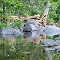
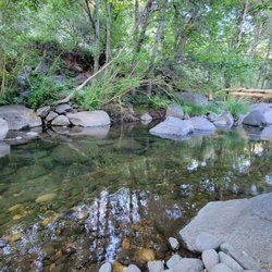
1994 before cell phones I was dating my first boyfriend who became my husband in the end. He took me camping to Sedona. Ages 21 and 22 we didn't think twice about leaving after work. By the time we arrived it was dark. The second day we made our way to Schnebly Hill road from a recommendation of a elder co-worker where I worked. We parked along the roadside and camped by a little creek. Not being established with camping gear we had a foam cooler, a tent and new sleeping bags. We also brought snacks, extra lean ground beef, eggs and drinks. As we set the tent the it rained. Later our weak foam cooler fell apart. He made giant burgers with thr meat I brought. Being used to a higher fat content meat he made them thin and as big as our heads. They never shrank. Ha ha For some reason the eggs refused to cook. A giant spider was hanging out on my toe at one point. With all the crazy things that happened we enjoyed one another and worked through it with smiles and laughter. Who knew this would end up being my life partner and best friend. That is why Schnebly Hill will always have a special place in my heart. It is paved for a short distance. Even on the sides of the pavement there are giant gouges that have washed away you must be careful of as thr hide in the shadows. Where the pavement ends is way rougher than it was when we went over 25 years ago. I do not recommend anything but offroad vehicles here. Take a Pink Jeep Tour and they will take you here. They have been running tours through here even before our first camping trip. So friendly and fun.


Amazing Road between the I 17 in Sedona that lets you go off in the middle of nowhere and do whatever you want. Most of the road is passable buy car but down toward Sedona it definitely gets into height clearance 4 x 4 territory. Lots of pink jeep tour is to annoy you as you drive your truck down this road. Great weather in that can fluctuate readily
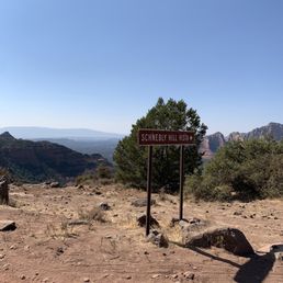

Super long (to me) trail that is a little on the rough side. You're on the side of a cliff a lot of the time, but you're working your way up to the vista. We were in a four-wheel-drive but saw a few non-off-road vehicles try to make it up. Not recommended for sure! Again, a little long for my taste but once you make it to the top, the views are absolutely breathtaking. If you are driving a jeep up, download the jeep badge of honor app and you will earn a jeep badge for your vehicle for completing this trail.


My family and I rented a Polaris RZR and made our way up to Schnebly Hill Vista, view point. Felt like we were never going to get there. Finally after what felt like a LONG drive, we made it to a beautiful scenic view. Can't complain about the view it self. Although there were views along the road to the view point that were waay better. It's a little hard to stop and pull over for a picture since other vehicle's (Jeeps&truck lady crew :) ) and other OTV's are passing by. By the time we got back down to the road my wife suffered from motion sickness :/ HELPFUL TIPS:if you get motion sickness, stand by, it's a rocky road. Also, Mesa Airport views are just as great without the long hideous drive. On my next visit I will definitely pass up this OTV trail. & Finally, don't attempt to take your Nissan Rogue SUV or similar vehicle up this trail, you won't make it.
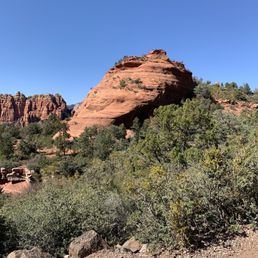


Gorgeous. Camping is great. There's elk running through the campsites at times. A couple miles in and there's an incredible lookout. The road gets too dangerous for a normal car after you pass the lookout. Don't take your car past it. Off road vehicles can continue down to Sedona but you'll be driving over lots of boulders. Definitely worth the view if you can do it.
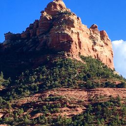

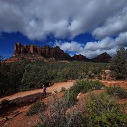
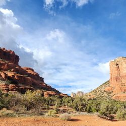
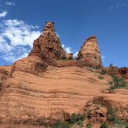
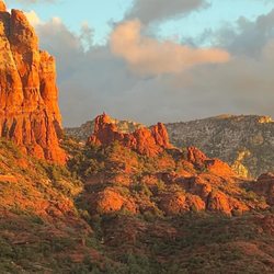
Schnebly Hill Road begins @ the roundabout on AZ179 near Tlaquepaque. The paved section ends about a mile from the Sedona side. There's a large turnaround parking lot with picnic tables, which was just what we were looking for. The trailhead gave us a choice of moderate hiking trails. We stopped frequently to take photos, as it was a sunny blue-sky day with many magnificent towering red rock formations above Sedona. Amazing sunset colors against the rocks.


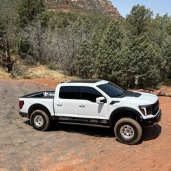
I hope you are ready to do some serious off roading. Get your 4x4 and hit this trail. An absolute gem. Yes this is one of many trails you can hit in Sedona. It is long and about medium difficulty, but even an amateur like myself can get through it. I took my #TundraTRDPro and it took it like a champ. Mind you my Tundra is stock. No modifications whatsoever. Once you get near the top the view is incredible. A Rock at the top which is very easy to reach by foot provides stunning... and I mean STUNNING view of the whole valley. Intimidating yet serene, it is a place one must see. Obviously the ascend took longer than the descent. And not the road is not narrow, providing plenty of room for two way traffic. At any point you can make a stop, get off and enjoy nature. Not heavily trafficked by vehicles either which is perfect. And best of all... it is FREE! Highly recommended Follow me and my adventures fb: Sin Aguayo Ig: @SinAguayo


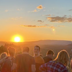
Yes it goes all the way through! I took this route from the Sedona side. It felt like it took forever but it was fun! I took it at sunset and it was beautiful! It gets rough in some spots but the last couple miles are easy and smooth, just before you merge onto the 17. It places you about 15 miles outside of Sedona so it's about a 25 minute drive back to town. I would say this is more of a easy-moderate drive!
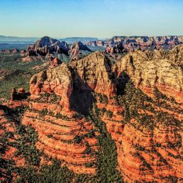


This is a very scenic trail with a few good views overlooking sedona. It connects to the i-17 to Sedona but takes maybe 2 hours so I like to use it when leaving or driving into sedona. It's barely rougher than a dirt road but there are quite a few places a car would have clearance issues so I would recommend a 4x4.


10 months ago
Took this trail with my younger brother and it was such a fun off-road trail. The trail itself isn't too challenging and the scenery was spectacular! We started at the top and went one direction down into Sedona this method was something my brother had read was a better approach and while I don't have anything to compare it to, I did appreciate doing it this way instead of an out and back. If you're in the mood to get a little mud on the tires I highly recommend this spot! read more


2 years ago


This trail is rated as "easy," and from what I've read about it; it used to be. I don't think it is being maintained anymore. My husband and I rented a Jeep Wrangler and thought this "easy". 11.8 mile trail would be fun to do before going out to dinner. First of all there is no way a vehicle that was not a 4x4 could complete this trail; there are HUGE boulders everywhere.....I'm talking rocks that are over a foot tall all over the trail, and often times there is no way to go but right over them! Add that to the fact that you have 2,000-3,000 foot drops all around you & it's pretty terrifying! I was the passenger and I was hanging on for dear life! The entire trail took almost 2 hours and I couldn't wait for it to be over! I had no idea it would take almost 2 hours to complete....and needless to say there are no bathrooms anywhere! No cell service most of the time either! Several Pink Jeep tours passed us: and maybe I would have felt more comfortable with an experienced guide who knew the area. My husband did seem to enjoy the ride; but I'm pretty sure he was a little scared at times too. I am from Florida where there are no hills; let alone mountains! I did learn one thing from this experience.....off-roading is not my cup of tea! read more

4 years ago
1994 before cell phones I was dating my first boyfriend who became my husband in the end. He took me camping to Sedona. Ages 21 and 22 we didn't think twice about leaving after work. By the time we arrived it was dark. The second day we made our way to Schnebly Hill road from a recommendation of a elder co-worker where I worked. We parked along the roadside and camped by a little creek. Not being established with camping gear we had a foam cooler, a tent and new sleeping bags. We also brought snacks, extra lean ground beef, eggs and drinks. As we set the tent the it rained. Later our weak foam cooler fell apart. He made giant burgers with thr meat I brought. Being used to a higher fat content meat he made them thin and as big as our heads. They never shrank. Ha ha For some reason the eggs refused to cook. A giant spider was hanging out on my toe at one point. With all the crazy things that happened we enjoyed one another and worked through it with smiles and laughter. Who knew this would end up being my life partner and best friend. That is why Schnebly Hill will always have a special place in my heart. It is paved for a short distance. Even on the sides of the pavement there are giant gouges that have washed away you must be careful of as thr hide in the shadows. Where the pavement ends is way rougher than it was when we went over 25 years ago. I do not recommend anything but offroad vehicles here. Take a Pink Jeep Tour and they will take you here. They have been running tours through here even before our first camping trip. So friendly and fun. read more


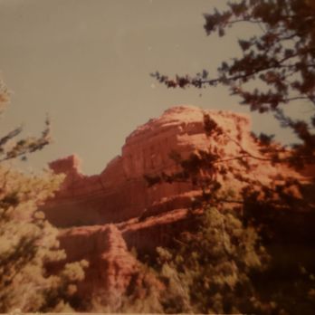

Great Trail to go on good scenery see waterfalls fron the rain and snow run off you need four wheel drive though at least I would recommend it but went to make it to the top time with the little mountain and the great view of the canyon read more


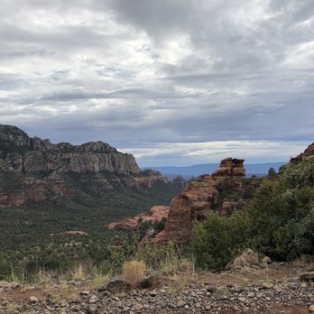
Amazing Road between the I 17 in Sedona that lets you go off in the middle of nowhere and do whatever you want. Most of the road is passable buy car but down toward Sedona it definitely gets into height clearance 4 x 4 territory. Lots of pink jeep tour is to annoy you as you drive your truck down this road. Great weather in that can fluctuate readily read more





5 years ago
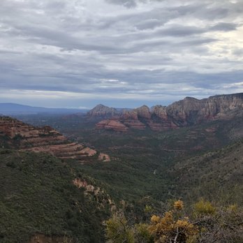
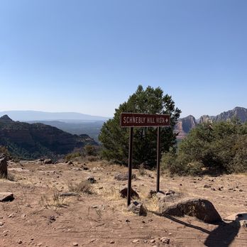
Super long (to me) trail that is a little on the rough side. You're on the side of a cliff a lot of the time, but you're working your way up to the vista. We were in a four-wheel-drive but saw a few non-off-road vehicles try to make it up. Not recommended for sure! Again, a little long for my taste but once you make it to the top, the views are absolutely breathtaking. If you are driving a jeep up, download the jeep badge of honor app and you will earn a jeep badge for your vehicle for completing this trail. read more


6 years ago
My family and I rented a Polaris RZR and made our way up to Schnebly Hill Vista, view point. Felt like we were never going to get there. Finally after what felt like a LONG drive, we made it to a beautiful scenic view. Can't complain about the view it self. Although there were views along the road to the view point that were waay better. It's a little hard to stop and pull over for a picture since other vehicle's (Jeeps&truck lady crew :) ) and other OTV's are passing by. By the time we got back down to the road my wife suffered from motion sickness :/ HELPFUL TIPS:if you get motion sickness, stand by, it's a rocky road. Also, Mesa Airport views are just as great without the long hideous drive. On my next visit I will definitely pass up this OTV trail. & Finally, don't attempt to take your Nissan Rogue SUV or similar vehicle up this trail, you won't make it. read more


10 years ago

7 years ago
My friend and I rented an ATV and went up the trail. It was such an amazing experience. The views are absolutely breath taking. We had so much fun and loved this trail!!! read more


4 years ago
Gorgeous. Camping is great. There's elk running through the campsites at times. A couple miles in and there's an incredible lookout. The road gets too dangerous for a normal car after you pass the lookout. Don't take your car past it. Off road vehicles can continue down to Sedona but you'll be driving over lots of boulders. Definitely worth the view if you can do it. read more


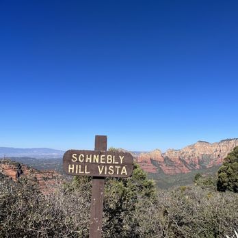

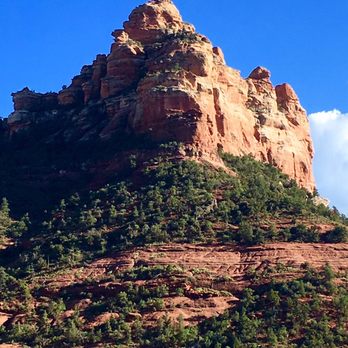
Schnebly Hill Road begins @ the roundabout on AZ179 near Tlaquepaque. The paved section ends about a mile from the Sedona side. There's a large turnaround parking lot with picnic tables, which was just what we were looking for. The trailhead gave us a choice of moderate hiking trails. We stopped frequently to take photos, as it was a sunny blue-sky day with many magnificent towering red rock formations above Sedona. Amazing sunset colors against the rocks. read more


6 years ago
I hope you are ready to do some serious off roading. Get your 4x4 and hit this trail. An absolute gem. Yes this is one of many trails you can hit in Sedona. It is long and about medium difficulty, but even an amateur like myself can get through it. I took my #TundraTRDPro and it took it like a champ. Mind you my Tundra is stock. No modifications whatsoever. Once you get near the top the view is incredible. A Rock at the top which is very easy to reach by foot provides stunning... and I mean STUNNING view of the whole valley. Intimidating yet serene, it is a place one must see. Obviously the ascend took longer than the descent. And not the road is not narrow, providing plenty of room for two way traffic. At any point you can make a stop, get off and enjoy nature. Not heavily trafficked by vehicles either which is perfect. And best of all... it is FREE! Highly recommended Follow me and my adventures fb: Sin Aguayo Ig: @SinAguayo read more


4 years ago

8 years ago
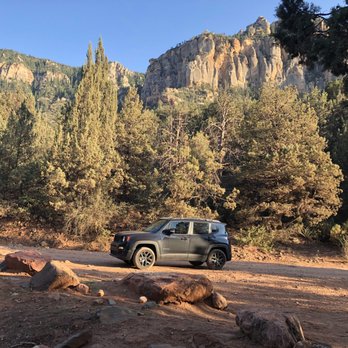
Yes it goes all the way through! I took this route from the Sedona side. It felt like it took forever but it was fun! I took it at sunset and it was beautiful! It gets rough in some spots but the last couple miles are easy and smooth, just before you merge onto the 17. It places you about 15 miles outside of Sedona so it's about a 25 minute drive back to town. I would say this is more of a easy-moderate drive! read more




5 years ago

8 years ago

8 years ago
SUV or Truck suggested for better ground clearance ,albeit I got about 6 miles in to Schnebly Hill Vista point for this Photograph in a FWD Camry / no worries. One of the most Incredible Drive's One Can Take in Arizona period. read more



8 years ago

11 years ago
This is a very scenic trail with a few good views overlooking sedona. It connects to the i-17 to Sedona but takes maybe 2 hours so I like to use it when leaving or driving into sedona. It's barely rougher than a dirt road but there are quite a few places a car would have clearance issues so I would recommend a 4x4. read more


9 years ago
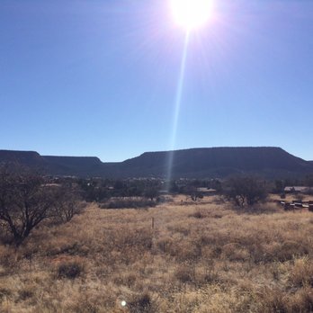
Excellent Off Road Trail that you can start from Sedona or the I17. This trail is VERY bumpy most of the time but the views are amazing and there are lots of camping and hiking trail throughout... Some Off Road books claim that a car or minivan can make this trail but that is not the case. 4x4 and high clearance is recommended. read more


7 years ago

11 years ago

10 years ago

10 years ago
More info about Schnebly Hill Road
Schnebly Hill Road
Sedona, AZ 86336
Directions
Hours
Outdoor Amenities
Ask the Community - Schnebly Hill Road
Review Highlights - Schnebly Hill Road
You might also consider















Why does Yelp recommend reviews?
1 review that is not currently recommended
The reviews below are not factored into the business's overall star rating.

11 months ago
Schnebly Hill Road - hiking - Updated May 2026
Best of Sedona
People found Schnebly Hill Road by searching for…
Trending Searches in Sedona, AZ
Boat Rental near Schnebly Hill Road
Botanical Gardens near Schnebly Hill Road
Bounce House Rentals near Schnebly Hill Road
Campgrounds near Schnebly Hill Road
Cliff Jumping near Schnebly Hill Road
Creeks near Schnebly Hill Road
Dog Friendly Things To Do near Schnebly Hill Road
Flower Fields near Schnebly Hill Road
Flower Shop near Schnebly Hill Road
Garage Sales near Schnebly Hill Road
Lakes & Ponds near Schnebly Hill Road
Movie Theatre near Schnebly Hill Road
Nurseries & Gardening near Schnebly Hill Road
Outdoor Activities near Schnebly Hill Road
Outdoor Furniture Stores near Schnebly Hill Road
Party Equipment Rentals near Schnebly Hill Road
Pedicure near Schnebly Hill Road
Pick Your Own Farms near Schnebly Hill Road
Picnic Areas near Schnebly Hill Road
Rainy Day Activities near Schnebly Hill Road
Running Trails near Schnebly Hill Road
Scenic Drive near Schnebly Hill Road
Secret Spots near Schnebly Hill Road
State Parks near Schnebly Hill Road
Sunrise View near Schnebly Hill Road
Swimming Holes near Schnebly Hill Road
Things To Do On A Rainy Day near Schnebly Hill Road
Browse Nearby
Browse Brands
Related Searches in Sedona, AZ
Affordable Kayak Rental Services in Sedona, Arizona
Best Fishing Locations and Guides in Sedona, Arizona
Best Places for Horseback Riding in Sedona, Arizona
Best Waterfalls and Swimming Holes in Sedona, Arizona
Check Out Off Road Trails in Sedona, Arizona
Discover Dog Friendly Trails to Explore in Sedona, Arizona
Discover Kid Friendly Hiking Trails in Sedona, Arizona
Discover Scenic Mountain Bike Trails Near Sedona, Arizona
Discover Scenic Waterfall Spots in Sedona, Arizona
Discover a Hiking Trail in Sedona, Arizona
Discover the Best Night Hike Trails in Sedona, Arizona
Dog-Friendly Hikes With Dogs in Sedona, Arizona
Enjoy Camping Adventures Around Sedona, Arizona
Enjoy Exciting Mountain Biking Adventures in Sedona, Arizona
Enjoy Kayaking Adventures in Sedona, Arizona
Enjoy Tent Camping Spots Around Sedona, Arizona
Enjoy the Best Picnic Spots and Ideas in Sedona, Arizona
Enjoy the Best Walking Trails in Sedona, Arizona
Exciting Cliff Jumping Spots in Sedona, Arizona
Experience Thrilling White Water Rafting in Sedona, Arizona
Explore Beautiful Parks and Green Spaces in Sedona, Arizona
Explore Bike Rentals Throughout Sedona, Arizona
Explore Easy Hikes Perfect for All in Sedona, Arizona
Explore Fun Activities to Do in Sedona, Arizona
Explore Popular Campgrounds Near Sedona, Arizona
Explore Top Dog Parks in Sedona, Arizona Near You
Explore the Best Boating Spots in Sedona, Arizona
Explore the Best Swimming Holes Around Sedona, Arizona
Explore the Best Trail Options in Sedona, Arizona
Family Friendly Hiking With Kids in Sedona, Arizona
Find Beautiful Views in Sedona, Arizona
Find Parks and Recreation Activities in Sedona, Arizona
Find Popular Ziplining Spots Around Sedona, Arizona
Find the Best Parks for Picnics in Sedona, Arizona
Find the Best Scenic View Locations in Sedona, Arizona
Hiking Trails With Waterfalls in Sedona, Arizona
Off Leash Dog Hiking Trails in Sedona, Arizona
Plan a Scenic Drive Route Near Sedona, Arizona
Popular Fishing Spots to Explore in Sedona, Arizona
Popular Outdoor Activities to Try in Sedona, Arizona
Popular Picnic Spots to Visit in Sedona, Arizona
Popular Things to Do in Sedona, Arizona
Safe River Swimming Areas in Sedona, Arizona
Safe and Fun Parks for Kids in Sedona, Arizona
Top Climbing Spots and Gyms in Sedona, Arizona
Top Running Trails to Explore in Sedona, Arizona
Top Swimming Spots and Pools in Sedona, Arizona
Top Things to Do With Kids in Sedona, Arizona
Browse Articles
People who viewed Schnebly Hill Road also viewed

Broken Arrow Trail
62 reviews

Boynton Canyon Trail
99 reviews

Raven's Cave Trail
4 reviews

Brins Mesa Trail #119
19 reviews

Wilson Mountain Trail
8 reviews

Baldwin Trail
13 reviews

Airport Mesa
146 reviews

Grasshopper Point Swimming & Picnic Area
45 reviews

Crescent Moon Picnic Site
27 reviews

Chuckwagon Trail
6 reviews