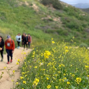
1. Santiago Creek Trail

0

,

Cancel

Open app

Search

Santiago Creek Trail

5.0 (7 reviews)

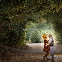
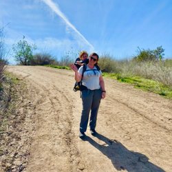
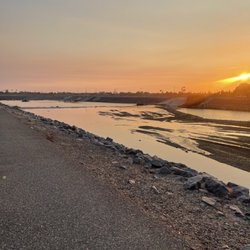
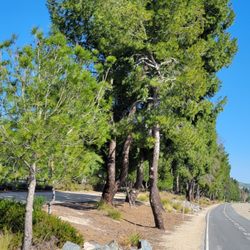
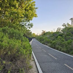
Santiago Creek Trail Photos

You might also consider

Recommended Reviews - Santiago Creek Trail

Your trust is our priority, so businesses can't pay to alter or remove their reviews. Learn more about reviews.
Yelp app icon
Browse more easily on the app
Review Feed Illustration

1 year ago

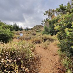
So beautiful!! It's mountain lion county so be aware but for the most part it's very nice & comforting

Helpful 0
Thanks 0
Love this 1
Oh no 0

4 years ago

Helpful 8
Thanks 1
Love this 2
Oh no 0
Photo of Martha F.
0
62
101

2 years ago

Helpful 3
Thanks 0
Love this 4
Oh no 2

3 years ago

Liked it nice area, good to take the dog and go for a long walk. Inexpensive facilities are in good condition

Helpful 1
Thanks 0
Love this 0
Oh no 1
Photo of Candice L.
266
109
82

2 years ago

Helpful 3
Thanks 0
Love this 0
Oh no 2

2 years ago

Nice place to hike at just a very beautiful place. Theres easy hikes and slight intense

Helpful 1
Thanks 0
Love this 0
Oh no 1
Photo of Jon B.
203
3
0

7 years ago

Helpful 3
Thanks 0
Love this 3
Oh no 5

Ask the Community - Santiago Creek Trail

You might also consider

Verify this business for free

People searched for Hiking 6,108 times last month within 15 miles of this business.

Verify this business

Peters Canyon Hike - 1st timer here w Powee Dowee. Started @ 11:15 finished at 12:37 p.m. 9,031 steps 2.04.26
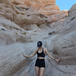
Peters Canyon Hike

4.4(386 reviews)
4.9 km

Great place for a hike. There is hardly any shade though so best to go early in the am, or early…read moreevening, or cloudy day. You will get a great workout. You can park at the start of the park where gps takes you or I start on the back side. You can go for 4mile along the top route &/or the hike around the lake. You choose. When there's rain, it's beautiful to see the surroundings. Otherwise, it's a little dry. I've seen it all. Been hiking this for year. SYOY!

Review 30/365 day challenge 2.04.26…read more Finally made it here to PC for a late morning hike w my hiking Gfren Pow. She's a regular here and been coming. Have told mee several times she loves this hike and it's a good hike where it's a bit more busier than other hiking trails that you feel safe to go to. Started the hike a little late morning around 11:15 a.m. and finished right before 12:40 p.m. A little over 4 miles. We went to a much easier hike trail. Where it was much shading area until you enter the hiking trail and then it was full of sun. Luckily it was a bit breezy so wasn't too fully hot. There's different areas to park, some where it's free of charge and they have the main parking where supposedly have av actual public restroom for $ 3. We parked near some residential area. Right before entering the entrance where the trail started, there was about 5 porter potties available. As all hikes there are warning signs of Rattlesnakes, poison ivy, mountain lions etc. Located in Tustin borderline of Orange. Not too far from Irvine Regional park off Jamboree. Will definitely return to hike here and check out the different trails.

Photos
Peters Canyon Hike - Beautiful Wednesday afternoon w Powee Dowee 2.04.26

Beautiful Wednesday afternoon w Powee Dowee 2.04.26

Peters Canyon Hike - Beautiful Wednesday afternoon w Powee Dowee 2.04.26

Beautiful Wednesday afternoon w Powee Dowee 2.04.26

Peters Canyon Hike - Family memories

See all

Family memories

Santa Ana River Trail

Santa Ana River Trail

4.1(117 reviews)
7.9 km

I have had this place bookmarked forever and finally experienced the Santa Ana River Trail. I live…read morein the neighboring apartments by the Angel Stadium so I have no idea why it has taken me almost two years to finally experience this gem! Entrance: Multiple entrances but the one most convenient to my apartment is right by Angel stadium parking lot across from golden road which is DuPont and Orangewood. If you don't live in the nearby apartments then I recommend parking by golden road brewery and walking over. You will see bike pathways with entrances (attached photo). Otherwise, the bike trail has quite a few bikers so don't be that annoying pedestrian that is in the way. Walk along the side, lol. If you enter by Angel Stadium the trail to the left will take you down to Honda center, roughly 1.2 miles, maybe a little less. Otherwise, the trail circles back and takes you down to Orange, and then some. I stopped around 4 miles since it started to drizzle but would love to see how long this trail can go! Tip--they cleaned up this trail tremendously. I saw no homeless people or anybody loitering. I felt safe going by myself on a Sunday morning.

I've been biking on this trail everyday now. Personally, I'm getting more and more fond of it. It's…read moretrying to be part of my lifestyle these days. The trail is relatively safe. I don't see as many homeless people as I used to which is a very nice and refreshing. Some of the landscapes along the trail are just too beautiful. Who needs a gym when you have the Santa Ana River Trail!

Photos
Santa Ana River Trail

See all

Red Rock Canyon

Red Rock Canyon

4.7(136 reviews)
16.5 km

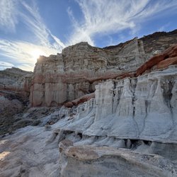
I had no idea Red Rock was so close to us. We did a day trip and it was perfect. October is…read moredefinitely the time of year to go. It's sunny, but breezy and cool once you get to hike. It is a desert , but it is a beautiful experience. The different layered rocks really stand out on the cliffs and they go as far as you can see. The sunset here is also beautiful as the light hits the colored cliffs. The trails are pretty straightforward. A little over a mile in length. Bring water and electrolytes. Ideally a camel pak.

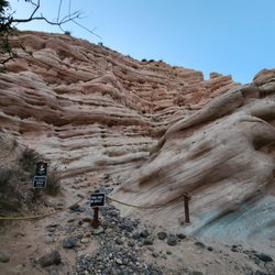
Red Rock Canyon is located in the City of Lake Forest. Who knew one could view glimpses of red rock…read moreformations and plateaus in Orange County? When we arrived around 8:30 on a Saturday morning, the paid parking lot was already full. There are very few parking spaces overall in the paid $3 lot. We ended up as Ralph's customers that morning and found a couple of last-minute items that we needed before starting our hike. It was a nice and cool morning with a slight breeze, which was perfect to kick off our hike. We opted to take the easy trail, Borrego Canyon Trail. There is a lot of soft sand through out parts of the trail, similar to a beach like sensation for your walking pleasure. It also felt like a magical forest during some areas with trickling streams. We also experienced some parts full of various sized rocks. This is NOT a child- friendly trail for little ones. As we approached parts that were more desert like, we got closer to the red rocks. There was much anticipation to the end and the trail concludes with what feels like a small dead end as you gaze into the view of the towering red rocks. Going downhill was much quicker and fun. It was an easy trail with some sections that forced me to go slower as I didn't want to slip on some small rocks. There was so much positivity coming from other hikers and bicyclists. So many good mornings shared, it was contagious. Bicyclists are one-way so they are only coming from behind you and so many were thankful for us moving out of their way. I've never experienced such polite and friendly trail enthusiasts. I'd love to return to experience this beautiful trail again.

Photos
Red Rock Canyon - I'm definitely on Mars!

I'm definitely on Mars!

Red Rock Canyon
Red Rock Canyon

See all

Carbon Canyon Regional Park - Squirrelly came to visit :)

Carbon Canyon Regional Park

4.4(360 reviews)
14.8 km

Overall a wonderful park - lots of PLAYGROUNDS for all ages, TENNIS COURTS, nice walking paths, big…read moregrass areas, and public RESTROOMS throughout the park. The playgrounds are so much fun for our kids and it is also a great space for picnics too. There is a lot of parking here and it's never too busy. Only downside is that you have to pay $3 to $5 to get in but it is well worth it. Definitely one of our top favorite parks to bring the family.

I looked for walking spots in the Brea area and this park popped up. There was a bit of a line to…read moreget in on Memorial Day and the cost for parking on a holiday was $7. The display also showed $5 for weekends and $3 midweek. We wanted to do the Redwood trail and were directed to parking lot A. The park is big and beautifully landscaped with a pond and various picnic areas that can be rented in advance. There is enough space to set up all kinds of games. We brought a picnic lunch and sat on a bench that was perfectly situated alone amongst the desert plants. After lunch, we followed the signs for the Redwood Grove Trail which was labeled as easy and is a 1.5 miles dirt trail to the Redwood trees. When you arrive you'll see a small Redwood forest with the history of the trees displayed before you enter. A really beautiful and peaceful spot to relax for a bit. On our way back we decided to take the Creek Trail to see where it would lead us. I was hoping to see water at the end of this trail. But, we only saw a bunch of rocks at one point that may be filled with water if it rains. The end of this trail did lead us to a beautiful butterfly garden and the opposite end of the park. We made the walk back and stopped at the pond. There appeared to be other trails surrounding the park and a trail that leads to the Carbon Canyon Dam.

Photos
Carbon Canyon Regional Park - Redwoods!!

Redwoods!!

Carbon Canyon Regional Park - Family Photos 2023

Family Photos 2023

Carbon Canyon Regional Park - Fun in the sun :) my baby girl she makes me so proud

See all

Fun in the sun :) my baby girl she makes me so proud

Santiago Creek Trail - hiking - Updated October 2026

Loading...
Loading...
Loading...