Cancel

    Open app

    Search

    Sandspit Beach

    4.4 (9 reviews)

    Sandspit Beach Photos

    You might also consider

    Recommended Reviews - Sandspit Beach

    Your trust is our priority, so businesses can't pay to alter or remove their reviews. Learn more about reviews.
    Yelp app icon
    Browse more easily on the app
    Review Feed Illustration

    Reviews With Photos

    Blue Heron
    Roger M.

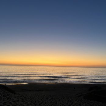
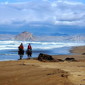
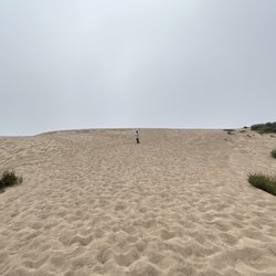
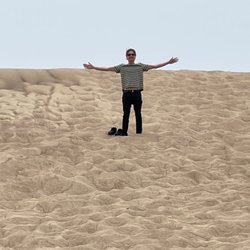
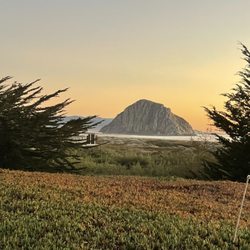
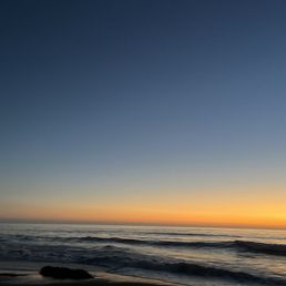
    Sandspit is a stretch 10 miles of Sand dunes helping to form the Morro Bay lagoon. On this winter day - It's picturesque. Easy walking. Waves mesmerizing. Sky clouded. Glorious sunshine. Go barefoot and connect to ground with your Mother Earth. Earthing (also known as grounding) refers to contact with the Earth's surface electrons by walking barefoot outside that transfers the energy from the ground into the body. Oh yea! It's free. Get me some more of that grounding! Free earth to me - tune up! No big winds, probably due to direction the spit faces. Walking up onto the dunes uses more energy as your sink into the sand - takes a little more work. Just breathtaking views up or down the coast, but looking Northward you can see Morro Rock, the volcanic plug 580 feet tall jetting out of the bay. Keep an eye out for shells and shore birds like to walk with you. Stay grounded and walk the sandpit!
    Located inside of Montana de Oro State Park
    Shayla B.

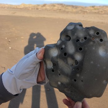
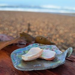
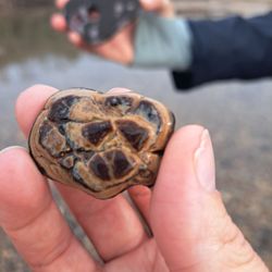
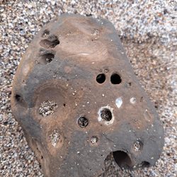
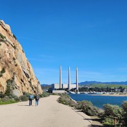
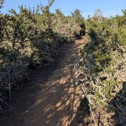
    A secluded beauty! Probably one of the most peaceful beaches that I've ever encountered. A beach that's far less travelled with very few visitors. While I was on my way to Montana de Oro, I saw a sign along the road that read "Sandspit Beach". Pause! This wasn't where I was supposed to be going, but the explorer in me just had to go and see this beach. The end of the road took me to a small parking lot. It was still fairly early, and there were lots of empty spaces. I spotted a few benches near what looked to be a walking trail. A closer look revealed that this trail provided access to the beach. The trail was less than a half mile and had several warning signs about recurring rip currents on the beach. Maybe this was why I didn't see too many people parked? I guess the half mile walk to the beach could be a deterrent as well. But, holy Mother... reaching the end of this path felt like I had just stepped into Heaven. I practically had this beautiful beach all to myself! It wasn't the warmest day, but way warmer than it had been. I could feel the sun on my back as the wind from the waves blew across my face. Peaceful. It was the only word that I could think of at the time. I just sat there and watched the waves. To my left, a gorgeous view of the central coastline. To my right, a stunning view of Morro Rock in the distance surrounded by the bluest waters of the ocean. And right in front of me lay these magical waves and calming currents that just seemed to flow so effortlessly. Hypnotizing... the type of beach that makes you want to spend your entire day there. No interruptions, and nothing to worry about. If it had been warmer, I would gotten in and fully enjoyed. The sand is so soft and full of bull kelp. I found a couple of pretty sea shells that I ended up taking home with me. There aren't a ton of rocks for collecting, but some hidden gems can be found amongst the sand dunes for sure. Only 2 surfers, 1 runner, and a friendly couple were spotted while I spent time at this beach. Granted it was during the winter time, but I can already tell that this one doesn't get very busy. It's quiet. It's stunning. It's secluded. It's definitely a place that I am planning on visiting again this summer to escape the overly crowded Bay Area beaches. I'm so happy that I discovered it and I'm looking forward to coming back.
    See all

    10 months ago

    Helpful 2
    Thanks 0
    Love this 0
    Oh no 0

    6 years ago

    Helpful 9
    Thanks 0
    Love this 8
    Oh no 1

    3 years ago

    Helpful 0
    Thanks 0
    Love this 0
    Oh no 0
    Photo of Paul M.
    994
    751
    19617

    5 years ago

    Helpful 17
    Thanks 0
    Love this 11
    Oh no 0

    6 years ago

    Helpful 1
    Thanks 0
    Love this 5
    Oh no 0

    8 years ago

    Helpful 20
    Thanks 0
    Love this 24
    Oh no 0
    Photo of Ed T.
    74
    770
    2239

    6 years ago

    Helpful 2
    Thanks 0
    Love this 2
    Oh no 1

    10 years ago

    Helpful 3
    Thanks 0
    Love this 4
    Oh no 0

    9 years ago

    Helpful 2
    Thanks 0
    Love this 1
    Oh no 0

    Ask the Community - Sandspit Beach

    Verify this business for free

    People searched for Beaches 1,048 times last month within 15 miles of this business.

    Verify this business

    Montana de Oro State Park - Montaña de Oro State Park

    Montana de Oro State Park

    4.7(350 reviews)
    2.3 mi

    Located in 3550 Pecho Valley Rd, Los Osos, CA 93402 Montaña de Oro…read moreis 15 miles west of San Luis Obispo on Los Osos Valley Rd. until it turns into Pecho Valley Rd. I have been there many times since seven years ago and there used to be a set of wooden stairs that I would use them for getting to the beach but since two years ago they closed that path. It changed a lot during years ago but it still beautiful. People come here for walking, bicycling, surfing, swimming, camping and believe or not they used have free WiFi there. During thanksgiving and Black Friday I decided to go to nature instead of shopping; therefore, I went to a couple places including Montana de Oro and I am glad that I did that. It's was refreshing and very nice.

    I felt it was only appropriate to review one of my favorite state parks for my 1000th review…read more This park has an extensive history dating back to the Chumash Native American inhabitation. These people lived here long before European explorers arrived. The park was purchased in 1965 by the State of California and made a state park. Prior to it becoming a state park, the land was used for agricultural use as well as farming and dairy use. It consists of 8000 acres of cliffs, seven miles of shoreline, coastal plains, canyons and hills. There is such a peaceful and calm vibe that you feel as you enter the park. As you enter through this colossal Eucalyptus forrest, you are mesmerized with their size. Clouds flow through the forrest and open up to the mighty Pacific Ocean. I always feel like I am entering a different world when I come here. There are so many fun trails to hike at ocean level, mountain level etc. Abundant wildlife is everywhere. You can also just take leisurely walks and enjoy the beauty of the ocean. Plenty of places to picnic, and a small beach to hang out with family and friends. There is also a small campground but what a great place to camp! Dogs are allowed but need to be on a leash. My first time out here was back in 2021. I mainly walked the Bluff Trail and took in the wind shaped jagged cliffs, caves, and rocky shore. I then completed a long beach walk on the strand that led from the park to the shores of Morro Rock. I saw so many dead jellyfish which was odd. I also saw huge turkey vultures. The next summer I took a recommendation from a worker at a local coffee shop. He told me all about Coon Creek trail. I started on this trail but it was pretty flat and I wanted something a little more challenging. I saw a sign for Oats Peak Summit and I went for it. A steep climb but so worth it at the top. Views were incredible on this ultra sunny day. Last summer I took my hubby with me and we decided to hike Valencia Peak. Hiking from sea level up to 1,347 feet proved to be a challenge but such a fabulous reward at the top. I could have spent the day up there just taking in the 360 degree views of the ocean, Morro Bay, Los Osos, and the SLO valley in the background. We absolutely loved this hike! If you find yourself lucky enough to be visiting the central coast, be sure to check out this phenomenal state park. It's truly one of California's finest offerings. Most of all remember to pack in and pack out - LEAVE NO TRACE.

    Photos
    Montana de Oro State Park - Bluff Trail at Montaña de Oro State Park - Los Osos, CA

    Bluff Trail at Montaña de Oro State Park - Los Osos, CA

    Montana de Oro State Park - Bluff Trail at Montaña de Oro State Park - Los Osos, CA

    Bluff Trail at Montaña de Oro State Park - Los Osos, CA

    Montana de Oro State Park - Montaña de Oro State Park

    See all

    Montaña de Oro State Park

    Monarch Butterfly Groves - Los Osos - It was not fun climbing the sand dune

    Monarch Butterfly Groves - Los Osos

    5.0(1 review)
    1.0 mi

    This monarch buttery preserve location is not very well known online. It is definitely a must to…read morevisit if you're in California Central Coast area and want to go on a good hike! Let me share some details about this preserve area. Background: This is a community project that successfully created a temporary home for the beautiful monarch butterflies. They're usually available from October to March. At the time we visited in June, they were all gone. We did get lucky and saw 2 butterflies! It is about 18 acre in size Location: The preserve is situated at the end of Monarch Lane in Los Osos. Parking: Free street parking! Fee: Free! What's out here: There is a sign "Coastal Access Trail Open To The Public" when you get to the end of the cul-de-sac. The beginning of the trail is filled with eucalyptus trees and it smells amazing! As you follow the fence line in the eucalyptus grove, you'll eventually reach an open area that is filled with coastal grass land. The grass land is enormous and you can hike in any directions you like. If you just hike straight for about half a mile, you'll eventually reach the sand dune. After you hike up the sand dune, you'll reach the ocean in another half mile. The beach was extremely secluded. As you hike, you'll see various plants and critters. This is my first time out here and thought I let you know what's to expect: - This area is coastal so you'll be hiking in sand! Bring shoes and flip flop! - There is no bathroom - There is no shades after the eucalyptus grove area. In the grassland, you'll see a few trees and that's about it! I recommend bringing a hat and lots of sunscreen for your excursion. - From the entrance to the beach is about 1 mile long. - If you want to enjoy the beach, bring beach gears. - The sand dune is a huge hill. - There are lots of horse poops along the trails as the locals ride horses around the area. - Great views when you get to the top of the sand dune. - Great way to get away from crowds. - Great wildlife opportunities.

    Photos
    Monarch Butterfly Groves - Los Osos - The only tree within sight

    The only tree within sight

    Monarch Butterfly Groves - Los Osos
    Monarch Butterfly Groves - Los Osos - We helped the guy out

    See all

    We helped the guy out

    Point Buchon Trail

    Point Buchon Trail

    4.5(21 reviews)
    0.8 mi

    This trail is managed by PG&E as it abuts the Diablo Canyon nuclear power plant, so there is a…read morecheck-in/out procedure and the trail is not open all the time. However, my wife and I hike this trail every year when we celebrate our anniversary (in October) or our birthdays (in November) nearby and love the return to it. This year we only went as far as Lookout Point before we had to turn back due to a reservation elsewhere (a kayak tour of Morro Bay). But we usually hike all the way to the end. Spectacular views of the coast and the rock formations jutting out into the ocean. Birds galore on the rocks and often seals in the water. Sometimes we have spotted whales far offshore. PG&E maintains the trails nicely and the walk is easy, though several miles long to the end. Along with the many hiking trails in next-door Montana de Oro, this is not to be missed by any hiking enthusiast on the central cost.

    Wow. This might be one of my favorite trails I've ever hiked…read morein my life. My cousin and I recently re-visited the Montana De Oro State Park area. Last time, we had hiked Valenica, Oates, and Hazard Peaks, which you can read about here: http://tinyurl.com/8mjdzhha This time, we wanted to hike Point Buchon Trail through Diablo Canyon, which only accepts a limited number of hiking reservations per day. Luckily, we made it on time, and were able to register in person at the kiosk on the trail. (Technically, Point Buchon trail is owned and operated by PG&E, and is not a part of Montana De Oro State Park, but the road is the same, and the parking areas are right next to each other.) My cousin had mentioned some "cool rocks," but that barely even begins to describe what we saw here. There were spectacular geological formations around every single bend in the trail. The views were indescribable. I've never seen anything like this in my life, even though I am originally from Southern California. Most of the "cool rocks" are the remnants of eroded coastlines (the ruins of ancient beaches). There are numerous arches and caves, and even a sinkhole. Watching the waves come in through the sinkhole was one of the most interesting things we saw that day. We had originally planned to go down into some of the caves, but the tide was way too high for that. In fact, the tide was the highest I've ever seen in my life. Once we were nearing the end of the trail, from up on the cliffs near the power plant, we saw some waves that we estimated to be about thirty feet high. Down on the beach, back on the calmer side of the trail, we found all kinds of tide pools and tiny shells. While I was busy taking pictures of sea snails inside of pink abalone shells, my cousin was jumping rope with a giant piece of bull kelp. My cousin said we hiked eight miles, but I swear it only felt like one. Time flies. This trail was pretty easy to hike, but for an added challenge, it would be easy to add on any of the nearby three peaks in Montana De Oro. Point Buchon Trail is a must-see. If you haven't been here yet, I highly recommend checking it out at least once!

    Photos
    Point Buchon Trail
    Point Buchon Trail
    Point Buchon Trail

    See all

    Sandspit Beach - beaches - Updated May 2026

    Loading...
    Loading...
    Loading...