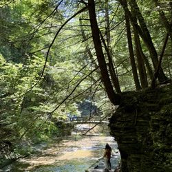
1. Salt Springs State Park

0

Montrose, PA

Cancel

Open app

Search

Salt Springs State Park

4.9 (9 reviews)

Salt Springs State Park Photos

Recommended Reviews - Salt Springs State Park

Your trust is our priority, so businesses can't pay to alter or remove their reviews. Learn more about reviews.
Yelp app icon
Browse more easily on the app
Review Feed Illustration

Reviews With Photos

Damian D.

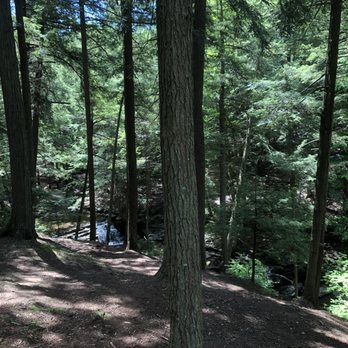
Charming and gorgeous spot to hike with the pup. Being around the moving water energizes as well as calms you!

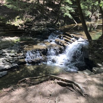
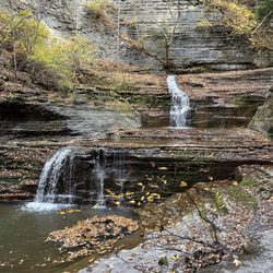
Lowest falls

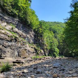
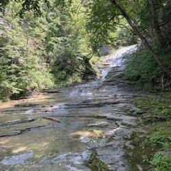
We hiked Ricketts Glen the day before and it was amazing, but the kids really wanted to get in the water. After some internet research, we came upon this state park and it exceeded our expectations. Being able to walk in the stream and climb the waterfalls was beyond fun. It was beautiful and not crowded. Highly recommended! Only drawbacks were the non-flushing toilets and not super clearly marked trails, but still overall a 5 out of 5 for us!
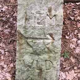
Yugolav, my uncle.

See all

28 days ago

Helpful 0
Thanks 0
Love this 0
Oh no 0
Photo of Fey S.
52
8
6

3 months ago

Helpful 0
Thanks 0
Love this 0
Oh no 0

5 months ago

Helpful 0
Thanks 0
Love this 0
Oh no 0

8 years ago

Helpful 1
Thanks 0
Love this 2
Oh no 0

5 years ago

Helpful 1
Thanks 0
Love this 1
Oh no 2

3 years ago

Helpful 0
Thanks 0
Love this 0
Oh no 0

5 years ago

Beautiful place for camping, biking and hiking. Plenty of amazing wildlife. Rolling mountains are beautiful

Helpful 0
Thanks 0
Love this 0
Oh no 0

5 years ago

Great place to go with the children a lot of hiking pads places to stop and eat very enjoyable

Helpful 0
Thanks 0
Love this 1
Oh no 0

6 years ago

Helpful 0
Thanks 0
Love this 1
Oh no 0

Ask the Community - Salt Springs State Park

Where is it located?

Off route 706 in montrose, at the light near golf course, make a right onto rt. 29. Stay str8 a few miles & you’ll see brown signs for Salt Springs Park. You make a left just before Snake Creek Boats. Go a few country miles Salt Springs on your… 

Don’t See Your Question? Ask Away!

Verify this business for free

People searched for Parks 130 times last month within 15 miles of this business.

Verify this business

Woodbourne Forest & Wildlife Preserve - Swamp

Woodbourne Forest & Wildlife Preserve

4.7(3 reviews)
4.6 mi

Really 3.5 stars,rounded up, because the smile stayed on my face…read more This place is remote. I thought I lived in the country, but I'd obviously managed to forget what the country looks like. This is the country! Good luck finding it. Yelp has bungled the address, so look on the Nature Conservancy website for written directions. Yelp grabbed the address at the bottom of that page, which seems to be the home address for the person who maintains this preserve. Sorry, guy! I was the person who posted this listing, and I posted it using the current location. One suggestion for the Nature Conservancy staff--I know that this place has no actual address, but GPS coordinates would be really helpful. Our drive to the site took forever, but once we were there we made it home in half the time. The hike sits on Rt 29, which runs directly to Tunkhannock. I suggest that route coming and going. This hike focuses on a swamp. It is a lovely hike, and quite easy, but also very muddy. Be prepared with bug repellant, towels, and an extra set of shoes. I took my sunglasses off soon after entering the treelike, and did not need them at all. The woods were lovely and cool. There is a privy (outhouse) at the site. It is not at the beginning of the path, but rather at the trail head itself, which is a 5 minute walk down a windy path. Very nice, unless, like me, you've just finished a two hour drive to get to this place. It might have been nice to have a sign or something. All in all, a nice walk in the woods, but honestly, I have nicer, less remote hikes closer to home. If you are anywhere near Dimock (Montrose, Tunkhannock) though, this is a site well worth the visit.

Did the Blue Trail... 5.18 miles... Very rustic.. Make sure you have good boots, long sleeve shirt…read moreand long pants.. Trail at the beginning (went clockwise) is overgrown.. once you cross Baker road trail is difficult to follow..Several trees were down on the trail and some of the trail markers can be deceiving... Got lost the trail on the return to Baker Road but used my compass to set my location.. Next time will go counter clockwise and see if trail is better marked. Why did I give it 5 stars... Nothing quite like it... Make sure you bring bug spay. watch out for tick, keep yourself hydrated. On my way home I saw a 500 pound black bear so I will bring bear spay..

Photos
Woodbourne Forest & Wildlife Preserve - Mud!  Mud everywhere!

Mud! Mud everywhere!

Woodbourne Forest & Wildlife Preserve - Orchid

Orchid

Woodbourne Forest & Wildlife Preserve - Cared for by the Nature Conservancy.  Good people!

See all

Cared for by the Nature Conservancy. Good people!

Worlds End State Park - Playground

Worlds End State Park

4.8(29 reviews)
47.7 mi

Worlds End is another fantastic state park in Pennsylvania! There are a lot of sights to see and…read morethings to do. Unfortunately, the weather interfered with our ability to see as much as we had hoped, but we still had a great time! There is a nice visitor center with a variety of historic and nature info available, including some great info on the CCC work that took place in the park (there's a really nice interactive model of a CCC camp too) and how and where the park name is suspected to have been derived from. There is a real snake to look at, as well. A very nice playground is located nearby, and this section of the park also offers easy access to the Loysalsock Creek and the beach with a snack bar, plus multiple picnic tables and shelterhouses. It's beautiful even just to look at the valley walls and the creek itself. There are several gorgeous vistas available, some by foot and some by foot or car. We especially liked the Loyalsock Canyon Vista, which can be reached on foot or by car. It is located next to the Rock Garden, which is a very neat grouping of giant rocks and boulders that is a lot of fun to check out. The park also offers camping and plenty of trails. Worlds End is located within the Loyalsock State Forest, so there is also a lot more that one could explore in the area.

It was a great park that offers some great hike. You need to stay at least 1 night to enjoy the parkread more

Photos
Worlds End State Park - Visitors Center displays

Visitors Center displays

Worlds End State Park - Playground

Playground

Worlds End State Park - Creek

See all

Creek

Ricketts Glen State Park

Ricketts Glen State Park

4.5(130 reviews)
44.9 mi

Ricketts Glen is a very special place for me and my family, and we have been visiting annually for…read moremany years. Lodging: My family likes to stay in the little cabins in the park. They have two or three bedrooms, a kitchen, a bathroom, and a fire ring. They are fully furnished and climate controlled, which is nice in the winter and summer. However, there is no WiFi or cell service (unless you have A T and T) so be mindful of that when you book. I have never stayed at the campsites, so I cant speak for accommodations there. Activities: There's so much to do around the park, including boating or swimming at Lake Jean, exploring the many miles of trails, or having a family barbecue. The most famous trail in the park, the Falls Trail, is a must-hike for visitors. The trail can be steep, rocky, and slippery, and the main loop (not including the bottom three falls) runs about 5 miles, which is longer than the advertised distance, so be prepared. Bring good shoes and lots of water and expect some amazing views of the falls. The other trails in the park are also beautiful, albeit far less traveled. I did the 13 mile loop from cherry run to mountain springs road to the mountain springs trail, and it was a great distance and not too steep. We went past the old Lake Leigh dam breast and an unnamed waterfall with a nice swimming hole. The cherry run and mountain springs trails have lots of tall grass, so make sure to wear long pants in case of ticks. Additionally, the spring runs right through portions of the mountain springs trail, so be prepared to get your feet a little wet. I look forward to each year I get to go to Ricketts and even though I am sad I'm home, I'm super excited for next year!

My birthday is the most important day of the year. This is a fact. I get very ornery if I don't…read morespend the day/week/month the way that I want. For 3 years running The Plan has been to go to Acadia. First year: someone went to an international wedding of 500 people and got the Rona Second year: someone bought a big rig and rates were in the toilet Third year: Someone was tired and the planing was overwhelming I just knew this would be The Year. Sike - Rain and thunderstorms forecasted from May 27-June 4 and we had a campsite lmaaoooooo But one thing about me - I'm gon pivot every time. So we booked a Hipcamp and headed to PA instead. I wanted open land, dark skies, and opportunities to hike. Ricketts was only 10 minutes away!! All I knew about this park beforehand was that it was a waterfall paradise. We had our dog with us and arrived at Ricketts around 4pm on a Sunday. We checked out some of the small falls at the trailhead then did the Evergreen Trail. Beautiful view of Adams Falls, a lovely wooded walk through an old growth forest, and some climbs here and there to keep your heart rate up. I love when Wesley goes out on the trails - he sniffs everything, bounds ahead to scout the path, and patiently waits until I can clear obstacles. Still, given the height and uneven terrain of even this shorter trail in the park, I would likely return without him to take on some of the more challenging routes. Making sure he didn't fly off the ledge and I didn't fall off the stone steps had my nervous system on fire lol. I'm also old now and believe feet should always stay rooted to the floor. So yeah. The park is very dog friendly and we love that. But for me and mine, maybe we'll come solo next time. Summed Up: Beautiful Ethereal Calming Steep Heights Dog-friendly Free Do it!

Photos
Ricketts Glen State Park - Falls Trail | Instagram: @telephonesmoothie

Falls Trail | Instagram: @telephonesmoothie

Ricketts Glen State Park
Ricketts Glen State Park - Falls Trail | Instagram: @telephonesmoothie

See all

Falls Trail | Instagram: @telephonesmoothie

Archbald Pothole State Park

Archbald Pothole State Park

3.0(3 reviews)
30.9 mi

Pennsylvania has some mighty fine state parks. Arguably, the commonwealth's system of state parks…read moreis the nicest, biggest, baddest and most diverse in these United States of ours. You've got amazing places like Ohiopyle with all of its outdoor activities, places like Oil Creek which is where the first well in the country was drilled, the boulder field at Hickory Run or places that serve as monuments like Kinzua Bridge. But, with these destination spots you also get a place like Archbald Pothole. What is Archbald Pothole State Park? Did I really just type the word pothole? Does this place actually matter? Should this place really be a state park? Like Seinfeld, it's a park about nothing. Amazingly yes I did. Probably not and probably not. This park is an "ecological wonder" that was formed around 15,000 years ago during a glacial period. The pothole is 38 feet deep and has an elliptical shape. The largest diameter is 42 feet by 24 feet. At the bottom it is 17 feet by 14 feet. The pothole has a volume of about 18,600 cubic feet. From the Internet: "A meltwater stream flowing on top of the glacier probably broke through a crevasse (a crack in the glacier) and fell to the bedrock hundreds of feet below. There was enough force generated by the falling water to begin a whirling motion of rock fragments in a small depression. As the rock fragments swirled and bumped each other, they carved the bedrock, making the depression deeper and larger. The rock fragments eventually were reduced to tiny particles, but new rock fragments continually tumbled into the hole, enabling the grinding process to continue. As the glacier moved, so did the crevasse and the waterfall. Sand, gravel and rounded stones filled in Archbald Pothole and the waterfall moved off to make new potholes." The pothole was found in 1884 by an area miner during some blasting. The pothole was used briefly as an airshaft for the mine but by 1887 the owner of the land built a fence around the area and began to give tours. In 1914, the acre around the pothole was deeded to the Lackawanna Historical Society. In 1940 with the addition of 150 surrounding acres Archbald Pothole became a Lackawanna County park which Lackawanna County then flipped to the Commonwealth of Pennsylvania in 1961 thus creating what you have today. If you look at the park's map it more or less will show you what is here which is nothing. On one side you have apparently some athletic fields and on the other side you have the small area with the parking and the pothole with nothing in the middle except land for hunting. The state park website claims there is some sort of walking trail near the parking lot but if it's there, it's not marked. If you go: The pothole is open sunrise to sunset daily from mid-April to mid-November. The rest of the year the park is closed and there is no ranger presence or anything else here as the nearest station is over at Lackawanna State Park which is ten miles away. If you want to unleash your inner Elmer Fudd deer, squirrel and turkey hunting is allowed in the appropriate season on the 100+ acres designated for hunting.

Really? This is a State Park? I understand that's there's historical significance to this…read more"Pothole", but really Pennsylvania? A platform and fence around the outside just doesn't cut it. Looks like there's a lot of ground around, so a couple of walking trails would be nice. As it is, it takes a whopping 15 minutes to see it all. Also there's also trash in the hole. Let's get down there and clean it up.

Photos
Archbald Pothole State Park
Archbald Pothole State Park - Roadsign

Roadsign

Archbald Pothole State Park - The hole

See all

The hole

Salt Springs State Park - parks - Updated October 2026

Loading...
Loading...
Loading...