Wow!
Just wow!
I'd heard that the north half of the Pine Creek Rail Trail is considered one of the best in the United States. And having biked this end of the trail, I believe it.
Let me back up a moment. The Pine Creek Rail Trail was one of the first rails-to-trails in the area, having been completed in 1996. As its name implies, this was once a rail line and it was built in 1883 to haul timber products and coal. Throughout the years it was operated by various rail companies, the last being Conrail Railroad, which shut it down in 1988. The present trail starts in Jersey Shore, PA and ends just north of Wellsboro, PA. The entire trail is crushed limestone and is an easy ride. The steepest grade is only about 2%. My husband Rick and I were doing a budget vacation in the area and as we'd already biked the southern half of the trail http://www.yelp.com/biz/pine-creek-rail-trail-jersey-shore#hrid:9OAQkxhmiMH9kWSSiYiRYw/src:self we thought we'd return and do the northern half. Keep in mind that the trail is 61 miles in length and doing the whole trail in a single round trip would be impossible.
We start at the Wellsboro end of the trail, right off of PA #287. The trail ends right at the highway and if you look closely, you can see where they used to turn trains around. On the other side of the road, it's still an active railroad operated by a shortline company. To reach the parking, go north of the trail to the intersection of PA #287, then go north on Lower Marsh Creek Road. Turn left on T533 and you'll find parking at the trail. There are rest rooms here--pit toilets actually-- and I suggest you use them because it's 7 miles to the next "Comfort Station."
So for the first 5 miles or so we head westward. Here the countryside is rather open and the trail a bit flat--though the foothills flank either side of the trail. The trail follows US #6 through here. Commonly called "The Grand Army of the Republic Highway", US #6 runs from Provincetown, MA to Bishop, CA. After about milepost 4, the trail curves to the southwest and crosses Pine Creek. Right before Ansonia, US #6 veers to the right and we find ourselves at the Ansonia Access Area. An equestrian path with horse trailer parking is located here. In the 1.2 miles between Ansonia and Darlington Run there are three access points and two comfort stations. Rick and I take a short break at the facilities by the Darling Run Access Area. You see, we need to get ready for the next portion of the ride....the 17 miles between Ansonia and Blackwell.
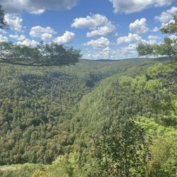
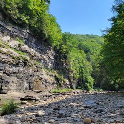
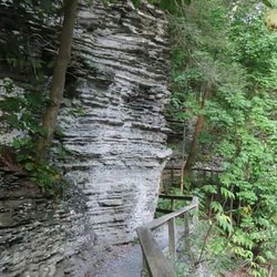
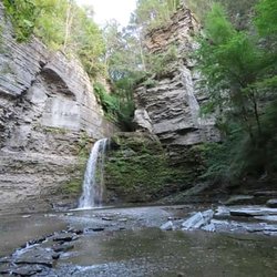
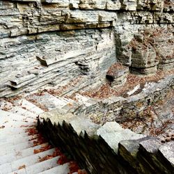
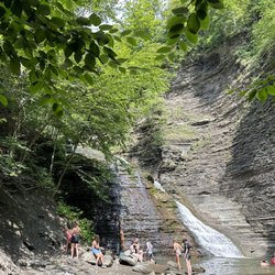
This segment of the ride contains the most fantastic scenery Rick and I have ever pedaled. The trail goes through Pine Creek Gorge, sometimes called "The Grand Canyon of Pennsylvania." Pine Creek Gorge is more than 800 feet deep here and its deepest point is 1,450 feet. I should warn you though, the section between Ansonia and Blackwell is very remote, and much of the trail is inaccessible by road. You must absolutely make sure you have adequate supplies with you in here because there are no places to obtain them. Within the Tioga National Forest, this segment passes through Leonard Harrison State Park and Colton Park. Serious hikers may be interested to know that the semi-parallel West Rim Trail is just on the other side of the creek. About 7 miles after leaving Ansonia, we find the Tiadaghton Campground. This campsite is very primitive, however pit toilets are available for those who need them. We press on because we want to make Blackwell. maybe it's just the time of day, but we haven't seen another soul along this portion.
Once we hit Blackwell, another 8 miles south of Tiadhagton, it's kind of a return to civilization. We see more cyclists and hikers south of here. There are more access points to the trail too, although it's recommended that cyclists park at the Rattlesnake Rock Access Area, which has more spaces. We wind up our ride at Hillborn Fields Comfort Station, where we left off the other day. It's time to head back and all-in-all it's been a spectacular ride.
And to wrap things up, here are Susan's biking tips:
1) Portions of this trail are very remote. I recommend against biking alone because if something was to happen to you, it's possible no one would find you in time.
2) Bring snacks and a sack lunch. There are no places to obtain these and few places to obtain water.
3) Bring a chain tool, tire repair kit, and mini air pump and know how to use them. Girls, it's not hard to learn how.
4) Also make sure your bike is in good repair. Few things spoil a bike ride than having to walk several miles with a broken down bike.
5) Take only photos and leave only footprints and tire tracks.
6) Above all, take your time and enjoy the scenery. read more