Cancel

    Open app

    Search

    Pierce Point Ranch

    4.0 (2 reviews)

    Pierce Point Ranch Photos

    You might also consider

    Recommended Reviews - Pierce Point Ranch

    Your trust is our priority, so businesses can't pay to alter or remove their reviews. Learn more about reviews.
    Yelp app icon
    Browse more easily on the app
    Review Feed Illustration

    4 months ago

    Helpful 1
    Thanks 0
    Love this 1
    Oh no 0

    4 years ago

    Helpful 15
    Thanks 1
    Love this 14
    Oh no 0

    You might also consider
    Verify this business for free

    People searched for Hiking 779 times last month within 15 miles of this business.

    Verify this business

    Point Reyes National Seashore - Lighthouse

    Point Reyes National Seashore - Lighthouse

    4.4
    (262 reviews)
    13.2 mi

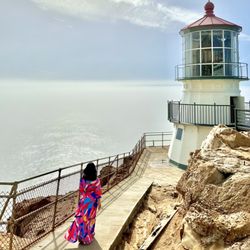
    The Point Reyes Lighthouse contains the ORIGINAL first order Fresnel lens and clockworks that were…read moreon display at the 1867 World Fair in Paris. Not just a replica, but the actual model that was actually on display in Paris. The best time to see the inside of the lighthouse (where the lens and clockworks reside) is typically on weekends between 10am-noon and 1:30-3:30pm, but only in winds under 40mph, and (ideally), when it's not foggy. (Check the park website or call for current hours, which may fluctuate.) During these hours, rangers and volunteers are often around to answer questions, give educational talks, and sell merchandise. For safety reasons, the lighthouse and stairs are always closed to the public when the winds exceed 40mph-- which happens often. This is the windiest spot on the west coast. When you check the wind online, the results come from a weather station miles away from the lighthouse. Wind speeds may be much higher at the actual lighthouse than what you see online. To avoid wasting gas and time, you can always call the park visitor center (after 10am) to ask about the winds for that day. The Point Reyes lighthouse parking lot sits about a quarter mile away from the viewing platform above the lighthouse. This portion of the trail is accessible. There is also a closer accessible lot for those with handicapped placards. From the viewing platform, it's 313 stairs plus two steep slopes (of about 100 feet each) down to the actual lighthouse. The reason the lighthouse sits so low below the viewing platform is because the heavy fog that plagues the area is often just above this level. So, it's essentially below fog level-- except for when it's not. For those circumstances, there are foghorns. The modern foghorns are controlled by the coast guard, and are not on display. However, a large equipment-building-turned-museum, which sits at the same level as the lighthouse, houses several of the historic horns and air compressors, along with a few interpretive signs. In my personal opinion, the lighthouse could use a lot more pictures and interpretive signs. I personally think that it would be cool if these were plastered all over the inside of the lighthouse, like they are in Heceta. Is it worth the 313 stairs to see the lighthouse? I am the wrong person to answer this question, since, for me, the stairs have always been my main motivation for visiting. I would climb these stairs just for fun, and I've done so many times. And yes, I bought one of the "I survived the climb!" stickers from the visitor center at the top of the stairs, which is typically open the same hours as the lighthouse. The lens itself is pretty chipped up, but still beautiful to look at. I'm not sure if the chips are due to the weather, historic vandalism, or routine maintenance. What I do know is that the glass is technically irreplaceable. The original glass was made by French artisans in the 1800s. The modern replacement glass is manufactured in England, from different sand, which is apparently a different color and clarity than the original. Typically speaking, even when on display, the lighthouse is not rotated, and the curtains are kept mostly closed. Some people (me) might argue that it's deceptive to call it "fully functional" or claim that it's "in working order." That being said, the clockworks (a cabinet full of gears, pulleys, and cables) is pretty cool too see. It looks like a giant nineteenth century wind-up toy. The park keeps it painted, polished, and well-maintained. National Lighthouse Day is coming up on August 7th. Historically, including last year, the park has operated the lighthouse for this event. I haven't seen anything online about it yet, but maybe they'll celebrate this year, too. The nearest gas and food to the lighthouse are about thirty minutes away, so make sure you plan for that ahead of time. Chimney Rock is a short drive away. Drake's Beach (including the Ken Patrick visitor center), North Beach, South Beach, and the Cypress tree tunnel are all passed on the road between the lighthouse and Inverness, so if you plan right, you could definitely knock all of those sights out in one day. If you're a real overachiever, you could also add Tomales Point/Pierce Point Ranch to the same day, as the road to these destinations is between the lighthouse and Point Reyes Station.

    Beautiful views of the coast and at this historic site. There is a small parking lot otherwise you…read morecould park along the road. It's quite a walk from there to the lighthouse. There is a small visitor center and some bathrooms. They closed the stairwell to the lighthouse because of the wind. Bring a coat or windbreaker no matter what time of year. No fees for entry or parking. There are some beautiful views

    Photos
    June 2025
    June 2025
    Point Reyes National Seashore - Lighthouse
    Point Reyes National Seashore - Lighthouse

    See all

    Chimney Rock - Point Reyes National Seashore

    Chimney Rock - Point Reyes National Seashore

    4.7
    (30 reviews)
    13.2 mi

    "Where is the best place to get 360 degree views of the ocean?" Someone asked me this question last…read moreweek while I was hiking out at Tomales Point, and I've decided that the answer is Chimney Rock. (I mean, technically, the answer is actually 'from a boat in the middle of the ocean,' but I'm pretty sure they meant like, 300 degree views.) Chimney Rock is a thin straight of land that peeps out into the ocean. Or, in more technical terms, according to the NPS website, it is "the Eastern spur of the Point Reyes headlands." If you think of Point Reyes as being shaped like a double-headed wrench, the lighthouse and Chimney Rock are on the same side of the wrench, but they are the tips that oppose each other. Each one juts out into the ocean on its own. Of course, you could also get great, nearly all-around views at the lighthouse, but this requires hiking down 313 stairs. As opposed to the lighthouse, Chimney Rock is a much easier hike. In fact, this hike would have been a breeze, if not for the actual breeze, which was blowing at about 45mph. (Point Reyes is the second windiest point on the West Coast. If you are not able to maintain a very strong stance against the wind, then consider a different hike.) The hike was less than a mile each way. There were not very many wildflowers, but in some ways, this is actually an advantage over Tomales Point, because it allows for better unobstructed views. There are a lot of social trails at Chimney Rock. NPS has posted signs in front of these trails that say, "Unauthorized trail, hazardous cliffs. Please stay on authorized trails." I stayed on the authorized trails, not just because I'm a goody-two-shoes as a hiker, but because, as a California native, I understand cliff geology, and the very real risks associated with it. You may be thinking, "This cliff isn't really going to crumble and drop me into the ocean," but actually, this can and does happen all the time. (In fact, this actually happened to a member of my cohort at UC Santa Barbara.) A side hike can take you down to the Historic Life Saving Station. There is not a sign that says "this way to the life saving station," but you will know which trail it is because it is *not* marked with an unauthorized trail sign. (I have not yet taken that side hike, but it looks interesting.)

    Yelp has the wrong map location for this spot. A nice hike and we were close and personal with a…read morecoyote during our hike. We just kept still and it walked on by. Pretty cool! The easy walk itself is fairly short out and back with a mandatory turnaround at the end of the trail. Make sure you venture to the right toward the beginning to get that awesome sheer cliff ocean view. And be careful because that little 20 foot desire comes with some wind. Many folks miss this feature of the hike. Lots of flowers during springtime.

    Photos
    Chimney Rock
    Chimney Rock
    Chimney Rock
    Chimney Rock
    One of the cliff views

    See all

    One of the cliff views
    Point Reyes National Seashore

    Point Reyes National Seashore

    4.7
    (408 reviews)
    13.2 mi

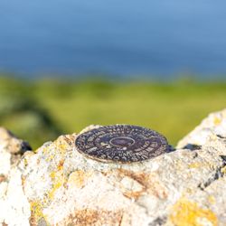
    What a somewhat hidden gem! Definitely lesser traveled than a lot of other NPS places. When we…read morewent, in the beginning of July, it was cold and windy - about 55F but with windchill. I ended up buying a sweater at the visitor's center and used it during the entire trip! Our itinerary included the Bear Valley Visitors Center, Chimney Rock, Elephant Seal Overlook, Lighthouse, Drakes Beach, Cypress Tree Tunnel, then back to the Bear Valley Visitors Center. The entire trip took about 6.5 hours - it was great! The visitors center was clean, well-stocked, and informative. Bathrooms on the outside, plenty of parking. Inside there's a shop with lots of goodies including clothing, totes, stickers/pins, first aid supplies, and more typical goodies. Rangers were very friendly and informative. Lots of interactive displays as well. Chimney Rock was a quick hike. There's a bathroom and a bench or two at the trailhead. We thought the hike was pretty easy. Lots to see including wildflowers, bugs, birds, and deer! Plus, the view at the end is gorgeous, and there's a geological stamp there too. No elephant seals at the overlook, but it's not peak season, so we weren't expecting any. The lighthouse was a nice surprise! According to the website, it should have been closed on a Tuesday, but the ranger told us that summer hours are different, and it was open! We went to the small visitors center, then walked the 313 steps down to see the lighthouse. It was super windy. There are several rest points along the staircase in case folks need it. While we couldn't climb into the lighthouse, we could go inside and peak around, which was pretty cool. There was a ranger there who answered questions, and we saw some people looking for whales. Drakes Beach was gorgeous. We ended up staying for about 1.5 hours because the kids had so much fun digging in the sand and watching crabs scurry along the beach. There was barely anyone else there, so we had a huge part to ourselves. And there are a bunch of sand dollars! That was so cool to see. Most of them were cracked, but occasionally we saw some whole ones. The visitors center here was closed, but looked like it was well-stocked with unique goodies. Bathrooms were open, big, and clean. Cypress Tree Tunnel was every bit as beautiful as I've seen in photos. Quite a few people there walking the tunnel and taking photos. The boys earned their Junior Ranger badge at the end of the visit. And we got our stamps! Fun times - we'll definitely be back!

    How fortunate we are to have Point Reyes National Seashore. The headquarters is fantastic- maps,…read morerecommendations, nice restrooms & plenty of free parking. Today we chose the Bear Valley hike trail. The path is wide and mostly flat and even includes a bathroom midway. As you walk you are able to hear the beautiful sounds of the babbling brook along the route. Being late Spring we were able to spot a good amount of wildflowers- buttercups, poppies, bleeding heart, foxglove and more. We encountered several equestrian's throughout our hike.

    Photos
    Tomales Point Trail - Tule Elk Preserve, Point Reyes National Seashore
    Tomales Point Trail - Tule Elk Preserve, Point Reyes National Seashore
    Tomales Point Trail - Tule Elk Preserve, Point Reyes National Seashore
    Tomales Point Trail - Tule Elk Preserve, Point Reyes National Seashore
    Tomales Point Trail - Tule Elk Preserve, Point Reyes National Seashore

    See all

    Tomales Point Trail - Tule Elk Preserve, Point Reyes National Seashore
    Historic Life-Saving Station and G Ranch Cemetery

    Historic Life-Saving Station and G Ranch Cemetery

    5.0
    (2 reviews)
    6.8 mi

    Awww yes, the Life-Saving Cemetery of Inverness…read more As you head toward the Point Reyes Lighthouse, you'll pass Drakes Bay Oyster Farm, and Schooner Creek. At this point on Sir Francis Drake Blvd. you'll see a sign directing you to turn off the main rain, toward the cemetery. While I don't think heading down random roads in an area with no cell phone coverage in search of cemetery land is always a good idea, we were in an adventurous spirit and had plenty of daylight left. We would be safe. There is a two-car parking area and one car had taken both spots, so we put our car nearby and hiked up the (small) hill to a grove of large trees, keeping the graves shaded and mostly hidden from sight. Bright yellow flowers littered the walkway up the hill, bringing life to an otherwise very quiet place. Was it getting windier as we reached the top? Did the sun just hide behind a cloud? A crumbly, white picket fence surrounded the small cemetary. We each laid a yellow flower at the first graves we came to. You cant actually get to the headstones - they are surrounded by personal fences, but you can read their inscriptions. It was really cool. The place was a little beat up looking and not that well maintained, but I imagine they weren't getting a lot of complaints from the residents. At the top of the small cemetery sat a small bench, made from a tree. We quietly reflected on our day and our lives, then turned to head back down the hill and were on our way. I thought it'd be pretty fun to stay around here and wait for another car, and hide behind a tree before jumping out and scaring them, but this area is pretty isolated and it might have been a long wait.

    As we drove towards Chimney Rock on Sir Francis Drake Blvd, we noticed a sign for the Life Saving…read moreStation Cemetery. We thought that sounded unique and talked about how we would stop by on our way back after doing our Chimney Rock hike. Later on the way back, we looked for a sign, but there was none. As we passed the Drakes Estero pullout, we looked back and noticed the sign. We did a turnaround and we were on our way! Once we were on the road to the cemetery, we drove all the way down the road, looking for a second sign to direct us to the cemetery, but there was nothing. At the end of the road, we ended up at the US Coast Guard property that was fenced with no access. Again a turnaround and this time we noticed a two-car parking area on our way back to Sir Francis Drake Blvd. We parked and walked down a road, looking for the cemetery. Still nothing, and we walked back to the car. Then we noticed a hikers sign across the street from the parking area. The trail was overgrown, but we decided to check it out. After a thousand feet or so, we noticed a white picket fence, hoping it was the cemetery. Yes! We found the two different fenced in areas, with the gravesites. Very peaceful here, but now viewing the previous reviewer's photos from 2013, it was obvious that no one maintains the cemetery. It is overgrown and the trail is no longer clearly marked. Even so, we enjoyed our trek to the cemetery and finding the grave markers.

    Photos
    German
    German
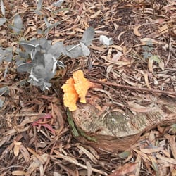
    A cool mushroom
    A cool mushroom
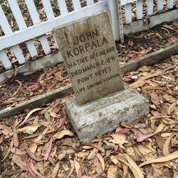
    Finnish

    See all

    Finnish

    Pierce Point Ranch - hiking - Updated July 2026

    Loading...
    Loading...
    Loading...