1. Pete's Lake Campground

0

Wetmore, MI

Cancel

Open app

Search

Pete's Lake Campground

3.5 (10 reviews)

Pete's Lake Campground Photos

More like Pete's Lake Campground

Recommended Reviews - Pete's Lake Campground

Your trust is our priority, so businesses can't pay to alter or remove their reviews. Learn more about reviews.
Yelp app icon
Browse more easily on the app
Review Feed Illustration
Photo of Jeff H.
261
207
1037

11 years ago

Helpful 3
Thanks 0
Love this 2
Oh no 0

1 year ago

Helpful 0
Thanks 0
Love this 0
Oh no 0

1 year ago

Helpful 0
Thanks 0
Love this 0
Oh no 0

2 years ago

Helpful 0
Thanks 2
Love this 0
Oh no 0

6 years ago

Helpful 0
Thanks 0
Love this 0
Oh no 0

7 years ago

Helpful 0
Thanks 0
Love this 0
Oh no 0

6 years ago

Helpful 0
Thanks 0
Love this 0
Oh no 0

11 years ago

Helpful 2
Thanks 0
Love this 0
Oh no 0

11 years ago

Helpful 0
Thanks 0
Love this 0
Oh no 0

6 years ago

Helpful 0
Thanks 0
Love this 0
Oh no 0

Ask the Community - Pete's Lake Campground

Verify this business for free

Get access to customer & competitor insights.

Verify this business

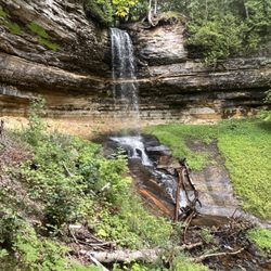
Miners Falls - This is Miners Falls.

Miners Falls

4.8(20 reviews)
10.7 mi

Miners Falls is a great hike for all ages and abilities in Painted Rocks National Seashore. The…read moretrail is well maintained and easy to follow. Along the way, you will be treated to beautiful forests and peaceful surroundings. When you get to the end of the trail the best viewpoint of the falls is down the set of stairs to your left. It is well worth the climb back up. The falls is 39 feet high and it has a pretty good water flow. The total distance on this hike is 1.2 miles. The parking is large and there are pit toilets at the trailhead. Signage is also good at the trailhead. We enjoyed our hike out to the falls, in all we took about 50 minutes on this hike, stopping along the way for pictures of cool trees and also taking a bunch of pictures of the falls.

Miners Falls is another great, relatively easy hike that can be done by all skill levels and I…read morewould highly recommend it as well during your Pictured Rocks trip, either before or after you make a stop at Miners Castle as well. Clocking it at 1.2 miles, it takes about half an hour to complete out and back. Miners Falls is way bigger and grander than Munising Falls, so it's definitely impressive and worth the hike out. You aren't able to get as close to it as you do to Munising Falls, you view it from 2 different viewing platforms across a wide river, but it's still impressive just the same. The hike is more intensive. It's mostly shallow, sometimes steeper in areas decline through forest on the way there, but that just means that you know the way back is going to be a constant uphill, which is a bit killer. Total elevation gain here is about 150 feet. Great part about this hike is that the trail is so WIDE, tons of space to walk and be distant from other people, not that this trail was even all that heavily trafficked by any means. When you get to the falls, the first viewpoint you get to really doesn't give you a good view. For both viewpoints, you are already looking down at the falls, and the first viewpoint, which is much higher up, is blocked by trees and at too high of an angle for you to appreciate much of anything. So it's imperative that you head to viewpoint #2, which is down one final series of steep stairs. From this viewing platform, you get a great, impressive view of the falls, get a moment to take pictures, catch your breath, before you embark on the not-so-long-but-sort-of-feels-long-because-it's-all-uphill journey back up to the parking lot. I was definitely breathing hard by the time I got to the parking lot, but it was a great, short hike to do! It really didn't hurt either that there was gorgeous fall foliage all along the road leading into the Miners Falls parking lot and spots of color along the entire hike as well. Can't be anything but happy when looking at fall rolling in! :)

Photos
Miners Falls
Miners Falls - Miners Fall

Miners Fall

Miners Falls

See all

Pictured Rocks National Lakeshore Miner's Castle/Beach - Miner's Beach

Pictured Rocks National Lakeshore Miner's Castle/Beach

4.8(34 reviews)
18.7 mi

We visited Pictured Rocks in mid-May with our dog and had a great day! We hiked to Miners Castle (a…read morebit over a mile each way) from the Miners Beach parking lot and spent an hour or so at Miners Beach after our hike. The views on our hike were incredible, especially towards the top when you could start to see the Pictured Rocks. We took some time to enjoy the view from the viewing decks and our pup enjoyed getting lots of love from all the kids that were there (you can drive directly up to Miners Castle if hiking isn't your thing, there are also viewing windows for kiddos on the platforms so they can enjoy the view too). After spending some time at the top enjoying the view of Pictured Rocks/Miners Castle, we hiked down and went directly to Miners Beach. While it was a bit chilly, it was still comfortable to sit in the sand and play with our dog in shorts/tshirt! We enjoyed our day at Pictured Rocks during our trip up north and would highly recommend this hike/beach! Note - at the time of our visit, the main entrance to Miners Beach was blocked off due to emergency conditions by the National Park Service, but there was another access point a few hundred feet down the dirt path that was open/recommended for use! You do not need to hike to access Miners Beach from the Miners Beach parking lot, the main access point is directly in front of the lot and the one we used is only a few hundred feet down the dirt path.

Miner's Castle is a nice gentle hike for folks who aren't big hikers, with an upper viewing (in my…read moreopinion the better of the two), and a lower viewing point. Parking is limited, so we circled until someone left; bathrooms were more plentiful at the Miner's Castle than at National Lakeshore, but they did have some there as well. We loved the beach at the National Lakeshore; clean sand and the beautiful, Caribbean-like waters you expect from Lake Superior. Water is cold, but was so refreshing after a day of hiking and sun! Miner's Castle is a one and done spot for us, but we will definitely be back to the beach at the National Lakeshore!

Photos
Pictured Rocks National Lakeshore Miner's Castle/Beach - View of Pictured Rocks from nearing the end of hike from Miners Beach to Miners Castle

View of Pictured Rocks from nearing the end of hike from Miners Beach to Miners Castle

Pictured Rocks National Lakeshore Miner's Castle/Beach - The trail down

The trail down

Pictured Rocks National Lakeshore Miner's Castle/Beach - Pictured Rocks view from viewing decks at Miners Castle

See all

Pictured Rocks view from viewing decks at Miners Castle

Alger Falls

Alger Falls

4.6(5 reviews)
11.5 mi

Just outside Munising in the lovely Upper Peninsula of Michigan we happened upon this water fall…read moreon the way to our Holiday Inn Hotel. the falls are visible from the road. Nice to not have a hike or stairs to see a water fall. There was some area for cars to pull over. this was our visit time to the Upper P. a lovely trip.

Alger Falls is a quick 5-minute roadside stop convenient for checking off another waterfall here in…read moreMunising, Michigan. I tell ya...I can't get over how cool of a town Munising, Michigan is. Situated at one end of Pictured Rocks National Lakeshore, you can spend an entire day simply stopping at all the waterfalls within the area. And funny, once you visit and get a picture of one waterfall, it then becomes an obsession. Like some sort of mission to officially announce that you've been to them all, lol, at least that's from my view, hehehe. But...in the big picture around Munising, this Alger Falls is definitely the easiest of all the waterfalls to stop at and grab a fast picture of. It's a no-nonsense pullover, which can often be easily overlooked among the more commonly well-known waterfalls of Munising. In fact, the sign for Alger Falls is so small, it can definitely be missed while driving. But...good thing around town, cell phone reception works perfectly so you can just plug Alger Falls into Google Maps and find your way here. Again...be careful while driving you can easily pass this waterfall. I'd advise to go slowly. Then, pull over your car to the shoulder and that's it. You don't even need to hike anywhere. Alger Falls may not be statuesque or stunning in appearance, but for when I was here in late afternoon, the sun was at my back which reflected well onto the falls. I found the setting to be pretty pleasant. I took a few pictures and then went on my way. It was so simple and because of the time of day and accessibility, I enjoyed coming here. And that's it, a brief moment is all you need to check this waterfall off your To-Do-List without any hassles. Following here at Alger Falls, the next morning I visited Chapel Falls, Mosquito Falls and Horseshoe Falls. Like I said...the town of Munising is "waterfall central" within the UP - Upper Peninsula of Michigan!

Photos
Alger Falls
Alger Falls - Getting a picture in with Alger Falls.

Getting a picture in with Alger Falls.

Alger Falls

See all

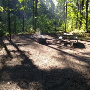
Pioneer Trail Park - Fire ring.

Pioneer Trail Park

4.7(3 reviews)
37.7 mi

Pioneer Trail Park is not a place for Glampers, but it's a great place to park your trailer or tent…read moreto unwind a bit, stop for the night, or use as a home base for fishing, paddling, or hiking in the area. The grounds and most notably the shower facilities were very clean. The staff was friendly, and I had no noisy neighbors. I camped in the primitive section, as I didn't need water or electricity at the site, though the sites in the more developed section had those. That section was much more full than the primitive area where I was. For my site I paid just 15$ a night, less than some state or national forest campgrounds that don't have showers or flushing loos. My camp overlooked a side channel of the Escanaba River. A large marsh dividing that channel from the main flow gave me concerns about mosquitos, but I saw very few. The tradeoff for this is some ambient noise. The highway is nearby, and there are some industrial facilities in the area from which you can hear some rumbling and clanking throughout the day. Escanaba seems to have a lot of train traffic, since I don't think I went 5 minutes without hearing a train whistle somewhere in the distance. There is actually a track running directly along the primitive camping section, though only a couple of short trains went by on it while I was there. Not a place for solitude and silence, though there are plenty of those available in the UP. If you want a few more amenities and proximity to some city pleasures, this is a great place to stay.

This is a well maintained campground. We got a campsite under the pine trees. The campsites there…read moreare spaced well apart. No noise from other campers, although the railroad runs a couple hundred feet behind the site. You hear the train rumble by, but they don't blow the whistle. Because it is shaded there is no grass, so it can get muddy when it rains. I didn't care for the fire rings they have there. They are too tall, about twice the hight of most. You can't really see the fire in the pit. They don't have a grill grate either so you can't use them for cooking. This is a nice campground, but does have a few drawbacks.

Photos
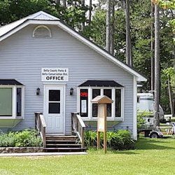
Pioneer Trail Park - PTP office

PTP office

Pioneer Trail Park - View from my campsite

View from my campsite

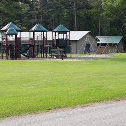
Pioneer Trail Park - Playground

See all

Playground

Munising Falls - Creek between visitors center and Munising Falls

Munising Falls

4.4(20 reviews)
13.5 mi

From the parking lot to the falls, this trail is not even half a mile out and back. Definitely…read morefriendly to all skill-levels and a very easy stop at the beginning (or end) of the Pictured Rocks National Lakeshore, whichever way you look at it. Fun / sad story: My parents came here 30+ years ago, well before I was born, and it was one of their first trips after they had moved to Michigan. Back then, you were still able to walk the entire trail all the way up to the falls and then walk BEHIND the falls, so that you got to experience the water falling on one side of you and the rock wall on the other side. Over 30 years later, erosion has sadly caused it so that you can no longer walk behind the falls, there's simply not even enough pathway left to do so. So this past weekend, when I went to Munising Falls for the first time with my parents who were coming for the second time, we were all pretty disappointed to see that we could no longer walk behind the falls. Instead, now there are just three different viewpoints you can walk up to: 1) a middle, head on, from the ground up view, 2) a medium altitude, left-side vantage point view, and 3) a highest altitude, right-side vantage point, almost looking down at the falls kind of view. The highest altitude viewpoint involves quite a bit of climb and forks out early on in the path. Viewpoints 1 & 2 go hand in hand. You arrive at the first viewpoint, take some photos, then can take the staircase up a bit to the left of the viewing platform up to viewpoint #2. My group ultimately only did 1 & 2 because we were pressed for time, but I believe viewpoint #3 would have the best view of the falls out of the 3 if you're down to make the climb. If not, viewpoint #1 gets you a great view as well and I was more than satisfied with what I got to see! Onwards to the next destination!

The Munising Falls are about 800 feet from the visitor center. The main path is paved with some…read morewooden bridge areas, but overall it's a smooth trail, definitely family friendly. It follows the stream so you can hear and admire the pretty tannin-stained water. There's a trail to the lower falls which takes you to the level of the plunge pool (and then stairs from that point to a middle vantage point), but also branches to stairs to the upper falls if you want to get another viewpoint. The upper falls trail also winds close to the sandstone cliffs, some of which have been unfortunately defaced by graffiti. Overall this can be a quick stop if you're in a hurry, or you can spend longer if you take some time to absorb your surroundings. Make sure to bring bug repellent since there's plenty of mosquitoes around!

Photos
Munising Falls - Upper viewpoint path, which winds along the base of the sandstone cliffs.

Upper viewpoint path, which winds along the base of the sandstone cliffs.

Munising Falls - Twin Falls

Twin Falls

Munising Falls - Twin Falls

See all

Twin Falls

Widewaters Campground - Tiny view of the water from our site.

Widewaters Campground

4.0(2 reviews)
1.5 mi

Camper in a nice spot and had a tiny view of the water from our site. I didn't care for how many…read moremosquitoes were here though. If you camp here definitely be aware of that. The spots are decent sized and I did like they were spaced apart. I don't like vault toilets but this spot was a compromise for a camping trip with my boyfriend. I need showers and actual bathrooms but for a day in a tent this place was actually really good. The toilets didn't smell but definitely take a light with you as there isn't one in there and even in daylight it's a little dark.

Nice quiet "rustic" campground located on the Indian River. Wooded campsites and most you can…read morebarely see your neighbor. I would recommend the campsites on the river, good views of the River and your own spot to launch your water craft. I would recommend site 13. The loop around the site is paved so good for pushing a stroller. We stayed a couple nights in September, colors were great and the kayaking was excellent on the Indian, I would recommend putting in closer to Steuben. We did the stretch from McCormick to the access on bass lake road, awesome water and scenery to float, fishing was poor but end of September was too late, I'm sure action would be good in the summer. Maps located at access points on the River. There is a very friendly convenience store just south on 13 where the lady was glad to let me fill up my camper with potable water and has gas, another one just north that looked nice too. Nice overall campground and area, pure Michigan!

Photos
Widewaters Campground - Site 13 looking towards the Indian River

Site 13 looking towards the Indian River

Widewaters Campground - Walk down some steps and into the river to put in

Walk down some steps and into the river to put in

Widewaters Campground

See all

Pete's Lake Campground - lakes - Updated October 2026

Loading...
Loading...
Loading...