1. Hiawatha National Forest

0

,

Cancel

Open app

Search

Hiawatha National Forest

5.0 (1 review)

Hiawatha National Forest Photos

You might also consider

More like Hiawatha National Forest

Recommended Reviews - Hiawatha National Forest

Your trust is our priority, so businesses can't pay to alter or remove their reviews. Learn more about reviews.
Yelp app icon
Browse more easily on the app
Review Feed Illustration
Photo of Sadie M.
5
203
113

9 years ago

Helpful 0
Thanks 0
Love this 0
Oh no 0

Verify this business for free

Get access to customer & competitor insights.

Verify this business

Rock Island State Park - Inside the party room above boathouse. Look at the chandelier.

Rock Island State Park

4.8(21 reviews)
94.1 km

This island is definitely worth the ferry rides to get there. You can tour the lighthouse and hike…read morethe entire island. The lighthouse attendants are so friendly and knowledgeable. Very beautiful place to see.

Rock Island is, well, rocky. Make sure you have sturdy soled shoes or hiking boots because hiking…read morearound without them will sincerely tire out your feet. Unless you have your own boat access, you will take two boats to get there. The first is from the tip of the Door County peninsula to Washington Island, and the second is from Washington Island to Rock Island. Now, you may take your vehicle to Washington Island, but Rock Island is pedestrian traffic only. That is because there is nothing on it....it's uninhabited forest save for birds and some ground dwelling animals, like squirrels and chipmunks. You may hike around the island (it's large, but not huge, it doesn't take all day), and primitive camp. There are a few buildings you can visit and some you can even go in. Food and beverage is allowed, but you must bring it with you, and take all trash with you when you leave. Make sure to get back to the dock at one of the scheduled departure times, especially if you need to make the ferry back to the mainland. If you miss the last boat on either island, you're stuck until the following day. 6/2025

Photos
Rock Island State Park - Me doing yoga on a rock in the lake.

Me doing yoga on a rock in the lake.

Rock Island State Park - Fireplace in the upstairs party room.

Fireplace in the upstairs party room.

Rock Island State Park - Boathouse and upstairs party room, which is gorgeous.

See all

Boathouse and upstairs party room, which is gorgeous.

Miners Falls - This is Miners Falls.

Miners Falls

4.8(20 reviews)
19.0 km

Miners Falls is a great hike for all ages and abilities in Painted Rocks National Seashore. The…read moretrail is well maintained and easy to follow. Along the way, you will be treated to beautiful forests and peaceful surroundings. When you get to the end of the trail the best viewpoint of the falls is down the set of stairs to your left. It is well worth the climb back up. The falls is 39 feet high and it has a pretty good water flow. The total distance on this hike is 1.2 miles. The parking is large and there are pit toilets at the trailhead. Signage is also good at the trailhead. We enjoyed our hike out to the falls, in all we took about 50 minutes on this hike, stopping along the way for pictures of cool trees and also taking a bunch of pictures of the falls.

Miners Falls is another great, relatively easy hike that can be done by all skill levels and I…read morewould highly recommend it as well during your Pictured Rocks trip, either before or after you make a stop at Miners Castle as well. Clocking it at 1.2 miles, it takes about half an hour to complete out and back. Miners Falls is way bigger and grander than Munising Falls, so it's definitely impressive and worth the hike out. You aren't able to get as close to it as you do to Munising Falls, you view it from 2 different viewing platforms across a wide river, but it's still impressive just the same. The hike is more intensive. It's mostly shallow, sometimes steeper in areas decline through forest on the way there, but that just means that you know the way back is going to be a constant uphill, which is a bit killer. Total elevation gain here is about 150 feet. Great part about this hike is that the trail is so WIDE, tons of space to walk and be distant from other people, not that this trail was even all that heavily trafficked by any means. When you get to the falls, the first viewpoint you get to really doesn't give you a good view. For both viewpoints, you are already looking down at the falls, and the first viewpoint, which is much higher up, is blocked by trees and at too high of an angle for you to appreciate much of anything. So it's imperative that you head to viewpoint #2, which is down one final series of steep stairs. From this viewing platform, you get a great, impressive view of the falls, get a moment to take pictures, catch your breath, before you embark on the not-so-long-but-sort-of-feels-long-because-it's-all-uphill journey back up to the parking lot. I was definitely breathing hard by the time I got to the parking lot, but it was a great, short hike to do! It really didn't hurt either that there was gorgeous fall foliage all along the road leading into the Miners Falls parking lot and spots of color along the entire hike as well. Can't be anything but happy when looking at fall rolling in! :)

Photos
Miners Falls
Miners Falls - Miners Fall

Miners Fall

Miners Falls

See all

Pete's Lake Campground - Firewood here is

Pete's Lake Campground

3.5(10 reviews)
7.2 km

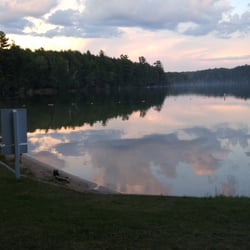
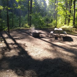
Pete's Lake is a perfect rustic campground (if that's your sort of thing). Here's what to expect…read morein terms of limited amenities: Pit toilets, pump stations for potable water, fire pits, picnic tables, and a set of really awesome/helpful campground hosts (at least this year, in 2015). Other than that you are more or less on your own. It's about a 15 minute drive into Munising if you need anything fancier. But why would you? This is one of the prettiest campgrounds I've ever stayed in. The views are consistently gorgeous and the lake access is just lovely. I particularly enjoyed watching the stars from the "beach" at night and if fishing is your thing there is a great dock built for just that purpose--as well as the ability to take your own boat out into the lake. If hiking is your thing, make sure you check out Bruno's Run. It's a 10 mile loop in Hiawatha Forest that makes its way directly through Pete's Lake campground. One of the camp hosts, Jim, took my wife and I (and his cute dogs) on a venture over to Grassy Lake and McKeever lake. It was a lovely trail and made even better by Jim's informative narration. The guided element was a nice touch but not at all required to enjoy such a hike as this one. My wife and I thoroughly enjoyed ourselves and plan on making Pete's Lake a regular thing. You'd be hard pressed to find any drive-in campground as nice as this in the greater Pictured Rocks region.

Well kept trails and beautiful scenery! Have been driving past this spot for most of my life and…read morerecently a friend hiked it and showed photos....gorgeous! Easy access and the vistas along the trails offer beautiful landscapes indicative of the great Upper Peninsula:)

Photos
Pete's Lake Campground - Great sunsets!

Great sunsets!

Pete's Lake Campground - Sample Campsite

Sample Campsite

Pete's Lake Campground

See all

Alger Falls

Alger Falls

4.6(5 reviews)
20.8 km

Alger Falls is a quick 5-minute roadside stop convenient for checking off another waterfall here in…read moreMunising, Michigan. I tell ya...I can't get over how cool of a town Munising, Michigan is. Situated at one end of Pictured Rocks National Lakeshore, you can spend an entire day simply stopping at all the waterfalls within the area. And funny, once you visit and get a picture of one waterfall, it then becomes an obsession. Like some sort of mission to officially announce that you've been to them all, lol, at least that's from my view, hehehe. But...in the big picture around Munising, this Alger Falls is definitely the easiest of all the waterfalls to stop at and grab a fast picture of. It's a no-nonsense pullover, which can often be easily overlooked among the more commonly well-known waterfalls of Munising. In fact, the sign for Alger Falls is so small, it can definitely be missed while driving. But...good thing around town, cell phone reception works perfectly so you can just plug Alger Falls into Google Maps and find your way here. Again...be careful while driving you can easily pass this waterfall. I'd advise to go slowly. Then, pull over your car to the shoulder and that's it. You don't even need to hike anywhere. Alger Falls may not be statuesque or stunning in appearance, but for when I was here in late afternoon, the sun was at my back which reflected well onto the falls. I found the setting to be pretty pleasant. I took a few pictures and then went on my way. It was so simple and because of the time of day and accessibility, I enjoyed coming here. And that's it, a brief moment is all you need to check this waterfall off your To-Do-List without any hassles. Following here at Alger Falls, the next morning I visited Chapel Falls, Mosquito Falls and Horseshoe Falls. Like I said...the town of Munising is "waterfall central" within the UP - Upper Peninsula of Michigan!

Just outside Munising in the lovely Upper Peninsula of Michigan we happened upon this water fall…read moreon the way to our Holiday Inn Hotel. the falls are visible from the road. Nice to not have a hike or stairs to see a water fall. There was some area for cars to pull over. this was our visit time to the Upper P. a lovely trip.

Photos
Alger Falls
Alger Falls - Getting a picture in with Alger Falls.

Getting a picture in with Alger Falls.

Alger Falls

See all

Hiawatha National Forest - hiking - Updated October 2026

Loading...
Loading...
Loading...