Cancel

    Open app

    Search

    Palisades Canyon Loop

    4.0 (1 review)

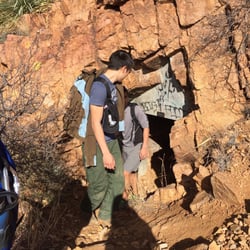
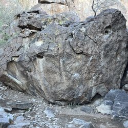
    Palisades Canyon Loop Photos

    Recommended Reviews - Palisades Canyon Loop

    Your trust is our priority, so businesses can't pay to alter or remove their reviews. Learn more about reviews.
    Yelp app icon
    Browse more easily on the app
    Review Feed Illustration

    3 years ago

    Helpful 4
    Thanks 0
    Love this 1
    Oh no 0

    Verify this business for free

    People searched for Hiking 432 times last month within 15 miles of this business.

    Verify this business

    El Paso Tin Mines Hike - The lower mines

    El Paso Tin Mines Hike

    (9 reviews)

    I LOVE this hiking trail. I take my friends whenever they come visit because I this it's a pretty…read moreunique place. You can see the history of El Paso. You can park your car at Chuck Heinrich park when you go hike. I like to take the longer route on the way to the mine rather than following the trail up and down because the trail is a little boring. I usually do like 6-7 miles round trip. I did see a huge snake on the trail last time I went there. He crossed RIGHT in front of me that I almost stepped on it. So be careful when you walk.

    I've known about this hike for some time now, but it was just never in the cards for me so I made…read moreit my mission to host a Yelp hike here for Yelp's Fit Club and it was one of the best hikes I've done in El Paso. With the exception of the few trails over at McKelligon Canyon, I'm really not familiar with the trails in the Northeast. This trail picks up at the Chuck Heinrich Park, the trailhead is at the end of the parking lot where the posts are, but I'm not actually sure what this trailhead is called... we'll just call it the Chuck Heinrich Trailhead. We were lucky enough to have Rey D.'s two sons with us who had both been out to the Tin Mines so they were able to expertly lead us to the mines without adding an additional 1-2 mile "I'm lost" hike. There were a few signs out there, but nothing I saw with actual arrows... just signs telling you what trail you were on so if you get to far off the right trail, eventually you'd figure it out. From the Chuck Heinrich Trailhead, the mines are up in the mountains and to your right. While walking if you can see a large metal grate in the distance just keep heading that way. The hike up isn't too strenuous, but it is basically all up hill. The last 200 meters to the mines is the only part I was actually breathing hard for. The El Paso Puzzler was passing through while we were on the trail and with the exception of those cyclists, it wasn't really heavily trafficked. These trails are pretty dog friendly, but depending on the distance and how tough your pup's paws are you may want to invest in some Musher's Secret (we found out about this on the trek down). The mines themselves are really cool and the view from them is amazing! So there's the upper and lower mines. There is a little bit of graffiti among the two mines (the lower I only saw graffiti on the door) which makes you wonder, what kind of delinquents spent the time hiking 3 miles just to tag these mines? The upper mines are underneath the big metal grate. This one doesn't go as far back as the others, but I did a little research online and found out somewhere further up there is a second entrance to the upper mines that goes much further. We didn't find the second entrance to the upper, but from that research it's not really clear to me if the second entrance is like the others where you can just walk in or if it's more of a climb down. All in all, the upper mines are pretty cool because you have a lot of light to see your surroundings. The lower mines are a few steps below the metal grate. You'll see wood placed in the perfect step formation and as soon as you get to the bottom there is a short door to your immediate right. The door made it look like a crawl space to me, but once you actually get inside it's more of a "crouch space". The lower mines were my favorite because you can go a lot further. There are also a few actual crawl spaces in these mines so if you're feeling brave, that may be for you. While we were down there we did see a baby bat (still wondering where it's mama was and the rest of it's family) and Rey's sons said they had seen mice down there once so be prepared to see some small wildlife... and be realistic that there could also be large wildlife down there too. Take flashlights and don't just depend on your phone flashlight because it's really not as bright as you'd like once you're in complete darkness. While we were down there I kept thinking, why didn't I bring my headlamp. It's dark and cold so maybe bring a long sleeve shirt if you're planning on doing a ton of exploring while in the mines. I would say the hike up is beginner, but keep in mind it's about 3 miles out there so do the pace you're comfortable with. Great hike for anyone that wants to see do something unique and see a part of El Paso's history.

    Trans Mountain Road - Evening Views

    Trans Mountain Road

    (14 reviews)

    Beautiful views and a lovely road to cruise. Awesome houses up there with beautiful views. Quite…read morea few park areas to get out and picture take as well as sit and just enjoy the surroundings. There are sitting areas as well as markers proving information about the area.

    Scenic drives are kind of my thing, and the drive up Trans Mountain Road was completely satisfying…read more Not only is the drive an adrenaline rush (albeit a tad bit scary too), the city views are quite astounding at the top. It's also an excellent way to skip the traffic when traveling from New Mexico to El Paso (and probably visa versa but can't confidently confirm that part). I was leaving New Mexico after having a wonderful dinner and saw that there was a ton of traffic getting back to El Paso on my GPS. It suggested an alternate route; Trans Mountain Road. Normally, I'd probably just sit in traffic when I'm in an unfamiliar place. I'm from the Bay Area (California), and I am no stranger to horrible traffic. But who the hell wants to sit in traffic while they're on vacation?! I already deal with that 5 days out of the week, so spare me. It was still daylight so I decided to do it. I've driven on many windy roads, but I'll admit that this one was kind of nerve racking. Mostly because some of you Texans just don't know how to drive (sorry, not sorry). But once I got to the top of the hill and those views started to appear, it became enjoyable. I saw a vista point with a few cars parked in the distance and immediately pulled off to park there. Yep, this was it. I hit the jackpot. The pictures of the vista point doesn't do it justice. The views are outstanding! Panoramic beauty and lots of it. There's even a cute little lookout point and some picnic tables up there. It was windy as hell though, so not sure if I'd sit out there and eat something for fear of being blown over. Maybe in the summer when the weather is warmer and the winds are milder, but still. Fantastic city views of El Paso and some nice views of the New Mexican desert hills. This is definitely a hidden chill spot. I can only imagine how gorgeous the sunrises and sunsets are, but I'm sure it's even gnarlier to drive this road when it's dark. In any event, it's a lovely vista with an adventurous drive and a nice escape from traffic.

    Hueco Tanks State Historic Site

    Hueco Tanks State Historic Site

    (42 reviews)

    This small state park ROCKS!!!…read more We attended the second day of the 2025 Hueco Tanks Community Fair Day, it was pretty nice. They had Gozo ice cream and other local vendors in attendance, but the biggest thing was that the park showed out it rare side. We went out on an afternoon hike of Mescalero Canyon with volunteers Phil and Courtney, they were great at getting us out as far as the pond enroute to Tabloid Pass. It was rare to see how green the Tanks were. We got to see one of the major pictographs on the Atlaloc Pass that looked like a frog and a tortoise. We zoomed back to the interpretive center. We were able to explore a little on the Las Tinajas side of the North Mountain. Great time today, and looking forward to some good camping on the next visit to Hueco Tanks.

    Hueco Tanks is an incredibly beautiful and special state park! You have to do your research before…read morecoming here though as the logistics are more complicated than most parks. We called in order to get a permit for a self-guided tour at North Mountain and you have to stop at the visitor center to pick up the permits and watch an 11 minute orientation video. It costs $7/person to enter the park. We hiked the chain trail and Laguna prieta trail to kiva cave. Both trails are rather short, but give great overlooks of the park! The kiva trail has some remarkable yellow and red pictographs if you can find them (we had to belly crawl into the cave)! I've also gone bouldering on East mountain with a guide. The climbing here is AMAZING and I hope to return again soon to check out more of the climbs!

    Rio Bosque Wetlands Park - The river!

    Rio Bosque Wetlands Park

    (4 reviews)

    I've had this bookmarked for years. Literally, years! The longing I had to come here was…read moreinsufferable. But when I did some research I found out it was bone-dry and had been for years. That really took the fun out of a "bosque" or "wetland". Then, my boyfriend recently attempted to remember the name of a park that just opened up a canal that would filter water into the surrounding canals... could it be, could it really be the Rio Bosque Wetlands Park? It could. There was one thing that we learned from using GPS to get to this secret location... screw GPS! Sure, open it up on your GPS app, but do not follow the directions. It turns out their physical address will not lead you to a road that can be taken by car. The best way I can explain it is to exit Zaragosa (from North Loop), take a right on Panemerican, and take Panemerican all the way down until you pass the canal. There will be a RBWP sign immediately in front of you. We unfortunately followed GPS and wound up trying to navigate a way in ourselves off of dirt roads, eventually we hit the border fence and decided to turn back and somehow stumbled upon a dirt road that lead us to the right place. We try to take our pack of dogs to different places around the city so they can explore and more importantly, get extremely tired and not bother us for the rest of the day. So of course our pack came along for this trip and they absolutely loved it! The paths were all well maintained and even though our dogs hopped off the trails once or twice (which made my heart drop into my butt because I feared they would get bit by a snake... although we didn't see any snakes) they always hopped back on the trail (after being yelled at) unharmed. The entire day we only pulled out a single thorn that our larger dog had the unfortunate luck of meeting while off the trails. I also loved the amount of markers and signage in the area. It made the already interesting hour and a half walk even more enjoyable. After the initial RBWP sign with all the park info, the first sign we came to was The Burrowing Owls sign. We read all the information and I thought aloud "Wouldn't it be cool if we actually got to see the owls?" We hadn't taken ten steps and we immediately saw one sitting on a post. Turns out their burrows were only a few feet behind the sign. Our dogs were oblivious to the owl perched only ten or fifteen feet away, but their noses were going a mile a minute. Luckily, our dogs are good listeners for the most part so we didn't have to worry about them dragging us on a owl hunt (although they seemed more curious, than ready to hunt), but the owl's home isn't that far from the start of the trail so if your dog is a puller be prepared. The markers were a great help and also gave us a good laugh. There are three different major trails: the Rio Trail, Bosque Trail, and Wetlands Trail. Each one is represented, one by a duck, one by a frog, and one by a dragonfly. Even though this is clearly outlined on the sign with all the information about RBWP, we somehow missed that and followed each sign with the anticipation of seeing each creature. This way to the ducks, this way to the frogs, this way to the dragonflies. Somewhere along the way, I actually asked, "Do you want to see ducks or frogs first?" As fate would have it, we actually did see each of these creatures on their respective trails. The Bosque Trail (aka Frog Trail) was the only trail that didn't follow water, but it appeared as though water was slowly trickling to this part of the park so maybe in a few months it will be filled with water. And frogs. The Wetland Trail (aka Duck Trail) was my favorite. Throughout the duration of the trail there are benches in great condition that are shaded under large trees. The whole thing follows a little creek, if you will, that's home to many wild ducks. There are even a couple of spots on the trail where you can cross the creek on a well-designed bridge. And last, but not least... The Rio Trail (aka Dragonfly Trail). This one is immediately to your left at the trail-head. We didn't follow this one completely so we could've missed something totally amazing, but we did stop about fifteen feet into it to take a seat on the bench that was cloaked by a large, yet somehow whimsical tree. It made me feel like I was in a piece of a real life Secret Garden. The dragonflies that were swarming around were some of the prettiest I've ever seen. Although I did see some larger dragonflies, a vast majority of them were these tiny baby blue things, no bigger than my thumb. These canals have just been opened up and are now pumping water, but already they've attracted a large amount of wildlife back to the area! I really think we'll be back multiple times to explore more of the area. And I really can't wait to see this place after a good rain in EP. This is one of the coolest walking trails in El Paso and we need more places like this!

    Rio Bosque Wetlands Park is a lovely little getaway, right within the city limits! Even though you…read moredon't have to travel far, it feels like you've completely left El Paso behind and travelled to some foreign land, filled with peacefully chirping birds and gently bubbling waterways. A drive or walk along the levees will allow you to see countless little critters, from frogs and dragonflies to a wide range of different types of birds. Depending on how far you continue, you may even find yourself right up against the border fence! This gave my fiancé and me an interesting, up-close view of something we drive by all the time, but have never been quite this close to before. While there, my fiancé and I saw several people fishing, walking their dogs, and running. This truly is quite the hidden oasis!

    Blue Lizard Climbing and Yoga - Beth Marek bouldering in Hueco Tanks, Moonshine Roof.

    Blue Lizard Climbing and Yoga

    (6 reviews)

    I had a great experience bouldering with Blue Lizard Climbing and Yoga in Hueco Tanks. They…read moreprovided guiding services for my partner, two friends, and me (4 people total). Our guide Steve support us with hauling pads and setting up below climbs. He shared beta (only when we wanted it and without spraying), taught us about the historic significance of the park, and helped us respect the land's integrity while we were climbing together. Steve has a positive spirit and love for climbing that made the experience extra special. I recommend Blue Lizard Climbing & Yoga to anyone who wants to boulder at Hueco Tanks.

    I cannot stress enough how top notch Blue Lizzard Climbing and Yoga is!…read more Myself and three friends went out bouldering with Stephen in Heuco tanks. I have worked previously for guide companies, so I say this with a certain level of authority. Stephen was knowledgeable, professional, personable and an over all incredible guide. He went far above and beyond what I would a have expected of a single guide. I fully expected to more or less just be paying for access to the park and maybe someone to show us where certain problems were. Not only did they manage all permit issues, but Stephen joined in humping pads, knew not only where the climbs were but also about the geology and history of the park, knew where the cave art was, was knowledgeable about beta when we got stuck, led in managing pads to ensure safety, and on top of that he took pictures and was a fun guy to spend a day with. Superb service! I'll be looking them up again next time I'm around.

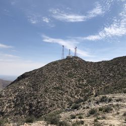
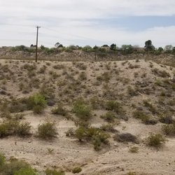
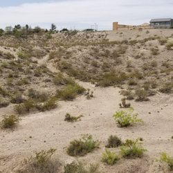
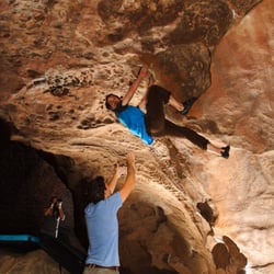
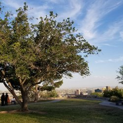
    Palisades Canyon Loop - hiking - Updated May 2026

    Loading...
    Loading...
    Loading...