Cancel

    Open app

    Search

    NRA Whittington Center

    4.4 (8 reviews)
    Closed 8:00 am - 5:00 pm

    NRA Whittington Center Photos

    More like NRA Whittington Center

    Recommended Reviews - NRA Whittington Center

    Your trust is our priority, so businesses can't pay to alter or remove their reviews. Learn more about reviews.
    Yelp app icon
    Browse more easily on the app
    Review Feed Illustration
    Photo of Ben B.
    1
    30
    6

    3 years ago

    Helpful 0
    Thanks 0
    Love this 0
    Oh no 0
    Photo of Chris B.
    2
    471
    64

    3 years ago

    Helpful 0
    Thanks 0
    Love this 2
    Oh no 0

    3 years ago

    Helpful 0
    Thanks 0
    Love this 0
    Oh no 0

    3 years ago

    Helpful 0
    Thanks 0
    Love this 0
    Oh no 0

    7 years ago

    Helpful 4
    Thanks 0
    Love this 0
    Oh no 0

    3 years ago

    One of the best shooting ranges in the country. Every type of shooting available. Great housing options. All very affordable.

    Helpful 1
    Thanks 0
    Love this 0
    Oh no 0

    4 years ago

    Helpful 0
    Thanks 0
    Love this 0
    Oh no 0

    6 years ago

    Such a beautiful place in the mountains. And a friendly staff. You will want to stay forever.

    Helpful 0
    Thanks 0
    Love this 0
    Oh no 0

    Ask the Community - NRA Whittington Center

    Verify this business for free

    Get access to customer & competitor insights.

    Verify this business

    Sugarite Canyon State Park

    Sugarite Canyon State Park

    4.3(3 reviews)
    13.1 mi

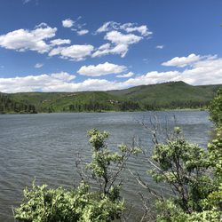
    An Afternoon Well Spent !!…read more It has been many years since I've been to the Raton area and typically whenever I was in the area it was just a quick to use the bathroom or get gas. On this visit, it was on a Friday afternoon and I had a few hours to kill and wanted to actually see some of the area. I remembered from years past that there were some lakes up in the mountains that I had always wanted to see and now was my chance. The Park is only about 20 miles from Raton and the roads were not that busy. The drive up is really nice as you see mountains, hills ranches, and some great scenery. On the way to Lake Maloya I stopped at one of the smaller lakes, Lake Alice and spent about half an hour checking it out. There really isn't access to that lake but you can tell its frequented by anglers. It is a nice small scenic lake. I then made my way up to Lake Maloya which is a reservoir for the area and right on the Colorado border. The lake is magnificent!! On a nice warm summer day, there was a nice breeze and no bugs. There were boaters on the lake, some people canoeing and some campers but it was not that busy at all. I spent a good two hours stopping and driving farther up the lake until I came to the gate that takes you to Dorothy Lake ( for another time). The views are just amazing, I suggest bringing a canoe or kayak and spending a good day there. I'm not sure if there is swimming since I didn't see anyone swimming in the water. Next up was Sugarite Canyon, and when you stop at the main entrance they use the honour system where you pay, so please pay!!! I made my way to the visitors center and got a map of the trails. The canyon is a great place to hike and I saw no one else on the trail and felt like I had the place to myself. I can't describe how nice it was walking through the canyon, and all there is to see. I highly recommend hiking with a buddy since it is in a remote area and I saw a few different animal tracks as I made my way through the trails. In short, this area is worth a visit, you can spend a few hours there or a few days, its truly part of the magnificence that is New Mexico.

    Google know all about this place but not yelp? We are fixing…read morethat right now. As the parks service says "The nature enthusiast will appreciate the abundance of wildlife, birds, butterflies, and wildflowers among the lakes, creeks, forests, and meadows. Nearly all outdoor recreation activities are possible: Fishing, boating, hiking, horseback riding, hunting, and camping." All true. This is a huge park. Full of lakes, trails & wildlife. We took a 6 mile loop trail starting at the dam yesterday and saw NO ONE else. Lots of scat indicate there lots of moose and bear around, so be aware. There are numerous other trails as well add the aforementioned activities. Definitely worth a visit if you're in the area.

    Photos
    Sugarite Canyon State Park - Ponderosa Trail

    Ponderosa Trail

    Sugarite Canyon State Park
    Sugarite Canyon State Park

    See all

    Capulin Volcano National Monument - Inside the cone

    Capulin Volcano National Monument

    4.4(48 reviews)
    28.6 mi

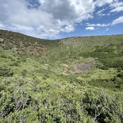
    Volcano Erupted 60,000yrs ago. We are holding the the…read moremolten Lava Rock. It's everywhere. You can go all the way up but we are not doing that. This place is beautiful and can hike all the way up. We were just driving by and coulnd't do it today but we will I swear! Worth the stop to see tjis historical site

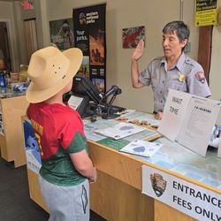
    Our visit to Capulin Volcano National Monument was absolutely fantastic--an unexpected gem on our…read moreroad trip! This place is not only rich in natural beauty and history, but also super family-friendly. We were especially thrilled to get in for free thanks to the Every Kid Outdoors program--our daughter is in 4th grade, and the monument participates in the initiative, which made the experience even better. Driving up the volcano was both scenic and a little thrilling with winding roads and sweeping views. Once at the top, the views from the rim were absolutely breathtaking. You can see miles across the surrounding landscape--plains, mesas, and distant mountains--all from the rim of an ancient volcano. It made for some truly stunning photos, especially with the big New Mexico skies as a backdrop. We took the short walk into the crater and around part of the rim trail. The trails are well maintained, and there are plenty of signs to help explain the geology and history. It's a great mix of education and outdoor adventure, especially for kids. There were also picnic areas and clean restrooms, which made the stop convenient as well as memorable. This was a perfect family outing and one of the best photo ops of our trip. Highly recommend stopping if you're anywhere nearby--beautiful, unique, and surprisingly fun for all ages!

    Photos
    Capulin Volcano National Monument - Volcano

    Volcano

    Capulin Volcano National Monument
    Capulin Volcano National Monument

    See all

    Rio Grande del Norte National Monument - Rio Grande Gorge Bridge

    Rio Grande del Norte National Monument

    4.8(4 reviews)
    80.3 mi

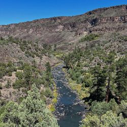
    Rio Grande Del Norte is vast-there are many different areas to explore and various corners of this…read morenational monument that range from moderately trafficked to fairly remote. Taos.org has a great summary page of the different areas. https://taos.org/explore/landmarks/rio-grande-del-norte-national-monument/ I had done some further research after this overview and opted to visit the Wild Rivers area in the morning and the Rio Grande Gorge area later in the day after lunch back in Taos. Wild Rivers is about 50 minutes from Taos but a scenic drive. Once you are in the public lands, the scenery gets more and more amazing. In the Wild Rivers area, there's a visitor center (currently only open on weekends), a scenic byway with overlooks, campgrounds and hiking trails that take you down to the river. I opted to do the trail to Big Arsenic Springs. The byway was very well signed and there's day use parking that does have a self paid fee. Since it's a BLM administered park (federal) you can instead display your America the Beautiful National Parks pass. Amazing scenery of the river and surrounding canyons along the petroglyphs towards the end of the Big Arsenic trail. The hike I opted for was short (2.5 miles but with an 800 ft elevation gain on the way back up from the river.) The park does an amazing job maintaining the trails and the well graded switchbacks made it a pleasant hike. On the drive out, after my hike, I stopped at other scenic view points. Later in the day, I visited another section of the park, closer to Taos where you can walk across and take in vistas of the Rio Grande Gorge bridge. If you're visiting Taos and love the outdoors, a visit to this park is a must. It's quieter than your typical national parks with fewer amenities but still an awe inspiring outdoor adventure (without the crowds!)

    We took an hour walk on the West Rim Trail that's part of Rio Grande del Norte National Monument…read morewhile visiting the Rio Grande bridge in late May 2023. The trail starts right at the parking lot and it's beautiful. Gorgeous views of the river too. Many bunnies that day.

    Photos
    Rio Grande del Norte National Monument - Wild Rivers hike down to Big Arsenic Springs

    Wild Rivers hike down to Big Arsenic Springs

    Rio Grande del Norte National Monument - Start of the trail down to Big Arscenic Springs

    Start of the trail down to Big Arscenic Springs

    Rio Grande del Norte National Monument - Scenic views along the Wild Rivers byway

    See all

    Scenic views along the Wild Rivers byway

    Williams Lake Trail - Fresh snow

    Williams Lake Trail

    4.3(6 reviews)
    66.8 mi

    We hiked Williams Lake for two reasons:…read more 1. To check out the turn off to the Wheeler Peak trail 2. To enjoy a leisurely couple's hike before tackling the big stuff And both we did! The journey to the lake from Alpine Village Suites to Williams lake trail (even amongst the construction) is refreshing. We drove to the trailhead, but if you're looking for a more strenuous hike, you can certain add a few extra miles (and a lot of elevation) by hiking amongst the residential mountain homes to the trailhead. If you're from out of town, be mindful of the weather, and make sure you have the adequate mods/the appropriate vehicle for driving to the trailhead. It almost goes without saying, but, speaking of weather, dress appropriately for three hike. At that altitude, we caught first snow of the season, so although the ski lifts were not running, we still needed our gloves and such towards the middle and end of the hike (even though there was no snow to be found further down the mountain). The hike itself is alright, not the most picturesque, and there aren't a ton of switchbacks if that's your thing, but it's very accessible and full of fresh air as well as moments to enjoy. The lake is a lake, but it's pretty expansive, and there's a good amount to explore. The vibe is forest adventure, and the trail is well maintained. While out, we saw a handful of doggos on the trail with their owners, couples, and small groups. So why am I hating on nature? Why give nature 4-stars?! Because this is a man made trail, and the current abundance of construction completely breaks the illusion. I'm sure it'll be back to 5 stars once the construction/selective tree demolition etc is complete. If you're in the area, no matter your skill level, highly recommend this quickie of a hike! Bonus points: when you complete your hike (if you choose to hike during season), you're rewarded with a Bavarian restaurant near the trailhead.

    I am not a hiker. I was 66 at the time and in pretty good shape. A NY'er, I was in Taos to…read morevolunteer with Habitat for Humanity. On a day off I decided to do this hike to see where the turn off was for Wheeler Peak. I enjoyed the hike although sections were rather rocky. Started to rain on the way up and continued lightly most of the way down. Rain was predicted but an accurate weather prediction in Taos is not the norm. But I'm glad I got to the turnoff near Williams and knew the next leg would take hours which I didn't have.

    Photos
    Williams Lake Trail - Fresh snow on the trail

    Fresh snow on the trail

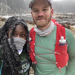
    Williams Lake Trail - Do I look cold...I'm cold

    Do I look cold...I'm cold

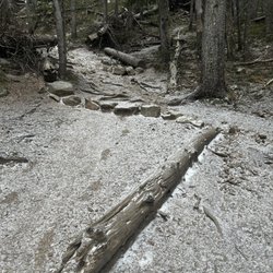
    Williams Lake Trail - Random miss and trees on the trail

    See all

    Random miss and trees on the trail

    Wheeler Peak - Marmot on the trail.

    Wheeler Peak

    4.7(7 reviews)
    53.7 mi

    Unless you're traversing the Continental Divide Trail, this is the ultimate in New Mexico popular…read morehiking. The 16 mile roundtrip takes you in a looping ascent from Taos Ski Valley to the summit and back. Having spent plenty of time on 14ers, I've crossed paths with my share of marmots. This tip top rock had more than I've ever seen, perhaps 50 along the way. Of course, the views are majestic. While not a 14er, New Mexico does not offer any, at 13,167' it is still an exquisite outing. This state high point is a must for anyone on the 50 state quest. If you're looking for your share of 14ers, dear western traveler, you need not worry. Colorado boasts 58 of the nation's soaring peaks and is just a short trip away. Call it 53 14ers, if you're an alpine purist.

    I spent a summer in the New Mexico high country years ago, and while I did my fair share of hiking…read morethat summer, I never took on Wheeler Peak, the highest point in New Mexico at just over 13,100 feet. I always figured I'd return to the area at some point, and maybe do the hike. Well, "some point" finally arrived, and I decided that I was going to make a serious effort at hiking this rather daunting-looking rocky, steep mountain. I gave myself permission to fail - while over the years I've probably spent far more time at altitude than 99.9% of South Floridians, the fact remains that I have spent most of my life at oxygen-rich sea level. I didn't practice for this. My existing fitness would either allow me to make it, or fail me. There are two main ways to get up the mountain, a longer, less steep 8 mile trail, and a shorter but steeper trail at just over 4 miles, known as the Williams Lake trail. I chose Williams Lake. The trailhead starts near the famous Bavarian restaurant within the Taos ski area. You basically take the road to the ski area, drive past it and find a dirt road. 2 miles up this dirt road and you'll find the trailhead parking lot. You can't miss it. I started my hike around 7:45AM. It is highly recommended to start early, as the weather above tree line is unpredictable and can change on a dime. You do NOT want to be stuck up there as an afternoon thunderstorm builds up in a matter of minutes. It is an exposed high alpine summit, subject to all the same potential extreme weather conditions of most high exposed summits. To me this hike can be broken down into 3 sections: 1) base at the Bavarian restaurant through the woods up to Williams Lake, about 2 miles, 2) Williams Lake up through ever sparser trees to tree line, about three-quarters of a mile, and 3) tree line to summit, traversing several rocky scree/talus slopes on the way, about a mile and a half. The first section up to Williams Lake is a nice hike in itself, and a popular day hike for families. It is a steady climb and not easy, and will be a challenge to inexperienced hikers, but most should be able to make it if they persevere. The payoff is a pretty high alpine lake situated in a picturesque bowl at about 11,000 feet with higher peaks on all sides. From there, part 2 gets you through sparse trees up to tree line. While not much more difficult than the first part, it was here when it became pretty apparent that every step was taking me to less oxygen. I was still strong at this point, but when you emerge in the meadows above tree line, you can see the peak and it looks way up there. In practical terms, from here you still have to climb a little higher than the Empire State Building, over the course of a mile and a half. At altitude. Above tree line. This is where it gets steeper, and rockier, as you traverse some loose talus slopes. It starts out fairly mild but ramps up fast. At this point, every step was difficult....I felt like Frodo taking the Ring to Mount Doom. It would have been very easy to quit. Some people did. It can be done though. One step at a time, keep drinking your water and you'll eventually make it. Keep an eye out for some fat marmots and bighorn sheep! Eventually you come to a staggeringly high saddle/ridgeline. From here, make a right and continue up the steep rocky slope....the payoff is only a few minutes away. Such amazing views, Wheeler Peak feels like the top of the world. What a feeling, to have walked and earned this view on the strength of your two legs. Now, after the adrenaline rush of reaching the summit, you have to descend. Pay attention. Cardio isn't a problem going down, but everything else is. Thighs burn like crazy. Lots of loose rock to slip on and hurt yourself. This was the most stunning hike I've ever done. If you think you can deal with a tough high altitude hike, I highly recommend it.

    Photos
    Wheeler Peak - Some of the wildlife along the trail.

    Some of the wildlife along the trail.

    Wheeler Peak - Panorama View from the Peak.

    Panorama View from the Peak.

    Wheeler Peak

    See all

    NRA Whittington Center - wildlifehunting - Updated August 2026

    Loading...
    Loading...
    Loading...