Climax Canyon Photos


You might also consider
More like Climax Canyon
Recommended Reviews - Climax Canyon
Start your review...

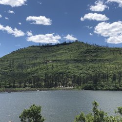
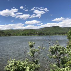
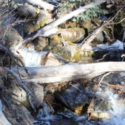
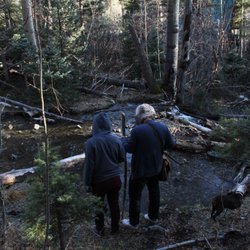
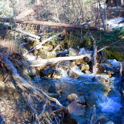
An excellent hike for novices, families, and even more advanced hikers. This is a two trail system with multiple entry points, easy to find and well-marked trails, lots of parking, and wonderful views that you hardly notice you are climbing a mountain to see. There is an East Loop and West Loop Trail, both are under 2 miles so they could be combined for a longer hike. The trail is narrow and definitely only for single file hiking , but it is incredibly well maintained and so delightfully curated it almost seems like it is intentionally landscaped. Someone has taken a lot of trouble to line the trail with the many perfectly sized pieces of sandstone in the area and a variety of cactus scrub Oak and Pines lead the way winding up the side of a mountain to lovely views of Raton and the surrounding Countryside. All in all a very nice hike right in the middle of town! read more


7 years ago
More info about Climax Canyon
801-899 Apache Ave
Raton, NM 87740
Directions
Hours
Outdoor Amenities


Climax Canyon - hiking - Updated June 2026
Best of Raton
People found Climax Canyon by searching for…
Things to Do in Raton, New Mexico
Hiking Trails in Raton, New Mexico
Easy Hikes in Raton, New Mexico
Attractions in Raton, New Mexico
Photo Spots in Raton, New Mexico
Picnic Areas in Raton, New Mexico
State Parks in Raton, New Mexico
Canyoneering in Raton, New Mexico
Places to Take Pictures in Raton, New Mexico
Walking Trails in Raton, New Mexico
Tourist Attractions in Raton, New Mexico
Off Road Trails in Raton, New Mexico
View Points in Raton, New Mexico
Scenic View in Raton, New Mexico
Running Trails in Raton, New Mexico
Things to See in Raton, New Mexico
Family Fun in Raton, New Mexico
What to Do in Raton, New Mexico
Playgrounds in Raton, New Mexico
Public Shower in Raton, New Mexico
Waterfalls in Raton, New Mexico
Trending Searches in Raton, NM
Browse Articles
Browse Nearby
BEST of Raton, New Mexico Things to Do near Climax Canyon
BEST of Raton, New Mexico Parks near Climax Canyon
BEST of Raton, New Mexico Coffee near Climax Canyon
BEST of Raton, New Mexico Restaurants near Climax Canyon
BEST of Raton, New Mexico Waterfalls near Climax Canyon
BEST of Raton, New Mexico Ski Resorts near Climax Canyon
BEST of Raton, New Mexico Campgrounds near Climax Canyon
BEST of Raton, New Mexico Breakfast near Climax Canyon
BEST of Raton, New Mexico Visitor Centers near Climax Canyon
Browse Brands
Related Searches in Raton, NM
Best Fishing Locations and Guides in Raton, New Mexico
Best Nature Trails for Hiking in Raton, New Mexico
Best Places for Stunning Views in Raton, New Mexico
Best Sledding Spots and Fun in Raton, New Mexico
Best Spots for Star Gazing in Raton, New Mexico
Best Things to Do on a Rainy Day in Raton, New Mexico
Check Out Great Playgrounds in Raton, New Mexico
Discover Lakes & Ponds to Explore in Raton, New Mexico
Discover Popular Bike Trails in Raton, New Mexico
Discover Popular Photo Spots in Raton, New Mexico
Discover Top Nature Parks to Visit in Raton, New Mexico
Discover the Best Fishing Lake in Raton, New Mexico
Enjoy Camping Adventures Around Raton, New Mexico
Enjoy Exciting Mountain Biking Adventures in Raton, New Mexico
Enjoy Water Activities and Fun in Raton, New Mexico
Enjoy the Best Picnic Spots and Ideas in Raton, New Mexico
Enjoy the Best Tubing Experiences in Raton, New Mexico
Enjoy the Best Walking Trails in Raton, New Mexico
Experience Stunning Sunset Views in Raton, New Mexico
Explore Beautiful Parks and Green Spaces in Raton, New Mexico
Explore Free Things to Do Around Raton, New Mexico
Explore Kid Friendly Places and Events in Raton, New Mexico
Explore Landmarks & Historical Buildings in Raton, New Mexico
Explore Nature Spots Around Raton, New Mexico
Explore Popular Campgrounds Near Raton, New Mexico
Explore Popular Picnic Areas Around Raton, New Mexico
Explore Popular RV Parks Around Raton, New Mexico
Explore Popular Scenic Views Near Raton, New Mexico
Explore Scenic Lakes to Visit in Raton, New Mexico
Explore Top Gyms in Raton, New Mexico Now
Explore the Scenic River in Raton, New Mexico
Family Friendly Hiking With Kids in Raton, New Mexico
Find Beautiful Views in Raton, New Mexico
Find the Best Parks for Picnics in Raton, New Mexico
Find the Best Scenic View Locations in Raton, New Mexico
Great Places to Swim in Raton, New Mexico
Perfect Spots to Watch Sunset in Raton, New Mexico
Plan a Scenic Drive Route Near Raton, New Mexico
Popular Fishing Spots to Explore in Raton, New Mexico
Popular Outdoor Activities to Try in Raton, New Mexico
Popular Things to Do in Raton, New Mexico
Popular Things to See in Raton, New Mexico
Safe and Fun Parks for Kids in Raton, New Mexico
Top Must See Attractions and Spots in Raton, New Mexico
Top Playgrounds for Kids to Enjoy in Raton, New Mexico
Top RV Campgrounds to Visit in Raton, New Mexico
Top Things to Do With Kids in Raton, New Mexico