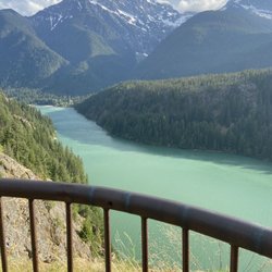
Nooksack Falls Photos


You might also consider

More like Nooksack Falls
Recommended Reviews - Nooksack Falls
Start your review...


Reviews With Photos
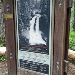

Two things come to mind about these falls. The first is actually a bit sad. There is a plaque at the beginning trailhead honoring all the people who lost their lives here at the waterfalls. They were all 20-somethings. And there was an unborn child on the list. Oh my heart breaks! So yeah. It's a good reminder to be careful in mother nature. But it also helps you understand the big chain-link that surrounds and rather obstructs the view. I am sure all the photographers are frustrated by the barrier but I totally get it. The second is that this really is not a trail. It's a viewpoint. After you park your car and read said solemn plaque you walk down 15 paces and you are already there at the cliffs viewing the falls. So yeah. No need to pack for a hike. Just be careful climbing down the rocks. We went on a dry day and the stones were still pretty slick. On a wet day these rocks are very slippery. And next thing you know you are reaching for that chain link fence to keep yourself from falling over the edge. Watch those kiddos. Now that I scared the crap out of you. Sorry! I really did not mean to. These falls are harmless. Just know what you are doing. To get there...You will enjoy some mini-off roading as you taking the poorly marked dirt side road down to the parking lot. Which by the way is pretty small. There is additional parking further down. There are no bathrooms and no picnic tables.


Absolutely gorgeous falls with an abundance of water just off the main road. Easily accessible for any car that can drive a dirt road (a short one at that) and a less than minute walk from the parking lot. This was one our highlights at the national forest for sure, as all the other waterfalls we could make out were far far away. I highly recommend checking this one out! Just be safe and don't cross the fence where it says not to ;)
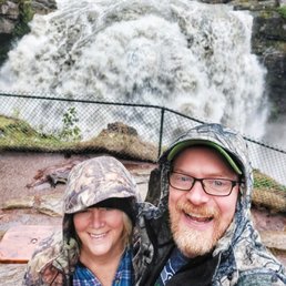

Our planned ski trek to Artist Point was rained out yesterday morning, so we decided to finally check out the Falls as a consolation prize. We were not disappointed! It's a short, windy drive from 542 down to river level, with a generous parking area available on both sides of the bridge. My partner wasn't eager to step out on the bridge, given the volume of water roaring by underneath, but it was definitely impressive to see the flow that close. Glad the supports were well-built & able to handle the volume. Making our way down to the viewing area, we could see the draw of this area; the view of the falls from here is epic, but you can also look down into the chasm where Wells Creek collides with the North Fork of the Nooksack River; pretty incredible to get this perspective. The trail to the viewpoint travels through some slanted rock areas, which are a bit slippery with mist from the Falls; might be a bit treacherous for some, so trekking poles are advised. We were fortunate to hit the falls at the peak of flood volume; so incredible to see that much water passing over, and looking at the image on the information board, was much higher than normal. Leaving here, we headed off down to Glacier for some coffee & courage to face the long drive home from there.


Beautiful falls. Few miles from waterfall location it does get curvier. Short road on FR 33 from main road has several potholes and not paved. I would not reccomend for lower cars. I did not see any restrooms at the location. Located opposite side of parking area are the falls. Additional parking just past bridge but you will need to be able to turn car around. Fenced and slippery rocks. Not recommended for strollers or wheelchairs. Parents please keep an eye on small children due to exposed tree roots and slippery rocks. Easy to get to falls if taking adequate time for conditions. Powerful, peaceful and stunning views. Gas station located in Deming seemed to be the best price around. One of my favorites but due to not wheelchair or stoller access and no restroom I only gave 4 stars... but the falls are a 5 STAR in my eyes. Definitely worth the drive.


1 year ago

Nooksack Falls truly took my breath away. The drive there alone on Mount Baker Highway was exquisite. What is so mind blowing about a waterfall? Everything. I believe you feel a sense of peace in the presence of one. The sound of the powerful water, the mist surrounding, and the wet air is quite the moment. read more


Beautiful scenery. It is close to the parking lot, even old people can walk there. Also, for those that don't know, if you drive across the bridge, through the gate, and uphill for about 5-8 minutes, there is a beautiful spot for family photos or selfies read more


7 years ago
Two things come to mind about these falls. The first is actually a bit sad. There is a plaque at the beginning trailhead honoring all the people who lost their lives here at the waterfalls. They were all 20-somethings. And there was an unborn child on the list. Oh my heart breaks! So yeah. It's a good reminder to be careful in mother nature. But it also helps you understand the big chain-link that surrounds and rather obstructs the view. I am sure all the photographers are frustrated by the barrier but I totally get it. The second is that this really is not a trail. It's a viewpoint. After you park your car and read said solemn plaque you walk down 15 paces and you are already there at the cliffs viewing the falls. So yeah. No need to pack for a hike. Just be careful climbing down the rocks. We went on a dry day and the stones were still pretty slick. On a wet day these rocks are very slippery. And next thing you know you are reaching for that chain link fence to keep yourself from falling over the edge. Watch those kiddos. Now that I scared the crap out of you. Sorry! I really did not mean to. These falls are harmless. Just know what you are doing. To get there...You will enjoy some mini-off roading as you taking the poorly marked dirt side road down to the parking lot. Which by the way is pretty small. There is additional parking further down. There are no bathrooms and no picnic tables. read more


Absolutely gorgeous falls with an abundance of water just off the main road. Easily accessible for any car that can drive a dirt road (a short one at that) and a less than minute walk from the parking lot. This was one our highlights at the national forest for sure, as all the other waterfalls we could make out were far far away. I highly recommend checking this one out! Just be safe and don't cross the fence where it says not to ;) read more

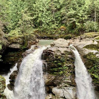

Our planned ski trek to Artist Point was rained out yesterday morning, so we decided to finally check out the Falls as a consolation prize. We were not disappointed! It's a short, windy drive from 542 down to river level, with a generous parking area available on both sides of the bridge. My partner wasn't eager to step out on the bridge, given the volume of water roaring by underneath, but it was definitely impressive to see the flow that close. Glad the supports were well-built & able to handle the volume. Making our way down to the viewing area, we could see the draw of this area; the view of the falls from here is epic, but you can also look down into the chasm where Wells Creek collides with the North Fork of the Nooksack River; pretty incredible to get this perspective. The trail to the viewpoint travels through some slanted rock areas, which are a bit slippery with mist from the Falls; might be a bit treacherous for some, so trekking poles are advised. We were fortunate to hit the falls at the peak of flood volume; so incredible to see that much water passing over, and looking at the image on the information board, was much higher than normal. Leaving here, we headed off down to Glacier for some coffee & courage to face the long drive home from there. read more


Beautiful falls. Few miles from waterfall location it does get curvier. Short road on FR 33 from main road has several potholes and not paved. I would not reccomend for lower cars. I did not see any restrooms at the location. Located opposite side of parking area are the falls. Additional parking just past bridge but you will need to be able to turn car around. Fenced and slippery rocks. Not recommended for strollers or wheelchairs. Parents please keep an eye on small children due to exposed tree roots and slippery rocks. Easy to get to falls if taking adequate time for conditions. Powerful, peaceful and stunning views. Gas station located in Deming seemed to be the best price around. One of my favorites but due to not wheelchair or stoller access and no restroom I only gave 4 stars... but the falls are a 5 STAR in my eyes. Definitely worth the drive. read more


10 years ago
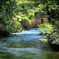
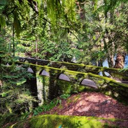
Nooksack Falls has been around since, well, a longggggg time before I moved to Whatcom County, and it was one of the first places I visited when I arrived here nearly 20 years ago. Not at lot has changed in those two decades, which is not necessarily a bad thing. The falls themselves are a gorgeous cascade of wonderness on the North Fork Nooksack River. There's a viewing area which can be accessed down a fairly steep, but short, trail - and viewers are protected by a chain link fence so it's child-safe. Above the falls there's a bridge from which you can view the pretty pool at the top, or look up the Nooksack where tumbling rapids greet you. The road getting in to the falls is fairly narrow, so be careful and slow (especially on busy days). There's a decent-sized parking area, but no bathrooms. A small sign near the parking lot explains the history of the falls. It's a pretty day trip on a nice day; although if you go during the rainy season the falls are even more spectacular. read more


7 years ago
More info about Nooksack Falls
Mt Baker Hwy Nf-33
Glacier, WA 98244
Directions
Hours
Outdoor Amenities