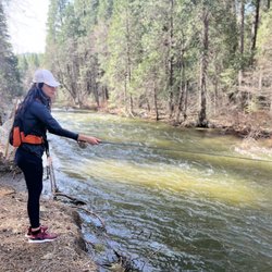
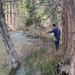
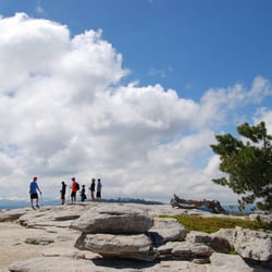
Mt. Dana Photos

More like Mt. Dana
Recommended Reviews - Mt. Dana
Start your review...

17 years ago
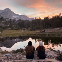
You won't find the Mt. Dana Summit Trail on your National Park Service map and you're unlikely to find it in your hiking guidebook either. What you will find on this trail however, is a challenging trip up the second highest peak in Yosemite National Park which rewards with some of the best panoramic views you'll experience anywhere. read more


10 years ago
More info about Mt. Dana
Lee Vining, CA 93541
Directions
Hours
Outdoor Amenities


Mt. Dana - hiking - Updated June 2026
Best of Lee Vining
People found Mt. Dana by searching for…
Things to Do in Lee Vining, California
Natural Hot Springs in Lee Vining, California
Parks in Lee Vining, California
Hiking Trails in Lee Vining, California
Lookout Points in Lee Vining, California
Public Shower in Lee Vining, California
State Parks in Lee Vining, California
Nature in Lee Vining, California
Photo Spots in Lee Vining, California
Swimming Holes in Lee Vining, California
National Parks in Lee Vining, California
Beautiful Views in Lee Vining, California
Rock in Lee Vining, California
View Points in Lee Vining, California
Swimming Lakes in Lee Vining, California
Experience in Lee Vining, California
Attraction in Lee Vining, California
Nature Trails in Lee Vining, California
Off Road Trails in Lee Vining, California
Trending Searches in Lee Vining, CA
Browse Articles
Browse Nearby
BEST of Lee Vining, California Things to Do near Mt. Dana
BEST of Lee Vining, California Restaurants near Mt. Dana
BEST of Lee Vining, California Parks near Mt. Dana
BEST of Lee Vining, California Coffee near Mt. Dana
BEST of Lee Vining, California Swimming Holes near Mt. Dana
BEST of Lee Vining, California Hot Springs near Mt. Dana
BEST of Lee Vining, California Breakfast near Mt. Dana
BEST of Lee Vining, California Visitor Centers near Mt. Dana
Browse Brands
Related Searches in Lee Vining, CA
Affordable Kayak Rental Services in Lee Vining, California
Best Fishing Locations and Guides in Lee Vining, California
Best Nature Trails for Hiking in Lee Vining, California
Best Places for Horseback Riding in Lee Vining, California
Best Sledding Spots and Fun in Lee Vining, California
Discover Dog Friendly Trails to Explore in Lee Vining, California
Discover Popular Bike Trails in Lee Vining, California
Discover Scenic Mountain Bike Trails Near Lee Vining, California
Discover Scenic Waterfall Spots in Lee Vining, California
Discover Top Nature Parks to Visit in Lee Vining, California
Discover a Hiking Trail in Lee Vining, California
Discover the Best Night Hike Trails in Lee Vining, California
Dog-Friendly Hikes With Dogs in Lee Vining, California
Effective Stairs Workout Spots in Lee Vining, California
Enjoy Camping Adventures Around Lee Vining, California
Enjoy Kayaking Adventures in Lee Vining, California
Enjoy Tent Camping Spots Around Lee Vining, California
Enjoy the Best Tubing Experiences in Lee Vining, California
Enjoy the Best Walking Trails in Lee Vining, California
Exciting Cliff Jumping Spots in Lee Vining, California
Experience Thrilling White Water Rafting in Lee Vining, California
Explore Beautiful Parks and Green Spaces in Lee Vining, California
Explore Bike Rentals Throughout Lee Vining, California
Explore Easy Hikes Perfect for All in Lee Vining, California
Explore Fun Activities to Do in Lee Vining, California
Explore Popular Campgrounds Near Lee Vining, California
Explore Popular RV Parks Around Lee Vining, California
Explore Scenic Lakes to Visit in Lee Vining, California
Explore the Best Boating Spots in Lee Vining, California
Explore the Best Swimming Holes Around Lee Vining, California
Family Friendly Hiking With Kids in Lee Vining, California
Find Popular Ziplining Spots Around Lee Vining, California
Find the Best Parks for Picnics in Lee Vining, California
Find the Best Swimming Pools in Lee Vining, California Today
Hiking Trails With Waterfalls in Lee Vining, California
Locate a Public Shower Facility in Lee Vining, California
Must-See Tourist Attractions Around Lee Vining, California
Off Leash Dog Hiking Trails in Lee Vining, California
Plan a Scenic Drive Route Near Lee Vining, California
Popular Fishing Spots to Explore in Lee Vining, California
Popular Kids Activities in Lee Vining, California
Popular Outdoor Activities to Try in Lee Vining, California
Popular Picnic Spots to Visit in Lee Vining, California
Popular Things to Do in Lee Vining, California
Relax at Natural Hot Springs Near Lee Vining, California
Safe and Fun Parks for Kids in Lee Vining, California
Top Climbing Spots and Gyms in Lee Vining, California
Top Paddleboarding Activities in Lee Vining, California